Category:Wherstead
English: Located in county Suffolk, England Wherstead village lies three miles (2 km) south of Ipswich. It is an ancient settlement, and from its soil the plough has brought to light many evidences of occupation by Romans and by early Britons. In the Domesday Book the place is described under the names Querstede and Wervesteda. The name of the village and parish is in today generally pronounced Wersted or Warsted by the residents, the "a" in the latter case having the sound of "a" in father.
village in Suffolk, England, UK  | |||||
| Upload media | |||||
| Instance of | |||||
|---|---|---|---|---|---|
| Location | Babergh, Suffolk, East of England, England | ||||
 | |||||
Subcategories
This category has the following 11 subcategories, out of 11 total.
A
- Alton Business Centre (3 F)
B
- Belstead Creek (3 F)
- Bourne Bridge, Ipswich (9 F)
H
- Wherstead Hall (6 F)
O
- Oyster Reach (5 F)
P
- Pylons in Wherstead (26 F)
R
S
- Suffolk Food Hall (5 F)
V
- Valley Lane, Wherstead (10 F)
W
- Wherstead Park (12 F)
Media in category "Wherstead"
The following 200 files are in this category, out of 337 total.
(previous page) (next page)-
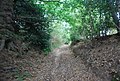
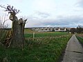
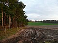
 "Not in my country lane" - geograph.org.uk - 4378561.jpg 1,024 × 768; 585 KB
-
 A corner of Holbrook Park - geograph.org.uk - 5611305.jpg 640 × 480; 113 KB
-
 A14 Ipswich bypass, from the railway line - geograph.org.uk - 5603131.jpg 1,314 × 950; 242 KB
-
 Across to Greenwich Wharf - geograph.org.uk - 3260689.jpg 640 × 425; 257 KB
-
 Beefeater restaurant, Bourne Hill - geograph.org.uk - 5871459.jpg 1,000 × 775; 143 KB
-

-
 Beet field south of Alder Carr - geograph.org.uk - 1002134.jpg 640 × 426; 116 KB
-
 Belstead Bank - geograph.org.uk - 6394070.jpg 1,200 × 805; 1,013 KB
-
 Belstead Bank - geograph.org.uk - 6431974.jpg 1,200 × 809; 1.14 MB
-
 Black pigs at Wherstead, Suffolk.jpg 1,829 × 1,372; 1,017 KB
-
 Black sheep in field near Jimmy's Farm - geograph.org.uk - 2510759.jpg 3,648 × 2,736; 2.4 MB
-
 Blacksmith's Cottage - geograph.org.uk - 3232378.jpg 640 × 430; 78 KB
-
 Blacksmith's Cottage Postbox - geograph.org.uk - 3484761.jpg 2,304 × 3,072; 1.5 MB
-
 Blacksmith's Cottage Postbox - geograph.org.uk - 3484762.jpg 2,304 × 3,072; 1.43 MB
-
 Blue drum in field - geograph.org.uk - 3858795.jpg 800 × 600; 159 KB
-
 Boats in the Orwell - geograph.org.uk - 2462201.jpg 640 × 480; 93 KB
-
 Bridge near Thorington Hall - geograph.org.uk - 3858045.jpg 800 × 600; 138 KB
-

-
 Bridlepath towards Bentley Manor - geograph.org.uk - 5237314.jpg 4,592 × 3,056; 5.04 MB
-
 Bridleway by Sandpit Covert - geograph.org.uk - 3228206.jpg 640 × 430; 107 KB
-
 Bridleway by Sandpit Covert - geograph.org.uk - 3228210.jpg 640 × 430; 141 KB
-
 Bridleway by Sandpit Covert - geograph.org.uk - 3228213.jpg 640 × 430; 116 KB
-
 Bridleway crosses the railway - geograph.org.uk - 3228202.jpg 640 × 430; 96 KB
-
 Bridleway junction of the bridleway to Freston Street - geograph.org.uk - 3515563.jpg 3,072 × 2,304; 1.63 MB
-
 Bridleway off The Street - geograph.org.uk - 3484326.jpg 3,072 × 2,304; 1.28 MB
-
 Bridleway off The Street - geograph.org.uk - 3515621.jpg 3,072 × 2,304; 1.66 MB
-
 Bridleway off The Street - geograph.org.uk - 3515630.jpg 3,072 × 2,304; 1.25 MB
-
 Bridleway off The Street - geograph.org.uk - 3515635.jpg 3,072 × 2,304; 1.25 MB
-
 Bridleway signs of the bridleway to Freston Street - geograph.org.uk - 3515564.jpg 2,304 × 3,072; 1.54 MB
-
 Bridleway to Freston Street - geograph.org.uk - 3515567.jpg 3,072 × 2,304; 1.68 MB
-
 Bridleway to Valley Farm ^ Valley Lane - geograph.org.uk - 3620263.jpg 3,072 × 2,304; 1.27 MB
-
 Bridleway to Vicarage Lane - geograph.org.uk - 3515572.jpg 3,072 × 2,304; 1.49 MB
-

-
 Car park and outbuildings at Jimmy's Farm - geograph.org.uk - 4378570.jpg 1,024 × 768; 380 KB
-
 Commemorative Plaque - geograph.org.uk - 2131454.jpg 640 × 479; 93 KB
-
 Construction of the Orwell Bridge near Ipswich - geograph.org.uk - 6431399.jpg 1,198 × 1,797; 364 KB
-
 Construction of the Orwell Bridge near Ipswich - geograph.org.uk - 6431402.jpg 1,802 × 1,201; 301 KB
-
 Construction of the Orwell Bridge near Ipswich - geograph.org.uk - 6431406.jpg 1,800 × 1,200; 320 KB
-
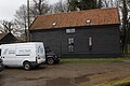 Converted farm building - geograph.org.uk - 6418711.jpg 800 × 533; 124 KB
-
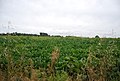
 Corn field - geograph.org.uk - 3059715.jpg 640 × 423; 75 KB
-
 Corner Cottage - geograph.org.uk - 3232388.jpg 640 × 430; 87 KB
-
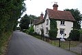
 Cottage at Wherstead - geograph.org.uk - 2510885.jpg 3,648 × 2,736; 2.89 MB
-
 Cottage near Wherstead Hall - geograph.org.uk - 3236686.jpg 640 × 430; 71 KB
-
 Countryside near Wherstead - geograph.org.uk - 3232398.jpg 640 × 430; 82 KB
-
 Countryside near Wherstead - geograph.org.uk - 3236624.jpg 640 × 430; 57 KB
-

-
 Crop field near Belstead - geograph.org.uk - 5381537.jpg 640 × 423; 27 KB
-
 Cropland near Wherstead - geograph.org.uk - 3236631.jpg 640 × 430; 79 KB
-
 Crops near Wherstead - geograph.org.uk - 3232400.jpg 640 × 430; 77 KB
-
 Cultivated field south of Park Farm, Wherstead - geograph.org.uk - 6107015.jpg 6,000 × 4,000; 6.33 MB
-
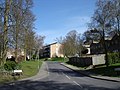 Downside Close - geograph.org.uk - 1237086.jpg 640 × 480; 98 KB
-
 Driveway to Wherstead Hall - geograph.org.uk - 4850821.jpg 2,048 × 1,536; 821 KB
-

-
 Easter Pigs - geograph.org.uk - 387917.jpg 640 × 480; 126 KB
-
 Electricity Pole at Wherstead Hall Farm - geograph.org.uk - 2498936.jpg 2,304 × 3,072; 1.31 MB
-
 End of a lay-by on A14 and railway bridge at Wherstead - geograph.org.uk - 4057603.jpg 1,536 × 1,152; 800 KB
-

-
 Entering Belstead on The Street - geograph.org.uk - 3515844.jpg 3,072 × 2,304; 1.3 MB
-
 Entering Jimmy's Farm - geograph.org.uk - 1131437.jpg 640 × 480; 101 KB
-
 Entrance of Pannington Hall Farm - geograph.org.uk - 3515641.jpg 2,857 × 1,989; 810 KB
-
 Entrance to Pannington Hall Farm - geograph.org.uk - 3515638.jpg 3,072 × 2,304; 1.33 MB
-
 Entrance to Peninsula Business Centre - geograph.org.uk - 3620205.jpg 3,072 × 2,304; 1.35 MB
-
 Entrance to public footpath - geograph.org.uk - 2513669.jpg 3,648 × 2,736; 4.46 MB
-

-
 Entrances of Wherstead Park ^ Wherstead Hall - geograph.org.uk - 3620219.jpg 3,072 × 2,304; 1.22 MB
-
 Essex boar.jpg 1,955 × 1,466; 1.58 MB
-
 Fallow field - geograph.org.uk - 3236661.jpg 640 × 430; 56 KB
-
 Farm area from near Thorington Hall - geograph.org.uk - 3858297.jpg 800 × 600; 91 KB
-
 Farm Track at Wherstead Hall Farm - geograph.org.uk - 2499814.jpg 3,072 × 2,304; 1.48 MB
-
 Farm Track at Wherstead Hall Farm - geograph.org.uk - 2499820.jpg 2,304 × 3,072; 1.34 MB
-

-
 Farmland near Wherstead Hall - geograph.org.uk - 3236662.jpg 640 × 430; 63 KB
-
 Farmland towards Bourne Park - geograph.org.uk - 5376029.jpg 640 × 399; 43 KB
-

-
 Field at Wherstead Hall Farm - geograph.org.uk - 2499815.jpg 3,072 × 2,304; 1.31 MB
-
 Field at Wherstead Hall Farm - geograph.org.uk - 2499816.jpg 3,072 × 2,304; 1.32 MB
-
 Field boundary - geograph.org.uk - 2510897.jpg 3,648 × 2,736; 3.81 MB
-
 Field edge near the church, Wherstead - geograph.org.uk - 4850801.jpg 2,048 × 1,536; 907 KB
-

-

-
 Field looking onto the A14 - geograph.org.uk - 3858174.jpg 800 × 600; 108 KB
-
 Field looking towards Belstead - geograph.org.uk - 3858908.jpg 800 × 600; 74 KB
-
 Field of maize - geograph.org.uk - 3228217.jpg 640 × 430; 62 KB
-
 Fields and woodland near Wherstead - geograph.org.uk - 3833851.jpg 3,648 × 2,048; 1.55 MB
-
 Fields off The Street, south of Pannington Hall - geograph.org.uk - 5745928.jpg 1,600 × 1,200; 274 KB
-
 Footpath east from Wherstead - geograph.org.uk - 3232399.jpg 640 × 430; 67 KB
-
 Footpath near Wherstead Hall - geograph.org.uk - 3236689.jpg 640 × 430; 66 KB
-
 Footpath off The Street - geograph.org.uk - 3515649.jpg 3,072 × 2,304; 1.27 MB
-

-
 Footpath over meadow - geograph.org.uk - 2511833.jpg 3,648 × 2,736; 4.2 MB
-
 Footpath past Wherstead Park - geograph.org.uk - 3232402.jpg 640 × 430; 78 KB
-
 Footpath sign towards Pannington - geograph.org.uk - 3858217.jpg 800 × 600; 181 KB
-
 Footpath signs at Wherstead Hall Farm - geograph.org.uk - 2498953.jpg 2,304 × 3,072; 1.5 MB
-
 Footpath signs at Wherstead Hall Farm - geograph.org.uk - 2498954.jpg 2,304 × 3,072; 1.63 MB
-
 Footpath through tall corn - geograph.org.uk - 3240142.jpg 640 × 430; 90 KB
-
 Footpath to Bobbits Lane - geograph.org.uk - 3484504.jpg 3,072 × 2,304; 1.36 MB
-
 Footpath to Freston Street - geograph.org.uk - 3620258.jpg 3,072 × 2,304; 1.26 MB
-
 Footpath to Spinney Wood - geograph.org.uk - 3858288.jpg 800 × 600; 97 KB
-
 Footpath to the A137 - geograph.org.uk - 3515579.jpg 3,072 × 2,304; 1.35 MB
-
 Footpath to the B1456 ^ entrance to Wherstead Hall - geograph.org.uk - 3620018.jpg 3,072 × 2,304; 1.3 MB
-
 Footpath to the barn at Wherstead Hall Farm - geograph.org.uk - 2498841.jpg 2,304 × 3,072; 1.64 MB
-
 Footpath to the barn at Wherstead Hall Farm - geograph.org.uk - 2498843.jpg 2,304 × 3,072; 1.54 MB
-
 Footpath to The Street - geograph.org.uk - 3620015.jpg 2,304 × 3,072; 1.65 MB
-
 Footpath to the Suffolk Food Hall ^ Penny Jones Pilates - geograph.org.uk - 2498839.jpg 2,304 × 3,072; 1.66 MB
-

-

-
 Footpath towards Pannington (2) - geograph.org.uk - 3858232.jpg 800 × 600; 89 KB
-
 Footpath towards Pannington - geograph.org.uk - 3858204.jpg 800 × 600; 173 KB
-
 Footpath towards Thorington Hall - geograph.org.uk - 3858145.jpg 800 × 600; 180 KB
-
 Former mast near Belstead - geograph.org.uk - 3858644.jpg 800 × 600; 87 KB
-
 Former sewage disposal jetty - geograph.org.uk - 1026801.jpg 640 × 427; 71 KB
-
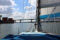
 Fox's Marina - geograph.org.uk - 5627097.jpg 640 × 428; 83 KB
-
 Fox's Marina - geograph.org.uk - 5627143.jpg 640 × 480; 129 KB
-
 Fox's Marina and Wherstead Ooze from the bridge - geograph.org.uk - 4378701.jpg 1,024 × 768; 393 KB
-
 Freston Brook - geograph.org.uk - 3261846.jpg 640 × 425; 326 KB
-
 Freston Brook - geograph.org.uk - 3261853.jpg 640 × 425; 266 KB
-
 Freston Brook - geograph.org.uk - 3261874.jpg 425 × 640; 368 KB
-
 Freston Brook entering the River Orwell - geograph.org.uk - 6088986.jpg 6,000 × 4,000; 6.24 MB
-
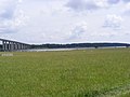
 Freston Reach - geograph.org.uk - 2961373.jpg 640 × 480; 159 KB
-
 Freston Reach - geograph.org.uk - 3833577.jpg 3,648 × 2,048; 1.91 MB
-
 Freston Reach on the river Orwell - geograph.org.uk - 5318738.jpg 3,456 × 2,592; 2.43 MB
-
 Freston Reach viewed from Redgate Hard - geograph.org.uk - 6088969.jpg 6,000 × 4,000; 6.32 MB
-
 Garden Cottage - geograph.org.uk - 3232386.jpg 640 × 430; 92 KB
-
 Gloucester Old Spot Boar, England.jpg 1,589 × 1,192; 950 KB
-
 Gloucester Old Spot.jpg 1,537 × 962; 251 KB
-
 Gorse on Piper's Vale with the Orwell Bridge - geograph.org.uk - 4378722.jpg 1,024 × 768; 484 KB
-
 Great Eastern Main Line - geograph.org.uk - 3228203.jpg 640 × 430; 86 KB
-
 Great Eastern Main Line - geograph.org.uk - 3228205.jpg 640 × 430; 81 KB
-
 Great Eastern Mainline - geograph.org.uk - 3228184.jpg 640 × 430; 64 KB
-
 Green navigation buoy, River Orwell - geograph.org.uk - 5489964.jpg 1,024 × 768; 137 KB
-
 Grey drum in field - geograph.org.uk - 3858855.jpg 800 × 600; 128 KB
-
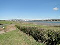
 High water at Redgate Hard - geograph.org.uk - 3574274.jpg 640 × 425; 147 KB
-
 Holbrook Park - geograph.org.uk - 4161159.jpg 640 × 430; 121 KB
-
 Holbrook Park - geograph.org.uk - 4161163.jpg 640 × 430; 85 KB
-
 Holbrook Park - geograph.org.uk - 4161178.jpg 640 × 430; 97 KB
-
 Holbrook Park in Bluebell time - geograph.org.uk - 2107992.jpg 2,816 × 2,112; 2.41 MB
-
 House by the bridge - geograph.org.uk - 2510898.jpg 2,921 × 1,826; 1.53 MB
-
 House on The Street - geograph.org.uk - 3232380.jpg 640 × 430; 73 KB
-
 Industry on the east bank of the River Orwell - geograph.org.uk - 4378715.jpg 1,024 × 768; 339 KB
-
 Industry on the Orwell - geograph.org.uk - 4378705.jpg 1,024 × 768; 319 KB
-
 Ipswich bound service at Belstead - geograph.org.uk - 884520.jpg 640 × 442; 97 KB
-
 Ipswich Docks ^ River Orwell in 1986 - geograph.org.uk - 2224060.jpg 1,013 × 676; 122 KB
-
 Ipswich from the air - geograph.org.uk - 3311978.jpg 640 × 480; 109 KB
-
 Ipswich from the air - geograph.org.uk - 3367266.jpg 640 × 480; 136 KB
-
 Ipswich from the air - geograph.org.uk - 3367268.jpg 640 × 480; 137 KB
-
 Ipswich from the air - geograph.org.uk - 4661563.jpg 640 × 480; 194 KB
-
 Ipswich we salute you^ - geograph.org.uk - 4198146.jpg 480 × 640; 56 KB
-

-
 Jetty at the outfall, River Orwell, Ipswich - geograph.org.uk - 5489967.jpg 1,024 × 615; 103 KB
-
 Jetty in River Orwell - geograph.org.uk - 3260699.jpg 640 × 425; 326 KB
-
 Junction of The Street from Jimmy's Farm exit - geograph.org.uk - 4378562.jpg 1,024 × 768; 313 KB
-

-
 London bound slow train passing Old Hall Wood - geograph.org.uk - 5237307.jpg 4,592 × 3,056; 3.38 MB
-

-

-

-

-
 Looking down Redgate Lane - geograph.org.uk - 1294499.jpg 640 × 480; 126 KB
-
 Looking into Ipswich - geograph.org.uk - 3858696.jpg 800 × 600; 64 KB
-
 Looking to the Church of St Mary - geograph.org.uk - 3236656.jpg 640 × 430; 89 KB
-
 Looking to the River Orwell - geograph.org.uk - 3236691.jpg 640 × 430; 50 KB
-
 Looking towards Holbrook Park - geograph.org.uk - 2457484.jpg 640 × 400; 168 KB
-
 Looking towards Spinney Wood - geograph.org.uk - 3858757.jpg 800 × 600; 102 KB
-
 Looking towards the Suffolk Food Hall ^ entrance - geograph.org.uk - 2498921.jpg 3,072 × 2,304; 1.47 MB
-
 Looking towards Wherstead Hall Lodge - geograph.org.uk - 2498919.jpg 2,304 × 3,072; 1.36 MB
-
 Low lying field by the A137 - geograph.org.uk - 1001606.jpg 640 × 506; 133 KB
-
 Low tide at Redgate Hard - geograph.org.uk - 6088222.jpg 6,000 × 4,000; 6.42 MB
-
 Maize Crop at Wherstead Hall Farm - geograph.org.uk - 2498938.jpg 2,304 × 3,072; 1.33 MB
-
 Maize Crop at Wherstead Hall Farm - geograph.org.uk - 2499811.jpg 2,304 × 3,072; 1.31 MB
-
 Maize field - geograph.org.uk - 3228221.jpg 640 × 430; 68 KB
-
 Meadow backed by railway embankment - geograph.org.uk - 1001598.jpg 640 × 414; 88 KB
-
 Memorial cross with a view - geograph.org.uk - 4850816.jpg 2,004 × 1,497; 986 KB
-
 Mudflats At Low Tide - geograph.org.uk - 2131329.jpg 1,024 × 768; 222 KB
-
 Narrow bridleway, Sandpit Covert - geograph.org.uk - 3228211.jpg 640 × 430; 138 KB
-
 New Channel - geograph.org.uk - 2131326.jpg 1,024 × 768; 213 KB
-
 New hedge near Thorington Hall - geograph.org.uk - 3858185.jpg 800 × 600; 184 KB
-
 New Lodge - geograph.org.uk - 3232396.jpg 640 × 430; 75 KB
-
 North to east panorama of the River Orwell and the bridge - geograph.org.uk - 4378719.jpg 4,121 × 1,080; 1.16 MB
-
 Old barn on Redgate Lane - geograph.org.uk - 1294374.jpg 640 × 480; 64 KB
-
 Old barn on Redgate Lane - geograph.org.uk - 1294493.jpg 640 × 480; 51 KB
-
 Old course of A137 - geograph.org.uk - 3232377.jpg 640 × 430; 91 KB
-

-
 Orwell Bridge - geograph.org.uk - 4234367.jpg 640 × 480; 73 KB
-
 Orwell Bridge - geograph.org.uk - 4234375.jpg 640 × 480; 55 KB
-
 Orwell Bridge - geograph.org.uk - 5813343.jpg 6,000 × 4,000; 6.47 MB
-
 Orwell Bridge access - geograph.org.uk - 1964955.jpg 427 × 640; 87 KB
-

-
 Orwell Bridge from the Ipswich side - geograph.org.uk - 5069634.jpg 640 × 427; 68 KB
-
 Orwell Bridge from the River Orwell (1) - geograph.org.uk - 5489974.jpg 768 × 1,024; 133 KB
-
 Orwell Bridge from the River Orwell (2) - geograph.org.uk - 5489979.jpg 1,024 × 768; 122 KB
-
 Ostrich Creek from the River Orwell - geograph.org.uk - 5489674.jpg 1,024 × 615; 117 KB
-
 Overlooking Redgate Hard - geograph.org.uk - 4422493.jpg 970 × 674; 212 KB
-

-
 Pannington Hall and the A14 from the air - geograph.org.uk - 4881091.jpg 640 × 480; 145 KB
-
 Pannington Hall Lane - geograph.org.uk - 2744152.jpg 3,072 × 2,304; 1.36 MB
-
 Pannington Hall Lane sign - geograph.org.uk - 2744150.jpg 3,072 × 2,304; 1.49 MB
-
 Panoramic view of the Orwell from northeast to southeast - geograph.org.uk - 4378682.jpg 2,824 × 1,056; 799 KB
-
 Parking area on the A14 south of Ipswich - geograph.org.uk - 5376663.jpg 2,256 × 1,664; 1.11 MB
-
 Parkland tree near Redgate Lane - geograph.org.uk - 6108074.jpg 6,000 × 4,000; 6.87 MB
-
 Parkland trees near Redgate Lane - geograph.org.uk - 6108063.jpg 6,000 × 4,000; 6.73 MB


_-_geograph.org.uk_-_3858232.jpg)


_-_geograph.org.uk_-_5489974.jpg)
_-_geograph.org.uk_-_5489979.jpg)


