Category:Whitehill, Kent
village in Kent, United Kingdom  | |||||
| Upload media | |||||
| Instance of | |||||
|---|---|---|---|---|---|
| Location | Ospringe, Swale, Kent, South East England, England | ||||
 | |||||
Media in category "Whitehill, Kent"
The following 11 files are in this category, out of 11 total.
-
 Bridleway in Badgin Wood - geograph.org.uk - 1369975.jpg 640 × 480; 109 KB
-
 Twin oasts - geograph.org.uk - 251790.jpg 640 × 482; 81 KB
-
 Bridge over no water - geograph.org.uk - 650182.jpg 640 × 480; 116 KB
-
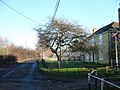
 Brogdale Road, Whitehill - geograph.org.uk - 397375.jpg 640 × 481; 92 KB
-
 Cattle in Belmont park - geograph.org.uk - 241566.jpg 640 × 480; 148 KB
-
 Eastling Road, Whitehill - geograph.org.uk - 650175.jpg 640 × 480; 77 KB
-
 Footpath at Lorenden - geograph.org.uk - 650177.jpg 480 × 640; 118 KB
-
 Fruit trees at Whitehill - geograph.org.uk - 264421.jpg 640 × 480; 111 KB
-

-
 Plane tree in Lorenden Park - geograph.org.uk - 650189.jpg 480 × 640; 106 KB
-
 Sorry tunnels at Whitehill - geograph.org.uk - 397355.jpg 640 × 480; 122 KB


