Category:Whitfield, Kent
English: Whitfield is an ancient village and civil parish in the English county of Kent. It has a modern counterpart in the large settlement located at the junction of the A2 and A256 roads, some four miles (6.4km) north of Dover, of which that part of Whitfield has become a suburb of the Dover urban area.
village and civil parish in Dover, Kent, England  | |||||
| Upload media | |||||
| Instance of | |||||
|---|---|---|---|---|---|
| Location | Dover, Kent, South East England, England | ||||
 | |||||
Subcategories
This category has the following 2 subcategories, out of 2 total.
C
D
- Dover Transport Museum (6 F)
Media in category "Whitfield, Kent"
The following 200 files are in this category, out of 234 total.
(previous page) (next page)-
 A2, westbound - geograph.org.uk - 5199887.jpg 640 × 426; 51 KB
-
 A2, westbound - geograph.org.uk - 5199888.jpg 640 × 426; 48 KB
-
 A256 Bridge over Napchester Road - geograph.org.uk - 1975053.jpg 1,024 × 768; 216 KB
-
 A256 road bridge, A2 - geograph.org.uk - 5199884.jpg 640 × 426; 50 KB
-
 A256 towards Sandwich - geograph.org.uk - 6184106.jpg 1,024 × 684; 253 KB
-
 A256 Whitfield Hill - geograph.org.uk - 6183759.jpg 1,024 × 684; 290 KB
-
 A256, London Road - geograph.org.uk - 1846182.jpg 1,024 × 768; 177 KB
-
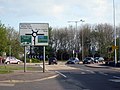 Approaching Whitfield Roundabout - geograph.org.uk - 1846177.jpg 1,024 × 768; 249 KB
-
 Arable land beside Honeywood Parkway - geograph.org.uk - 3231843.jpg 848 × 614; 143 KB
-
 Arable Road - geograph.org.uk - 5534857.jpg 3,264 × 2,448; 1.89 MB
-
 Barn Owl Way, Richmond Park - geograph.org.uk - 5708072.jpg 3,264 × 2,448; 3.72 MB
-
 Barn Owl Way, Richmond Park - geograph.org.uk - 5708078.jpg 3,264 × 2,408; 2.02 MB
-
 Barricade across Richmond Way, Richmond Park - geograph.org.uk - 5923610.jpg 3,264 × 2,448; 2.37 MB
-
 Barricade across Richmond Way, Richmond Park - geograph.org.uk - 6036218.jpg 3,264 × 2,448; 3.7 MB
-
 Beechwood Close, Whitfield - geograph.org.uk - 2144030.jpg 3,072 × 2,304; 1.67 MB
-
 Beechwood House - geograph.org.uk - 2014575.jpg 3,072 × 2,304; 1.68 MB
-
 Bend on the byway beside the A2 - geograph.org.uk - 2303699.jpg 3,072 × 2,304; 1.85 MB
-
 Buildbase, Honeywood Parkway - geograph.org.uk - 1975067.jpg 1,024 × 683; 192 KB
-
 Building site - geograph.org.uk - 4904444.jpg 3,264 × 2,448; 3.74 MB
-
 Building site, Honeywood Parkway - geograph.org.uk - 5547542.jpg 3,264 × 2,448; 3.88 MB
-

-

-
-
 Burgess Close - geograph.org.uk - 4342629.jpg 640 × 480; 93 KB
-

-
 B^Q Dover - geograph.org.uk - 4675162.jpg 640 × 480; 101 KB
-
 B^Q, White Cliffs Business Park, Dover - geograph.org.uk - 3175922.jpg 821 × 615; 143 KB
-
 Church Whitfield Road - geograph.org.uk - 6183657.jpg 1,024 × 768; 481 KB
-
 Construction site, Honeywood Parkway - geograph.org.uk - 6400069.jpg 3,264 × 2,448; 1.96 MB
-

-

-
 Distant view of a building site, Archer’s Court Road - geograph.org.uk - 5189511.jpg 3,264 × 2,448; 2.03 MB
-
 Distant view of a building site, Archer’s Court Road - geograph.org.uk - 5533690.jpg 3,264 × 2,448; 3.95 MB
-
 Dover Christ Church Academy, Melbourne Avenue - geograph.org.uk - 5102717.jpg 3,264 × 2,448; 1.83 MB
-
 Dover District Leisure Centre, Fitness Fields - geograph.org.uk - 6153050.jpg 3,264 × 2,448; 2.26 MB
-
 Dover Tesco Extra superstore - geograph.org.uk - 2014495.jpg 3,072 × 2,304; 1.69 MB
-
 Dover Transport Museum - geograph.org.uk - 2615239.jpg 3,648 × 2,736; 2.86 MB
-
 Dover Transport Museum - geograph.org.uk - 2615245.jpg 3,648 × 2,736; 2.37 MB
-
 Dover Transport Museum - geograph.org.uk - 2615253.jpg 3,648 × 2,736; 2.79 MB
-
 Dover Transport Museum - geograph.org.uk - 2615256.jpg 3,648 × 2,736; 2.65 MB
-
 Dover Transport Museum - geograph.org.uk - 2615260.jpg 3,648 × 2,736; 2.87 MB
-
 Dover Transport Museum - geograph.org.uk - 2615270.jpg 3,648 × 2,736; 3.12 MB
-
 Dover Transport Museum - geograph.org.uk - 2615626.jpg 3,648 × 2,736; 1.67 MB
-
 Dover Transport Museum - geograph.org.uk - 2616588.jpg 2,736 × 3,648; 1.47 MB
-
 Dover Transport Museum - geograph.org.uk - 2616623.jpg 3,648 × 2,736; 1.44 MB
-

-
 Dover, Burgoyne Grove - geograph.org.uk - 2616735.jpg 3,648 × 2,736; 1.47 MB
-
 Dover, Menzies Road - geograph.org.uk - 2616692.jpg 3,648 × 2,736; 2.19 MB
-
 Dover, White Cliffs Industrial Park - geograph.org.uk - 2583296.jpg 3,648 × 2,736; 1.3 MB
-
 Dover, White Cliffs Industrial Park - geograph.org.uk - 2583307.jpg 3,648 × 2,736; 1.23 MB
-
 Dover, Willingdon Road - geograph.org.uk - 2615210.jpg 3,648 × 2,736; 2.92 MB
-
 Dover, Willingdon Road - geograph.org.uk - 2615231.jpg 3,648 × 2,736; 2.01 MB
-
 Eagle Drive, Richmond Park - geograph.org.uk - 5629978.jpg 3,264 × 2,448; 3.78 MB
-
 East Kent archives, Whitfield, Dover - geograph.org.uk - 1191427.jpg 640 × 480; 72 KB
-
 Entrance to a building site, Archer’s Court Road - geograph.org.uk - 5189509.jpg 3,264 × 2,448; 1.72 MB
-
 Entrance to a building site, Archer’s Court Road - geograph.org.uk - 5533665.jpg 3,264 × 2,448; 3.65 MB
-

-
 Erection of a detached building, Honeywood Parkway - geograph.org.uk - 4335199.jpg 3,264 × 2,448; 2.31 MB
-
 Erection of a Lidl store, Honeywood Parkway - geograph.org.uk - 5547547.jpg 3,264 × 2,448; 3.77 MB
-
 Erection of two houses, Archer’s Court Road - geograph.org.uk - 5115947.jpg 3,264 × 2,376; 2.15 MB
-
 Excavation for additional parking - geograph.org.uk - 4127937.jpg 1,075 × 806; 208 KB
-

-

-
 Farm track in Lenacre Court Farm fields - geograph.org.uk - 2144081.jpg 3,072 × 2,304; 1.98 MB
-
 Farmhouse on The Pier - geograph.org.uk - 2144050.jpg 3,072 × 2,304; 1.79 MB
-
 Farmland, Honeywood Parkway - geograph.org.uk - 5589035.jpg 3,264 × 2,448; 3.84 MB
-
 Farncombe Way - geograph.org.uk - 4342637.jpg 640 × 480; 72 KB
-
 Field of Horses - geograph.org.uk - 1975059.jpg 1,024 × 768; 170 KB
-
 Field Road View - geograph.org.uk - 5534882.jpg 3,264 × 2,448; 3.75 MB
-
 Field south of Singledge Lane - geograph.org.uk - 2751336.jpg 640 × 480; 51 KB
-
 Field View Road - geograph.org.uk - 4858127.jpg 3,264 × 2,448; 1.81 MB
-
 Flint Barn in Pineham - geograph.org.uk - 2303748.jpg 3,072 × 2,304; 2.62 MB
-
 Footpath crosses Forge Lane - geograph.org.uk - 2144049.jpg 3,072 × 2,304; 2.96 MB
-
 Footpath in Great Pineham Farm - geograph.org.uk - 2303753.jpg 3,072 × 2,304; 3.18 MB
-
 Footpath junction near Whitfield - geograph.org.uk - 2303790.jpg 3,072 × 2,304; 1.69 MB
-
 Footpath junction near Whitfield - geograph.org.uk - 2303798.jpg 3,072 × 2,304; 1.58 MB
-
 Footpath junction on the byway to Pineham - geograph.org.uk - 2303709.jpg 3,072 × 2,304; 2.46 MB
-
 Footpath past Lenacre Farm - geograph.org.uk - 1968494.jpg 1,024 × 768; 222 KB
-
 Footpath through Wheat Field - geograph.org.uk - 1968501.jpg 1,024 × 768; 245 KB
-
 Footpath to Archer's Court Road - geograph.org.uk - 2303780.jpg 3,072 × 2,304; 2.59 MB
-
 Footpath to East Langdon - geograph.org.uk - 2330632.jpg 3,072 × 2,304; 2.24 MB
-
 Footpath to Pineham - geograph.org.uk - 2303772.jpg 3,072 × 2,304; 1.8 MB
-
 Footpath to Singledge Lane - geograph.org.uk - 2303812.jpg 3,072 × 2,304; 2.09 MB
-
 Footpath to Singledge Wood - geograph.org.uk - 2144060.jpg 3,072 × 2,304; 2.39 MB
-
 Footpath to the A2 - geograph.org.uk - 2303809.jpg 3,072 × 2,304; 1.89 MB
-
 Footpath towards Whitfield - geograph.org.uk - 2303757.jpg 3,072 × 2,304; 2.17 MB
-
 Forge Lane - geograph.org.uk - 2144044.jpg 3,072 × 2,304; 1.81 MB
-

-

-
 Gate near Pineham Bottom Farm - geograph.org.uk - 2330647.jpg 3,072 × 2,304; 1.84 MB
-
 Gate on the footpath to Singledge Wood - geograph.org.uk - 2144066.jpg 3,072 × 2,304; 1.98 MB
-
 Green Path to Pineham Bottom Farm - geograph.org.uk - 2330665.jpg 3,072 × 2,304; 3.15 MB
-
 Harvest Road - geograph.org.uk - 4904433.jpg 3,264 × 2,448; 1.75 MB
-
 Harvest Road - geograph.org.uk - 5534852.jpg 3,264 × 2,448; 2.3 MB
-
 Hobby Drive, Richmond Park - geograph.org.uk - 5927158.jpg 3,195 × 2,448; 2.06 MB
-
 Hobby Drive, Richmond Park - geograph.org.uk - 6036240.jpg 3,264 × 2,448; 1.81 MB
-
 Homebase, Honeywood Parkway - geograph.org.uk - 5588022.jpg 3,264 × 2,448; 2.76 MB
-
 Honeywood Road - geograph.org.uk - 1924831.jpg 640 × 480; 75 KB
-
 Kearsney Avenue, Kearsney - geograph.org.uk - 2751259.jpg 640 × 480; 66 KB
-
 Kestrel Grove, Richmond Park - geograph.org.uk - 5629986.jpg 3,264 × 2,448; 3.76 MB
-
 Kissing gate near Pineham Bottom Farm - geograph.org.uk - 2330677.jpg 3,072 × 2,304; 2.79 MB
-
 Lenacre Court Farm - geograph.org.uk - 2144055.jpg 3,072 × 2,304; 1.72 MB
-
 Lidl, Honeywood Parkway - geograph.org.uk - 6153085.jpg 3,264 × 2,448; 2.44 MB
-
 Lonfield Farm, Caravan Club Site - geograph.org.uk - 2751343.jpg 640 × 480; 49 KB
-
 Looking NE along Napchester Road - geograph.org.uk - 964494.jpg 640 × 480; 174 KB
-
 Looking north-northeast along Sandwich Road - geograph.org.uk - 4858118.jpg 3,264 × 2,448; 1.92 MB
-
 Looking north-northeast along Sandwich Road - geograph.org.uk - 4858140.jpg 3,264 × 2,448; 1.82 MB
-
 Looking SE along road to Church Whitfield - geograph.org.uk - 963206.jpg 640 × 480; 183 KB
-
 McDonald's, Whitfield - geograph.org.uk - 5390175.jpg 1,200 × 803; 269 KB
-
 Merlin Avenue, Richmond Park - geograph.org.uk - 5927169.jpg 3,264 × 2,448; 2.03 MB
-
 Merlin Avenue, Richmond Park - geograph.org.uk - 6036203.jpg 2,764 × 2,423; 1.53 MB
-
 Merlin Avenue, Richmond Park - geograph.org.uk - 6155270.jpg 3,264 × 2,448; 1.84 MB
-
 Merlin Avenue, Richmond Park - geograph.org.uk - 6310844.jpg 3,258 × 1,949; 1.64 MB
-
 Muddy footpath to Whitfield - geograph.org.uk - 1141909.jpg 640 × 480; 176 KB
-
 Nearing completion - geograph.org.uk - 744055.jpg 640 × 480; 164 KB
-
 New retail store, Honeywood Parkway - geograph.org.uk - 4586505.jpg 1,061 × 782; 205 KB
-
 New site for Perrys Vauxhall dealership, Honeywood Parkway - geograph.org.uk - 5588037.jpg 3,264 × 2,448; 1.94 MB
-
 New unit nearing completion - geograph.org.uk - 744638.jpg 640 × 208; 108 KB
-
 Newlands, Whitfield - geograph.org.uk - 1226666.jpg 640 × 392; 39 KB
-
 North Downs Way in Pineham - geograph.org.uk - 2330696.jpg 3,072 × 2,304; 2.64 MB
-
 North Downs Way on a muddy byway to Dover Road - geograph.org.uk - 2303599.jpg 3,072 × 2,304; 3.58 MB
-
 North Downs Way reaches Pineham Road - geograph.org.uk - 2303746.jpg 3,072 × 2,304; 2.5 MB
-
 North Downs Way to Cane Wood - geograph.org.uk - 2330778.jpg 3,072 × 2,304; 1.74 MB
-
 North Downs Way to Dover - geograph.org.uk - 2303595.jpg 3,072 × 2,304; 1.62 MB
-
 North Downs Way to Dover Road - geograph.org.uk - 2303575.jpg 3,072 × 2,304; 2.14 MB
-
 North Downs Way to Dover Road - geograph.org.uk - 2303728.jpg 3,072 × 2,304; 1.94 MB
-
 North Downs Way to Great Pineham Farm - geograph.org.uk - 2303731.jpg 3,072 × 2,304; 1.75 MB
-
 North Downs Way to Pineham (2) - geograph.org.uk - 2303716.jpg 3,072 × 2,304; 2.8 MB
-
 North Downs Way to Pineham - geograph.org.uk - 2303708.jpg 3,072 × 2,304; 2.49 MB
-
 North Downs Way to Pineham - geograph.org.uk - 2303720.jpg 3,072 × 2,304; 3.29 MB
-
 North Downs Way to Pineham - geograph.org.uk - 2330714.jpg 3,072 × 2,304; 1.94 MB
-
 North Downs Way towards West Langdon - geograph.org.uk - 2330727.jpg 3,072 × 2,304; 2.92 MB
-
 Nursery Lane, Whitfield - geograph.org.uk - 2751347.jpg 640 × 480; 48 KB
-
 Nursery Lane, Whitfield - geograph.org.uk - 6183621.jpg 1,024 × 684; 386 KB
-
 Osprey Gardens, Richmond Park - geograph.org.uk - 6310802.jpg 3,264 × 2,448; 3.81 MB
-
 Parsonage Farm, Church Whitfield - geograph.org.uk - 1141819.jpg 640 × 480; 145 KB
-
 Part of a Footpath to Whitfield - geograph.org.uk - 2144085.jpg 3,072 × 2,304; 2.53 MB
-
 Pedestrian crossing by Whitfield post office - geograph.org.uk - 6183638.jpg 1,024 × 684; 273 KB
-
 Ploughed field west of Roman Road - geograph.org.uk - 4675131.jpg 640 × 480; 127 KB
-
 Postbox Bewsbury Cross Lane - geograph.org.uk - 1191030.jpg 640 × 480; 106 KB
-
 Queueing lorries, A2 - geograph.org.uk - 5199891.jpg 640 × 426; 63 KB
-

-
 Richmond Way, Richmond Park - geograph.org.uk - 5629991.jpg 3,264 × 2,351; 2.27 MB
-
 Richmond Way, Richmond Park - geograph.org.uk - 5629996.jpg 3,264 × 2,448; 4 MB
-
 Richmond Way, Richmond Park - geograph.org.uk - 5630002.jpg 3,264 × 2,448; 2.34 MB
-
 Richmond Way, Richmond Park - geograph.org.uk - 5708065.jpg 3,264 × 2,382; 1.91 MB
-
 Richmond Way, Richmond Park - geograph.org.uk - 5927150.jpg 3,145 × 2,345; 1.64 MB
-
 Richmond Way, Richmond Park - geograph.org.uk - 6036257.jpg 3,264 × 2,448; 3.81 MB
-
 Richmond Way, Richmond Park - geograph.org.uk - 6154194.jpg 3,264 × 2,448; 1.64 MB
-
 Richmond Way, Richmond Park - geograph.org.uk - 6154204.jpg 3,264 × 2,448; 1.73 MB
-
 Richmond Way, Richmond Park - geograph.org.uk - 6155302.jpg 3,133 × 2,423; 1.91 MB
-
 Richmond Way, Richmond Park - geograph.org.uk - 6156695.jpg 3,264 × 2,448; 1.8 MB
-
 Richmond Way, Richmond Park - geograph.org.uk - 6310835.jpg 3,264 × 2,448; 2.35 MB
-
 Road passed church - geograph.org.uk - 1481049.jpg 640 × 426; 92 KB
-
 Road passed church - geograph.org.uk - 1481052.jpg 640 × 426; 98 KB
-
 Road to Church Whitfield - geograph.org.uk - 1226647.jpg 640 × 476; 71 KB
-
 Roadworks on roundabout - geograph.org.uk - 475054.jpg 640 × 480; 53 KB
-

-
 Roman Road crosses Archer's Court Road - geograph.org.uk - 2330744.jpg 3,072 × 2,304; 1.78 MB
-

-
 Sandwich Road - geograph.org.uk - 1846172.jpg 1,024 × 768; 152 KB
-
 Sandwich Road, Whitfield - geograph.org.uk - 1923104.jpg 640 × 480; 64 KB
-
 Sandwich Road, Whitfield - geograph.org.uk - 6183632.jpg 1,024 × 684; 338 KB
-
 Shepherd's Cross - geograph.org.uk - 4342643.jpg 640 × 480; 47 KB
-
 Shepherd's Cross - geograph.org.uk - 4342645.jpg 640 × 480; 30 KB
-
 Singledge Lane - geograph.org.uk - 2751331.jpg 640 × 480; 48 KB
-
 Singledge Lane - geograph.org.uk - 6183602.jpg 1,024 × 684; 370 KB
-
 Site of leisure centre - geograph.org.uk - 5547574.jpg 3,264 × 2,448; 3.93 MB
-
 Stile near Newlands - geograph.org.uk - 2303794.jpg 3,072 × 2,304; 1.89 MB
-
 Storage, Honeywood Parkway - geograph.org.uk - 6153065.jpg 3,264 × 2,448; 3.77 MB
-
 Tesco Extra - geograph.org.uk - 4341424.jpg 640 × 480; 47 KB
-
 The A256 Whitfield Hill - geograph.org.uk - 1652864.jpg 640 × 479; 61 KB
-
 The Archer's Court Youth Centre Subway - geograph.org.uk - 2303803.jpg 3,072 × 2,304; 2.27 MB
-
 The development of Richmond Park - geograph.org.uk - 5927177.jpg 3,264 × 2,448; 2.65 MB
-
 The development of Richmond Park - geograph.org.uk - 6034571.jpg 2,995 × 2,442; 1.74 MB
-
 The development of Richmond Park - geograph.org.uk - 6155283.jpg 3,264 × 2,448; 2.91 MB
-
 The development of Richmond Park - geograph.org.uk - 6310820.jpg 2,657 × 2,176; 2.17 MB
-
 The Kittiwake Pub- Restaurant, Dover - geograph.org.uk - 2014509.jpg 3,072 × 2,304; 1.81 MB
-

-
 The North Downs Way leaving Dover - geograph.org.uk - 6243352.jpg 2,592 × 1,944; 1.5 MB
-
 The Old Boiler House - geograph.org.uk - 2014502.jpg 3,072 × 2,304; 1.8 MB
-
 Track to Temple Farm - geograph.org.uk - 3532707.jpg 937 × 690; 146 KB
-
 Two new houses, Archer’s Court Road - geograph.org.uk - 5533742.jpg 3,264 × 2,448; 2.01 MB
-
 View across fields from North Downs Way - geograph.org.uk - 1540905.jpg 640 × 480; 128 KB
-
 View along Napchester Road, Whitfield - geograph.org.uk - 638314.jpg 640 × 480; 185 KB
-
 View along road into Church Whitfield - geograph.org.uk - 1141911.jpg 640 × 480; 262 KB
-
 View along the new extension to the A256 - geograph.org.uk - 744595.jpg 640 × 480; 167 KB
-
 View along the new extension to the A256 - geograph.org.uk - 744606.jpg 640 × 480; 122 KB
-
 View from Church Whitfield - geograph.org.uk - 1141879.jpg 640 × 480; 199 KB
-
 View towards the A256 bridge over Napchester Road - geograph.org.uk - 2144027.jpg 3,072 × 1,728; 1.11 MB
-

-
 Warehouses along Honeywood Parkway - geograph.org.uk - 3232847.jpg 838 × 618; 140 KB
-
 Wheat Field at Temple Farm - geograph.org.uk - 1968415.jpg 1,024 × 683; 256 KB
-
 White Cliffs business park Whitfield - geograph.org.uk - 1191058.jpg 640 × 480; 49 KB
-
 Whitfield - 2016 - geograph.org.uk - 5144362.jpg 3,648 × 2,736; 4.22 MB
-
 Whitfield - 2016 - geograph.org.uk - 5155943.jpg 3,648 × 2,736; 4.12 MB
-
 Whitfield - 2016 - geograph.org.uk - 5155946.jpg 3,648 × 2,736; 4.27 MB
-
 Whitfield - 2016 - geograph.org.uk - 5155953.jpg 3,648 × 2,736; 3.85 MB
-
 Whitfield - 2016 - geograph.org.uk - 5155957.jpg 3,648 × 2,736; 3.98 MB
-
 Whitfield - 2016 - geograph.org.uk - 5155958.jpg 3,648 × 2,736; 1.12 MB


_-_geograph.org.uk_-_2303716.jpg)


_leaving_Pineham_-_geograph.org.uk_-_6243417.jpg)


