Category:Whitfield Lane - Barnston footpath
This footpath runs from Whitfeld Lane next to Heswall Primary school generally northeast across fields to Barnston, emerging to the north of Christ Church and forms part of the Arrowe Park - Parkgate Circular Walk. It is numbered FP25 on the Wirral Metropolitan Borough Council Definitive Map of 2013. A farm track runs from it to Barnston Road near Barnston Women's Institute.

Subcategories
This category has only the following subcategory.
T
Media in category "Whitfield Lane - Barnston footpath"
The following 14 files are in this category, out of 14 total.
-
 Start of FP25 on Whitfield Lane.jpg 3,470 × 4,060; 15.31 MB
-
 Fingerpost at the start of FP25 on Whitfield Lane.jpg 3,456 × 4,608; 13.68 MB
-
 Stile at the start of FP25 on Whitfield Lane.jpg 4,329 × 3,309; 13.95 MB
-
 Stream on Whitefield Lane - Barnston footpath.jpg 4,608 × 3,456; 17.09 MB
-
 Kissing gate (1) on FP25.jpg 4,608 × 3,456; 13.67 MB
-
 Kissing gate (2) on FP25.jpg 4,608 × 3,456; 16.23 MB
-
 Along FP25 from the junction of the farm track.jpg 4,608 × 3,456; 12.84 MB
-
 Barnston village from FP25.jpg 5,047 × 3,364; 10.9 MB
-
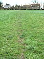
 FP25 crosses the field.jpg 3,307 × 4,408; 10.58 MB
-
 Kissing gate (3) on FP25.jpg 4,401 × 3,447; 12.36 MB
-
 FP25 approaches the church.jpg 3,389 × 4,519; 13.69 MB
-
 Stile into the churchyard of Christ Church.jpg 4,608 × 3,456; 17.13 MB
-
 Steps, Churchyard of Christ Church, Barnston.jpg 4,463 × 3,347; 16.15 MB
-
 Footpath FP25 in Barnston.jpg 3,228 × 5,253; 10.7 MB


_on_FP25.jpg)
_on_FP25.jpg)


_on_FP25.jpg)


