Category:Whitton and Tosson
civil parish in Northumberland, England  | |||||
| Upload media | |||||
| Instance of | |||||
|---|---|---|---|---|---|
| Location | Northumberland, North East England, England | ||||
 | |||||
Subcategories
This category has the following 6 subcategories, out of 6 total.
G
L
- Little Tosson (13 F)
N
- Newtown, Whitton and Tosson (1 F)
S
- Sharpe's Folly (2 F)
T
- Tosson Lime Kiln (11 F)
W
- Whitton, Northumberland (7 F)
Media in category "Whitton and Tosson"
The following 200 files are in this category, out of 219 total.
(previous page) (next page)-
 'Hollow' tracks near Burgh Hill - geograph.org.uk - 4227780.jpg 1,024 × 768; 282 KB
-
 A forest of wind turbines - geograph.org.uk - 5399886.jpg 1,600 × 1,067; 164 KB
-
 Allerdene Pant - geograph.org.uk - 6397044.jpg 2,448 × 3,264; 4.33 MB
-
 Approaching Lamb Cairn - geograph.org.uk - 5399673.jpg 1,600 × 1,067; 331 KB
-
 Arable fields - geograph.org.uk - 3353436.jpg 1,600 × 1,197; 295 KB
-
 Bags o' boulders - geograph.org.uk - 872529.jpg 427 × 640; 82 KB
-
 Barn at Carterside - geograph.org.uk - 2101153.jpg 640 × 480; 89 KB
-
 Barns at Allerdene - geograph.org.uk - 2100454.jpg 640 × 480; 79 KB
-
 Beautifully crafted drinking trough - geograph.org.uk - 5292348.jpg 3,264 × 2,448; 1.84 MB
-
 Birky Hill - geograph.org.uk - 3647351.jpg 1,600 × 1,081; 303 KB
-
 Black Burn at Newton - geograph.org.uk - 3353452.jpg 1,600 × 1,271; 663 KB
-

-
 Boundary Stone on Ravens Heugh - geograph.org.uk - 5500557.jpg 1,600 × 1,151; 661 KB
-
 Boundary Stone, Ravens Heugh - geograph.org.uk - 4228023.jpg 1,024 × 768; 311 KB
-
 Bridge between Newtown and Rothbury - geograph.org.uk - 4659193.jpg 800 × 600; 493 KB
-
 Bridge over Black Burn - geograph.org.uk - 3353444.jpg 1,600 × 1,162; 527 KB
-
 Bridge over the River Coquet - geograph.org.uk - 2101156.jpg 640 × 480; 60 KB
-
 Bridleway junction - geograph.org.uk - 5184215.jpg 1,600 × 1,067; 459 KB
-
 Burgh Hill - geograph.org.uk - 2554056.jpg 4,000 × 3,000; 3.71 MB
-
 Burgh Hill with its fort - geograph.org.uk - 3412933.jpg 1,600 × 937; 203 KB
-
 Cairn, Ravens Heugh - geograph.org.uk - 4228249.jpg 1,024 × 770; 357 KB
-
 Caistron Lake - geograph.org.uk - 2100018.jpg 640 × 480; 91 KB
-
 Carterside Cottages - geograph.org.uk - 2101154.jpg 640 × 480; 83 KB
-
 Carterside Cottages - geograph.org.uk - 2101155.jpg 640 × 480; 69 KB
-
 Carved rock on path to Simonside - geograph.org.uk - 1888117.jpg 1,024 × 768; 303 KB
-
 Carved rock on path to Simonside - geograph.org.uk - 4228272.jpg 767 × 1,024; 306 KB
-
 Cattle grid entering Simonside Forest - geograph.org.uk - 3646769.jpg 1,600 × 1,176; 348 KB
-
 Chester Hope - geograph.org.uk - 4227836.jpg 1,024 × 768; 217 KB
-
 Chester Hope - geograph.org.uk - 5036953.jpg 1,600 × 1,200; 333 KB
-
 Chester Hope below the Simonside Hills - geograph.org.uk - 1888030.jpg 1,024 × 768; 187 KB
-
 Chesterhope Burn - geograph.org.uk - 4227814.jpg 1,024 × 768; 373 KB
-
 Cist below Simonside - geograph.org.uk - 5570954.jpg 640 × 480; 185 KB
-

-
 Clear felled conifers below Simonside - geograph.org.uk - 3647346.jpg 1,600 × 1,200; 400 KB
-
 Clear felled forest - geograph.org.uk - 5399676.jpg 1,600 × 1,067; 293 KB
-
 Cleared area of forest - geograph.org.uk - 5866662.jpg 2,048 × 1,536; 959 KB
-
 Climbing Simonside - geograph.org.uk - 872536.jpg 640 × 427; 92 KB
-
 Coe Burn - geograph.org.uk - 5041520.jpg 1,600 × 1,200; 635 KB
-
 Common Adder or Common Viper (Vipera berus) - geograph.org.uk - 5500594.jpg 1,600 × 1,463; 732 KB
-
 Coquetdale - geograph.org.uk - 3506012.jpg 640 × 480; 248 KB
-
 Coquetdale - geograph.org.uk - 4659208.jpg 800 × 600; 453 KB
-
 Coquetdale from the air - geograph.org.uk - 3870369.jpg 640 × 480; 111 KB
-
 Coquetdale from the air - geograph.org.uk - 3870371.jpg 640 × 437; 109 KB
-
 Coquetdale, Rothbury, Northumberland - geograph.org.uk - 3076303.jpg 1,024 × 768; 268 KB
-
 Cottages at Allerdene - geograph.org.uk - 2100026.jpg 640 × 480; 105 KB
-

-

-
 Cup and ring "Main Rock", Lordenshaw - geograph.org.uk - 5567738.jpg 640 × 480; 85 KB
-
 Cup and ring marked boulder on Birky Hill - geograph.org.uk - 4134206.jpg 900 × 1,200; 266 KB
-
 Dunghill beside oilseed rape crop - geograph.org.uk - 5350944.jpg 1,600 × 1,067; 301 KB
-
 End of the track - geograph.org.uk - 5350951.jpg 1,600 × 1,067; 389 KB
-
 Farm road near Thropton - geograph.org.uk - 3020291.jpg 640 × 435; 64 KB
-
 Farmland near Whitton - geograph.org.uk - 2186675.jpg 640 × 362; 180 KB
-
 Farmlands and Sheep - geograph.org.uk - 4040898.jpg 2,560 × 1,920; 1.35 MB
-

-
 Fence, Ravens Heugh - geograph.org.uk - 2059763.jpg 427 × 640; 295 KB
-
 Field, Newtown - geograph.org.uk - 4659201.jpg 800 × 600; 528 KB
-
 Footbridge over the River Coquet - geograph.org.uk - 3353411.jpg 1,600 × 1,326; 306 KB
-
 Footbridge over the River Coquet - geograph.org.uk - 4828183.jpg 1,600 × 1,200; 284 KB
-
 Footpath above Chester Hope - geograph.org.uk - 5036964.jpg 1,600 × 1,191; 353 KB
-
 Footpath to Newtown - geograph.org.uk - 2675154.jpg 640 × 426; 43 KB
-
 Forest path below Kate ^ Geordie - geograph.org.uk - 4227880.jpg 1,024 × 768; 340 KB
-
 Forest track - geograph.org.uk - 5036981.jpg 1,600 × 1,200; 487 KB
-
 Forestry road near Weather Head - geograph.org.uk - 2674327.jpg 640 × 426; 92 KB
-
 Forestry track - geograph.org.uk - 5036956.jpg 1,000 × 1,192; 408 KB
-
 Forestry track meanders - geograph.org.uk - 5399860.jpg 1,600 × 1,067; 406 KB
-
 From Cragside to Simonside - geograph.org.uk - 4153026.jpg 3,648 × 2,736; 4.73 MB
-
 From Weather Head - geograph.org.uk - 872556.jpg 640 × 427; 120 KB
-
 Grassland and bracken - geograph.org.uk - 5184223.jpg 1,600 × 1,067; 257 KB
-

-
 Harvesting ahead - geograph.org.uk - 872559.jpg 640 × 427; 72 KB
-
 Harvesting on Weather Head - geograph.org.uk - 872565.jpg 640 × 427; 117 KB
-
 Harvesting on Weather Head - geograph.org.uk - 872568.jpg 640 × 427; 95 KB
-
 Head of Cove Glen - geograph.org.uk - 5060184.jpg 1,500 × 1,010; 1.4 MB
-
 Heather on Birky Hill - geograph.org.uk - 1142200.jpg 640 × 480; 115 KB
-
 Hillside east of Tosson Burgh - geograph.org.uk - 1887947.jpg 1,024 × 768; 238 KB
-
 Hillside near Chester Hope - geograph.org.uk - 4227796.jpg 1,024 × 768; 263 KB
-
 Houses at Summerville - geograph.org.uk - 3353927.jpg 1,600 × 1,199; 381 KB
-
 I want to be alone - geograph.org.uk - 872469.jpg 427 × 640; 112 KB
-
 In Simonside forest - geograph.org.uk - 872509.jpg 640 × 427; 85 KB
-
 In Simonside forest - geograph.org.uk - 874100.jpg 427 × 640; 121 KB
-
 In the foothills of Simonside Hills - geograph.org.uk - 3646726.jpg 1,600 × 1,200; 300 KB
-
 Joe's Wood - geograph.org.uk - 872500.jpg 640 × 427; 86 KB
-
 Joe's Wood on Coe Burn - geograph.org.uk - 826166.jpg 640 × 427; 118 KB
-
 Kate ^ Geordie - geograph.org.uk - 4227899.jpg 1,024 × 768; 436 KB
-

-
 Lion's green beard - geograph.org.uk - 6397064.jpg 1,297 × 1,910; 1.31 MB
-
 Little Church - geograph.org.uk - 4228307.jpg 768 × 1,024; 375 KB
-
 Little Church cave - geograph.org.uk - 5570883.jpg 480 × 640; 157 KB
-
 Little Church from the west - geograph.org.uk - 4230340.jpg 768 × 1,024; 354 KB
-
 Little Church Rock - geograph.org.uk - 1114435.jpg 640 × 427; 97 KB
-
 Little Church Rock - geograph.org.uk - 2674312.jpg 426 × 640; 84 KB
-
 Little Church Rock - geograph.org.uk - 950893.jpg 397 × 539; 53 KB
-
 Little Church rock, Simonside (2) - geograph.org.uk - 5570909.jpg 640 × 480; 142 KB
-
 Little Church rock, Simonside - geograph.org.uk - 5570829.jpg 480 × 640; 128 KB
-
 Little to Great Tosson - geograph.org.uk - 4659216.jpg 800 × 600; 523 KB
-
 Looking across Birky Hill - geograph.org.uk - 3647342.jpg 1,600 × 1,133; 298 KB
-
 Looking across Coquetdale - geograph.org.uk - 3353917.jpg 1,600 × 1,207; 531 KB
-
 Looking across the golf course - geograph.org.uk - 3353391.jpg 1,600 × 1,185; 340 KB
-
 Looking across the heather to The Beacon - geograph.org.uk - 3646799.jpg 1,600 × 1,200; 298 KB
-
 Looking east across the forest - geograph.org.uk - 5399869.jpg 1,600 × 1,207; 322 KB
-
 Looking over the forest from Weather Head - geograph.org.uk - 5399877.jpg 1,600 × 1,067; 301 KB
-
 Lowermost rock of Kate ^ Geordie - geograph.org.uk - 4227924.jpg 1,024 × 768; 457 KB
-
 Main Stone, west of Simonside - geograph.org.uk - 4228148.jpg 1,024 × 638; 254 KB
-
 Meander on the River Coquet - geograph.org.uk - 2100023.jpg 640 × 480; 91 KB
-
 Middle Coquetdale - geograph.org.uk - 2100014.jpg 640 × 480; 76 KB
-
 Middle Coquetdale - geograph.org.uk - 2100015.jpg 640 × 480; 103 KB
-
 Moorland at Simonside - geograph.org.uk - 2825005.jpg 3,072 × 2,304; 2.06 MB
-
 Moorland west of Lordenshaw hillfort - geograph.org.uk - 5567812.jpg 640 × 480; 85 KB
-
 Near Simonside - geograph.org.uk - 2674330.jpg 640 × 426; 64 KB
-
 New flagged path to Simonside summit - geograph.org.uk - 1889685.jpg 768 × 1,024; 272 KB
-
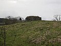 Newtown Pillbox (Whitton and Tosson) - geograph.org.uk - 4758476.jpg 1,066 × 800; 205 KB
-
 North of Simonside - geograph.org.uk - 5041344.jpg 1,600 × 1,200; 219 KB
-
 North-west from Ravens Heugh - geograph.org.uk - 4228007.jpg 1,024 × 768; 229 KB
-
 Northern Harwood Forest - geograph.org.uk - 5866555.jpg 2,048 × 1,536; 1.07 MB
-
 Northumberland Lights, Simonside - geograph.org.uk - 6344588.jpg 1,024 × 769; 801 KB
-
 Old pond at Whittondean - geograph.org.uk - 1426995.jpg 640 × 480; 126 KB
-
 Old post box, Newtown - geograph.org.uk - 4659199.jpg 600 × 800; 160 KB
-
 On Birky Hill - geograph.org.uk - 3646802.jpg 1,600 × 1,200; 317 KB
-
 On the forest trail, Simonside - geograph.org.uk - 872478.jpg 427 × 640; 122 KB
-
 Panoramic view below The Beacon - geograph.org.uk - 1193862.jpg 3,000 × 1,078; 739 KB
-
 Parish Boundary at Ravensheugh Crags - geograph.org.uk - 4228020.jpg 1,024 × 768; 260 KB
-
 Pasture south of Newtown - geograph.org.uk - 1887895.jpg 1,024 × 768; 278 KB
-
 Path between Ravens Heugh ^ Simonside - geograph.org.uk - 4228164.jpg 1,024 × 768; 312 KB
-
 Path from Simonside Hills to Tosson Hill - geograph.org.uk - 1818031.jpg 3,072 × 2,304; 3.05 MB
-
 Path marker cairn - geograph.org.uk - 5500586.jpg 1,600 × 1,067; 505 KB
-
 Path south of minor road - geograph.org.uk - 1193478.jpg 640 × 480; 77 KB
-

-
 Pool in Simonside - geograph.org.uk - 872514.jpg 640 × 427; 104 KB
-
 Prehistoric art - geograph.org.uk - 5184222.jpg 1,600 × 1,067; 363 KB
-
 Quarry on Weather Head - geograph.org.uk - 872549.jpg 640 × 427; 120 KB
-
 Reeds and pasture above the River Coquet - geograph.org.uk - 3646733.jpg 1,600 × 1,117; 299 KB
-
 Reedy hole surrounded by stone wall - geograph.org.uk - 4134215.jpg 1,600 × 1,200; 473 KB
-
 River Coquet - geograph.org.uk - 2101151.jpg 640 × 480; 79 KB
-
 River Coquet - geograph.org.uk - 2675140.jpg 640 × 426; 56 KB
-
 River Coquet - geograph.org.uk - 4659194.jpg 800 × 600; 489 KB
-
 River Coquet, Rothbury Golf Club - geograph.org.uk - 3092768.jpg 3,988 × 2,982; 2.28 MB
-
 Road junction at Allerdene - geograph.org.uk - 3353994.jpg 1,600 × 1,200; 488 KB
-
 Road leading to Simonside Forest - geograph.org.uk - 1193369.jpg 640 × 480; 93 KB
-
 Road to Lordenshaw at Newtown Park - geograph.org.uk - 4060549.jpg 4,000 × 3,000; 4.97 MB
-
 Rock on the path up to Simonside - geograph.org.uk - 5570932.jpg 480 × 640; 122 KB
-
 Rock outcrop above Little Church - geograph.org.uk - 5570907.jpg 640 × 480; 154 KB
-
 Rock outcrop below Simonside - geograph.org.uk - 5570936.jpg 640 × 480; 101 KB
-

-

-
 Rocks at The Beacon - geograph.org.uk - 5062984.jpg 1,500 × 789; 1.08 MB
-
 Rothbery Forest from the air - geograph.org.uk - 5680093.jpg 640 × 480; 128 KB
-
 Rough pasture south of Whitton Burn - geograph.org.uk - 1139380.jpg 640 × 480; 117 KB
-
 Ryehill Cottages - geograph.org.uk - 1095029.jpg 640 × 480; 86 KB
-
 Seat with a view - geograph.org.uk - 872522.jpg 640 × 427; 76 KB
-
 Seed bed - geograph.org.uk - 4659213.jpg 800 × 600; 494 KB
-
 Sheds at Allerdene - geograph.org.uk - 2100025.jpg 640 × 480; 92 KB
-
 Sheep in pasture - geograph.org.uk - 3646772.jpg 1,600 × 1,354; 317 KB
-
 Sheepfold on the edge of moorland - geograph.org.uk - 5350936.jpg 1,600 × 1,067; 292 KB
-
 Silverton Lane, Whitton - geograph.org.uk - 2186671.jpg 640 × 412; 191 KB
-
 Simonside - geograph.org.uk - 2674321.jpg 640 × 426; 56 KB
-
 Simonside - geograph.org.uk - 4060572.jpg 4,000 × 3,000; 4.86 MB
-
 Simonside Car Park - geograph.org.uk - 2674300.jpg 640 × 426; 112 KB
-
 Simonside Crag - geograph.org.uk - 1818016.jpg 3,872 × 2,592; 3.34 MB
-
 Simonside from Ravens Heugh - geograph.org.uk - 4228000.jpg 1,024 × 768; 253 KB
-
 Simonside Hills - geograph.org.uk - 1818008.jpg 3,872 × 2,592; 3.92 MB
-
 Simonside Hills - geograph.org.uk - 3550111.jpg 3,648 × 2,736; 4.92 MB
-
 Simonside Summit Cairn - geograph.org.uk - 4060592.jpg 4,000 × 3,000; 4.79 MB
-
 Spring and associated 'stream' - geograph.org.uk - 5292353.jpg 2,425 × 1,652; 1.53 MB
-
 St Oswald's Way - geograph.org.uk - 3647375.jpg 1,600 × 1,200; 325 KB
-
 Stile, Near Coquet Cairn - geograph.org.uk - 2059768.jpg 640 × 427; 293 KB
-
 Still life with chicken and pumpkins - geograph.org.uk - 4227757.jpg 1,024 × 768; 264 KB
-
 Stone for path improvements - geograph.org.uk - 872521.jpg 427 × 640; 78 KB
-
 The edge of Simonside Forest - geograph.org.uk - 3646776.jpg 1,600 × 1,200; 264 KB
-
 The guardian of Little Church cave - geograph.org.uk - 4228331.jpg 768 × 1,024; 441 KB
-
 The input end of Tosson Lime Kiln - geograph.org.uk - 3412954.jpg 1,600 × 1,200; 433 KB
-
 The lower of the two ponds west of Whittondean - geograph.org.uk - 1890664.jpg 1,024 × 768; 371 KB
-
 The main carved rock at Lordenshaw - geograph.org.uk - 4134050.jpg 900 × 1,200; 243 KB
-
 The Main Stone on Ravens Heugh - geograph.org.uk - 5500564.jpg 1,600 × 924; 392 KB
-
 The Main Stone, Ravens Heugh - geograph.org.uk - 2059759.jpg 640 × 427; 305 KB
-
 The Main Stone, Ravens Heugh - geograph.org.uk - 4228049.jpg 1,024 × 769; 262 KB
-
 The Main Stone, Ravens Heugh - geograph.org.uk - 4228128.jpg 1,024 × 640; 207 KB
-
 The northern slopes of Simonside - geograph.org.uk - 5570922.jpg 640 × 480; 97 KB
-
 The River Coquet and Lady's Bridge - geograph.org.uk - 3166050.jpg 4,608 × 3,456; 3.31 MB
-
 The River Coquet at Wolves Haugh - geograph.org.uk - 3166058.jpg 4,608 × 3,456; 3.21 MB
-
 The road to Great Tosson - geograph.org.uk - 3647379.jpg 1,600 × 1,089; 248 KB
-
 The start of Simonside Forest - geograph.org.uk - 5041525.jpg 1,600 × 1,229; 461 KB
-
 The summit cairn on Simonside - geograph.org.uk - 5041324.jpg 1,600 × 1,135; 332 KB
-
 The track to Wolfershiel - geograph.org.uk - 4047005.jpg 1,600 × 1,200; 333 KB
-
 Tosson Burgh hill fort from the south-east - geograph.org.uk - 1887967.jpg 1,024 × 768; 209 KB
-
 Tosson Burgh or Burgh Hill - geograph.org.uk - 5036988.jpg 1,600 × 1,215; 299 KB
-
 Tosson Burgh or Burgh Hill fort - geograph.org.uk - 5036991.jpg 1,600 × 1,200; 362 KB
-
 Tosson from Ravens Heugh - geograph.org.uk - 2059765.jpg 640 × 427; 291 KB
-
 Tosson Glebe - geograph.org.uk - 1887922.jpg 1,024 × 768; 273 KB
-
 Track heading to northernmost section of Harwood Forest - geograph.org.uk - 5400004.jpg 1,200 × 1,800; 349 KB
-
 Track junction - geograph.org.uk - 5041548.jpg 1,600 × 1,165; 474 KB
-
 Track through Simonside Forest - geograph.org.uk - 4060562.jpg 4,000 × 3,000; 5.16 MB
-
 Track towards Dove Crag - geograph.org.uk - 871202.jpg 640 × 427; 91 KB
-
 Trees guard the track to Wolfershiel - geograph.org.uk - 4047010.jpg 1,600 × 1,080; 382 KB
-
 Uppermost rock of Kate ^ Geordie - geograph.org.uk - 4227906.jpg 768 × 1,024; 382 KB
-
 View across arable fields from Carterside - geograph.org.uk - 3353419.jpg 1,600 × 1,170; 257 KB
-
 View across Upper Coquetdale - geograph.org.uk - 4393039.jpg 1,940 × 800; 264 KB
-
 View of fields from Carterside Cottages - geograph.org.uk - 4040896.jpg 2,558 × 1,688; 3.14 MB
-
 View of Rothbury - geograph.org.uk - 2383777.jpg 500 × 640; 254 KB
-
 View of Simonside - geograph.org.uk - 5500570.jpg 1,600 × 1,067; 345 KB


_-_geograph.org.uk_-_5500594.jpg)


_-_geograph.org.uk_-_5570909.jpg)


_-_geograph.org.uk_-_4758476.jpg)


