Category:Widemouth Bay
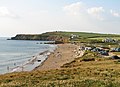
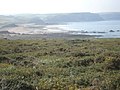
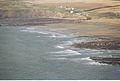
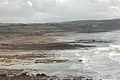
English: Widemouth Bay is a bay and beach on the Atlantic coast of Cornwall, England, UK, approximately 3 miles (5 km) south of Bude. This stretch of coast is steeped in the smuggling history of times before, and not far south of Widemouth Bay can be found many little inlets and coves.
village in United Kingdom  | |||||
| Upload media | |||||
| Instance of | |||||
|---|---|---|---|---|---|
| Location | Poundstock, Cornwall, South West England, England | ||||
 | |||||
Subcategories
This category has the following 2 subcategories, out of 2 total.
P
- Penhalt Cliff, Cornwall (12 F)
R
- Raven's Beak, St Gennys (6 F)
Media in category "Widemouth Bay"
The following 87 files are in this category, out of 87 total.
-
 Black Rock, Widemouth Beach, Devon - geograph.org.uk - 1470174.jpg 640 × 480; 74 KB
-
 Blackrock on Widemouth Bay - panoramio.jpg 2,048 × 1,536; 767 KB
-
 Bleak (2065504708).jpg 3,872 × 2,592; 5.5 MB
-
 Bungalows at Widemouth Bay - geograph.org.uk - 1550645.jpg 640 × 480; 62 KB
-
-
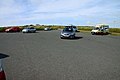
 Car Park, Widemouth Bay - geograph.org.uk - 1550651.jpg 640 × 480; 61 KB
-
 Checking out the surfers - geograph.org.uk - 5577708.jpg 1,795 × 1,346; 524 KB
-

-

-
 Coastal Scene - geograph.org.uk - 253166.jpg 640 × 426; 28 KB
-
 Coastal view near Widemouth Bay - geograph.org.uk - 1516405.jpg 640 × 418; 101 KB
-
 Cornish flag and fields with sheep - geograph.org.uk - 411206.jpg 480 × 640; 220 KB
-
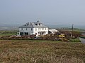
 Elements Hotel - geograph.org.uk - 563744.jpg 589 × 441; 119 KB
-
 Inn on the Coast Road - geograph.org.uk - 1535313.jpg 640 × 426; 91 KB
-
 Kennacott Court - panoramio.jpg 2,048 × 1,536; 770 KB
-
 Kennacott Court, Salthouse - panoramio - Ray Ok.jpg 2,048 × 1,536; 773 KB
-
 Kennacott Court, Salthouse - panoramio.jpg 2,048 × 1,536; 818 KB
-
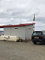 Lifeguardbude in Widemouth Bay, Cornwall.jpg 1,536 × 2,048; 468 KB
-

-
 Low tide at Widemouth Sand - geograph.org.uk - 5577709.jpg 1,795 × 1,346; 368 KB
-
 N Cornwall coast and GCHQ Bude.jpg 2,800 × 1,863; 2.33 MB
-
 North Cornish coast - geograph.org.uk - 1083823.jpg 640 × 480; 197 KB
-
 Penhalt Cliff, Poundstock - geograph.org.uk - 1385591.jpg 640 × 480; 113 KB
-

-
 Public conveniences at Widemouth Bay - geograph.org.uk - 1460047.jpg 640 × 427; 63 KB
-
 Road and gorse, Penhalt Cliff - geograph.org.uk - 411236.jpg 640 × 480; 228 KB
-
 Rocks (2069175342).jpg 3,296 × 2,472; 5.87 MB
-
 Rocks formation N Cornwall.jpg 2,800 × 1,772; 2.93 MB
-
 Rough sea at Widemouth Bay - geograph.org.uk - 2643590.jpg 3,040 × 2,288; 3 MB
-
 Saltstone Strand - geograph.org.uk - 505340.jpg 640 × 480; 135 KB
-
 Sea Bindweed at Widemouth Bay.jpg 1,992 × 1,544; 1.55 MB
-
 Silvery seas - geograph.org.uk - 4137952.jpg 640 × 480; 157 KB
-
 Stratton and Bude, Widemouth Sand - geograph.org.uk - 1275122.jpg 640 × 427; 406 KB
-
 Strong waves at Widemouth Bay.jpg 4,068 × 2,848; 5.43 MB
-
 The beach at Widemouth Bay - geograph.org.uk - 4917152.jpg 1,600 × 1,200; 224 KB
-

-
 The beach on Widemouth Sand - geograph.org.uk - 1460041.jpg 640 × 417; 71 KB
-
 The beach on Widemouth Sand - geograph.org.uk - 1460043.jpg 640 × 410; 51 KB
-
 The road to Widemouth Bay - geograph.org.uk - 1516363.jpg 640 × 413; 87 KB
-

-
 Underground Bunker - panoramio.jpg 2,048 × 1,536; 767 KB
-
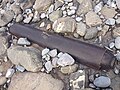 Unknown metal thingy at Widemouth Bay.jpg 3,264 × 2,448; 2.32 MB
-
 View North from Penhalt Cliff - geograph.org.uk - 25081.jpg 640 × 476; 128 KB
-
 Church of Our Lady and St Anne - geograph.org.uk - 415745.jpg 450 × 640; 68 KB
-
 Widemouth Bay (2065501720).jpg 3,872 × 2,592; 4.7 MB
-
 Widemouth Bay from Penhalt Cliff - geograph.org.uk - 914995.jpg 640 × 504; 80 KB
-
 Widemouth Bay from the south.jpg 3,976 × 2,796; 4.96 MB
-
 Widemouth Bay in north Cornwall - aerial image (29312833893).jpg 2,200 × 1,457; 1.34 MB
-
 Widemouth Bay in north Cornwall - aerial image (29825044612).jpg 2,200 × 1,457; 1.39 MB
-
 Widemouth Bay on a misty day - geograph.org.uk - 1573805.jpg 640 × 480; 59 KB
-
 Widemouth bay panorama.jpg 10,800 × 2,402; 7.54 MB
-
 Widemouth Sand - geograph.org.uk - 130810.jpg 640 × 424; 113 KB
-
 Widemouth Sand - geograph.org.uk - 1460027.jpg 640 × 423; 63 KB
-
 Widemouth Sand - geograph.org.uk - 1516353.jpg 640 × 427; 79 KB
-
 Widemouth Sand - geograph.org.uk - 1550647.jpg 640 × 480; 64 KB
-
 Widemouth Sand - geograph.org.uk - 1737611.jpg 640 × 427; 101 KB
-
 Widemouth Sand and Lower Longbeak - geograph.org.uk - 1447443.jpg 640 × 462; 95 KB
-
 Widemouth Sand.jpg 3,944 × 2,848; 4.04 MB
-
 Widemouthbay.jpg 1,280 × 960; 163 KB
-
 WidemouthBay2009.jpg 3,072 × 2,304; 814 KB
-
 WidemouthBay2009North.jpg 3,072 × 1,728; 553 KB
-
 WidemouthBay2009South.jpg 3,072 × 1,728; 530 KB
-
 Windswept Trees - panoramio.jpg 2,048 × 1,536; 804 KB
-
 Approaching Poundstock - geograph.org.uk - 839289.jpg 640 × 480; 131 KB
-
 Arable field near Widemouth Bay - geograph.org.uk - 1516400.jpg 640 × 427; 96 KB
-
 Coast road - geograph.org.uk - 253160.jpg 640 × 426; 54 KB
-
 Drive to Mill Farm - geograph.org.uk - 503094.jpg 640 × 480; 111 KB
-
 Dunes at Widemouth Bay - geograph.org.uk - 563709.jpg 640 × 480; 130 KB
-
 Elements Surf Hotel, Bude - geograph.org.uk - 411199.jpg 640 × 480; 238 KB
-
 Footpath to Millook leaving lane - geograph.org.uk - 505355.jpg 640 × 480; 117 KB
-
 Foreshore near Millook - geograph.org.uk - 501077.jpg 640 × 480; 139 KB
-
 Higher Longbeak - geograph.org.uk - 563725.jpg 640 × 480; 146 KB
-
 Joggers on coast path, Upton - geograph.org.uk - 411195.jpg 640 × 480; 226 KB
-
 Lower Longbeak - geograph.org.uk - 563704.jpg 640 × 480; 137 KB
-
 Pengallic - geograph.org.uk - 503072.jpg 640 × 480; 152 KB
-
 Phillip's Point, beach and cliffs - geograph.org.uk - 411201.jpg 640 × 480; 248 KB
-
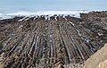
 Rock strata at Phillip's Point - geograph.org.uk - 563726.jpg 640 × 480; 140 KB
-
 Stepped coast path above Wanson Mouth - geograph.org.uk - 411208.jpg 480 × 640; 311 KB
-
 Stream by Wanson Mouth - geograph.org.uk - 404709.jpg 480 × 640; 323 KB
-
 Wanson Mouth and coast path - geograph.org.uk - 411216.jpg 480 × 640; 260 KB
-
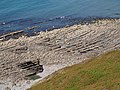
 Wave-cut platform below Phillips Point - geograph.org.uk - 404703.jpg 480 × 640; 256 KB
-
 Widemouth - geograph.org.uk - 253353.jpg 640 × 426; 55 KB
-
 Widemouth - geograph.org.uk - 253422.jpg 640 × 426; 48 KB
-
 Widemouth Sand - geograph.org.uk - 130813.jpg 640 × 432; 64 KB
-
 Widemouth Sand - geograph.org.uk - 253146.jpg 640 × 426; 33 KB
-
 Widemouth Sand - geograph.org.uk - 253150.jpg 640 × 426; 48 KB
-
 Widemouth Sand - geograph.org.uk - 253360.jpg 640 × 426; 45 KB


.jpg)


_-_geograph.org.uk_-_415746.jpg)


.jpg)


.jpg)

.jpg)
.jpg)


