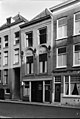
Category:Wijnstraat 110, Dordrecht
| Object location | | View all coordinates using: OpenStreetMap |
|---|
building in Dordrecht, Netherlands  | |||||
| Upload media | |||||
| Instance of | |||||
|---|---|---|---|---|---|
| Location | Dordrecht, South Holland, Netherlands | ||||
| Street address |
| ||||
| Heritage designation |
| ||||
 | |||||
|
This is a category about rijksmonument number 14024
|
| Address |
|
Media in category "Wijnstraat 110, Dordrecht"
The following 6 files are in this category, out of 6 total.
-
 Bleijenhoek, 3311 Dordrecht, Netherlands - panoramio (4).jpg 2,048 × 1,148; 592 KB
-
 RM14024 Dordrecht - Wijnstraat 110.jpg 1,944 × 2,592; 1.27 MB
-
 Voorgevels - Dordrecht - 20063144 - RCE.jpg 802 × 1,200; 174 KB
-
 Voorgevels - Dordrecht - 20063148 - RCE.jpg 804 × 1,200; 184 KB
-
 Voorgevels overzicht - Dordrecht - 20063145 - RCE.jpg 960 × 1,200; 230 KB
-
 Wijnstraat 88-110, Dordrecht Netherlands - panoramio (31).jpg 2,048 × 1,148; 436 KB
.jpg)


.jpg)