Category:Wikimaps
wikimapia | |||||
| Upload media | |||||
| Instance of | |||||
|---|---|---|---|---|---|
| Genre | |||||
| |||||
Wikimaps is a draft for a project, that aims to collect historical maps in Wikimedia Commons, georeference them via crowdsourcing and publish in a web mapping environment. From there the work can continue to storing and using historical geodata.
Subcategories
This category has the following 4 subcategories, out of 4 total.
C
Pages in category "Wikimaps"
The following 11 pages are in this category, out of 11 total.
W
- Commons:Wikimaps
- Commons:Wikimaps/Cartographic GLAM model
- Commons:Wikimaps/Design
- Commons:Wikimaps/Development
- Commons:Wikimaps/IEG
- Commons:Wikimaps/Participants
- Commons:Wikimaps/Requirements
- Commons:Wikimaps/Resources
- Commons:Wikimaps/Wikimaps Nordic
- Commons:Wikimaps/Wikimaps Nordic/Pilot
- Commons:Wikimaps/Wikimaps Tartu–Hong Kong
Media in category "Wikimaps"
The following 44 files are in this category, out of 44 total.
-

-
 DroneArt Helsinki! photoshoot.JPG 1,920 × 1,080; 1.1 MB
-
 Expert meeting Wiki Loves Maps, Amsterdam, 24 May 2014 02.jpg 1,840 × 3,264; 1.31 MB
-
 Flow-gwtoolset-01.png 1,254 × 416; 113 KB
-
 GLAM-WIKI Wikimaps.pdf 2,666 × 1,666, 31 pages; 3.69 MB
-
 Historical maps workshop.png 960 × 600; 1.3 MB
-
 Josephinische Landesaufnahme Wien 1768 Auszug Nordwestbahnstraße.jpg 469 × 447; 222 KB
-
 Maker space title.png 624 × 387; 102 KB
-
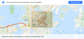
 Map display demo.png 599 × 463; 404 KB
-
 Map objects over time.svg 1,766 × 1,701; 29 KB
-
 Maplocatormap-noinfo.png 1,037 × 60; 4 KB
-
 Maplocatormap-overlay-01.png 1,037 × 484; 619 KB
-
 Maplocatormap-placed.png 1,037 × 484; 599 KB
-
 Maplocatormap-rotate 01.png 1,037 × 484; 637 KB
-
 Maplocatormap-scaled.png 1,038 × 425; 492 KB
-
 Maplocatormap-warped.png 1,037 × 484; 638 KB
-
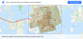
 Old map in article.png 1,192 × 697; 584 KB
-
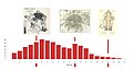 OSM map scales from BL georeferencing.jpg 1,240 × 657; 126 KB
-
 Overpass Turbo experiment with old maps.png 882 × 700; 1.5 MB
-
 Radial control sketch.png 181 × 166; 86 KB
-
 Sketch for a sidebar timeline.png 275 × 503; 178 KB
-
 Susanna Aanaes Wikimaps Nordic 131216.pdf 2,666 × 1,666, 46 pages; 2.71 MB
-
 Tutorial screenshot.png 1,127 × 704; 476 KB
-
 Wikimaps - Flow - Upload wizard.png 1,253 × 349; 66 KB
-
 Wikimaps Gadget scheme.png 1,254 × 385; 72 KB
-
 Wikimaps Gadget.png 165 × 187; 15 KB
-
 Wikimaps kickoff Helsingfors.jpeg 2,592 × 1,944; 2 MB
-
 Wikimaps kickoff panorama.jpeg 3,672 × 696; 1.65 MB
-
 Wikimaps kickoff Susanna.jpeg 2,592 × 1,944; 1.22 MB
-
 Wikimaps luonnos.jpeg 1,280 × 800; 291 KB
-
 Wikimaps maps session.jpeg 1,993 × 1,578; 699 KB
-
 Wikimaps presentation at Iberoconf 2014.pdf 2,666 × 1,666, 74 pages; 14.65 MB
-
 Wikimaps project flowchart.png 4,288 × 1,458; 686 KB
-
 Wikimaps scheme.png 1,280 × 800; 307 KB
-
 Wikimaps search input - Time.png 1,249 × 1,225; 115 KB
-
 Wikimaps Warper Category import.png 896 × 504; 738 KB
-
 Wikimaps Warper control point interface mockup.png 1,252 × 815; 1.23 MB
-
 Wikimaps Wikimania 2013.pdf 2,666 × 1,666, 55 pages; 9.9 MB
-
 Wikimaps-logo.svg 512 × 512; 292 bytes
-
 Wikimaps-warper mashup.png 1,252 × 815; 1.37 MB
-
 Wm–maps-search-free-01.png 2,842 × 1,858; 1.49 MB
-
 Wm–maps-warp-01.png 1,364 × 892; 1.29 MB
-
 Y13.png 256 × 256; 9 KB
-
 Y23.png 256 × 256; 5 KB


