Category:Wilcot
village and former civil parish in Wiltshire, UK  | |||||
| Upload media | |||||
| Instance of |
| ||||
|---|---|---|---|---|---|
| Location | Wilcot, Huish and Oare, Wiltshire, South West England, England | ||||
| official website | |||||
 | |||||
Subcategories
This category has the following 5 subcategories, out of 5 total.
Media in category "Wilcot"
The following 56 files are in this category, out of 56 total.
-
 2011 , Alton Road, looking north west - geograph.org.uk - 2678998.jpg 4,267 × 2,850; 5.85 MB
-
 2011 , North near West Stowell - geograph.org.uk - 2707657.jpg 3,753 × 2,345; 2.45 MB
-
 2011 , North of west near West Stowell - geograph.org.uk - 2707635.jpg 4,115 × 2,704; 4.89 MB
-

-

-
 Bowden's Bridge.. Kennet ^ Avon Canal - geograph.org.uk - 3351396.jpg 4,864 × 3,648; 2.8 MB
-
 Cottage near Stowell Park - geograph.org.uk - 3332863.jpg 3,463 × 2,736; 5.03 MB
-

-
 Dewpond on golden Ball Hill - geograph.org.uk - 1943558.jpg 1,256 × 924; 335 KB
-
 Draycott Hill - geograph.org.uk - 1912371.jpg 640 × 426; 84 KB
-
 Draycott Hill - geograph.org.uk - 1914105.jpg 640 × 427; 75 KB
-
 Draycott Hill - geograph.org.uk - 1914129.jpg 640 × 426; 79 KB
-
 Draycott Hill - geograph.org.uk - 1914151.jpg 640 × 426; 94 KB
-
 Draycott Hill - geograph.org.uk - 1917218.jpg 640 × 427; 109 KB
-
 Draycott Hill - geograph.org.uk - 1917236.jpg 640 × 426; 112 KB
-
 Draycott Hill - geograph.org.uk - 1917246.jpg 640 × 426; 90 KB
-
 Early bird weathervane in Wilcot - geograph.org.uk - 3435245.jpg 800 × 600; 66 KB
-
 Edge of Gopher Wood - geograph.org.uk - 1917073.jpg 640 × 426; 103 KB
-
 Farm road north west of Wilcot - geograph.org.uk - 3435283.jpg 800 × 600; 142 KB
-
 Field north of Gopher Wood - geograph.org.uk - 1916011.jpg 640 × 426; 98 KB
-
 Field south of Shaw Copse - geograph.org.uk - 1915991.jpg 640 × 426; 98 KB
-
 Gate at West Stowell - geograph.org.uk - 3365714.jpg 3,605 × 2,716; 4.37 MB
-
 Gateway by Gopher Wood - geograph.org.uk - 1917075.jpg 640 × 426; 137 KB
-
 Hare Street enters Wilcot - geograph.org.uk - 2957321.jpg 3,647 × 2,507; 1.59 MB
-
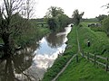
 Kennet and Avon Canal - geograph.org.uk - 86733.jpg 640 × 480; 144 KB
-
 Kennet and Avon Canal - geograph.org.uk - 86785.jpg 640 × 479; 59 KB
-
 Kennet and Avon Canal in the big freeze - geograph.org.uk - 1170869.jpg 640 × 419; 126 KB
-
 Kennet ^ Avon Canal (looking east) from Alton Road Bridge - geograph.org.uk - 2957475.jpg 3,648 × 2,736; 2.71 MB
-
 Kennet ^ Avon Canal (looking west) from Alton Road Bridge - geograph.org.uk - 2957473.jpg 3,648 × 2,736; 2.02 MB
-
 Ladies Bridge - geograph.org.uk - 3655.jpg 640 × 480; 62 KB
-
 Ladies Bridge, Kennet and Avon Canal - geograph.org.uk - 416264.jpg 640 × 515; 103 KB
-
 Ladies Bridge, Kennet and Avon Canal - geograph.org.uk - 856178.jpg 640 × 480; 116 KB
-
 Lane and cottages south of Wilcot Green - geograph.org.uk - 2957463.jpg 3,648 × 2,736; 3.07 MB
-
 Lane by Stowell Park - geograph.org.uk - 289995.jpg 640 × 480; 113 KB
-
 Lane junction northwest of Stowell Park - geograph.org.uk - 2957487.jpg 3,648 × 2,499; 2.1 MB
-
 Maize crop, West Stowell - geograph.org.uk - 1428813.jpg 640 × 480; 139 KB
-
 Ordnance Survey Drawings - Wilcot (OSD 62).jpg 4,000 × 2,705; 3.58 MB
-

-
 Small green by Wilcot church - geograph.org.uk - 3435252.jpg 800 × 655; 192 KB
-
 Southwest Gatehouse for Stowell Park - geograph.org.uk - 2957479.jpg 3,648 × 2,736; 2.15 MB
-

-
 Stowell Park House - geograph.org.uk - 3371122.jpg 4,864 × 3,648; 4.65 MB
-
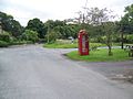 Telephone box, Wilcot - geograph.org.uk - 1429537.jpg 640 × 480; 120 KB
-
 The road by the church in Wilcot - geograph.org.uk - 3435270.jpg 800 × 560; 138 KB
-
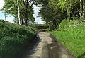
 The road going north west from Wilcot - geograph.org.uk - 3435279.jpg 800 × 600; 137 KB
-
 We can't hare along Hare Street - geograph.org.uk - 2957302.jpg 3,648 × 2,736; 2.06 MB
-
 West of Draycott Hill - geograph.org.uk - 1917262.jpg 640 × 432; 89 KB
-
 West of Draycott Hill - geograph.org.uk - 1917298.jpg 640 × 429; 84 KB
-
 Wilcot - Bristow Bridge - geograph.org.uk - 2834240.jpg 800 × 600; 223 KB
-
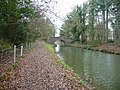
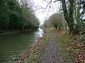 Wilcot - Kennet And Avon Canal - geograph.org.uk - 2834257.jpg 800 × 600; 203 KB
-
 Wilcot - Moss - geograph.org.uk - 2834223.jpg 800 × 600; 168 KB
-
 Wilcot - Pillbox - geograph.org.uk - 2834198.jpg 800 × 600; 252 KB
-
 Wilcot - Pillbox - geograph.org.uk - 2834213.jpg 800 × 600; 250 KB
-
 Wilcot Bridge 117, Kennet and Avon Canal - geograph.org.uk - 791289.jpg 640 × 405; 103 KB
-

-
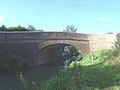
 Wilcot, Bridge No 116 (geograph 4793709).jpg 1,024 × 769; 178 KB


_from_Alton_Road_Bridge_-_geograph.org.uk_-_2957475.jpg)
_from_Alton_Road_Bridge_-_geograph.org.uk_-_2957473.jpg)


.jpg)


.jpg)