Category:Wilhelmsthal
municipality of Germany     | |||||
| Upload media | |||||
| Instance of |
| ||||
|---|---|---|---|---|---|
| Part of |
| ||||
| Location | Kronach, Upper Franconia, Bavaria, Germany | ||||
| Head of government |
| ||||
| Population |
| ||||
| Area |
| ||||
| Elevation above sea level |
| ||||
| Different from | |||||
| official website | |||||
 | |||||
Subcategories
This category has the following 4 subcategories, out of 4 total.
Media in category "Wilhelmsthal"
The following 13 files are in this category, out of 13 total.
-
 DEU Wilhelmsthal COA.svg 659 × 724; 57 KB
-
 Wappen von Wilhelmsthal.png 218 × 231; 12 KB
-
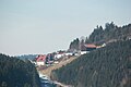
 Blick auf Wilhelmsthal - panoramio.jpg 2,560 × 1,920; 2.34 MB
-
 Digitales Orthofoto von Wilhelmsthal (Bayerische Vermessungsverwaltung).tif 22,500 × 40,000; 1.37 GB
-
 Dlkmldw.jpg 4,032 × 3,024; 1.95 MB
-
 Eichenleithen (MGK03759).jpg 5,184 × 3,456; 4.76 MB
-
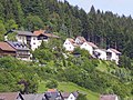
 Ein Haus in Wilhelmsthal - panoramio.jpg 2,560 × 1,920; 2.32 MB
-
 Haus mit Aussicht auf Wilhelmsthal - panoramio.jpg 2,560 × 1,920; 2.28 MB
-
 Wilhelmsthal im Landkreis Kronach.png 412 × 549; 51 KB
-
 Wilhelmsthal in KC.svg 456 × 555; 1.05 MB
-
 Wilhelmsthal Kraftpostlinie.jpg 1,656 × 921; 425 KB
-
 Wilhelmsthal, KC - Schäferei v N, Eibenberg Nr 38 v O Panorama.jpg 3,991 × 920; 243 KB
-
 Wilhelmsthal.jpg 640 × 428; 52 KB


.jpg)


