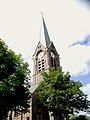
Category:Willibrorduskerk (Kloosterburen)
| Object location | | View all coordinates using: OpenStreetMap |
|---|
 | |||||
| Upload media | |||||
| Instance of | |||||
|---|---|---|---|---|---|
| Dedicated to | |||||
| Location | Kloosterburen, Het Hogeland, Groningen, Netherlands | ||||
| Street address |
| ||||
| Located on street |
| ||||
| Architect | |||||
| Heritage designation |
| ||||
| Inception |
| ||||
| Significant event |
| ||||
| Religion or worldview | |||||
| official website | |||||
 | |||||
|
This is a category about rijksmonument number 509515
|
Nederlands: Willibrorduskerk - anno 1869
| Address |
|
Subcategories
This category has only the following subcategory.
K
- Kloostertuin Kloosterburen (12 F)
Media in category "Willibrorduskerk (Kloosterburen)"
The following 10 files are in this category, out of 10 total.
-
 Exterieur - Kloosterburen - 20125948 - RCE.jpg 951 × 1,200; 220 KB
-
 Exterieur - Kloosterburen - 20125949 - RCE.jpg 954 × 1,200; 153 KB
-
 Exterieur - Kloosterburen - 20125950 - RCE.jpg 963 × 1,200; 399 KB
-
 Interieur - Kloosterburen - 20125947 - RCE.jpg 951 × 1,200; 265 KB
-
 Interieur - Kloosterburen - 20125951 - RCE.jpg 967 × 1,200; 259 KB
-
 Interieur - Kloosterburen - 20125952 - RCE.jpg 960 × 1,200; 251 KB
-
 Kleasterbuorren, Sint-Willibrordustsjerke.jpg 1,600 × 1,068; 1.47 MB
-
 Kloosterburen - Willibrorduskerk.jpg 4,884 × 3,489; 8.71 MB
-
 Kloosterburen.jpg 1,536 × 2,048; 593 KB
-
 Kloostertuin Kloosterburen 21 01 54 481000.jpeg 4,032 × 3,024; 5.17 MB


