Category:Wind pumps in Herefordshire
Media in category "Wind pumps in Herefordshire"
The following 17 files are in this category, out of 17 total.
-
 Disused windpump near Ingestone - geograph.org.uk - 245170.jpg 480 × 640; 189 KB
-
 Old windpump near Ledbury - geograph.org.uk - 753508.jpg 640 × 426; 59 KB
-
 Orchard windpump - geograph.org.uk - 171524.jpg 640 × 480; 78 KB
-
 Remains of Windpump, Freetown - geograph.org.uk - 100000.jpg 640 × 479; 57 KB
-
 Toward The Wind Pump - geograph.org.uk - 1200556.jpg 640 × 480; 182 KB
-
 Tractor Tramlines and Site of Windpump - geograph.org.uk - 99768.jpg 640 × 479; 105 KB
-
 Wind Pump and Cowarne Wood - geograph.org.uk - 95652.jpg 640 × 479; 61 KB
-
 Wind pump and Oasts at Munsley Court - geograph.org.uk - 2963324.jpg 2,256 × 1,496; 920 KB
-
 Wind pump at Mordiford - geograph.org.uk - 537727.jpg 480 × 640; 94 KB
-
 Wind pump near Hope's Rough - geograph.org.uk - 4639891.jpg 3,456 × 5,184; 5.02 MB
-
 Wind Pump near Hope's Rough - geograph.org.uk - 98786.jpg 640 × 479; 84 KB
-
 Wind pump near Tump Farm, Fownhope - geograph.org.uk - 532433.jpg 640 × 523; 115 KB
-
 Windpump at Folly Farm - geograph.org.uk - 171510.jpg 640 × 480; 57 KB
-
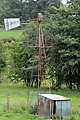
 Windpump at Munsley Court - geograph.org.uk - 70706.jpg 640 × 426; 93 KB
-
 Windpump near Dinglewood Park Farm - geograph.org.uk - 3613105.jpg 427 × 640; 86 KB
-
 Windpump, Buckton - geograph.org.uk - 2345346.jpg 640 × 430; 100 KB
-
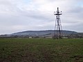
 Windpump, Dinedor Hill - geograph.org.uk - 159928.jpg 640 × 426; 88 KB


