Category:Wind speed maps
Subcategories
This category has the following 3 subcategories, out of 3 total.
Media in category "Wind speed maps"
The following 17 files are in this category, out of 17 total.
-
 Circulation Northeaster.png 522 × 644; 44 KB
-
 Colorado low circulation.png 1,280 × 1,024; 169 KB
-
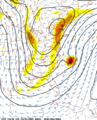
 Dirk-vents-Îles Britanniques.svg 1,300 × 2,276; 565 KB
-
 Historische kaart.jpg 3,507 × 2,480; 3.64 MB
-
 National Weather Service (NWS) August 2020 Derecho Damage Survey Composite Map.png 1,804 × 1,204; 184 KB
-
 National Weather Service (NWS) Des Moines August 2020 Derecho Wind Estimate Map.jpg 1,392 × 863; 1.23 MB
-

-
 NOAA Wavewatch III Sample Forecast.gif 535 × 478; 82 KB
-
 NWS-NOAA Omega wind heatwave June 28-July 4, 2015.jpg 610 × 490; 286 KB
-
 SantaAnaWinds QuikSCAT 2002feb.jpg 540 × 377; 92 KB
-
 Storm 150725 max uurgemiddelde wind.png 570 × 622; 256 KB
-
 Vents altitude vapeur eau.gif 640 × 480; 127 KB
-
 Vents altitude vapeur eau.png 640 × 480; 119 KB
-
 Wetter Atlantiksturm.png 1,586 × 877; 606 KB
-
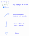 Wind barbs.fr.gif 464 × 588; 7 KB
-
 Wind Power Density in Africa from Global Wind Atlas.jpg 701 × 648; 100 KB
-
Wind vectors and monthly average CO2 concentrations in 2003.ogv 20 s, 960 × 540; 3.78 MB


_August_2020_Derecho_Damage_Survey_Composite_Map.png)
_Des_Moines_August_2020_Derecho_Wind_Estimate_Map.jpg)
_Quad_Cities_August_2020_Derecho_Localized_Wind_Estimate_Map.png)


