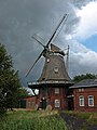
Category:Windmühle Dedesdorf
| Object location | | View all coordinates using: OpenStreetMap |
|---|
 | |||||
| Upload media | |||||
| Instance of | |||||
|---|---|---|---|---|---|
| Location | Loxstedt, Cuxhaven, Lower Saxony, Germany | ||||
| Heritage designation | |||||
| Source of energy |
| ||||
 | |||||
Media in category "Windmühle Dedesdorf"
The following 2 files are in this category, out of 2 total.
-
 Dedesdorf Muehle Ursel.jpg 2,736 × 3,648; 2.48 MB
-
 Windmuehle Dedesdorf.jpg 1,200 × 1,792; 428 KB
