Category:Winterton-on-Sea
English: Winterton-on-Sea is a village and civil parish in the English county of Norfolk. As its name suggests, it is situated on the coast some east of the city of Norwich.
village in the United Kingdom  | |||||
| Upload media | |||||
| Instance of | |||||
|---|---|---|---|---|---|
| Location | Great Yarmouth, Norfolk, East of England, England | ||||
| Population |
| ||||
| Area |
| ||||
 | |||||
Subcategories
This category has the following 3 subcategories, out of 3 total.
B
N
S
Media in category "Winterton-on-Sea"
The following 200 files are in this category, out of 208 total.
(previous page) (next page)-
 A whale stranded on the coast at Winterton. Wellcome V0050697.jpg 3,380 × 2,192; 3.78 MB
-
 Abandoned tractor, Winterton - geograph.org.uk - 1634001.jpg 640 × 427; 79 KB
-
 Access to the beach at Bramble Hill - geograph.org.uk - 6073535.jpg 800 × 555; 132 KB
-
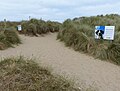
 Beach access, Winterton Ness - geograph.org.uk - 5608747.jpg 1,600 × 1,200; 224 KB
-

-
 Beach, Winterton-on-Sea - geograph.org.uk - 5588954.jpg 640 × 480; 63 KB
-
 Black Street, Winterton-on-Sea - geograph.org.uk - 4940905.jpg 640 × 480; 70 KB
-

-
 Bungalow, Long Beach Estate - geograph.org.uk - 4971594.jpg 640 × 480; 78 KB
-
 Bungalow, Long Beach Estate - geograph.org.uk - 4971597.jpg 640 × 480; 73 KB
-
 Bush and barn at Mill Farm - geograph.org.uk - 2996397.jpg 4,320 × 3,240; 5.95 MB
-
 Car dealer, Winterton on Sea - geograph.org.uk - 2984334.jpg 4,320 × 3,240; 4.55 MB
-
 Close up, Elizabeth II postbox, Long Beach, Hemsby - geograph.org.uk - 4940911.jpg 1,565 × 2,878; 953 KB
-
 Coastguard station at the beach car park - geograph.org.uk - 3290441.jpg 3,264 × 2,448; 1.57 MB
-
 Cottages opposite the pub - geograph.org.uk - 3724020.jpg 1,142 × 857; 348 KB
-
 Damp area, Winterton Dunes - geograph.org.uk - 5608749.jpg 1,600 × 1,200; 376 KB
-
 Danger - Keep Out - geograph.org.uk - 1083424.jpg 640 × 453; 85 KB
-
 Deep puddles on track - geograph.org.uk - 1083432.jpg 640 × 473; 104 KB
-
 Dune slack, Winterton - geograph.org.uk - 5608754.jpg 1,600 × 1,200; 331 KB
-
 Dunes at Winterton-on-Sea - geograph.org.uk - 5537954.jpg 5,184 × 3,456; 7.86 MB
-
 Dunes at Winterton-on-Sea - geograph.org.uk - 5537955.jpg 4,000 × 3,000; 3.36 MB
-
 Elizabeth II postbox, Winterton-on-Sea Post Office - geograph.org.uk - 4940924.jpg 1,392 × 2,472; 485 KB
-
 Empty car park by the Dunes Café - geograph.org.uk - 3968966.jpg 640 × 595; 137 KB
-
 Entering Winterton-on-Sea - geograph.org.uk - 4971526.jpg 640 × 431; 56 KB
-

-

-
 Farmland near Winterton-on-Sea - geograph.org.uk - 2996387.jpg 4,320 × 3,240; 5.62 MB
-
 Field west of Winterton - geograph.org.uk - 1246380.jpg 640 × 480; 104 KB
-
 Fishermans Return - geograph.org.uk - 388146.jpg 637 × 432; 92 KB
-
 Fishermans Return sign - geograph.org.uk - 5537960.jpg 2,202 × 2,936; 2 MB
-
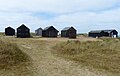 Fishermen's huts at Winterton-on-Sea - geograph.org.uk - 6073144.jpg 800 × 505; 85 KB
-
 Fishermens' huts - geograph.org.uk - 3008269.jpg 2,272 × 1,704; 2.12 MB
-
 Flat field near Winterton-on-Sea - geograph.org.uk - 4971584.jpg 640 × 480; 47 KB
-
 Footpath junction in the dunes - geograph.org.uk - 581886.jpg 480 × 640; 100 KB
-
 Foraging amongst the tank traps - geograph.org.uk - 3777614.jpg 857 × 1,142; 408 KB
-
 Former Primitive Methodist Chapel, Winterton - geograph.org.uk - 3777875.jpg 1,142 × 857; 339 KB
-

-
 Gap in the dunes near Hemsby - geograph.org.uk - 6070930.jpg 800 × 474; 99 KB
-
 General store, Winterton - geograph.org.uk - 1659387.jpg 640 × 427; 59 KB
-
 George V postbox on Black Street, Winterton-on-Sea - geograph.org.uk - 4940904.jpg 1,621 × 2,980; 815 KB
-
 Hemsby beach, just north of The Marrams - geograph.org.uk - 3733157.jpg 1,142 × 857; 219 KB
-
 Hemsby Road - geograph.org.uk - 4971580.jpg 640 × 480; 61 KB
-
 Hemsby Road - geograph.org.uk - 4971589.jpg 640 × 480; 70 KB
-
 High Barn Farm - geograph.org.uk - 4971586.jpg 640 × 480; 55 KB
-
 His and her holiday cottages, Winterton-on-Sea - geograph.org.uk - 2991856.jpg 4,320 × 3,240; 5.15 MB
-
 Holiday houses at Hermanus Holidays - geograph.org.uk - 5537945.jpg 5,184 × 3,456; 5.97 MB
-
 Holiday houses at Hermanus Holidays - geograph.org.uk - 5537948.jpg 5,184 × 3,456; 5.92 MB
-
 Holiday houses at Hermanus Holidays - geograph.org.uk - 5537950.jpg 5,184 × 3,456; 4.87 MB
-
 Holiday houses at Hermanus Holidays - geograph.org.uk - 5537952.jpg 5,184 × 3,456; 4.54 MB
-
 Holiday houses at Hermanus Holidays - geograph.org.uk - 5537956.jpg 4,000 × 3,000; 4.88 MB
-
 Holiday houses at Hermanus Holidays - geograph.org.uk - 5537957.jpg 5,184 × 3,456; 4.49 MB
-
 House on The Lane - geograph.org.uk - 5537959.jpg 4,000 × 3,000; 3.95 MB
-

-
 Informative sign at Winterton - geograph.org.uk - 5062160.jpg 640 × 480; 40 KB
-
 Irrigation hose in arable field near Winterton-on-Sea - geograph.org.uk - 3606972.jpg 4,320 × 3,240; 4.48 MB
-
 Junction of The Lane with Black Street - geograph.org.uk - 3734642.jpg 1,142 × 857; 450 KB
-
 King's Corner, Winterton-on-Sea - geograph.org.uk - 3590092.jpg 2,592 × 1,944; 1.3 MB
-
 Long Beach Estate - geograph.org.uk - 4971596.jpg 640 × 480; 61 KB
-

-

-

-

-
 Low Farm - geograph.org.uk - 3733170.jpg 1,142 × 857; 373 KB
-
 Luxury Holiday Barn, Mill Farm - geograph.org.uk - 4971579.jpg 640 × 436; 60 KB
-
 Marram grass glistening in the sunshine - geograph.org.uk - 1083415.jpg 640 × 480; 111 KB
-
 Marshland beside the path - geograph.org.uk - 1016204.jpg 480 × 640; 185 KB
-

-
 Mid section of Black Street - geograph.org.uk - 5105910.jpg 640 × 480; 52 KB
-
 Mill Farm at Winterton on Sea - geograph.org.uk - 3798358.jpg 1,142 × 857; 430 KB
-
 Names of the fallen on the Winterton war memorial 1 - geograph.org.uk - 5827069.jpg 1,512 × 2,016; 1.11 MB
-
 Names of the fallen on the Winterton war memorial 2 - geograph.org.uk - 5827071.jpg 1,512 × 2,016; 1.32 MB
-
 Names of the fallen on the Winterton war memorial 3 - geograph.org.uk - 5827073.jpg 1,512 × 2,016; 1.09 MB
-

-
 Nave of Holy Trinity ^ All Saints church, Winterton - geograph.org.uk - 5827076.jpg 2,016 × 1,512; 594 KB
-
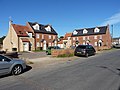 New housing in Winterton on Sea - geograph.org.uk - 3728523.jpg 1,142 × 857; 323 KB
-
 Norfolk Coast Path at Bramble Hill - geograph.org.uk - 6073326.jpg 800 × 548; 129 KB
-

-
 Norfolk Coast Path at Winterton Ness - geograph.org.uk - 6073312.jpg 800 × 506; 102 KB
-

-

-
 Norfolk coastline near Hemsby - geograph.org.uk - 6073113.jpg 800 × 600; 116 KB
-
 Ordnance Survey 1GL Bolt - geograph.org.uk - 4218621.jpg 480 × 640; 109 KB
-
 OS benchmark - High Barn Farm building - geograph.org.uk - 3798363.jpg 857 × 1,142; 460 KB
-
 OS benchmark - Winterton cross roads - geograph.org.uk - 3728527.jpg 857 × 1,142; 529 KB
-
 OS Flush Bracket at Mill Farm - geograph.org.uk - 3798357.jpg 857 × 1,142; 579 KB
-
 OS Flush Bracket S 047 - geograph.org.uk - 1856187.jpg 1,024 × 819; 272 KB
-

-
 Path to Holy Trinity ^ All Saints church, Winterton - geograph.org.uk - 5827084.jpg 4,030 × 2,989; 2.2 MB
-
 Paths in the Winterton dunes - geograph.org.uk - 3968929.jpg 640 × 480; 181 KB
-
 Paths through the Winterton Dunes - geograph.org.uk - 6073157.jpg 800 × 609; 117 KB
-

-
 Pool in Winterton Dunes - geograph.org.uk - 5608760.jpg 1,600 × 1,200; 463 KB
-
 Post Office, Winterton on Sea - geograph.org.uk - 905250.jpg 640 × 480; 69 KB
-

-
 Public toilets in Beach Road - geograph.org.uk - 3968958.jpg 640 × 480; 133 KB
-
 Reeds like Japanese calligraphy - geograph.org.uk - 905264.jpg 640 × 480; 89 KB
-
 Reindeer moss in the dunes at Winterton - geograph.org.uk - 3968922.jpg 640 × 480; 196 KB
-

-
 Restricted byway from Winterton Ness - geograph.org.uk - 3197319.jpg 1,600 × 1,200; 1.01 MB
-

-
 Road junction in Winterton-on-Sea - geograph.org.uk - 3590093.jpg 2,592 × 1,944; 1.3 MB
-
 Road junction south of Hemsby - geograph.org.uk - 3798360.jpg 1,142 × 857; 301 KB
-
 Rock groyne at Winterton Ness - geograph.org.uk - 3777606.jpg 801 × 1,068; 321 KB
-
 Round Holiday huts - geograph.org.uk - 1068305.jpg 640 × 480; 95 KB
-

-

-

-

-

-

-

-
 Rush hour in Winterton - geograph.org.uk - 5105914.jpg 640 × 480; 43 KB
-
 Sand dunes at Bramble Hill, Norfolk - geograph.org.uk - 6073542.jpg 800 × 600; 141 KB
-
 Scattered bushes and the boundary fence - geograph.org.uk - 3774548.jpg 1,142 × 857; 376 KB
-
 Sea wall by Bramble Hill beach access - geograph.org.uk - 5608757.jpg 1,600 × 1,200; 291 KB
-
 Seal (6577293817).jpg 4,288 × 2,848; 4.65 MB
-
 Seawards across the dunes nature reserve - geograph.org.uk - 3774543.jpg 1,142 × 857; 383 KB
-

-
 Small pool, Winterton Dunes - geograph.org.uk - 5608751.jpg 1,600 × 1,200; 350 KB
-
 So young and so tired - close-up - geograph.org.uk - 1083398.jpg 623 × 640; 145 KB
-
 Steps up the dune ridge - geograph.org.uk - 1016231.jpg 480 × 640; 189 KB
-
 Storm surge damage, Winterton - geograph.org.uk - 3772684.jpg 640 × 480; 184 KB
-
 Storm surge damage, Winterton - geograph.org.uk - 3772685.jpg 640 × 480; 167 KB
-
 Storm surge damage, Winterton - geograph.org.uk - 3772689.jpg 640 × 480; 177 KB
-
 Storm surge damage, Winterton - geograph.org.uk - 3772694.jpg 640 × 480; 181 KB
-
 Storm surge damage, Winterton - geograph.org.uk - 3772697.jpg 640 × 480; 190 KB
-
 Storm surge damage, Winterton - geograph.org.uk - 3772699.jpg 640 × 480; 166 KB
-
 Thatched house, Winterton-on-Sea - geograph.org.uk - 4971567.jpg 640 × 480; 57 KB
-
 The beach at Bramble Hill, Norfolk - geograph.org.uk - 6073539.jpg 800 × 600; 96 KB
-
 The beach at Hemsby - geograph.org.uk - 6070923.jpg 800 × 564; 109 KB
-
 The beach at Winterton-on-Sea - geograph.org.uk - 5825568.jpg 640 × 463; 81 KB
-
 The beach at Winterton-on-Sea - geograph.org.uk - 6073125.jpg 800 × 497; 79 KB
-

-

-
 The dune system at Winterton-on-Sea - geograph.org.uk - 946394.jpg 640 × 454; 161 KB
-
 The dunes at Winterton - geograph.org.uk - 3968924.jpg 640 × 480; 179 KB
-
 The dunes give way to scrub - geograph.org.uk - 3774544.jpg 1,142 × 857; 360 KB
-
 The Fishermans Return, Winterton - geograph.org.uk - 1659358.jpg 640 × 427; 80 KB
-

-
 The former Mariners' Arms - geograph.org.uk - 3724016.jpg 1,142 × 857; 350 KB
-
 The Loke - geograph.org.uk - 5537958.jpg 5,184 × 3,456; 4.78 MB
-
 The Loke from Beach Road - geograph.org.uk - 1230993.jpg 640 × 480; 73 KB
-
 The Loke, Winterton - geograph.org.uk - 1659292.jpg 640 × 427; 72 KB
-
 The Loke, Winterton on Sea - geograph.org.uk - 905237.jpg 640 × 480; 72 KB
-
 The Valley looking south - geograph.org.uk - 1633925.jpg 640 × 427; 59 KB
-
 The Valley, Winterton - geograph.org.uk - 1633908.jpg 640 × 427; 71 KB
-
 The village green with beached boat display - geograph.org.uk - 3290424.jpg 2,925 × 2,194; 3.05 MB
-
 The western side of the dunes nature reserve - geograph.org.uk - 3774542.jpg 1,142 × 857; 354 KB
-

-
 Tower of Holy Trinity ^ All Saints church, Winterton - geograph.org.uk - 5827083.jpg 3,022 × 3,942; 2.71 MB
-
 Track through Winterton Dunes - geograph.org.uk - 5608756.jpg 1,600 × 1,200; 294 KB
-
 Track to Bramble Hill - geograph.org.uk - 1016222.jpg 480 × 640; 175 KB
-
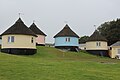
 Traditional Norfolk thatched roundhouses - geograph.org.uk - 2991827.jpg 4,320 × 3,240; 5.62 MB
-
 View back along the track - geograph.org.uk - 1016234.jpg 640 × 445; 133 KB
-
 View down into The Valley - geograph.org.uk - 581876.jpg 640 × 480; 109 KB
-
 View from the dunes at Winterton - geograph.org.uk - 3968936.jpg 640 × 480; 173 KB
-
 View north from wildlife pond - geograph.org.uk - 581115.jpg 640 × 480; 79 KB
-
 View north towards high dunes - geograph.org.uk - 946398.jpg 480 × 640; 186 KB
-
 View south from a high dune - geograph.org.uk - 581101.jpg 640 × 480; 51 KB
-
 View towards South Wood - geograph.org.uk - 581129.jpg 640 × 480; 80 KB
-
 Village green, Winterton on sea - geograph.org.uk - 2984329.jpg 4,320 × 3,240; 4.71 MB
-
 Village Hall, Winterton on Sea - geograph.org.uk - 905245.jpg 640 × 480; 77 KB
-
 Village Open Day - geograph.org.uk - 905243.jpg 480 × 640; 92 KB
-

-

-
 Wildlife Pond - geograph.org.uk - 581108.jpg 640 × 480; 71 KB
-
 Winterton - Glacial Erratic - geograph.org.uk - 2884717.jpg 800 × 600; 185 KB
-
 Winterton Dunes - geograph.org.uk - 3197309.jpg 1,600 × 1,200; 994 KB
-
 Winterton Dunes - geograph.org.uk - 5608744.jpg 1,600 × 1,200; 286 KB
-
 Winterton dunes - geograph.org.uk - 971680.jpg 640 × 427; 90 KB
-
 Winterton dunes - geograph.org.uk - 971721.jpg 640 × 427; 182 KB
-
 Winterton dunes - geograph.org.uk - 971725.jpg 640 × 427; 162 KB
-
 Winterton dunes - geograph.org.uk - 971731.jpg 640 × 427; 188 KB
-
 Winterton dunes - geograph.org.uk - 971738.jpg 640 × 427; 177 KB
-
 Winterton dunes - geograph.org.uk - 971742.jpg 427 × 640; 179 KB
-
 Winterton dunes - geograph.org.uk - 971745.jpg 427 × 640; 161 KB
-
 Winterton dunes - geograph.org.uk - 971754.jpg 427 × 640; 178 KB
-
 Winterton Dunes National Nature Reserve - geograph.org.uk - 6073199.jpg 800 × 573; 105 KB
-
 Winterton Dunes nature reserve - geograph.org.uk - 3774541.jpg 1,142 × 857; 373 KB
-
 Winterton Dunes Nature Reserve - geograph.org.uk - 581043.jpg 640 × 480; 66 KB
-
 Winterton Dunes Nature Reserve - geograph.org.uk - 581090.jpg 480 × 640; 68 KB
-
 Winterton on sea - geograph.org.uk - 1068268.jpg 640 × 480; 94 KB
-
 Winterton on sea - geograph.org.uk - 1068293.jpg 640 × 480; 97 KB
-
 Winterton on sea - geograph.org.uk - 1068317.jpg 640 × 480; 74 KB
-
 Winterton on sea - geograph.org.uk - 1068322.jpg 640 × 480; 132 KB
-
 Winterton on sea - geograph.org.uk - 1068333.jpg 640 × 480; 106 KB
-
 Winterton on sea - geograph.org.uk - 1068343.jpg 640 × 480; 105 KB
-
 Winterton on sea sand dunes - geograph.org.uk - 1068278.jpg 640 × 480; 55 KB
-
 Winterton on sea sand dunes - geograph.org.uk - 1068288.jpg 640 × 480; 75 KB
-
 Winterton on Sea village sign - geograph.org.uk - 6668309.jpg 1,648 × 1,648; 653 KB
-
 Winterton on Sea village sign - geograph.org.uk - 6668312.jpg 1,840 × 1,840; 723 KB
-
 Winterton on Sea village sign - geograph.org.uk - 6669314.jpg 3,072 × 4,608; 2.89 MB
-
 Winterton-On-Sea - geograph.org.uk - 477501.jpg 640 × 480; 99 KB
-
 Winterton-on-Sea - Holiday homes and lighthouse - geograph.org.uk - 2991804.jpg 4,320 × 3,240; 5.62 MB
-
 Winterton-on-Sea - The village green - geograph.org.uk - 2991743.jpg 4,320 × 3,240; 5.6 MB
-
 Winterton-on-Sea Post Office - geograph.org.uk - 4940928.jpg 640 × 480; 61 KB
-
 Winterton-on-Sea Post Office - geograph.org.uk - 4971534.jpg 640 × 480; 54 KB
-
 Winterton-on-Sea Village Hall - geograph.org.uk - 4971537.jpg 640 × 480; 66 KB
-
 WW2 anti-tank cubes at Winterton - geograph.org.uk - 3772681.jpg 640 × 480; 175 KB
-
 WWII concrete anti-tank cubes - geograph.org.uk - 946357.jpg 640 × 480; 175 KB


.jpg)


