Category:Wirdumerdijk 1, Leeuwarden
| Object location | | View all coordinates using: OpenStreetMap |
|---|
 | |||||
| Upload media | |||||
| Instance of |
| ||||
|---|---|---|---|---|---|
| Location | Leeuwarden, Friesland, Netherlands | ||||
| Located on street | |||||
| Heritage designation |
| ||||
 | |||||
|
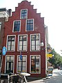
This is a category about rijksmonument number 24477
|
| Address |
|
Media in category "Wirdumerdijk 1, Leeuwarden"
The following 8 files are in this category, out of 8 total.
-
 Hoek Nauw - Leeuwarden - 20133008 - RCE.jpg 968 × 1,200; 276 KB
-
 Met straatoverzicht - Leeuwarden - 20133006 - RCE.jpg 959 × 1,200; 252 KB
-
 Tontjepijp - Leeuwarden - 20130559 - RCE.jpg 1,195 × 1,200; 298 KB
-
 Voor- en zijgevel - Leeuwarden - 20132605 - RCE.jpg 800 × 1,200; 175 KB
-
 Voorgevel - Leeuwarden - 20133009 - RCE.jpg 807 × 1,200; 174 KB
-
 Wirdumerdijk 1 Leeuwarden trapgevel.jpg 4,288 × 3,216; 3.02 MB
-
 Wirdumerdijk 1 Leeuwarden.jpg 3,216 × 4,288; 2.82 MB
-
 Zijgevel aan het Nauw - Leeuwarden - 20133007 - RCE.jpg 960 × 1,200; 252 KB


