Category:Withernsea
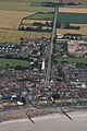
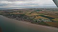
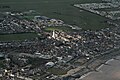
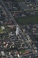
English: Withernsea is a seaside resort town and civil parish in the East Riding of Yorkshire, England, and forms the focal point for a wider community of small villages in Holderness. Its most famous landmark is the white inland lighthouse, rising around 127 feet (39 m) above Hull Road. The lighthouse — no longer active — now houses a museum to 1950s actress Kay Kendall, who was born in the town.
seaside resort town and civil parish in the East Riding of Yorkshire, England  | |||||
| Upload media | |||||
| Instance of | |||||
|---|---|---|---|---|---|
| Location | East Riding of Yorkshire, Yorkshire and the Humber, England | ||||
| Population |
| ||||
| official website | |||||
 | |||||
Subcategories
This category has the following 20 subcategories, out of 20 total.
B
H
M
- Model of Withernsea Pier (15 F)
P
- Pier Towers, Withernsea (66 F)
R
S
T
V
- Valley Gardens, Withernsea (19 F)
W
- Withernsea Beach (200 F)
- Withernsea Golf Club (13 F)
- Withernsea Lifeboat Station (17 F)
Media in category "Withernsea"
The following 105 files are in this category, out of 105 total.
-
 A camp site fishing pond at Withernsea (geograph 2097597).jpg 800 × 600; 208 KB
-
 A clear space on the Holiday Chalet site - geograph.org.uk - 1047968.jpg 640 × 427; 309 KB
-
 A Groyne on Withernsea Beach - geograph.org.uk - 6809724.jpg 4,494 × 3,338; 3.67 MB
-
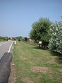
 A path leading to Ryecroft Drive, Withernsea (geograph 2259119).jpg 800 × 600; 234 KB
-
 A Sea Wall to Infinity - geograph.org.uk - 1411264.jpg 640 × 511; 121 KB
-
 A Withernsea Footpath - geograph.org.uk - 876777.jpg 640 × 480; 122 KB
-
 Abandoned caravan site (geograph 4329949).jpg 1,024 × 768; 187 KB
-
 Allotment Gardens, Withernsea - geograph.org.uk - 215568.jpg 640 × 468; 172 KB
-
 Allotment Gardens, Withernsea - geograph.org.uk - 290680.jpg 640 × 451; 99 KB
-
 Allotments - off Hull Road (geograph 4595308).jpg 640 × 480; 93 KB
-
 Approaching the cliff top (geograph 4329940).jpg 1,024 × 768; 279 KB
-
 Base of dismantled holiday chalet, Withernsea (geograph 6374811).jpg 800 × 556; 78 KB
-
 Benches on Withernsea's Promenade - geograph.org.uk - 1412916.jpg 640 × 480; 100 KB
-
 British Isles rural and coastal (4452303640).jpg 2,048 × 1,371; 863 KB
-

-
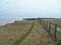
 Cliff top path to Withernsea (geograph 2406132).jpg 3,648 × 2,736; 3.08 MB
-
 Cliff Top Path, Withernsea South - geograph.org.uk - 1743454.jpg 800 × 600; 104 KB
-
 Clifftop Path south of Withernsea - geograph.org.uk - 758547.jpg 640 × 348; 160 KB
-

-
-
 Coastline South of Withernsea - geograph.org.uk - 274145.jpg 640 × 480; 106 KB
-

-
 East Ridings wind turbine landscape (geograph 4406998).jpg 1,714 × 236; 93 KB
-
 End of the fence (geograph 4329951).jpg 1,024 × 768; 226 KB
-
 Entering Withernsea (geograph 6374809).jpg 640 × 480; 65 KB
-
 Everyday is like Sunday - geograph.org.uk - 293371.jpg 477 × 640; 53 KB
-
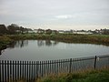
 Fishing Lake at South Promenade, Withernsea (geograph 5065446).jpg 1,200 × 799; 396 KB
-
 Flood gate in place (geograph 4330384).jpg 1,024 × 768; 134 KB
-
 Footpath to Waxholme Road (geograph 4329939).jpg 1,024 × 768; 220 KB
-

-
 High tide at Withernsea - geograph.org.uk - 4349157.jpg 1,600 × 1,062; 415 KB
-
 Historic Pictures on the Promenade (geograph 6423384).jpg 5,472 × 3,648; 1.8 MB
-
 Hollym Road, Withernsea - geograph.org.uk - 294436.jpg 640 × 480; 99 KB
-
 Holmpton Road - geograph.org.uk - 234159.jpg 480 × 640; 75 KB
-
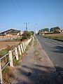 Hull Road - geograph.org.uk - 234202.jpg 480 × 640; 73 KB
-
 Italian Gardens and Boatyard - geograph.org.uk - 234144.jpg 640 × 480; 45 KB
-

-
 Lighthouse Garden - Hull Road (geograph 4595357).jpg 640 × 480; 96 KB
-
 Memorial Gardens, Withernsea (geograph 6382384).jpg 800 × 600; 76 KB
-
 Model pier - geograph.org.uk - 304289.jpg 640 × 480; 82 KB
-
 Newsham Gardens - geograph.org.uk - 1047974.jpg 640 × 427; 284 KB
-

-

-
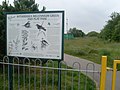 Notice at Withernsea Millennium Green - geograph.org.uk - 3736384.jpg 3,072 × 2,304; 1.77 MB
-
 Pasture, and cliffs north of Holmpton - geograph.org.uk - 1048578.jpg 640 × 427; 365 KB
-
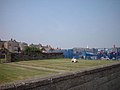
 Playing Fields - off Hull Road (geograph 4595304).jpg 640 × 480; 46 KB
-
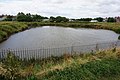
 Pond, Withernsea - geograph.org.uk - 1743184.jpg 800 × 600; 102 KB
-
 Promenaders at Withernsea - geograph.org.uk - 932250.jpg 640 × 480; 89 KB
-
 Saffron Court, Withernsea - geograph.org.uk - 689012.jpg 447 × 640; 83 KB
-
 Seafront, Owthorne (geograph 6365626).jpg 1,024 × 768; 159 KB
-
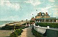
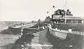
 Seafront, Withernsea - geograph.org.uk - 51712.jpg 640 × 480; 111 KB
-
 Seaside Road, Withernsea - geograph.org.uk - 249489.jpg 640 × 574; 92 KB
-
 Slope Fence to the Beach - geograph.org.uk - 6809705.jpg 3,456 × 4,608; 4.77 MB
-
 Son of Poseidon - geograph.org.uk - 751615.jpg 640 × 480; 88 KB
-

-
 St Matthew's C of E, Owthorne, Withernsea - geograph.org.uk - 713735.jpg 640 × 427; 111 KB
-
 Steps to the Beach - geograph.org.uk - 6809718.jpg 4,608 × 2,490; 2.74 MB
-
 That sinking feeling - geograph.org.uk - 201627.jpg 640 × 484; 85 KB
-
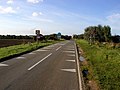
 The A1033 at Withernsea - geograph.org.uk - 57525.jpg 640 × 437; 70 KB
-
-
 The Beach at south Withernsea - geograph.org.uk - 6809709.jpg 4,447 × 3,275; 2.07 MB
-
 The Esplanade, Withernsea - geograph.org.uk - 537973.jpg 640 × 455; 53 KB
-
 The Hut Adventure Playground, Withernsea, July 2015 (geograph 4582418).jpg 1,728 × 1,152; 521 KB
-
 The Hut Adventure Playground, Withernsea, July 2015 (geograph 4582422).jpg 1,728 × 1,152; 519 KB
-

-
 The Pier Hotel, Withernsea - geograph.org.uk - 3390641.jpg 1,024 × 682; 190 KB
-
 The Pond, Withernsea - geograph.org.uk - 537979.jpg 640 × 367; 80 KB
-
 The Promenade at Withernsea - geograph.org.uk - 685874.jpg 640 × 480; 57 KB
-
 The road to Withernsea - geograph.org.uk - 57529.jpg 640 × 480; 93 KB
-
 Track around Playing Fields - off Hull Road (geograph 4595307).jpg 640 × 480; 108 KB
-
 Turner Avenue, Withernsea (geograph 2096128).jpg 800 × 600; 163 KB
-
 Upside down Union Flags No10 (geograph 2297983).jpg 800 × 600; 159 KB
-
 Weed on the Wall - geograph.org.uk - 1412903.jpg 640 × 353; 127 KB
-
 Withernsea - geograph.org.uk - 278502.jpg 640 × 429; 67 KB
-
 Withernsea 1.jpg 3,072 × 2,304; 2.18 MB
-
 Withernsea and its lighthouse- aerial 2015 (geograph 4583282).jpg 1,600 × 1,067; 329 KB
-

-

-
 Withernsea Beacon - geograph.org.uk - 1743105.jpg 600 × 800; 67 KB
-
 Withernsea Boating Social Club - geograph.org.uk - 234142.jpg 640 × 480; 47 KB
-
 Withernsea Boating Social Club, Withernsea (geograph 5075560).jpg 1,200 × 799; 348 KB
-
 Withernsea Boatyard - geograph.org.uk - 293370.jpg 640 × 464; 90 KB
-
 Withernsea Bowling Club - geograph.org.uk - 215554.jpg 640 × 462; 95 KB
-
-
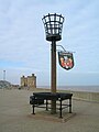
 Withernsea Coat of Arms - geograph.org.uk - 762183.jpg 640 × 480; 108 KB
-
 Withernsea Houses - geograph.org.uk - 1743460.jpg 800 × 600; 72 KB
-
 Withernsea IMG 6475 - panoramio.jpg 1,000 × 666; 349 KB
-
 Withernsea Lifeboat Station - geograph.org.uk - 6809696.jpg 4,528 × 2,846; 3.45 MB
-
 Withernsea lighthouse (4451523751).jpg 2,048 × 1,371; 654 KB
-
 Withernsea Lighthouse from the south - geograph.org.uk - 1042908.jpg 640 × 474; 73 KB
-
 Withernsea Market - geograph.org.uk - 241719.jpg 640 × 480; 38 KB
-
 Withernsea playground (geograph 1839260).jpg 464 × 640; 209 KB
-
 Withernsea promenade 12CT62.jpg 2,592 × 1,944; 1.17 MB
-
 Withernsea Promenade Fence - geograph.org.uk - 1412914.jpg 640 × 562; 75 KB
-
 Withernsea sea 28.jpg 2,304 × 1,728; 851 KB
-
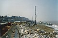
 Withernsea seafront improvements - geograph.org.uk - 278514.jpg 640 × 419; 63 KB
-
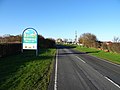
 Withernsea Town sign - geograph.org.uk - 685767.jpg 640 × 480; 29 KB
-
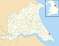 Withernsea UK parish locator map.svg 1,425 × 1,107; 1.68 MB
-
 Withernsea's Seawall Concrete - geograph.org.uk - 1412910.jpg 640 × 460; 219 KB
-
 Withernsea, East Yorkshire (geograph 3166081).jpg 1,024 × 763; 97 KB
-
-
 Withernsea- aerial 2015 (geograph 4582566).jpg 640 × 427; 52 KB
-
 Withernsea- aerial 2015 (geograph 4582576).jpg 640 × 358; 43 KB
-
 Withernsea- aerial 2018 (1) (geograph 5719094).jpg 800 × 533; 113 KB
-
 Withernsea- aerial 2018 (2) (geograph 5719097).jpg 427 × 640; 66 KB
.jpg)

.jpg)


.jpg)


.jpg)
.jpg)
.jpg)

.jpg)
_(34854491581).jpg)
.jpg)


.jpg)
_(34143884534).jpg)

.jpg)
.jpg)
.jpg)

.jpg)
.jpg)
.jpg)
_(26481289012).jpg)

.jpg)


.jpg)
.jpg)
.jpg)


_(34854490341).jpg)
_(34599129130).jpg)


.jpg)


.jpg)


.jpg)


_(34854493081).jpg)


.jpg)
.jpg)


.jpg)
.jpg)
.jpg)


.jpg)
_(34176299803).jpg)
_(34946691976).jpg)

.jpg)


_(28455531260).jpg)


.jpg)


.jpg)


.jpg)
.jpg)
.jpg)
.jpg)
_(geograph_5719094).jpg)
_(geograph_5719097).jpg)
.jpg)