Category:Wonston
village and civil parish in Hampshire, United Kingdom  | |||||
| Upload media | |||||
| Instance of | |||||
|---|---|---|---|---|---|
| Location | City of Winchester, Hampshire, South East England, England | ||||
| Population |
| ||||
| Said to be the same as | Wonston (Wikimedia duplicated page, civil parish) | ||||
 | |||||
Subcategories
This category has the following 7 subcategories, out of 7 total.
Media in category "Wonston"
The following 200 files are in this category, out of 446 total.
(previous page) (next page)-
 A field by the A34 - geograph.org.uk - 4873179.jpg 1,500 × 1,125; 356 KB
-
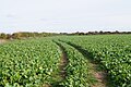 A field of turnips - geograph.org.uk - 4715754.jpg 1,600 × 1,062; 521 KB
-
 A thatched house in Stoke Charity - geograph.org.uk - 5463549.jpg 1,500 × 978; 212 KB
-
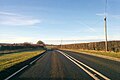
 A30 bridge over A34 at Sutton Scotney - geograph.org.uk - 6222120.jpg 1,600 × 1,143; 582 KB
-
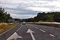
 A30 junction with Oxford Road - geograph.org.uk - 3365651.jpg 3,648 × 2,736; 1.59 MB
-
 A30 passes Pond Cottage - geograph.org.uk - 3365661.jpg 2,960 × 2,171; 763 KB
-
 A30 south of Cocum Farm - geograph.org.uk - 3365670.jpg 3,425 × 2,520; 1.21 MB
-
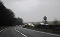
 A30 towards Salisbury - geograph.org.uk - 5628912.jpg 640 × 428; 82 KB
-
 A30 towards Salisbury - geograph.org.uk - 5628915.jpg 640 × 428; 75 KB
-
 A30 towards Salisbury - geograph.org.uk - 5628917.jpg 640 × 428; 96 KB
-
 A303 eastbound - geograph.org.uk - 3777999.jpg 1,815 × 1,219; 1.15 MB
-
 A303 eastbound - geograph.org.uk - 3778006.jpg 2,052 × 1,394; 1.54 MB
-
 A303 eastbound - geograph.org.uk - 5629524.jpg 640 × 428; 95 KB
-
 A303 eastbound - geograph.org.uk - 5821845.jpg 640 × 480; 56 KB
-
 A303 eastbound - geograph.org.uk - 5821847.jpg 640 × 476; 69 KB
-
 A303 exit for Micheldever Station - geograph.org.uk - 3778024.jpg 1,898 × 1,276; 1.42 MB
-
 A303 near Cranbourne Cottages - geograph.org.uk - 3324339.jpg 640 × 430; 27 KB
-
 A303 near Kitesland - geograph.org.uk - 3029875.jpg 640 × 430; 46 KB
-
 A303 near Kitesland - geograph.org.uk - 3324287.jpg 640 × 389; 21 KB
-
 A303, the road to the west - geograph.org.uk - 4261937.jpg 640 × 428; 81 KB
-
 A303, westbound (geograph 5274453).jpg 640 × 426; 66 KB
-
 A303, westbound (geograph 5274459).jpg 640 × 426; 58 KB
-
 A303, westbound - geograph.org.uk - 3324288.jpg 640 × 430; 35 KB
-
 A303, westbound - geograph.org.uk - 5274476.jpg 640 × 403; 56 KB
-
 A303, westbound - geograph.org.uk - 5274478.jpg 640 × 409; 61 KB
-
 A34 east of Sutton Down Cottages - geograph.org.uk - 4238111.jpg 640 × 481; 40 KB
-
 A34 near Pipers Hill - geograph.org.uk - 4238113.jpg 640 × 480; 61 KB
-
 A34 north of South Wonston - geograph.org.uk - 2693627.jpg 3,082 × 2,274; 1.1 MB
-
 A34 northbound - geograph.org.uk - 4645850.jpg 1,600 × 1,200; 720 KB
-
 A34 northbound - geograph.org.uk - 4645859.jpg 1,600 × 1,200; 446 KB
-
 A34 northbound - geograph.org.uk - 5636998.jpg 640 × 428; 70 KB
-
 A34 northbound - geograph.org.uk - 5637008.jpg 640 × 428; 66 KB
-
 A34 on Pipers Hill - geograph.org.uk - 2693634.jpg 3,026 × 2,181; 958 KB
-
 A34 roadbridge carries A30 - geograph.org.uk - 2693169.jpg 3,229 × 2,213; 1.04 MB
-
 A34 southbound near Sutton Scotney - geograph.org.uk - 672849.jpg 640 × 480; 264 KB
-
 A34, Layby near Sutton Down - geograph.org.uk - 3287372.jpg 640 × 480; 369 KB
-
 Access Bridge (Sutton Manor Farm) - geograph.org.uk - 3287390.jpg 640 × 480; 391 KB
-
 Access lane - Wonston Manor Farm - geograph.org.uk - 4715758.jpg 1,600 × 1,062; 594 KB
-
 Access to Wonston Manor Farm - geograph.org.uk - 4917443.jpg 1,024 × 680; 310 KB
-
 Alresford Drove near Wallers Ash - geograph.org.uk - 4932785.jpg 640 × 427; 98 KB
-

-

-
 Approaching Norton Manor - geograph.org.uk - 2348587.jpg 640 × 428; 136 KB
-
 Approaching Norton Wood - geograph.org.uk - 3069888.jpg 640 × 480; 82 KB
-

-

-
 Approaching the summit - geograph.org.uk - 2348756.jpg 640 × 428; 243 KB
-
 Are you receiving me^ over - geograph.org.uk - 3859659.jpg 1,063 × 1,600; 156 KB
-
 Around the corner - geograph.org.uk - 3069920.jpg 640 × 480; 59 KB
-
 Autumn fetches the rain - geograph.org.uk - 6651547.jpg 1,600 × 1,200; 587 KB
-

-

-
 Barn against stormy sky - geograph.org.uk - 5992312.jpg 1,024 × 683; 184 KB
-
 Barn at Norton Farm - geograph.org.uk - 2348593.jpg 640 × 379; 209 KB
-
 Barn at Upper Norton Farm - geograph.org.uk - 2348699.jpg 640 × 412; 196 KB
-

-
 Barn beside the bridleway - geograph.org.uk - 5992250.jpg 1,024 × 683; 256 KB
-
 Barn on the former railway line - geograph.org.uk - 1779955.jpg 640 × 427; 215 KB
-
 Barton Drove bridge over A34 at Sutton Scotney - geograph.org.uk - 6222117.jpg 1,600 × 882; 493 KB
-
 Bridleway approaching former railway - geograph.org.uk - 4918250.jpg 1,024 × 680; 327 KB
-
 Bridleway approaching former railway - geograph.org.uk - 4918262.jpg 1,024 × 680; 368 KB
-
 Bridleway approaching former railway - geograph.org.uk - 4918264.jpg 640 × 425; 91 KB
-
 Bridleway approaching former railway - geograph.org.uk - 4918291.jpg 640 × 425; 94 KB
-
 Bridleway approaching Norton Wood - geograph.org.uk - 3069900.jpg 640 × 480; 82 KB
-
 Bridleway approaching Norton Wood - geograph.org.uk - 3069905.jpg 640 × 480; 84 KB
-
 Bridleway approaching Wonston - geograph.org.uk - 4918412.jpg 1,024 × 680; 321 KB
-
 Bridleway approaching Wonston - geograph.org.uk - 943772.jpg 427 × 640; 140 KB
-

-
 Bridleway at Egypt - geograph.org.uk - 2348583.jpg 640 × 413; 220 KB
-
 Bridleway at Egypt - geograph.org.uk - 2348586.jpg 640 × 427; 186 KB
-
 Bridleway from Wonston - geograph.org.uk - 4918410.jpg 1,024 × 680; 370 KB
-
 Bridleway near Blind End Copse - geograph.org.uk - 2348707.jpg 640 × 427; 214 KB
-
 Bridleway north of Wonston Manor Farm - geograph.org.uk - 4918316.jpg 1,024 × 680; 348 KB
-
 Bridleway north of Wonston Manor Farm - geograph.org.uk - 4918317.jpg 800 × 531; 168 KB
-
 Bridleway north of Wonston Manor Farm - geograph.org.uk - 4918319.jpg 1,024 × 680; 348 KB
-
 Bridleway to Upper Norton Farm - geograph.org.uk - 3007174.jpg 640 × 480; 74 KB
-
 Bridleway to Wonston - geograph.org.uk - 4262030.jpg 640 × 480; 139 KB
-
 Bridleway towards Blind End Copse - geograph.org.uk - 3070089.jpg 800 × 600; 132 KB
-
 Bridleway towards Norton Wood - geograph.org.uk - 2348713.jpg 640 × 427; 208 KB
-
 Bridleway towards Norton Wood - geograph.org.uk - 3069907.jpg 640 × 480; 81 KB
-
 Bridleway towards Norton Wood - geograph.org.uk - 3069917.jpg 640 × 480; 68 KB
-
 Bridleway towards Norton Wood - geograph.org.uk - 3069924.jpg 640 × 480; 69 KB
-
 Bridleway towards Wonston - geograph.org.uk - 4918297.jpg 1,024 × 680; 308 KB
-
 Bridleway towards Wonston Manor Farm - geograph.org.uk - 5992261.jpg 1,024 × 683; 266 KB
-
 Bridleway west of Norton Wood - geograph.org.uk - 333129.jpg 4,368 × 2,912; 3.13 MB
-
 Buildings at East Stoke Farm - geograph.org.uk - 4262063.jpg 640 × 428; 88 KB
-
 Centre of Stoke Charity - geograph.org.uk - 4365012.jpg 1,600 × 1,063; 381 KB
-
 Centre of Stoke Charity - geograph.org.uk - 6485051.jpg 640 × 480; 72 KB
-
 Chickens at Upper Norton Farm - geograph.org.uk - 2348627.jpg 640 × 427; 170 KB
-
 Church Lane in late December - geograph.org.uk - 2282654.jpg 640 × 480; 85 KB
-
 City of Winchester , The A34 - geograph.org.uk - 5739358.jpg 6,000 × 4,000; 6.21 MB
-
 City of Winchester , The A34 - geograph.org.uk - 5739360.jpg 6,000 × 4,000; 6.78 MB
-
 City of Winchester , The A34 - geograph.org.uk - 5739362.jpg 6,000 × 4,000; 6.84 MB
-
 City of Winchester , The A34 - geograph.org.uk - 5739363.jpg 6,000 × 4,000; 6.08 MB
-
 Clearance above Wallers Ash Tunnel - geograph.org.uk - 3859386.jpg 1,600 × 1,063; 444 KB
-
 Cloud burst - geograph.org.uk - 6651551.jpg 1,600 × 1,200; 348 KB
-
 Corner of Freefolk Wood - geograph.org.uk - 3069890.jpg 640 × 480; 72 KB
-
 Corner of Kitelands Clump - geograph.org.uk - 3070100.jpg 800 × 600; 134 KB
-
 Country road near Micheldever Station - geograph.org.uk - 2772796.jpg 640 × 480; 306 KB
-
 Covered reservoir - geograph.org.uk - 4917434.jpg 1,024 × 641; 236 KB
-
 Crop east of the bridleway - geograph.org.uk - 4918277.jpg 1,024 × 680; 290 KB
-
 Crop east of the bridleway - geograph.org.uk - 4918282.jpg 640 × 425; 80 KB
-
 Crop east of the bridleway - geograph.org.uk - 4918283.jpg 640 × 425; 65 KB
-
 Crop west of the bridleway - geograph.org.uk - 4918288.jpg 1,024 × 680; 288 KB
-
 Crop west of the bridleway - geograph.org.uk - 4918292.jpg 640 × 425; 93 KB
-
 Crossing the River Dever - geograph.org.uk - 1780082.jpg 640 × 426; 248 KB
-
 Crossing the River Dever - geograph.org.uk - 3570834.jpg 800 × 540; 120 KB
-
 Days Inn at Sutton Scotney - geograph.org.uk - 4873165.jpg 1,500 × 1,125; 238 KB
-
 Days Inn, Sutton Scotney - geograph.org.uk - 4553267.jpg 1,600 × 1,200; 196 KB
-
 Days-Inn Hotel at Sutton Scotney Services - geograph.org.uk - 6713520.jpg 1,600 × 1,200; 405 KB
-
 Derelict barn and water tank - geograph.org.uk - 4715752.jpg 1,600 × 1,062; 633 KB
-
 Derelict farm building - geograph.org.uk - 4918274.jpg 1,024 × 680; 289 KB
-
 Direction Sign – Signpost - geograph.org.uk - 6518354.jpg 461 × 838; 177 KB
-
 Direction Sign – Signpost - geograph.org.uk - 6518359.jpg 480 × 640; 237 KB
-
 Direction Sign – Signpost - geograph.org.uk - 6518369.jpg 640 × 481; 304 KB
-
 Directional sign and shrubbery - geograph.org.uk - 2126841.jpg 1,024 × 683; 254 KB
-
 Double rainbow near West Stoke Farm - geograph.org.uk - 5992390.jpg 1,024 × 683; 203 KB
-
 Edge of a wheatfield alongside Hunton Down Lane - geograph.org.uk - 4070623.jpg 1,024 × 768; 251 KB
-

-
 Emerging crop east of the bridleway - geograph.org.uk - 4918845.jpg 1,024 × 680; 266 KB
-
 Emerging winter crop - geograph.org.uk - 3858794.jpg 1,600 × 1,063; 416 KB
-
 Emerging winter crop - geograph.org.uk - 4918849.jpg 1,024 × 680; 285 KB
-
 Emerging winter wheat - geograph.org.uk - 3007183.jpg 640 × 480; 72 KB
-
 End of the rainbow, near West Stoke Farm - geograph.org.uk - 5992394.jpg 1,024 × 683; 168 KB
-
 Entering Wonston on Wonston Lane - geograph.org.uk - 943782.jpg 640 × 521; 171 KB
-

-
 Entrance to Hunton Lodge, Hunton - geograph.org.uk - 4071202.jpg 1,024 × 615; 144 KB
-
 Entrance to the sheds, Hunton Grange Farm - geograph.org.uk - 4069713.jpg 1,024 × 614; 142 KB
-
 Exit onto Laverstoke Lane - geograph.org.uk - 2348774.jpg 500 × 640; 225 KB
-
 Farm building, Hunton Grange Farm - geograph.org.uk - 4069719.jpg 1,024 × 768; 129 KB
-
 Farm track crosses former railway - geograph.org.uk - 4715744.jpg 1,600 × 1,062; 471 KB
-
 Farm track leading to Wonston Lane - geograph.org.uk - 4918267.jpg 1,024 × 680; 231 KB
-
 Farm track running south from Hunton Down Lane - geograph.org.uk - 4070618.jpg 1,024 × 768; 136 KB
-
 Farm track to Wonston Manor Farm - geograph.org.uk - 4917444.jpg 1,024 × 680; 292 KB
-
 Farming by Freefolk Wood - geograph.org.uk - 3069923.jpg 640 × 480; 75 KB
-
 Farmland adjacent to the A303 - geograph.org.uk - 2348616.jpg 640 × 561; 302 KB
-
 Farmland at Egypt - geograph.org.uk - 2348581.jpg 640 × 427; 203 KB
-
 Farmland at Lower Norton Farm - geograph.org.uk - 2348609.jpg 640 × 584; 346 KB
-
 Farmland at Upper Bullington - geograph.org.uk - 2348600.jpg 640 × 469; 240 KB
-
 Farmland at Upper Bullington - geograph.org.uk - 2348606.jpg 640 × 427; 210 KB
-
 Farmland at Upper Norton Farm - geograph.org.uk - 2348664.jpg 640 × 425; 231 KB
-
 Farmland by the A303 - geograph.org.uk - 5274447.jpg 640 × 374; 22 KB
-
 Farmland by the A303 - geograph.org.uk - 5871767.jpg 3,273 × 1,528; 480 KB
-
 Farmland by the A303 - geograph.org.uk - 5871791.jpg 3,471 × 1,159; 542 KB
-
 Farmland east of the bridleway - geograph.org.uk - 4918325.jpg 1,024 × 680; 325 KB
-
 Farmland near Laverstoke Lane - geograph.org.uk - 2348769.jpg 640 × 427; 191 KB
-

-
 Farmland south of Freefolk Wood - geograph.org.uk - 3069886.jpg 640 × 480; 78 KB
-
 Farmland south of Stoke Charity - geograph.org.uk - 6350205.jpg 1,024 × 683; 317 KB
-
 Farmland south of Wonston - geograph.org.uk - 4918422.jpg 1,024 × 680; 305 KB
-
 Farmland south of Wonston - geograph.org.uk - 4918423.jpg 1,024 × 680; 309 KB
-
 Farmland south of Wonston - geograph.org.uk - 4918424.jpg 640 × 425; 95 KB
-
 Farmland, Sutton Scotney, Wonston - geograph.org.uk - 2845201.jpg 640 × 480; 157 KB
-
 Farmland, Sutton Scotney, Wonston - geograph.org.uk - 2845290.jpg 640 × 480; 169 KB
-
 Farmland, Wonston - geograph.org.uk - 2845189.jpg 640 × 480; 155 KB
-
 Farmland, Wonston - geograph.org.uk - 2845196.jpg 640 × 480; 151 KB
-
 Farmland, Wonston - geograph.org.uk - 2845270.jpg 640 × 480; 144 KB
-
 Farmland, Wonston - geograph.org.uk - 2845301.jpg 640 × 480; 141 KB
-
 Farmland, Wonston - geograph.org.uk - 2845321.jpg 640 × 480; 210 KB
-
 Farmland, Wonston - geograph.org.uk - 2845423.jpg 640 × 480; 110 KB
-
 Farmland, Wonston - geograph.org.uk - 2845481.jpg 640 × 480; 129 KB
-
 Farmland, Wonston - geograph.org.uk - 2845500.jpg 640 × 480; 144 KB
-
 Fenced meadow, north side of Hunton Down Lane - geograph.org.uk - 4070615.jpg 1,024 × 768; 139 KB
-
 Field access to bridleway - geograph.org.uk - 4918276.jpg 1,024 × 680; 259 KB
-
 Field boundary off Alresford Drove - geograph.org.uk - 3858875.jpg 1,600 × 1,063; 499 KB
-
 Field corner - geograph.org.uk - 3069864.jpg 640 × 480; 125 KB
-

-
 Field edge to the horizon, Wonston Manor Farm - geograph.org.uk - 5992315.jpg 1,024 × 683; 273 KB
-
 Field in Stoke Charity - geograph.org.uk - 4628213.jpg 2,560 × 1,920; 1.97 MB
-
 Field in Stoke Charity - geograph.org.uk - 4628215.jpg 2,560 × 1,920; 2.08 MB
-
 Field in Stoke Charity - geograph.org.uk - 4628216.jpg 2,560 × 1,920; 2.07 MB
-
 Field north of Alresford Drove - geograph.org.uk - 3858866.jpg 1,600 × 1,092; 586 KB
-
 Field north of Alresford Drove - geograph.org.uk - 3858869.jpg 1,600 × 1,063; 474 KB
-
 Field north of Alresford Drove - geograph.org.uk - 3858881.jpg 1,600 × 1,063; 428 KB
-
 Field north of Alresford Drove - geograph.org.uk - 3858890.jpg 1,600 × 1,053; 286 KB
-
 Field north of Alresford Drove - geograph.org.uk - 3858967.jpg 1,600 × 1,063; 405 KB
-
 Field north of Alresford Drove - geograph.org.uk - 3858969.jpg 1,600 × 1,063; 365 KB
-
 Field north of Alresford Drove - geograph.org.uk - 3858974.jpg 1,600 × 1,063; 488 KB
-
 Field north of Wonston - geograph.org.uk - 2811736.jpg 640 × 482; 51 KB
-
 Field south of Wonston Manor Farm - geograph.org.uk - 5992259.jpg 1,024 × 683; 276 KB
-

-
 Fields south of Freefolk Wood - geograph.org.uk - 3069919.jpg 640 × 480; 74 KB
-
 Fields south of Wonston Manor Farm - geograph.org.uk - 4918296.jpg 1,024 × 680; 271 KB
-
 Fields west of Norton Wood - geograph.org.uk - 3069914.jpg 640 × 480; 72 KB
-
 Fields west of Wallers Ash Tunnel - geograph.org.uk - 6713473.jpg 1,600 × 1,200; 319 KB
-
 Footpath near Upton House - geograph.org.uk - 4715756.jpg 1,600 × 1,062; 921 KB
-

-
 Former A30, westbound - geograph.org.uk - 5628865.jpg 640 × 428; 82 KB
-
 Former A30, westbound - geograph.org.uk - 5628877.jpg 640 × 428; 150 KB
-
 Former A30, westbound - geograph.org.uk - 5628882.jpg 640 × 428; 122 KB
-
 Former entrance to Norton Manor - geograph.org.uk - 2348596.jpg 640 × 421; 187 KB
-
 Former railway line - geograph.org.uk - 1779969.jpg 640 × 427; 208 KB
-
 Former railway track - geograph.org.uk - 4918293.jpg 640 × 425; 125 KB
-
 Freefolk Wood - geograph.org.uk - 3069875.jpg 640 × 480; 75 KB
-
 Freefolk Wood - geograph.org.uk - 3069882.jpg 640 × 480; 80 KB
-
 Freefolk Wood - geograph.org.uk - 3069899.jpg 640 × 480; 69 KB
-
 Glad the grass was cut - geograph.org.uk - 3572998.jpg 800 × 514; 79 KB
-
 Grade 2 listed barn, East Stoke Farm - geograph.org.uk - 4071527.jpg 1,024 × 614; 104 KB
-
 Green as far as the eye can see - geograph.org.uk - 2348729.jpg 640 × 404; 188 KB
-
 Green just off Church Lane - geograph.org.uk - 2282641.jpg 640 × 480; 69 KB


.jpg)
.jpg)


_-_geograph.org.uk_-_3287390.jpg)


