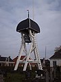
Category:Wooden bell tower, Broek
| Object location | | View all coordinates using: OpenStreetMap |
|---|
 | |||||
| Upload media | |||||
| Instance of | |||||
|---|---|---|---|---|---|
| Location | Broek, Friesland, De Fryske Marren, Friesland, Netherlands | ||||
| Heritage designation |
| ||||
 | |||||
|
This is a category about rijksmonument number 13224
|
| Address |
|
Media in category "Wooden bell tower, Broek"
The following 6 files are in this category, out of 6 total.
-
 De Broek, klokkestoel.jpg 2,135 × 2,136; 1.47 MB
-
 Klokkenstoel Broek 05w.JPG 576 × 768; 52 KB
-
 Klokkenstoel Broek.jpg 3,456 × 4,608; 2.89 MB
-
 Klokkestoel - Broek - 20043526 - RCE.jpg 1,200 × 1,187; 219 KB
-
 Klokkestoel - Broek - 20043527 - RCE.jpg 1,200 × 1,199; 240 KB
-
 Overzicht Broek.jpg 616 × 462; 77 KB


