Category:Woodhall Spa
Deutsch: Woodhall Spa ist ein Dorf in der Grafschaft Lincolnshire in England. Es hat (2009) geschätzte 5000 Einwohner und liegt etwa 10 km südwestlich von Horncastle und etwa 24 km ostsüdost von Lincoln.
English: Woodhall Spa is a civil parish and village in the East Lindsey district of Lincolnshire, England about south-east-east of Lincoln
civil parish and village in Lincolnshire, England  | |||||
| Upload media | |||||
| Instance of | |||||
|---|---|---|---|---|---|
| Location | East Lindsey, Lincolnshire, East Midlands, England | ||||
| Area |
| ||||
 | |||||
Subcategories
This category has the following 17 subcategories, out of 17 total.
A
B
F
H
- Hotels in Woodhall Spa (5 F)
K
L
M
P
R
S
- Shops in Woodhall Spa (6 F)
T
- Tower on the Moor (5 F)
- Trees in Woodhall Spa (8 F)
W
- Woodhall Spa Cottage Museum (3 F)
- Woodhall Spa railway station (5 F)
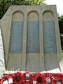
- Woodhall Spa War Memorial (1 F)
Media in category "Woodhall Spa"
The following 200 files are in this category, out of 276 total.
(previous page) (next page)-
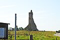
 617 Squadron (Dambusters) Memorial - geograph.org.uk - 5420275.jpg 4,032 × 3,024; 6.34 MB
-
 617 Squadron badge - geograph.org.uk - 4307741.jpg 1,024 × 985; 358 KB
-
 617 Squadron Memorial at Woodhall Spa - geograph.org.uk - 5798378.jpg 2,592 × 3,456; 3.17 MB
-
 Abbey Drive, Woodhall Spa - geograph.org.uk - 3189940.jpg 640 × 480; 69 KB
-
 Abbey Lodge - geograph.org.uk - 6168740.jpg 640 × 480; 73 KB
-
 Abbey Lodge, Kirkstead - geograph.org.uk - 5996005.jpg 1,600 × 1,066; 726 KB
-
 Afternoon teatime at the Petwood Hotel - geograph.org.uk - 5514279.jpg 768 × 1,024; 221 KB
-
 Ancient hedgeline - geograph.org.uk - 2412144.jpg 640 × 480; 174 KB
-

-
 B1191 Station Road and The Broadway Woodhall Spa - geograph.org.uk - 3685033.jpg 3,456 × 5,184; 3.14 MB
-
 B1191 towards Woodhall Spa - geograph.org.uk - 4758523.jpg 1,600 × 1,044; 359 KB
-
 B1192 - geograph.org.uk - 6168741.jpg 640 × 480; 62 KB
-
 B1192 entering Woodhall Spa - geograph.org.uk - 5584597.jpg 640 × 427; 102 KB
-
 Backlit Trees On Woodland Drive - geograph.org.uk - 324939.jpg 640 × 480; 125 KB
-
 Bee on a sunflower - geograph.org.uk - 555925.jpg 640 × 480; 106 KB
-

-
 Bungalow at Woodhall Spa.jpg 2,239 × 1,456; 806 KB
-
 Church in Woodhall Spa - geograph.org.uk - 6168766.jpg 480 × 640; 53 KB
-
 Clarence Road - geograph.org.uk - 2443182.jpg 3,264 × 2,448; 4.46 MB
-
 Clearing in the Woods - geograph.org.uk - 4775070.jpg 1,600 × 1,067; 1.35 MB
-
 Conservative Club - geograph.org.uk - 2447919.jpg 3,264 × 2,448; 4.58 MB
-
 Cows in the Kirkstead Abbey field - geograph.org.uk - 5584632.jpg 640 × 427; 74 KB
-

-
 Cricket in Jubilee Park - geograph.org.uk - 5748377.jpg 1,600 × 1,200; 481 KB
-

-

-
 Cut Mark, Kirkstead, St Leonard's Church - geograph.org.uk - 5747014.jpg 960 × 1,280; 454 KB
-

-
 Cut Mark, Woodhall Spa, 617 Bar - geograph.org.uk - 5732740.jpg 960 × 1,280; 448 KB
-
 Cut Mark, Woodhall Spa, 9 Stixwould Road - geograph.org.uk - 5732823.jpg 1,280 × 960; 332 KB
-
 Cut Mark, Woodhall Spa, Sandy Lane Gatepost - geograph.org.uk - 4771254.jpg 1,280 × 960; 391 KB
-
 Cycle Path - geograph.org.uk - 2443154.jpg 3,264 × 2,448; 5.04 MB
-
 Cycle Path - geograph.org.uk - 771616.jpg 640 × 480; 112 KB
-
 Dambusters Memorial - geograph.org.uk - 4307729.jpg 1,024 × 683; 280 KB
-
 Dandelions - geograph.org.uk - 2412116.jpg 640 × 480; 128 KB
-
 Diamond Jubilee Plantation - geograph.org.uk - 3593956.jpg 640 × 480; 61 KB
-
-
 Drain and Kirkstead Bridge - geograph.org.uk - 6233312.jpg 1,024 × 768; 295 KB
-
 Drain at End of Grove Drive - geograph.org.uk - 2585808.jpg 1,280 × 960; 581 KB
-
 Early 13th century knight - geograph.org.uk - 4572716.jpg 1,024 × 683; 193 KB
-
 East window, St Peter's church, Woodhall Spa - geograph.org.uk - 5543381.jpg 3,120 × 4,152; 5.06 MB
-

-
 Emmanuel House, 9 Stixwould Road - geograph.org.uk - 5732827.jpg 960 × 1,280; 236 KB
-
 Entering Woodhall Spa on B1191 - geograph.org.uk - 4758508.jpg 1,600 × 1,050; 603 KB
-
 Entering Woodhall Spa, Lincolnshire - geograph.org.uk - 2239304.jpg 800 × 600; 292 KB
-
 Entrance to the Woods - geograph.org.uk - 4774771.jpg 1,067 × 1,600; 1.25 MB
-
 Entrance to Woodhall Spa - geograph.org.uk - 6168784.jpg 480 × 640; 76 KB
-
 Exterieur van Victoria Hotel in Woodhall Spa, RP-F-F01135-CD.jpg 2,948 × 2,211; 787 KB
-
 Fairmead, Woodhall Spa - geograph.org.uk - 5369445.jpg 1,795 × 1,024; 931 KB
-
 Fairy Crafters shop, Woodhall Spa - geograph.org.uk - 5996011.jpg 1,600 × 1,200; 752 KB
-
 Field off Sandy Lane - geograph.org.uk - 3593882.jpg 640 × 480; 79 KB
-

-
 Fledgling Jackdaw - geograph.org.uk - 4308089.jpg 1,024 × 683; 300 KB
-
 Footpath and Finger Post - geograph.org.uk - 6168789.jpg 480 × 640; 130 KB
-
 Footpath off Monument Road, Woodhall Spa - geograph.org.uk - 4895106.jpg 3,776 × 2,520; 4.16 MB
-
 Footpath off Sandy Lane - geograph.org.uk - 3593961.jpg 640 × 480; 122 KB
-
 Former Alexandra Hotel - geograph.org.uk - 5747623.jpg 1,600 × 1,200; 478 KB
-
 Former Wesleyan Chapel - geograph.org.uk - 5748359.jpg 1,600 × 1,200; 566 KB
-
 Former Woodhall Spa Junction Crossing - geograph.org.uk - 2519713.jpg 1,600 × 1,200; 809 KB
-
 Golf course - geograph.org.uk - 6168786.jpg 480 × 640; 49 KB
-
 Golf Hotel ^ Spa, Woodhall Spa - geograph.org.uk - 5543654.jpg 5,568 × 3,712; 4.64 MB
-
 GR Wall Post Box - geograph.org.uk - 2439471.jpg 3,264 × 2,448; 4.94 MB
-
 Graveyard - geograph.org.uk - 6168773.jpg 480 × 640; 100 KB
-
 Green Lane - geograph.org.uk - 2412130.jpg 640 × 480; 98 KB
-
 Green Lane towards Woodhall Spa - geograph.org.uk - 3537607.jpg 2,256 × 1,504; 3.18 MB
-
 Guess The Time^ - geograph.org.uk - 2447947.jpg 3,264 × 2,448; 4.6 MB
-
 Hawker Hunter - geograph.org.uk - 2107048.jpg 640 × 427; 79 KB
-
 Hawker Hunter - geograph.org.uk - 2107074.jpg 640 × 427; 67 KB
-
 Hedge and fields near Waterloo Farm - geograph.org.uk - 5746124.jpg 1,600 × 1,200; 475 KB
-
-
 Iddesleigh Road - geograph.org.uk - 1198166.jpg 640 × 426; 96 KB
-
 Kinema in the Woods - geograph.org.uk - 2519348.jpg 1,600 × 1,200; 924 KB
-
 Kinema in the Woods - geograph.org.uk - 2831461.jpg 640 × 480; 70 KB
-
 Kinema in the Woods - geograph.org.uk - 3329093.jpg 640 × 480; 101 KB
-
 Kinema in the Woods - geograph.org.uk - 3329099.jpg 640 × 480; 116 KB
-
 Kinema in the Woods - geograph.org.uk - 4035885.jpg 1,024 × 683; 284 KB
-
 Kinema in the Woods - geograph.org.uk - 4035891.jpg 1,024 × 683; 289 KB
-
 Kinema in the Woods - geograph.org.uk - 5746118.jpg 1,600 × 1,200; 666 KB
-
 Kinema in the Woods, Woodhall Spa - geograph.org.uk - 4831322.jpg 4,780 × 3,203; 3.35 MB
-
 Kinema in the Woods.jpg 640 × 480; 326 KB
-
 Kirkby Lane - geograph.org.uk - 4775074.jpg 1,600 × 1,067; 1.15 MB
-
 Kirkby Lane Cemetery - geograph.org.uk - 2448759.jpg 3,264 × 2,448; 1.62 MB
-
 Kirkby Lane Pond - geograph.org.uk - 2449211.jpg 3,264 × 2,448; 5.7 MB
-
 Kirkby Lane, Woodhall Spa - geograph.org.uk - 3190314.jpg 640 × 480; 98 KB
-
 Kirkstead Abbey site, aerial 2018 - geograph.org.uk - 5932348.jpg 800 × 533; 101 KB
-
 Kirkstead Abbey, aerial 2018 (2) - geograph.org.uk - 5846604.jpg 800 × 533; 98 KB
-
 Kirkstead Abbey, aerial 2018 (3) - geograph.org.uk - 5846607.jpg 800 × 533; 129 KB
-
 Kirkstead Abbey, aerial 2018 - geograph.org.uk - 5846600.jpg 800 × 533; 116 KB
-
 Kirkstead Bridge - geograph.org.uk - 4598832.jpg 3,776 × 2,520; 4.19 MB
-
 Kirkstead farmland - geograph.org.uk - 2412105.jpg 640 × 480; 96 KB
-
 Kirkstead, St Leonard's Church - geograph.org.uk - 5747017.jpg 1,280 × 960; 416 KB
-
 Lambing Time - geograph.org.uk - 771627.jpg 640 × 480; 65 KB
-
 Lincolnshire speciality - geograph.org.uk - 3022034.jpg 1,280 × 960; 247 KB
-
 Lodge at Woodhall Spa.jpg 1,935 × 1,492; 763 KB
-
 Looking alongside Waterloo Wood - geograph.org.uk - 1978356.jpg 1,024 × 768; 138 KB
-
 Miscanthus Crop - geograph.org.uk - 2448812.jpg 3,264 × 2,448; 4.57 MB
-
 Monkey Puzzle Tree on Sandy Lane - geograph.org.uk - 3264212.jpg 2,256 × 1,504; 768 KB
-
 Monument Road - geograph.org.uk - 2412148.jpg 640 × 480; 119 KB
-
 Monument Road Woodhall Spa - geograph.org.uk - 5514306.jpg 1,024 × 685; 149 KB
-
 Narrowboat on the Witham - geograph.org.uk - 3006479.jpg 640 × 480; 118 KB
-
 Native species - geograph.org.uk - 773827.jpg 577 × 640; 183 KB
-
 New Dambusters 617 Squadron memorial - geograph.org.uk - 3488917.jpg 1,504 × 2,256; 2.08 MB
-
 New planted field - geograph.org.uk - 5748331.jpg 1,600 × 1,200; 634 KB
-
 New Surgery - geograph.org.uk - 5747593.jpg 1,600 × 1,200; 647 KB
-
 Oak Close - geograph.org.uk - 6168768.jpg 480 × 640; 86 KB
-

-
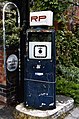
 Old fuel pump - geograph.org.uk - 1255284.jpg 426 × 640; 106 KB
-
 Old fuel pump - geograph.org.uk - 1255286.jpg 426 × 640; 69 KB
-
 Old petrol pump 21 The Broadway Woodhall Spa - geograph.org.uk - 3868285.jpg 1,408 × 2,124; 944 KB
-
 Old petrol pump 22 The Broadway Woodhall Spa - geograph.org.uk - 3868286.jpg 1,338 × 2,089; 676 KB
-
 On The Broadway, Woodhall Spa - geograph.org.uk - 4778356.jpg 1,500 × 2,000; 806 KB
-
 One large ploughed field - geograph.org.uk - 5995995.jpg 1,600 × 640; 489 KB
-
 Only standing ruins of Kirkstead Abbey - geograph.org.uk - 6261225.jpg 4,434 × 2,956; 1.43 MB
-
 Opium poppies - geograph.org.uk - 4049040.jpg 1,024 × 688; 359 KB
-
 Opium poppies - geograph.org.uk - 4049044.jpg 1,024 × 967; 168 KB
-
 Opium poppies - geograph.org.uk - 4049048.jpg 1,024 × 683; 445 KB
-
 Opium poppies - geograph.org.uk - 4049053.jpg 1,024 × 695; 212 KB
-
 Opium poppies - geograph.org.uk - 4305569.jpg 1,024 × 683; 105 KB
-
 Opium poppies - geograph.org.uk - 4305638.jpg 1,024 × 683; 342 KB
-
 Ordnance Survey Cut Mark - geograph.org.uk - 3057800.jpg 3,264 × 2,448; 1.6 MB
-
 Ordnance Survey Flush Bracket S6600 - geograph.org.uk - 3057814.jpg 3,264 × 2,448; 1.5 MB
-
 Ordnance Survey Flush Bracket S8605 - geograph.org.uk - 3057806.jpg 3,264 × 2,448; 1.96 MB
-
 Organ, St Peter's church, Woodhall Spa - geograph.org.uk - 5543640.jpg 4,895 × 3,577; 6.37 MB
-
 Penny Farthing B1191 Station Road Woodhall Spa - geograph.org.uk - 3685036.jpg 3,456 × 5,184; 2.73 MB
-
 Petrol Pump - geograph.org.uk - 4778362.jpg 1,500 × 2,000; 674 KB
-
 Petwood Hotel - geograph.org.uk - 5514278.jpg 1,024 × 806; 274 KB
-
 Petwood Hotel, Woodhall Spa, aerial 2018 - geograph.org.uk - 5931631.jpg 800 × 533; 133 KB
-
 Petwood, Woodhall Spa.jpg 1,697 × 2,198; 1.01 MB
-
 Pine Woods, Woodhall Spa - geograph.org.uk - 3769765.jpg 640 × 480; 132 KB
-
 Pine Woods, Woodhall Spa - geograph.org.uk - 3769770.jpg 480 × 640; 127 KB
-
 Pine Woods, Woodhall Spa - geograph.org.uk - 3769774.jpg 640 × 480; 134 KB
-
 Plane in a field, near Woodhall Spa - geograph.org.uk - 2585787.jpg 1,280 × 960; 260 KB
-
 Poultry Houses (disused) - geograph.org.uk - 2449233.jpg 3,264 × 2,448; 5.05 MB
-
 Public Conveniences, Spa Road, Woodhall Spa - geograph.org.uk - 2638650.jpg 4,000 × 3,000; 2.86 MB
-
 RAF 'Wings' memorial at Woodhall Spa - geograph.org.uk - 5798474.jpg 2,776 × 1,799; 2.22 MB
-
 Rainbow at Woodhall Spa - geograph.org.uk - 4831275.jpg 5,031 × 3,541; 4.76 MB
-
 Reeds Beck Farm - geograph.org.uk - 5746652.jpg 1,600 × 1,200; 688 KB
-
 Reeds Beck road junction - geograph.org.uk - 5514304.jpg 1,024 × 594; 109 KB
-
 Ristorante il Parco (Tea House in the Woods) - geograph.org.uk - 2519360.jpg 1,600 × 1,200; 880 KB
-

-
 River Witham - geograph.org.uk - 1978382.jpg 1,024 × 768; 174 KB
-

-
 Road Junction - geograph.org.uk - 3533496.jpg 2,256 × 1,504; 2.43 MB
-
 Road junction - geograph.org.uk - 6168770.jpg 480 × 640; 99 KB
-
 Road to Highall Farm - geograph.org.uk - 5746661.jpg 1,600 × 1,200; 406 KB
-
 Rough Pasture - geograph.org.uk - 773516.jpg 640 × 427; 75 KB
-
 Roughton Moor Cemetery - geograph.org.uk - 147539.jpg 640 × 427; 110 KB
-
 S8605, Woodhall Spa, St Peter's Church - geograph.org.uk - 5746181.jpg 960 × 1,280; 364 KB
-

-

-

-
 Sandy Lane - geograph.org.uk - 3593886.jpg 640 × 480; 79 KB
-
 Sandy Lane - geograph.org.uk - 3593958.jpg 640 × 480; 63 KB
-
 Scout Camp Fire - geograph.org.uk - 4774717.jpg 640 × 427; 131 KB
-
 Scout Hut - geograph.org.uk - 4774706.jpg 640 × 427; 108 KB
-
 Scout Hut - geograph.org.uk - 4775055.jpg 1,600 × 1,067; 1.16 MB
-
 Scout Hut - geograph.org.uk - 4775062.jpg 1,067 × 1,600; 1.46 MB
-
 Sewage works off Green Lane - geograph.org.uk - 3537725.jpg 2,256 × 1,504; 2.4 MB
-
 Sheep May Safely Graze - geograph.org.uk - 771637.jpg 640 × 480; 85 KB
-
 Shipping-Storage Container - geograph.org.uk - 4775059.jpg 1,600 × 1,067; 1.22 MB
-

-
 Site of Kirkstead Abbey, aerial 2019 (2) - geograph.org.uk - 6133859.jpg 800 × 534; 109 KB
-
 Site of Kirkstead Abbey, aerial 2019 (3) - geograph.org.uk - 6151572.jpg 1,024 × 683; 199 KB
-

-
 Site of St.Andrew's church - geograph.org.uk - 4308066.jpg 1,024 × 683; 351 KB
-
 Site of St.Andrew's church - geograph.org.uk - 4308083.jpg 683 × 1,024; 358 KB
-
 Southern entrance to the Spa Trail - geograph.org.uk - 3190324.jpg 640 × 480; 136 KB
-
 Spa Trail - geograph.org.uk - 2582581.jpg 640 × 480; 157 KB
-
 Spa Trail access - geograph.org.uk - 1906057.jpg 640 × 426; 104 KB
-
 Station Road, Woodhall Spa - geograph.org.uk - 4831255.jpg 4,604 × 3,151; 3.83 MB
-
 Station Road, Woodhall Spa - geograph.org.uk - 5584660.jpg 640 × 427; 93 KB
-
 Station Road, Woodhall Spa - geograph.org.uk - 6216242.jpg 1,024 × 683; 161 KB
-
 Streamlined cycling - geograph.org.uk - 2436744.jpg 640 × 480; 111 KB
-
 The B1191 approaching Woodhall Spa - geograph.org.uk - 5786190.jpg 2,052 × 1,450; 1.05 MB
-
 The Broadway, Woodhall Spa - geograph.org.uk - 3190283.jpg 640 × 480; 97 KB
-
 The Broadway, Woodhall Spa - geograph.org.uk - 4446976.jpg 2,816 × 1,880; 2.64 MB
-
 The Cottage Museum - geograph.org.uk - 4778641.jpg 2,000 × 1,500; 960 KB
-
 The Dam Busters Memorial at Woodhall Spa - geograph.org.uk - 5798367.jpg 2,592 × 3,456; 3.27 MB
-
 The Dam Busters Memorial at Woodhall Spa - geograph.org.uk - 5798371.jpg 2,592 × 3,456; 3.09 MB
-
 The Dam Busters Memorial at Woodhall Spa - geograph.org.uk - 5798374.jpg 2,592 × 3,456; 3.28 MB
-
 The Dam Busters Memorial in the form of a breached dam - geograph.org.uk - 5798365.jpg 3,456 × 2,592; 3.89 MB
-
 The Dam Busters Memorial in the form of a breached dam. - geograph.org.uk - 5798620.jpg 3,445 × 2,572; 3.09 MB
-
 The Gatehouse - geograph.org.uk - 2379534.jpg 640 × 480; 104 KB
-
 The Hodgkin Golf Course - geograph.org.uk - 937860.jpg 640 × 480; 99 KB
-
 The Hodgkin Golf Course - geograph.org.uk - 937881.jpg 640 × 480; 115 KB
-
 The Hotchkin Course - geograph.org.uk - 4779803.jpg 2,000 × 1,500; 1.03 MB
-
 The lake and grounds of Petwood Hotel - geograph.org.uk - 5435705.jpg 4,032 × 3,024; 7.07 MB
-
 The Mall - geograph.org.uk - 6168798.jpg 480 × 640; 52 KB
-
 The Memorial Gardens, Woodhall Spa - geograph.org.uk - 2239317.jpg 800 × 600; 362 KB
-
 The Mighty Compton - geograph.org.uk - 2831468.jpg 640 × 480; 95 KB
-
 The old Primitive Methodist chapel on Mill Lane - geograph.org.uk - 4831368.jpg 5,041 × 3,656; 4.71 MB
-

-
 The Railway Hotel, Kirkstead Bridge - geograph.org.uk - 2589119.jpg 640 × 427; 80 KB
-

-
 The River Witham near Bank Farm - geograph.org.uk - 4649604.jpg 640 × 480; 73 KB
-
 The Viking Way - geograph.org.uk - 2412109.jpg 640 × 480; 192 KB
-
 The Viking Way - geograph.org.uk - 2412114.jpg 480 × 640; 172 KB
-
 The Viking Way - geograph.org.uk - 2412129.jpg 640 × 480; 99 KB
-
 The Viking Way entering Woodhall Spa from the West - geograph.org.uk - 2638662.jpg 4,000 × 3,000; 2.95 MB
-
 The Viking Way footpath in Woodhall Spa - geograph.org.uk - 434316.jpg 640 × 480; 144 KB
_Memorial_-_geograph.org.uk_-_5420275.jpg)


_-_geograph.org.uk_-_5932285.jpg)
_-_geograph.org.uk_-_5932379.jpg)


_-_geograph.org.uk_-_5846604.jpg)
_-_geograph.org.uk_-_5846607.jpg)


_-_geograph.org.uk_-_2449233.jpg)


_-_geograph.org.uk_-_2519360.jpg)
_-_geograph.org.uk_-_2549251.jpg)


_-_geograph.org.uk_-_6133847.jpg)
_-_geograph.org.uk_-_6133859.jpg)
_-_geograph.org.uk_-_6151572.jpg)
_-_geograph.org.uk_-_6151573.jpg)


.jpg)


