Category:Woodlands in the City of Leeds
Subcategories
This category has the following 23 subcategories, out of 23 total.
A
B
- Barnbow Plantation (5 F)
- Barnbow Woods (1 F)
- Bell Wood, Leeds (4 F)
- Black Carr Wood (12 F)
- Bushy Cliffe Wood (9 F)
C
- Calverley Wood (17 F)
- Cunliff Wood (2 F)
G
- Gipton Wood (5 F)
- Gledhow Valley Woods (11 F)
N
- Nan Whins Wood (2 F)
- North Wood, Tong, Bradford (2 F)
Q
R
- Ram Wood, Roundhay Park (4 F)
- Ravenscliffe Wood (10 F)
- Ringhay Wood (2 F)
- Round Wood, Calverley (2 F)
S
- Shippen Plantation (3 F)
- Spring Wood, Tinshill (3 F)
W
- West Wood, Calverley (14 F)
- Woodhall Plantation (3 F)
Media in category "Woodlands in the City of Leeds"
The following 82 files are in this category, out of 82 total.
-
 A path in Bracken Hills Wood - geograph.org.uk - 3075916.jpg 800 × 600; 287 KB
-
 A walk from Oulton Church ^29 - geograph.org.uk - 2011165.jpg 800 × 600; 390 KB
-
 A walk from Oulton Church ^30 - geograph.org.uk - 2011171.jpg 800 × 600; 388 KB
-
 A walk from Oulton Church ^38 - geograph.org.uk - 2011226.jpg 800 × 600; 258 KB
-
 Adel WWII Bunker - geograph.org.uk - 729617.jpg 640 × 424; 142 KB
-
 Approaching the Woods above Hawksworth - geograph.org.uk - 3332067.jpg 4,320 × 3,240; 3.75 MB
-
 Armley Junction - geograph.org.uk - 5077980.jpg 1,024 × 768; 210 KB
-

-
 Avenue Wood - geograph.org.uk - 1998833.jpg 1,024 × 681; 267 KB
-
 Avenue Wood, Temple Newsam - geograph.org.uk - 180251.jpg 640 × 480; 257 KB
-
 Barnbow Woods - geograph.org.uk - 2598078.jpg 2,048 × 1,536; 634 KB
-
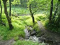
 Beck through Backhouse Wood - geograph.org.uk - 4999577.jpg 1,024 × 768; 402 KB
-
 Beech Bank, Harewood - geograph.org.uk - 141535.jpg 640 × 480; 77 KB
-
 Beech trees above the beck - geograph.org.uk - 4794127.jpg 640 × 427; 157 KB
-
 Beech trees in Coal Hill woods - geograph.org.uk - 6448352.jpg 1,024 × 768; 545 KB
-
 Beeches and Boulders - geograph.org.uk - 1021008.jpg 480 × 640; 123 KB
-
 Beilby Wood - geograph.org.uk - 256686.jpg 640 × 480; 37 KB
-
 Black Hill Plantation - geograph.org.uk - 2768221.jpg 2,592 × 3,872; 2.47 MB
-
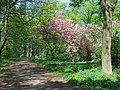 Blossom at Farnley Park. - geograph.org.uk - 167201.jpg 640 × 480; 166 KB
-
 Bluebell woods at the end of Broadlea Close - geograph.org.uk - 6450033.jpg 1,024 × 768; 411 KB
-
 Bluebells in Batcliffe Wood - geograph.org.uk - 6467979.jpg 1,024 × 768; 403 KB
-
 Bluebells in the woods - geograph.org.uk - 2120663.jpg 3,264 × 2,448; 1.43 MB
-
 Bridleway and footpath at Roker Lane Bottom - geograph.org.uk - 3350992.jpg 2,048 × 1,536; 515 KB
-
 Bridleway through Bell Wood - geograph.org.uk - 5300209.jpg 1,024 × 768; 369 KB
-
 Bridleway through Bull Wood, Calverley - geograph.org.uk - 2268741.jpg 2,000 × 1,500; 1.51 MB
-
 Bridleway to Garforth Golf Club - geograph.org.uk - 2578374.jpg 1,024 × 768; 190 KB
-
 Burnt-out car in Halton Moor Wood - geograph.org.uk - 5916595.jpg 1,024 × 768; 310 KB
-
 By the railway embankment, Backhouse Wood - geograph.org.uk - 821888.jpg 450 × 600; 164 KB
-
 Carr Beck, Tong - geograph.org.uk - 1381538.jpg 640 × 480; 191 KB
-
 CEGB cable marker - geograph.org.uk - 6439493.jpg 768 × 1,024; 343 KB
-
 Chevin Forest Park, Otley - geograph.org.uk - 365317.jpg 640 × 469; 148 KB
-
 Concrete tank (1), Horsforth - geograph.org.uk - 821261.jpg 450 × 600; 166 KB
-
 Concrete tank (2 and 3), Horsforth - geograph.org.uk - 821265.jpg 640 × 480; 161 KB
-
 Cowthwaite Plantation - geograph.org.uk - 319147.jpg 640 × 480; 221 KB
-
 Damp Birch Woodland - geograph.org.uk - 726511.jpg 640 × 480; 152 KB
-
 East of Lamplands - geograph.org.uk - 4624468.jpg 640 × 426; 43 KB
-
 Entrance to Post Hill woods from Troydale - geograph.org.uk - 5645160.jpg 1,024 × 768; 355 KB
-

-

-
 Farmland and woodland, Colton - geograph.org.uk - 2755178.jpg 640 × 445; 57 KB
-
 Field West of Newfield Plantation - geograph.org.uk - 688306.jpg 640 × 480; 78 KB
-

-
 Footpath in Post Hill Woods - geograph.org.uk - 4852850.jpg 1,024 × 768; 412 KB
-
 Footpath in Post Hill woods - geograph.org.uk - 5645140.jpg 1,024 × 768; 378 KB
-
 Forestry operations by the canal at Rodley - geograph.org.uk - 6565592.jpg 1,024 × 768; 339 KB
-
 Grazing and woodland, Howden Clough - geograph.org.uk - 6401259.jpg 800 × 612; 185 KB
-
 Harewood Castle 2020.jpg 4,160 × 3,120; 3.27 MB
-
 Hawksworth Wood entrance, Hawksworth - geograph.org.uk - 130426.jpg 480 × 640; 111 KB
-
 Heavy plant in Lindley Wood - geograph.org.uk - 579005.jpg 640 × 480; 182 KB
-
 High Wood from Eccup reservoir dam - geograph.org.uk - 141538.jpg 640 × 480; 85 KB
-
 Holly tree in Post Hill woods - geograph.org.uk - 5645158.jpg 1,024 × 768; 324 KB
-
 Howden Clough - geograph.org.uk - 31037.jpg 640 × 480; 174 KB
-
 Ledston Park - geograph.org.uk - 319134.jpg 640 × 480; 89 KB
-
 Lodge Wood - geograph.org.uk - 644472.jpg 640 × 480; 133 KB
-
 Lodge Wood near Calverley - geograph.org.uk - 43984.jpg 640 × 480; 124 KB
-
 Looking downhill in Middleton Woods - geograph.org.uk - 830830.jpg 640 × 480; 54 KB
-
 Makeshift gate (4069996458).jpg 2,560 × 1,920; 5.63 MB
-
 Parlington Lane (4070004290).jpg 1,920 × 2,560; 5.99 MB
-
 Parlington Lane (4078504153).jpg 1,920 × 2,560; 6.72 MB
-
 Pudsey Beck in Post Hill woods - geograph.org.uk - 5645168.jpg 1,024 × 768; 337 KB
-
 Saw Wood, Leeds Country Way - geograph.org.uk - 140439.jpg 640 × 480; 115 KB
-
 Spring in Cragg Wood - geograph.org.uk - 406184.jpg 450 × 600; 121 KB
-
 The Avenue, Temple Newsam - geograph.org.uk - 30536.jpg 480 × 640; 142 KB
-
 The Gorge, Roundhay Park - geograph.org.uk - 386600.jpg 480 × 640; 135 KB
-
 Track and stream in Post Hill nature reserve, Leeds.jpg 3,200 × 2,368; 4.1 MB
-
 Walking towards Garforth golf course - geograph.org.uk - 2785954.jpg 800 × 600; 235 KB
-
 Whittle Car - geograph.org.uk - 801291.jpg 600 × 400; 298 KB
-
 Woodhouse Ridge, Leeds (2715002780).jpg 1,920 × 2,560; 7.58 MB
-
 Woodland by Back Newton Lane - geograph.org.uk - 254301.jpg 640 × 348; 23 KB
-
 Woodland by Bayton Lane, Horsforth - geograph.org.uk - 663770.jpg 640 × 480; 150 KB
-
 Woodland off Royds Lane - geograph.org.uk - 2221190.jpg 1,024 × 768; 153 KB
-

-
 Woodland Path - off Hillfoot Drive - geograph.org.uk - 1296566.jpg 640 × 480; 370 KB
-
 Woods in Farnley Park. - geograph.org.uk - 119226.jpg 640 × 480; 174 KB
-
 Yellow skip in the woods - geograph.org.uk - 5418226.jpg 1,024 × 768; 1.22 MB
-
 A small deciduous wood, Bramhope - geograph.org.uk - 166246.jpg 640 × 480; 159 KB
-
 Belmont Wood, Yeadon - geograph.org.uk - 11861.jpg 640 × 480; 204 KB
-
 Cunliff Wood, Armley - geograph.org.uk - 260253.jpg 480 × 640; 130 KB
-
 Little Hawksworth Wood, Horsforth - geograph.org.uk - 130294.jpg 640 × 480; 146 KB
-
 Looking down into Hawksworth Wood - geograph.org.uk - 131173.jpg 640 × 480; 140 KB
-
 Nan Pie, Harewood Estate - geograph.org.uk - 154082.jpg 640 × 480; 301 KB
-
 Wike Wood. - geograph.org.uk - 217488.jpg 640 × 480; 155 KB


,_Horsforth_-_geograph.org.uk_-_821261.jpg)
,_Horsforth_-_geograph.org.uk_-_821265.jpg)


.jpg)
.jpg)
.jpg)


.jpg)


