Category:World maps about the COVID-19 pandemic
Subcategories
This category has the following 6 subcategories, out of 6 total.
Media in category "World maps about the COVID-19 pandemic"
The following 84 files are in this category, out of 84 total.
-
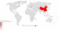
 2019-nCoV countries as of February 1, 2020.png 6,232 × 3,357; 1.53 MB
-
 202012 01 Outbreak World Map.png 1,455 × 722; 66 KB
-
 202201220421COVID-19 Outbreak World Map per Capita.svg 2,921 × 1,500; 2.59 MB
-
 501.V2 Variant Cases Map 13 January 2021.png 7,000 × 4,192; 2.14 MB
-
 501.V2 Variant Cases Map 14 January 2021.png 7,000 × 4,192; 2.15 MB
-
 501.V2 variant countries.svg 2,560 × 1,314; 4.53 MB
-
 Acute food insecurity forecast for 2020 including coronavirus famines.svg 2,754 × 1,398; 1.22 MB
-
 B.1.1.617 sequences by country as of 21 April 2021.svg 2,754 × 1,398; 1.05 MB
-
 B.1.1.7 Cases by country as of 25 Mar 2021.svg 2,754 × 1,398; 1.05 MB
-
 B117results17mar2021.svg 2,000 × 857; 151 KB
-
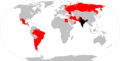
 Cases of coronavirus outside China on 4th February 2020 (49920935901).jpg 1,160 × 1,080; 344 KB
-
 Confirmed cases of 501.V2 as of 12 January 2021.png 7,000 × 4,192; 4.36 MB
-
 Confirmed cases of Variant 501.V2 world map.png 7,000 × 4,192; 2.14 MB
-
 Coronavirus Map With Human to Human Transmission.svg 512 × 263; 1.66 MB
-

-
 Countries that received medical supplies or aid from Turkey against COVID-19.svg 2,754 × 1,398; 1.13 MB
-
 COVID 19 Pandemic Travel Restrictions.png 7,000 × 3,526; 2.15 MB
-
 COVID-19 - Catholic masses suspensions.png 1,427 × 628; 42 KB
-
 Covid-19 cases as of 20 Mar 2021.svg 2,754 × 1,398; 1.05 MB
-
 Covid-19 cases by country as of 20 Mar 2021.svg 2,754 × 1,398; 1.05 MB
-
 COVID-19 date lockdowns.jpg 1,039 × 663; 371 KB
-
 COVID-19 outbreak associated travel restrictions.png 1,465 × 625; 37 KB
-
 COVID-19 Outbreak lockdowns.svg 2,754 × 1,398; 1.1 MB
-
 COVID-19 Outbreak World Map (33).svg 2,754 × 1,398; 1.1 MB
-
 COVID-19 Outbreak World Map (34).svg 2,580 × 1,309; 1.27 MB
-
 COVID-19 Outbreak World Map (35).svg 2,921 × 1,500; 1.68 MB
-
 COVID-19 Outbreak World Map (36).svg 2,921 × 1,500; 1.68 MB
-
 COVID-19 Outbreak World Map box (proposed).svg 512 × 263; 1.55 MB
-
 COVID-19 Outbreak World Map-Confirmed.svg 2,921 × 1,500; 1.73 MB
-
 COVID-19 Outbreak World Map-Deaths.svg 2,921 × 1,500; 1.73 MB
-
 COVID-19 Outbreak World Map-GlobalTravelBan.svg 2,754 × 1,398; 1.16 MB
-
 COVID-19 Outbreak World Map-Population.svg 2,921 × 1,500; 1.72 MB
-
 COVID-19 Outbreak World Map-Travel Restrictions.svg 2,754 × 1,398; 1.06 MB
-
 COVID-19 Outbreak World Map.svg 2,921 × 1,500; 1.72 MB
-

-
 COVID-19 pandemic cases among Overseas Filipinos.svg 2,754 × 1,398; 1.15 MB
-
 COVID-19 school closures worst state.svg 2,754 × 1,398; 1.06 MB
-
 COVID-19 school closures.svg 512 × 260; 812 KB
-
 COVID-19-outbreak-timeline.gif 1,194 × 606; 587 KB
-
COVID-19-outbreak-timeline.webm 39 s, 1,194 × 606; 462 KB
-
 COVID19 Travel Restrictions July.svg 2,754 × 1,398; 1.05 MB
-
 Daily new cases COVID-19 map 2021 10 29.svg 850 × 600; 168 KB
-
 Daily new cases COVID-19 map.svg 850 × 600; 160 KB
-

-
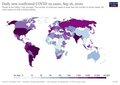
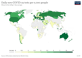 Daily new COVID-19 tests per 1,000 people.png 3,400 × 2,400; 573 KB
-
 Delta Variant countries.svg 2,921 × 1,500; 1.73 MB
-
 Edited Confirmed cases of 501.V2 as of 12 January 2021.png 7,000 × 4,192; 2.5 MB
-
 Epsilon variant countries.svg 2,921 × 1,500; 1.73 MB
-
 Eta variant countries.svg 2,921 × 1,500; 1.73 MB
-
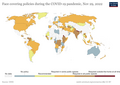 Face-covering-policies-covid.png 3,400 × 2,400; 815 KB
-
 Global monitoring of learners affected by school closures caused by Covid-19.png 1,778 × 776; 253 KB
-
 Impacts of COVID-19.png 2,002 × 1,043; 439 KB
-
 Imported COVID-19 Cases from Iran.svg 2,754 × 1,398; 1.3 MB
-
 Internationale Risikogebiete of Robert Koch-Institut.svg 2,560 × 1,314; 1.67 MB
-
 Lineage B.1.617.2 Map (MapChart).png 7,192 × 3,087; 1.32 MB
-
 Lineage P.1 sequences by country as of 21 April 2021.svg 2,754 × 1,398; 1.05 MB
-

-
 Map of countries that have altered an election date due to the COVID-19 pandemic.svg 2,754 × 1,398; 1.14 MB
-
 Map of countries with confirmed SARS-CoV-2 Omicron variant cases.svg 2,754 × 1,398; 1.2 MB
-
 Map of COVID-associated Mucormycosis (Black fungus) cases.png 2,754 × 1,398; 444 KB
-
 Map of daily confirmed new cases by country.png 3,400 × 2,400; 734 KB
-
 Mapa coronavirus América.jpg 600 × 305; 58 KB
-
 MapChart Map hICcVAzl edit 1445092956078968.jpg 4,020 × 2,029; 594 KB
-
 March 13 daily new cases.png 1,120 × 604; 176 KB
-
 Mask covid sans legende.jpg 1,705 × 920; 146 KB
-
 Mask laws around the world.svg 512 × 260; 792 KB
-
 Occupancy thresholds by Country in Retail Jun 2020.png 768 × 437; 365 KB
-
 Overseas Indonesians during the COVID-19 pandemic.jpg 4,020 × 2,114; 580 KB
-
 P.1 Map (MapChart).png 7,192 × 3,087; 1.32 MB
-
 Positive-rate-daily-smoothed (2).png 3,400 × 2,400; 805 KB
-

-
 Restricciones de entrada a españoles por SARS-CoV-2.svg 2,754 × 1,398; 1.18 MB
-
 Spain - Travel restrictions due to COVID-19.svg 2,754 × 1,398; 1.25 MB
-
 Spread of the Covid-19 pandemic worldwide.gif 2,624 × 1,424; 3.12 MB
-
 The Great Lockdown economic retraction map.png 6,460 × 3,480; 1.82 MB
-
 USA Travel Restrictions from COVID-19.svg 2,754 × 1,398; 797 KB
-
 Visa requirements for French citizens (COVID-19 pandemic).png 1,427 × 625; 40 KB
-
 Visa requirements for German citizens (COVID-19 pandemic).png 1,427 × 625; 47 KB
-
 Visa requirements for Polish citizens (COVID-19 pandemic).png 1,427 × 625; 40 KB
-
 VOC-202012-01 countries.svg 2,754 × 1,398; 1.12 MB
-

-

-

-
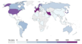
 Youngest-age-covid-vaccination.png 3,400 × 2,400; 889 KB


.jpg)


.svg)
.svg)
.svg)
.svg)
.svg)


.svg)


.png)


_cases.png)


.png)
.png)


.png)
.png)
.png)


.jpg)

