Category:Worthington, Greater Manchester
English: Worthington is a civil parish within the Metropolitan Borough of Wigan, in Greater Manchester, England, about north of Wigan. The parish is very sparsely populated, at the 2001 census having a population of 135, and apparently does not have an active parish council or parish meeting.
civil parish within the Metropolitan Borough of Wigan  | |||||
| Upload media | |||||
| Instance of | |||||
|---|---|---|---|---|---|
| Location | Wigan, Greater Manchester, North West England, England | ||||
| Different from | |||||
 | |||||
Media in category "Worthington, Greater Manchester"
The following 51 files are in this category, out of 51 total.
-
 A bend in Chorley Road (A5106) - geograph.org.uk - 4409502.jpg 640 × 480; 63 KB
-
 A bend in Chorley Road (A5106) - geograph.org.uk - 4409523.jpg 640 × 480; 74 KB
-
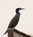 A cormorant feeling quite secure at Worthington Lakes - geograph.org.uk - 2396444.jpg 1,075 × 1,206; 580 KB
-
 Adlington Hall lodgehouse - geograph.org.uk - 2697395.jpg 1,600 × 1,198; 681 KB
-
 Adlington Reservoir - geograph.org.uk - 2396626.jpg 640 × 415; 84 KB
-
 Adlington Reservoir causeway - geograph.org.uk - 2697358.jpg 1,600 × 1,198; 445 KB
-
 An aqueduct - geograph.org.uk - 2396649.jpg 3,611 × 2,590; 5.45 MB
-
 Bores Hill at Bores Farm - geograph.org.uk - 3151706.jpg 640 × 480; 55 KB
-
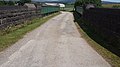 Bridge leading to Talbot House Farm - geograph.org.uk - 4552000.jpg 4,128 × 2,322; 5.07 MB
-
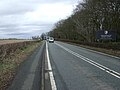
 Chorley Road (A5106) - geograph.org.uk - 2085748.jpg 800 × 480; 197 KB
-
 Chorley Road (A5106) - geograph.org.uk - 4409490.jpg 640 × 480; 74 KB
-
 Chorley Road (A5106) - geograph.org.uk - 4409494.jpg 640 × 480; 72 KB
-
 Chorley Road (A5106) - geograph.org.uk - 4409505.jpg 640 × 480; 77 KB
-

-
 Crop field near Worthington Hall - geograph.org.uk - 4409497.jpg 640 × 480; 79 KB
-
 Drain off Platt Lane - geograph.org.uk - 4409508.jpg 640 × 480; 73 KB
-
 Farmland off Platt Lane - geograph.org.uk - 4409510.jpg 640 × 480; 81 KB
-
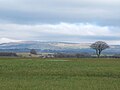
 Field west of Chorley Road (A5106) - geograph.org.uk - 4409488.jpg 640 × 480; 88 KB
-
 Fields near Gorse Hall, Standish - geograph.org.uk - 4871204.jpg 1,024 × 768; 117 KB
-
 Footbridge over Bradley Brook - geograph.org.uk - 4591047.jpg 1,024 × 768; 329 KB
-
 Footpath near Mill Bridge Farm - geograph.org.uk - 4591198.jpg 1,024 × 768; 171 KB
-
 Footpath on the west side of Worthington Lakes - geograph.org.uk - 4757104.jpg 3,264 × 2,448; 4.22 MB
-
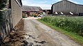
 Gorse Hall Farm - geograph.org.uk - 4551953.jpg 1,600 × 900; 470 KB
-
 Gorse Hall, Standish - geograph.org.uk - 4871202.jpg 1,024 × 768; 120 KB
-
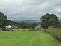
 Grazing east of Chorley Road (A5106) - geograph.org.uk - 4409521.jpg 640 × 480; 98 KB
-
 New Housing Development at Bores Farm - geograph.org.uk - 5726032.jpg 3,264 × 1,836; 2.08 MB
-
 Old distance marker stone on Chorley Road - geograph.org.uk - 4591728.jpg 766 × 1,024; 266 KB
-
 Ordnance Survey Benchmark on Chorley Road - geograph.org.uk - 4591731.jpg 1,024 × 768; 436 KB
-
 Platt Lane - geograph.org.uk - 4409518.jpg 640 × 480; 52 KB
-

-
 Railway line, Standish - geograph.org.uk - 4552008.jpg 1,600 × 900; 555 KB
-

-
 Sign on edge of woodland off Platt Lane - geograph.org.uk - 4591190.jpg 1,024 × 768; 408 KB
-
 Stone post with OS benchmark on Chorley Road - geograph.org.uk - 4591734.jpg 1,024 × 768; 314 KB
-
 Talbot House Farm - geograph.org.uk - 4552027.jpg 4,128 × 2,322; 5.89 MB
-

-
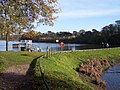 The causeway on the dam at Worthington Lake - geograph.org.uk - 2697343.jpg 1,600 × 1,198; 647 KB
-
 The Crown Hotel - geograph.org.uk - 5726036.jpg 3,264 × 1,836; 2.14 MB
-
 The entrance to Wrennalls Hall on Platt Lane - geograph.org.uk - 2725017.jpg 4,572 × 3,043; 6.71 MB
-
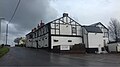
 The White Crow - geograph.org.uk - 2725103.jpg 4,274 × 2,844; 5.83 MB
-
 The White Crow on Chorley Road - geograph.org.uk - 2697398.jpg 1,600 × 1,198; 348 KB
-
 Walking the dog - Worthington Lakes - geograph.org.uk - 932764.jpg 640 × 466; 250 KB
-
 Water feeder channel at Worthington Lake - geograph.org.uk - 2697351.jpg 1,600 × 1,198; 815 KB
-
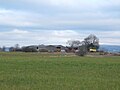
 Worthington Hall Farm, Chorley Road - geograph.org.uk - 4591726.jpg 1,024 × 768; 137 KB
-
 Worthington Lakes - geograph.org.uk - 4757109.jpg 3,264 × 2,448; 2.42 MB
-
 Worthington Lakes - geograph.org.uk - 921710.jpg 640 × 426; 270 KB
-
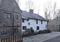 Worthington Manor House.JPG 1,383 × 968; 735 KB
-
 Worthington Park (geograph 2059376).jpg 4,592 × 3,056; 2.91 MB
-
 Worthington Park - geograph.org.uk - 921719.jpg 640 × 425; 129 KB
-
 Worthington Reservoir - geograph.org.uk - 2396453.jpg 4,592 × 3,056; 5.04 MB
-
 Coppull Moor - geograph.org.uk - 118428.jpg 640 × 426; 40 KB
_-_geograph.org.uk_-_4409502.jpg)
_-_geograph.org.uk_-_4409523.jpg)


_-_geograph.org.uk_-_2085748.jpg)
_-_geograph.org.uk_-_4409490.jpg)
_-_geograph.org.uk_-_4409494.jpg)
_-_geograph.org.uk_-_4409505.jpg)


_-_geograph.org.uk_-_4409488.jpg)


_-_geograph.org.uk_-_4409521.jpg)


_separating_Arley_Reservoir_(on_the_left)_and_Worthington_Reservoir_-_geograph.org.uk_-_2396480.jpg)


.jpg)


