Category:Wye Valley (community)
English: Wye Valley is a community in the principal area of Monmouthshire, Wales.
community in Monmouthshire, Wales | |||||
| Upload media | |||||
| Instance of | |||||
|---|---|---|---|---|---|
| Location | Monmouthshire, Wales | ||||
 | |||||
Subcategories
This category has the following 2 subcategories, out of 2 total.
Media in category "Wye Valley (community)"
The following 200 files are in this category, out of 470 total.
(previous page) (next page)-
 2024 Wales Monmouthshire Community Wye Valley map.svg 512 × 682; 603 KB
-
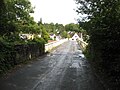
 A minor road in Tintern - geograph.org.uk - 3570870.jpg 800 × 769; 166 KB
-
 A study in arches - Tintern Abbey - geograph.org.uk - 6054840.jpg 1,060 × 1,600; 482 KB
-
 A track into Buckle Wood - geograph.org.uk - 5150474.jpg 2,592 × 1,944; 1.84 MB
-
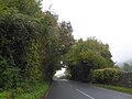 A tunnel of trees over the A466 - geograph.org.uk - 5589099.jpg 1,600 × 1,201; 733 KB
-
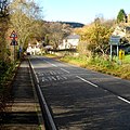
 A view NW along the A466 in Tintern - geograph.org.uk - 3570992.jpg 800 × 668; 149 KB
-

-
 A466 at Tintern - geograph.org.uk - 3792947.jpg 640 × 481; 66 KB
-
 A466 in Lower Linenwell Wood - geograph.org.uk - 5588943.jpg 1,600 × 1,280; 846 KB
-
 A466 near Black Cliff - geograph.org.uk - 3792943.jpg 640 × 481; 70 KB
-
 A466 northbound nears Tintern - geograph.org.uk - 3792946.jpg 640 × 480; 63 KB
-
 A466 past Tintern Abbey - geograph.org.uk - 6224041.jpg 4,032 × 2,268; 4.26 MB
-
 A466 towards Tintern Abbey - geograph.org.uk - 5501621.jpg 798 × 800; 177 KB
-
 Abbey Farm, Tintern - geograph.org.uk - 3582178.jpg 800 × 600; 103 KB
-
 Abbey House Studios, Tintern - geograph.org.uk - 3813204.jpg 800 × 471; 89 KB
-
 Abbey House Studios, Tintern - geograph.org.uk - 4119329.jpg 800 × 610; 134 KB
-
 Abbey Mill 'Boat House' - geograph.org.uk - 5333967.jpg 640 × 480; 109 KB
-
 Abbey Mill - geograph.org.uk - 5796858.jpg 640 × 435; 421 KB
-
 Abbey Mill and water wheel, Tintern - geograph.org.uk - 4130841.jpg 800 × 600; 207 KB
-
 Abbey Mill at Tintern - geograph.org.uk - 3622541.jpg 640 × 427; 88 KB
-
 Abbey Mill, Tintern - geograph.org.uk - 3570887.jpg 640 × 392; 64 KB
-
 Abbey Mill, Tintern - geograph.org.uk - 5335147.jpg 640 × 480; 105 KB
-
 Abbey Mill, Tintern - geograph.org.uk - 5335157.jpg 640 × 480; 101 KB
-
 Abbey Tintern Blast Furnace Remains - geograph.org.uk - 4285789.jpg 640 × 428; 92 KB
-

-
 Abbi the Water Wheel, Tintern - geograph.org.uk - 4130834.jpg 800 × 600; 186 KB
-
-
 Across Barbadoes Hill - geograph.org.uk - 5155697.jpg 1,024 × 575; 450 KB
-

-
 Afon Gwy - River Wye at Tintern - geograph.org.uk - 6048927.jpg 800 × 548; 117 KB
-
 Allt-yr-yn, Forge Road, Tintern - geograph.org.uk - 5500556.jpg 800 × 708; 153 KB
-

-
 Anghidi River in culvert - geograph.org.uk - 6090741.jpg 4,592 × 3,448; 6.14 MB
-

-
 Angiddy near Chapel Hill, Tintern - geograph.org.uk - 3866196.jpg 800 × 800; 297 KB
-

-
 Approaching Tintern on the Wye Valley Walk - geograph.org.uk - 4702039.jpg 2,592 × 1,944; 1.74 MB
-
 Arable land near Trelleck Grange - geograph.org.uk - 5348868.jpg 1,024 × 768; 294 KB
-
 Barbadoes Hill - geograph.org.uk - 4791614.jpg 480 × 640; 111 KB
-
 Barbadoes Hill - geograph.org.uk - 4791615.jpg 480 × 640; 98 KB
-
 Bellevue House, Tintern - geograph.org.uk - 6195961.jpg 1,024 × 878; 257 KB
-
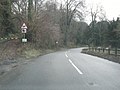
 Bend in the A466, Tintern - geograph.org.uk - 6195482.jpg 1,600 × 1,263; 423 KB
-

-
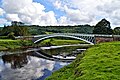 Bigsweir Bridge - geograph.org.uk - 5411453.jpg 3,248 × 2,160; 1.81 MB
-
 Bigsweir Bridge - geograph.org.uk - 5411505.jpg 3,281 × 1,925; 1.86 MB
-
 Bigsweir Bridge - geograph.org.uk - 6234978.jpg 1,024 × 768; 950 KB
-
 Bigsweir Bridge and toll house - geograph.org.uk - 6222968.jpg 3,472 × 1,960; 1.33 MB
-
 Bikers ride past Cross Farm - geograph.org.uk - 4598379.jpg 800 × 759; 252 KB
-
 Bilingual SLOW-ARAF on the A466, Tintern - geograph.org.uk - 5317475.jpg 800 × 545; 109 KB
-
 Black ^ white houses in Tintern - geograph.org.uk - 5315450.jpg 800 × 678; 102 KB
-
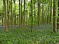 Bluebells in Black Cliff Wood - geograph.org.uk - 5773146.jpg 1,024 × 768; 360 KB
-
 Botany Bay Scouts Activity Centre - geograph.org.uk - 6235113.jpg 4,000 × 3,000; 2.86 MB
-
 Brass Foundry plaque, Tintern - geograph.org.uk - 5501481.jpg 800 × 777; 203 KB
-
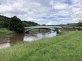
 Bridge over River Wye - geograph.org.uk - 3622400.jpg 640 × 427; 99 KB
-
 Bridge over River Wye - geograph.org.uk - 3622501.jpg 640 × 427; 88 KB
-
 Bridge over River Wye - geograph.org.uk - 3622525.jpg 640 × 427; 112 KB
-
 Bridge, Tintern - geograph.org.uk - 5155707.jpg 1,024 × 768; 419 KB
-

-
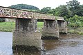
 Brockweir Bridge - geograph.org.uk - 3577066.jpg 800 × 609; 174 KB
-
 Brockweir Bridge - geograph.org.uk - 4377579.jpg 3,552 × 2,000; 2.41 MB
-
 Brockweir Bridge - geograph.org.uk - 4702008.jpg 2,592 × 1,944; 1.64 MB
-
 Brockweir Bridge - geograph.org.uk - 5165924.jpg 1,024 × 575; 332 KB
-
 Brockweir Bridge - geograph.org.uk - 5974219.jpg 6,000 × 4,000; 7.75 MB
-
 Brockweir Bridge - geograph.org.uk - 6168243.jpg 1,024 × 768; 288 KB
-
 Brockweir bridge - geograph.org.uk - 6218165.jpg 4,000 × 3,000; 3.19 MB
-
 Brockweir Bridge - geograph.org.uk - 6234451.jpg 1,024 × 768; 705 KB
-
 Brockweir Bridge and village beyond - geograph.org.uk - 3792951.jpg 640 × 480; 102 KB
-
 Browns Village Stores, Llandogo - geograph.org.uk - 5589135.jpg 1,600 × 1,200; 680 KB
-
 Building site at the Abbey Hotel, Tintern - geograph.org.uk - 5588950.jpg 1,600 × 1,200; 686 KB
-
 Bus shelter at east end of Llandogo - geograph.org.uk - 5589140.jpg 1,600 × 1,199; 795 KB
-
 Bus shelter by Bigsweir Bridge - geograph.org.uk - 5589151.jpg 1,600 × 1,198; 821 KB
-
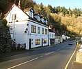
 Businesses alongside the A466 in Tintern - geograph.org.uk - 6195949.jpg 1,600 × 1,178; 367 KB
-
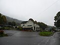
 Businesses in Tintern - geograph.org.uk - 5230287.jpg 1,024 × 768; 131 KB
-
 Car Park at Ancient Iron Works - geograph.org.uk - 4508398.jpg 640 × 428; 104 KB
-

-
 Carpet showroom, east of Llandogo on A466 - geograph.org.uk - 5589148.jpg 1,600 × 1,063; 700 KB
-
 Cattle next to Tintern Abbey - geograph.org.uk - 6051693.jpg 800 × 496; 127 KB
-
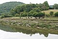 Cattle on the move - geograph.org.uk - 5973296.jpg 6,000 × 4,000; 7.5 MB
-
 Chancel of Llandogo church - geograph.org.uk - 5499651.jpg 600 × 800; 114 KB
-
 Chancel wall paintings, Llandogo church - geograph.org.uk - 5499663.jpg 683 × 1,024; 189 KB
-
 Chapel at Tintern - geograph.org.uk - 3622537.jpg 427 × 640; 114 KB
-
 Chepstow bus in Tintern - geograph.org.uk - 5315419.jpg 800 × 606; 86 KB
-
 Chepstow bus in Tintern - geograph.org.uk - 5501039.jpg 800 × 550; 90 KB
-
 Cherry Tree Inn, Tintern - geograph.org.uk - 3866257.jpg 800 × 654; 144 KB
-

-
 Children's play area, Tintern - geograph.org.uk - 3819015.jpg 800 × 600; 129 KB
-
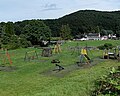 Children's playground in Tintern - geograph.org.uk - 4130927.jpg 800 × 642; 168 KB
-
 Church at Trelleck Grange - geograph.org.uk - 4312605.jpg 2,560 × 1,920; 1.97 MB
-
 Church at Trelleck Grange - geograph.org.uk - 4421368.jpg 640 × 480; 94 KB
-
 Cigar Store Indian, Tintern - geograph.org.uk - 3574543.jpg 800 × 595; 183 KB
-
 Closure of the A466 at Tintern - geograph.org.uk - 6224051.jpg 4,032 × 2,268; 5.58 MB
-

-

-
 Country near Fairoak - geograph.org.uk - 5150469.jpg 2,427 × 1,819; 1.01 MB
-
 Country to the south of Trelleck - geograph.org.uk - 5348881.jpg 1,024 × 768; 412 KB
-
 Cows at Abbey Farm - geograph.org.uk - 3621124.jpg 640 × 427; 112 KB
-
 Cross Farm west of Tintern - geograph.org.uk - 4598351.jpg 800 × 658; 140 KB
-
 Crossing of woodland paths - geograph.org.uk - 5974200.jpg 6,000 × 4,000; 6.1 MB
-

-
 Crown Lodge name sign, Tintern - geograph.org.uk - 5500584.jpg 493 × 640; 117 KB
-
 Crown Lodge, Tintern - geograph.org.uk - 3819026.jpg 800 × 705; 135 KB
-

-

-
 Decaying cottage in Tintern - geograph.org.uk - 5315436.jpg 800 × 495; 139 KB
-
 Derelict former Abbey Hotel, Tintern - geograph.org.uk - 5189050.jpg 800 × 595; 112 KB
-
 Diversion-Gwyriad sign alongside the A466, Tintern - geograph.org.uk - 6195441.jpg 1,600 × 1,353; 616 KB
-
 Dolly in Tintern - geograph.org.uk - 5315610.jpg 800 × 734; 178 KB
-
 Down the A466, Tintern - geograph.org.uk - 5501563.jpg 800 × 620; 110 KB
-
 Downstream along the Wye, Tintern - geograph.org.uk - 5317372.jpg 800 × 488; 94 KB
-
 DPD Local van in Tintern - geograph.org.uk - 5501042.jpg 800 × 678; 129 KB
-

-

-
 East window in St Oedoceus church, Llandogo - geograph.org.uk - 5499655.jpg 683 × 1,024; 230 KB
-
 Eastern boundary of Tintern - geograph.org.uk - 3581976.jpg 800 × 799; 222 KB
-
 Eastern end of Forge Road, Tintern - geograph.org.uk - 3819025.jpg 800 × 693; 171 KB
-
 End of the 30 zone beyond Tintern - geograph.org.uk - 5317447.jpg 800 × 575; 101 KB
-
 End of the 30 zone through Tintern - geograph.org.uk - 5189039.jpg 800 × 665; 190 KB
-

-
 Entering Fedw Wood, near St Arvans - geograph.org.uk - 4119431.jpg 2,560 × 1,920; 2.04 MB
-
 Entrance to Furnace Farm west of Tintern - geograph.org.uk - 4108099.jpg 800 × 600; 151 KB
-
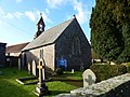
 Entrance to St Michael's Church, Tintern - geograph.org.uk - 5317403.jpg 800 × 600; 118 KB
-
 Entrance to The Abbey Hotel, Tintern - geograph.org.uk - 3582166.jpg 800 × 674; 118 KB
-
 Extraction lane - geograph.org.uk - 5155685.jpg 768 × 1,024; 565 KB
-
 Extraction lane - geograph.org.uk - 5155692.jpg 768 × 1,024; 591 KB
-
 Farm buildings by Tintern Abbey - geograph.org.uk - 5973293.jpg 6,000 × 4,000; 4.69 MB
-
 Fenced-off former hotel in Tintern - geograph.org.uk - 5189054.jpg 800 × 583; 123 KB
-
 Field at Medhope - geograph.org.uk - 5974177.jpg 6,000 × 4,000; 6.9 MB
-
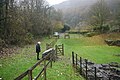
 Field near Price's Bridge - geograph.org.uk - 5155682.jpg 1,024 × 768; 565 KB
-
 Fields north of A466 - geograph.org.uk - 4267900.jpg 640 × 480; 57 KB
-

-
 Footbridge over River Wye - geograph.org.uk - 6090734.jpg 4,592 × 3,448; 4.91 MB
-
 Footbridge over the River Wye at Tintern - geograph.org.uk - 5772850.jpg 1,024 × 768; 196 KB
-
 Footings for the Launder - geograph.org.uk - 6130865.jpg 4,000 × 3,000; 4.9 MB
-
 Footpath to Brockweir - geograph.org.uk - 5974137.jpg 6,000 × 4,000; 5.73 MB
-
 Former Tintern Antiques, Tintern - geograph.org.uk - 3574525.jpg 800 × 623; 159 KB
-
 Former Tintern railway station - geograph.org.uk - 3576952.jpg 800 × 635; 186 KB
-

-
-
 Free car park near to Tintern Abbey - geograph.org.uk - 6224038.jpg 4,032 × 2,268; 4.55 MB
-
 Furnace Cottages in the Angiddy Valley - geograph.org.uk - 4131274.jpg 800 × 600; 164 KB
-

-
-

-
 High Tide River Wye at Tintern - geograph.org.uk - 5616611.jpg 1,600 × 1,200; 437 KB
-
 Hillside fog, Tintern - geograph.org.uk - 3819010.jpg 800 × 700; 128 KB
-
 Hillside houses, Tintern - geograph.org.uk - 5501516.jpg 800 × 609; 139 KB
-
 Holmleigh, Tintern - geograph.org.uk - 3574599.jpg 800 × 648; 166 KB
-
 House and bus stop, Tintern - geograph.org.uk - 3574572.jpg 800 × 593; 149 KB
-
 House in Parkhouse - geograph.org.uk - 5348891.jpg 1,024 × 768; 291 KB
-

-
 House, woodlands and bus shelter near Brockweir Bridge - geograph.org.uk - 5589078.jpg 1,600 × 1,200; 782 KB
-
 Houses in Tintern between the wooded hill and river - geograph.org.uk - 5589041.jpg 1,600 × 1,200; 832 KB
-

-
 Houses with a river view, Tintern - geograph.org.uk - 6196317.jpg 1,600 × 1,557; 682 KB
-
 I Prefer Standing This Way - geograph.org.uk - 4257300.jpg 640 × 480; 77 KB
-

-
 Interior of Llandogo church - geograph.org.uk - 5499712.jpg 768 × 1,024; 238 KB
-
 Interior remains of St Anne's Chapel - geograph.org.uk - 6224056.jpg 2,268 × 4,032; 2.48 MB
-
 Jenson Travel coach in Tintern - geograph.org.uk - 4131016.jpg 791 × 800; 207 KB
-
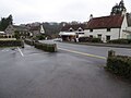
 Junction in Tintern Cross - geograph.org.uk - 4598246.jpg 800 × 779; 193 KB
-
 King George V postbox in a Tintern wall - geograph.org.uk - 5317546.jpg 576 × 800; 179 KB
-
 King Offa - Y Brenin Offa at Tintern Station - geograph.org.uk - 6023439.jpg 1,060 × 1,600; 511 KB
-

-

-

-
 Lippetts Grove - geograph.org.uk - 5155704.jpg 1,024 × 768; 366 KB
-
 Llandogo - geograph.org.uk - 6234968.jpg 1,024 × 768; 1.01 MB
-
 Llandogo church - geograph.org.uk - 5499639.jpg 768 × 1,024; 255 KB
-
 Llandogo church - geograph.org.uk - 5499644.jpg 1,024 × 768; 213 KB
-
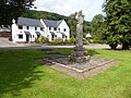
 Llandogo war memorial - geograph.org.uk - 5499720.jpg 768 × 1,024; 323 KB
-
 Llandogo war memorial - geograph.org.uk - 5499734.jpg 1,024 × 768; 300 KB
-
 Llandogo war memorial - geograph.org.uk - 5611834.jpg 768 × 1,024; 350 KB
-
 Llandogo war memorial - geograph.org.uk - 6221250.jpg 1,701 × 3,024; 935 KB
-
 Llandogo war memorial and St Oudoceus church - geograph.org.uk - 6221248.jpg 4,032 × 2,268; 1.65 MB
-
 Llanishen direction sign,Tintern - geograph.org.uk - 5501533.jpg 800 × 696; 142 KB
-
 Looking towards the East Transept, Tintern Abbey - geograph.org.uk - 6054852.jpg 1,060 × 1,600; 495 KB
-
 Lower Hale Wood - geograph.org.uk - 5155693.jpg 1,024 × 575; 433 KB
-
 Lower Wireworks car park, Tintern - geograph.org.uk - 3819134.jpg 800 × 755; 219 KB
-
 Lower Wireworks carpark, Tintern - geograph.org.uk - 4791613.jpg 480 × 640; 64 KB
-

-
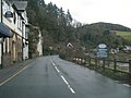
 Main Road, Tintern - geograph.org.uk - 5501558.jpg 800 × 619; 113 KB
-
 Manor House entrance drive, Tintern - geograph.org.uk - 5317538.jpg 798 × 800; 168 KB
-
 Memorial in Llandogo church - geograph.org.uk - 5499672.jpg 683 × 1,024; 134 KB
-
 Memorial to Lionel Arthur Bosenquet - geograph.org.uk - 5499669.jpg 1,024 × 768; 164 KB
-
 Mill at Tintern - geograph.org.uk - 3622539.jpg 640 × 480; 101 KB
-

-

-

-
 Mobile Post Office - geograph.org.uk - 5230274.jpg 800 × 600; 97 KB
-

-
 Model railway turntable - geograph.org.uk - 6168225.jpg 1,024 × 768; 364 KB
-
 Monmouth bus in Tintern - geograph.org.uk - 3813201.jpg 800 × 690; 126 KB
-
 Monmouth bus on the A466 in Tintern - geograph.org.uk - 5317516.jpg 799 × 800; 146 KB
-
 Moon and Sixpence - geograph.org.uk - 4285858.jpg 640 × 428; 83 KB
-
 Moon and Sixpence pub - geograph.org.uk - 3622555.jpg 640 × 427; 86 KB
-

-
 Muddy roadside corner near Parkhouse - geograph.org.uk - 4312879.jpg 2,560 × 1,920; 2.17 MB
-

-
 Names of the fallen on the Llandogo war memorial - geograph.org.uk - 6221252.jpg 1,701 × 3,024; 1.05 MB
-


&filefrom=New+bus+shelter%2C+Bigsweir+-+geograph.org.uk+-+5419333.jpg#mw-category-media)