Category:Yester
Scottish parish in East Lothian, Scotland, UK | |||||
| Upload media | |||||
| Instance of | |||||
|---|---|---|---|---|---|
| Part of |
| ||||
| Location |
| ||||
| Population |
| ||||
| Area |
| ||||
 | |||||
Subcategories
This category has the following 3 subcategories, out of 3 total.
Media in category "Yester"
The following 200 files are in this category, out of 545 total.
(previous page) (next page)-
 A new hedge, Port Wood - geograph.org.uk - 2717548.jpg 640 × 480; 329 KB
-
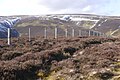
 A wind turbine at Townhead - geograph.org.uk - 2645541.jpg 393 × 640; 307 KB
-

-

-
 Aikeyside farm - geograph.org.uk - 2383489.jpg 2,592 × 1,944; 2.58 MB
-
 Aikieside Hill - geograph.org.uk - 4930401.jpg 1,024 × 683; 374 KB
-
 Alders on the Gamuelston Burn - geograph.org.uk - 6379225.jpg 3,264 × 2,448; 4.64 MB
-
 Antipersonnel fence - geograph.org.uk - 5676126.jpg 1,024 × 683; 462 KB
-

-
 Arable farmland, Leehouses - geograph.org.uk - 4968629.jpg 1,024 × 576; 200 KB
-
 Arable land, Newton Hall - geograph.org.uk - 917979.jpg 640 × 359; 50 KB
-
 Arable land, Woodhead - geograph.org.uk - 4122259.jpg 640 × 480; 298 KB
-
 Attractive Row of Houses by village green in Gifford - geograph.org.uk - 5952424.jpg 2,048 × 1,536; 1.47 MB
-
 Autumn in Gifford East Lothian - geograph.org.uk - 5952635.jpg 2,048 × 1,536; 1.59 MB
-
 B6355 towards Chirnside - geograph.org.uk - 5480017.jpg 640 × 480; 69 KB
-
 B6355 towards Gifford - geograph.org.uk - 5478632.jpg 640 × 480; 76 KB
-
 B6355, Cross Hill - geograph.org.uk - 5479991.jpg 640 × 480; 75 KB
-
 B6355, Gifford - geograph.org.uk - 5702193.jpg 1,024 × 576; 325 KB
-
 B6355, Pyotshaw - geograph.org.uk - 4229399.jpg 800 × 600; 424 KB
-
 B6355, Pyotshaw - geograph.org.uk - 5478623.jpg 640 × 480; 54 KB
-
 B6355. Gifford - geograph.org.uk - 5478643.jpg 640 × 480; 92 KB
-
 B6370 - geograph.org.uk - 5702605.jpg 1,024 × 576; 266 KB
-
 B6370, Townhead - geograph.org.uk - 5702602.jpg 1,024 × 576; 284 KB
-
 Barley, Sheriffside - geograph.org.uk - 3599623.jpg 640 × 480; 262 KB
-
 Battered crops, Long Newton - geograph.org.uk - 6377095.jpg 1,024 × 576; 276 KB
-
 Beech hedge near Leehouses - geograph.org.uk - 2078534.jpg 3,072 × 2,304; 1.25 MB
-
 Beech tree at Baro - geograph.org.uk - 6375463.jpg 3,264 × 2,448; 4.42 MB
-
 Beeches, Pishwanton Wood - geograph.org.uk - 5646325.jpg 1,024 × 683; 428 KB
-
 Beeches, Yester Woods - geograph.org.uk - 3902843.jpg 640 × 853; 593 KB
-
 Bench Mark, Yester Kirk - geograph.org.uk - 2624259.jpg 640 × 480; 99 KB
-
 Beside the road to Bara Loch - geograph.org.uk - 6304763.jpg 640 × 427; 469 KB
-
 Bike park, Lanterne Rouge, Gifford - geograph.org.uk - 5445952.jpg 1,024 × 683; 365 KB
-
 Blawearie Wood - geograph.org.uk - 2717553.jpg 640 × 480; 344 KB
-
 Blawearie Wood - geograph.org.uk - 4229621.jpg 800 × 450; 377 KB
-
 Blawearie Wood - geograph.org.uk - 5675149.jpg 1,024 × 683; 487 KB
-
 Bob the Bus - geograph.org.uk - 6501698.jpg 2,333 × 3,111; 2.81 MB
-
 Bridge over Gifford Water - geograph.org.uk - 2639248.jpg 800 × 530; 195 KB
-
 Bridge over Harelaw Burn - geograph.org.uk - 3122709.jpg 640 × 480; 97 KB
-
 Bridge over the Gifford Water - geograph.org.uk - 873847.jpg 640 × 480; 117 KB
-
 Bridge, Gifford - geograph.org.uk - 4235912.jpg 800 × 600; 548 KB
-
 Bridge, Pishwanton Wood - geograph.org.uk - 5646312.jpg 1,024 × 683; 507 KB
-
 Brown Rig and track to Lammer Law - geograph.org.uk - 6379128.jpg 3,264 × 2,448; 4.32 MB
-
 Brown Rig, near Longyester - geograph.org.uk - 6379170.jpg 3,264 × 2,448; 5.07 MB
-
 Burn, Yester woodlands - geograph.org.uk - 3896626.jpg 640 × 480; 387 KB
-
 Cairn and pillar, Lammer Law - geograph.org.uk - 6002667.jpg 1,024 × 683; 398 KB
-
 Cairn at Hare Law hill fort - geograph.org.uk - 1274433.jpg 640 × 424; 94 KB
-

-
 Castles Wood - geograph.org.uk - 6377073.jpg 1,024 × 576; 273 KB
-

-
 Cattle, Highside Hill - geograph.org.uk - 6376713.jpg 1,024 × 576; 219 KB
-
 Cattle, Kidlaw - geograph.org.uk - 6376693.jpg 1,024 × 576; 227 KB
-
 Cereal crop, Townhead - geograph.org.uk - 5479992.jpg 640 × 480; 65 KB
-

-
 Col between the Aikieside Burn and Lammerloch - geograph.org.uk - 5752866.jpg 1,024 × 683; 239 KB
-
 Colstoun Water - geograph.org.uk - 4229341.jpg 800 × 600; 555 KB
-
 Community building at Pishwanton Wood - geograph.org.uk - 1284133.jpg 640 × 480; 125 KB
-
 Coulston Water - geograph.org.uk - 2795871.jpg 640 × 490; 369 KB
-
 Country road east of Longyester - geograph.org.uk - 3122727.jpg 640 × 480; 69 KB
-
 Cricket field, Gifford - geograph.org.uk - 2795861.jpg 640 × 360; 213 KB
-
 Crop field, Duncanlaw - geograph.org.uk - 5479989.jpg 640 × 480; 63 KB
-
 Cropped cereal field near Leehouses - geograph.org.uk - 2078549.jpg 3,072 × 2,304; 1.1 MB
-
 Cropped cereal ^ straw bales at Leehouses - geograph.org.uk - 2078524.jpg 3,072 × 2,304; 1.34 MB
-
 Crow Cairn summit - geograph.org.uk - 6426485.jpg 1,024 × 683; 288 KB
-
 Culvert at Yester Mains - geograph.org.uk - 6379138.jpg 3,264 × 2,448; 6.27 MB
-
 Cycle tourists, Gifford - geograph.org.uk - 5398715.jpg 1,024 × 683; 336 KB
-
 Dam and road on the Kidlaw Burn - geograph.org.uk - 6376699.jpg 1,024 × 576; 268 KB
-
 Dam on the Kidlaw Burn - geograph.org.uk - 6377058.jpg 1,024 × 576; 239 KB
-
 Dean Wood - geograph.org.uk - 5551074.jpg 640 × 425; 232 KB
-
 Dean Wood - geograph.org.uk - 5991030.jpg 1,024 × 768; 514 KB
-
 Detail, Yester Kirk - geograph.org.uk - 2624285.jpg 640 × 481; 92 KB
-
 Detail, Yester Kirk - geograph.org.uk - 2624290.jpg 482 × 640; 82 KB
-
 Direction Sign – Signpost - geograph.org.uk - 6515042.jpg 540 × 960; 211 KB
-
 Direction Sign – Signpost - geograph.org.uk - 6515050.jpg 470 × 659; 113 KB
-
 Direction Sign – Signpost in Gifford - geograph.org.uk - 6514810.jpg 540 × 960; 210 KB
-
 Dumping, Yester - geograph.org.uk - 5675210.jpg 1,024 × 683; 489 KB
-
 Duncan's Bog - geograph.org.uk - 3902826.jpg 640 × 480; 349 KB
-
 Duns Road (B6355), Gifford - geograph.org.uk - 5479988.jpg 640 × 480; 51 KB
-
 Dyke, Long Newton - geograph.org.uk - 6377083.jpg 1,024 × 576; 264 KB
-
 Earth banks at Hare Law fort - geograph.org.uk - 1274411.jpg 640 × 424; 89 KB
-
-

-

-
 East Lothian County Council Fingerposts , Baxtersyke - geograph.org.uk - 4184272.jpg 1,200 × 1,600; 261 KB
-
 East Lothian County Council Fingerposts , Hopes Road-end - geograph.org.uk - 4184241.jpg 1,200 × 1,600; 462 KB
-
 East Lothian County Council Fingerposts , Longyester - geograph.org.uk - 4184232.jpg 1,600 × 1,200; 622 KB
-

-
 East Lothian Farm Signs , Long Newton - geograph.org.uk - 4184157.jpg 1,600 × 1,200; 393 KB
-
 East Lothian fieldscape in March - geograph.org.uk - 4389761.jpg 3,264 × 2,448; 3.06 MB
-
 East Lothian finger post - geograph.org.uk - 6379223.jpg 3,264 × 2,448; 2.56 MB
-
 East Lothian in spring - geograph.org.uk - 2383339.jpg 2,592 × 1,944; 2.73 MB
-

-

-
 East Lothian Landscape , Out In The Field - geograph.org.uk - 4149667.jpg 1,600 × 1,200; 456 KB
-
 East Lothian Landscape , Roadside Scene Near Longyester - geograph.org.uk - 4184207.jpg 1,600 × 1,200; 298 KB
-
 East Lothian Landscape , The Junction Tree - geograph.org.uk - 4184128.jpg 1,600 × 1,200; 515 KB
-
 East Lothian Townscape , High Street, Gifford - geograph.org.uk - 2013131.jpg 2,560 × 1,920; 3.07 MB
-
 ELCC Fingerposts , Redshill Crossroads (detail) - geograph.org.uk - 4183831.jpg 1,600 × 1,200; 220 KB
-
 Elizabethan postbox, Gifford Post Office - geograph.org.uk - 5480663.jpg 2,136 × 2,848; 1.37 MB
-
 Entering Pishwanton Wood - geograph.org.uk - 1188339.jpg 427 × 640; 145 KB
-
 Entrance on the bend - geograph.org.uk - 1044077.jpg 640 × 480; 118 KB
-
 Entrance to private house at Long Newton - geograph.org.uk - 1859100.jpg 640 × 480; 126 KB
-
 Estate track to Inglisfield - geograph.org.uk - 3280518.jpg 800 × 530; 193 KB
-
 Ewe and lamb, Longyester - geograph.org.uk - 3903028.jpg 640 × 480; 285 KB
-
 Ewelie Wood - geograph.org.uk - 4691902.jpg 800 × 450; 335 KB
-
 Ewes and lambs, Longyester - geograph.org.uk - 3902851.jpg 640 × 480; 271 KB
-
 Farm barn at Fawn's Wood - geograph.org.uk - 6379186.jpg 3,264 × 2,448; 2.17 MB
-
 Farm buildings at Kidlaw - geograph.org.uk - 1284044.jpg 640 × 480; 69 KB
-
 Farm buildings at Newton Hall - geograph.org.uk - 6378479.jpg 3,264 × 2,448; 3.72 MB
-

-
 Farm buildings near Leehouses - geograph.org.uk - 1443810.jpg 640 × 480; 68 KB
-
 Farm road near Gifford - geograph.org.uk - 3604598.jpg 640 × 480; 284 KB
-
 Farm road, Scarhill Wood - geograph.org.uk - 5675177.jpg 1,024 × 683; 419 KB
-
 Farm road, Townhead - geograph.org.uk - 5445933.jpg 1,024 × 683; 373 KB
-
 Farm shed at Townhead near Gifford - geograph.org.uk - 1706793.jpg 640 × 480; 64 KB
-
 Farm track - geograph.org.uk - 3903021.jpg 640 × 480; 319 KB
-
 Farm track by Leahouses - geograph.org.uk - 6317220.jpg 1,024 × 683; 297 KB
-
 Farm track, Kidlaw - geograph.org.uk - 5752847.jpg 1,024 × 683; 274 KB
-
 Farm track, Scarhill Wood - geograph.org.uk - 2717653.jpg 640 × 480; 283 KB
-
 Farm track, Townhead - geograph.org.uk - 5445942.jpg 1,024 × 683; 360 KB
-
 Farming landscape on Bohomy Hill - geograph.org.uk - 2383351.jpg 2,592 × 1,944; 2.99 MB
-
 Farmland and stripwood - geograph.org.uk - 917981.jpg 640 × 359; 48 KB
-
 Farmland at Aikeyside - geograph.org.uk - 1188362.jpg 640 × 390; 133 KB
-
 Farmland at Aikeyside - geograph.org.uk - 2383481.jpg 2,592 × 1,944; 2.38 MB
-
 Farmland at Latch - geograph.org.uk - 6378475.jpg 3,264 × 2,448; 4.54 MB
-
 Farmland at Woodhead - geograph.org.uk - 6378656.jpg 3,264 × 2,448; 4.16 MB
-
 Farmland between Ewingston and Leehouses - geograph.org.uk - 2383314.jpg 2,592 × 1,944; 2.77 MB
-
 Farmland, Kidlaw Burn - geograph.org.uk - 917985.jpg 640 × 359; 52 KB
-
 Fawn Wood - geograph.org.uk - 1288786.jpg 480 × 640; 121 KB
-
 Fawn Wood - geograph.org.uk - 4690753.jpg 800 × 600; 510 KB
-
 Fawn Wood - geograph.org.uk - 4690756.jpg 800 × 600; 628 KB
-
 Felsite quarry, Highside Hill - geograph.org.uk - 6376710.jpg 1,024 × 576; 274 KB
-
 Fence junction, Lammer Law - geograph.org.uk - 6002029.jpg 1,024 × 683; 367 KB
-
 Field edge boundary near Leehouses - geograph.org.uk - 2078542.jpg 3,072 × 2,304; 1.08 MB
-
 Field edge path, Gifford - geograph.org.uk - 5446452.jpg 1,024 × 683; 341 KB
-
 Field entrance beside Townhead Wood - geograph.org.uk - 5480011.jpg 640 × 480; 65 KB
-
 Field headland, hedge and group of trees - geograph.org.uk - 2383497.jpg 2,592 × 1,944; 3.29 MB
-
 Field margin and drain near Gifford - geograph.org.uk - 6378073.jpg 3,264 × 2,448; 4.44 MB
-
 Field under the Lammermuirs - geograph.org.uk - 6002723.jpg 1,024 × 683; 334 KB
-
 Field, Gifford - geograph.org.uk - 4229348.jpg 800 × 600; 468 KB
-
 Field, Gifford - geograph.org.uk - 4691896.jpg 800 × 600; 444 KB
-
 Fields near Woodhead - geograph.org.uk - 5429573.jpg 800 × 800; 344 KB
-
 Fields, Longyester - geograph.org.uk - 5646316.jpg 1,024 × 683; 255 KB
-
 Fine trees at Yester - geograph.org.uk - 873873.jpg 480 × 640; 107 KB
-
 Fingerpost, Kidlaw - geograph.org.uk - 3887143.jpg 640 × 480; 235 KB
-
 Fingerpost, Kidlaw - geograph.org.uk - 3891556.jpg 640 × 480; 252 KB
-
 Fingerpost, Kidlaw - geograph.org.uk - 4930395.jpg 1,024 × 683; 320 KB
-
 Fingerpost, Longyester - geograph.org.uk - 3910138.jpg 640 × 480; 216 KB
-
 Fire ring, Wester Wood - geograph.org.uk - 5551052.jpg 640 × 425; 213 KB
-
 Flight pool, Newhall - geograph.org.uk - 6442080.jpg 1,024 × 576; 264 KB
-
 Flowering butterbur - geograph.org.uk - 3896639.jpg 640 × 480; 376 KB
-
 Former railway line, Gifford - geograph.org.uk - 3280529.jpg 800 × 530; 216 KB
-
 Former shop, Gifford - geograph.org.uk - 5702182.jpg 1,024 × 576; 232 KB
-
 Fort, Hare Law - geograph.org.uk - 6426490.jpg 1,024 × 683; 246 KB
-
 Fort, Kidlaw - geograph.org.uk - 5752852.jpg 1,024 × 683; 235 KB
-
 Friesians, Yester Mains - geograph.org.uk - 974359.jpg 640 × 359; 58 KB
-

-
 Gamuelston Burn - geograph.org.uk - 3773942.jpg 640 × 480; 248 KB
-
 Gamuelston Burn - geograph.org.uk - 3909187.jpg 640 × 480; 358 KB
-
 Gamuelston Burn - geograph.org.uk - 974374.jpg 480 × 640; 150 KB
-
 Gate, Yester Kirk - geograph.org.uk - 2624299.jpg 640 × 480; 68 KB
-
 Gatehouse of Yester House - geograph.org.uk - 5952263.jpg 2,048 × 1,536; 1.43 MB
-
 Giant killer at Newton Hall - geograph.org.uk - 6378470.jpg 3,264 × 2,448; 5.53 MB
-
 Gifford - geograph.org.uk - 4235910.jpg 800 × 600; 574 KB
-
 Gifford - Main Street - geograph.org.uk - 6478104.jpg 1,799 × 1,199; 183 KB
-
 Gifford - Tweeddale Arms Hotel - geograph.org.uk - 6478106.jpg 1,800 × 1,200; 272 KB
-
 Gifford and Garvald Light Railway - geograph.org.uk - 5552744.jpg 800 × 531; 281 KB
-
 Gifford and Garvald Light Railway bridge - geograph.org.uk - 961775.jpg 640 × 480; 150 KB
-

-
-
 Gifford and Garvald Railway - geograph.org.uk - 5756711.jpg 1,024 × 576; 355 KB
-
 Gifford and Garvald Railway - geograph.org.uk - 5756713.jpg 1,024 × 576; 454 KB
-
 Gifford and Garvald Railway - geograph.org.uk - 5756714.jpg 1,024 × 576; 395 KB
-
 Gifford and Garvald Railway - geograph.org.uk - 5756715.jpg 1,024 × 576; 302 KB
-
 Gifford and Garvald Railway - geograph.org.uk - 5991036.jpg 1,024 × 768; 426 KB
-
 Gifford and Garvald Railway - geograph.org.uk - 6442079.jpg 1,024 × 576; 327 KB
-
 Gifford and Garvald Railway - geograph.org.uk - 6442085.jpg 1,024 × 576; 210 KB
-
 Gifford Bank - geograph.org.uk - 5478640.jpg 640 × 480; 86 KB
-
 Gifford Bowling Club - geograph.org.uk - 2639252.jpg 800 × 530; 92 KB
-
 Gifford Garage - geograph.org.uk - 5479986.jpg 640 × 480; 48 KB
-
 Gifford Golf Club - geograph.org.uk - 5675154.jpg 1,024 × 683; 221 KB
-
 Gifford in Springtime - geograph.org.uk - 6409330.jpg 1,600 × 1,200; 621 KB
-
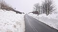
 Gifford in the snow - geograph.org.uk - 5702180.jpg 1,024 × 576; 268 KB
-
 Gifford, New Year's Day - geograph.org.uk - 5552746.jpg 800 × 531; 201 KB
-

-
 Goblin Ha' - geograph.org.uk - 3909714.jpg 640 × 853; 389 KB
-
 Grassland off the Hope Road - geograph.org.uk - 4122224.jpg 640 × 480; 280 KB
-
 Grassland off the Hopes Road - geograph.org.uk - 6317235.jpg 1,024 × 576; 251 KB
-
 Grassland, Longyester - geograph.org.uk - 3771025.jpg 640 × 480; 251 KB
-

-
-
 Grazing, Lammermuir Hills - geograph.org.uk - 926871.jpg 640 × 359; 49 KB
-
 Green lane, Yester - geograph.org.uk - 974369.jpg 640 × 480; 111 KB
-
 Heading for Gifford - geograph.org.uk - 1044459.jpg 640 × 480; 44 KB
-
 Heather, Cowie Law - geograph.org.uk - 1503384.jpg 640 × 480; 109 KB
-
 High Latch - geograph.org.uk - 6377071.jpg 1,024 × 576; 214 KB
-
 High Street, Gifford - geograph.org.uk - 2285591.jpg 800 × 530; 142 KB
-
 High Street, Gifford - geograph.org.uk - 5280353.jpg 1,024 × 683; 299 KB
-
 High Street, Gifford - geograph.org.uk - 5973222.jpg 1,024 × 683; 288 KB
-
 Highside Hill - geograph.org.uk - 6376707.jpg 1,024 × 576; 272 KB
-
 Hill fort, Hare Law - geograph.org.uk - 1274404.jpg 640 × 424; 52 KB


,_Gifford_-_geograph.org.uk_-_5479988.jpg)


_-_geograph.org.uk_-_4183831.jpg)


