Category:Zagori
|
This place is a UNESCO World Heritage Site, listed as
Zagori Cultural Landscape.
|
historical and geographical region of Epirus, Greece   | |||||
| Upload media | |||||
| Instance of | |||||
|---|---|---|---|---|---|
| Location | Ioannina Regional Unit, Epirus Region, Greece | ||||
| Heritage designation |
| ||||
| Population |
| ||||
| Area |
| ||||
| Different from | |||||
 | |||||
English: Zagori (Greek: Ζαγόρι), is a region and a municipality in the Pindus mountains in Epirus, in northwestern Greece. The seat of the municipality is the village Asprangeli.
Français : Zagori (Ζαγόρι) est un dème d'Épire en Grèce. Depuis 2010 (réforme Kallikratis), Zagori est l'un des 325 dèmes (communes, ou municipalités) de Grèce (population : 3,724 habitants en 2011) issu de la fusion dèmes de Papigko, de Tymfi, de Vovousa, de Zagori Central et de Zagori de l'Est.
Subcategories
This category has the following 31 subcategories, out of 31 total.
- Agios Minas (Zagori) (1 F)
- Ano Pedina (4 F)
- Anthrakitis (1 F)
- Aristi (16 F)
- Dikorfo (4 F)
- Dilofo (Zagori) (2 F)
- Kavallari (2 F)
- Koukouli (1 F)
- Papigko (42 F)
- Skamneli (5 F)
- Vitsa Ioanninon (19 F)
A
B
C
E
G
H
L
N
P
- People of Zagori (2 F)
- Postcards of Zagori (1 F)
S
- Sports in Zagori (1 F)
T
V
W
Media in category "Zagori"
The following 10 files are in this category, out of 10 total.
-
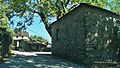
 Entering Zagori - panoramio.jpg 1,280 × 720; 1.14 MB
-
 Gamilla Peak.jpg 3,872 × 2,592; 7.07 MB
-
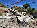 New rebuild center of Sheperi.jpg 4,032 × 3,024; 8.93 MB
-
 Papingo Blossom.jpg 4,000 × 6,016; 4.46 MB
-
 Papingo, Zagorohoria.jpg 4,000 × 6,016; 4.55 MB
-
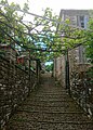 Pergolas ZagoriGreece.jpg 3,000 × 4,191; 2.87 MB
-
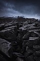 Snowy Peaks!.jpg 3,456 × 5,184; 7.44 MB
-
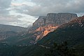
 View of Gamilla from Aristi Village.jpg 3,872 × 2,592; 7.33 MB
-
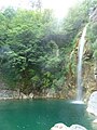 Waterfalls of Iliochori.JPG 1,920 × 2,560; 2.1 MB
-
 Zagori - Manassis - panoramio.jpg 1,920 × 1,080; 641 KB


