Category:Zhongshan District, Taipei
日本語: 中山区。
中文(臺灣):中山區。
| Geocoded outline |
Google Maps OpenStreetMap 臺北市中山區 |
|---|
| Object location | | View all coordinates using: OpenStreetMap |
|---|
A district in Taipei   | |||||
| Upload media | |||||
| Instance of | |||||
|---|---|---|---|---|---|
| Part of | |||||
| Location | Taipei, ROC | ||||
| Population |
| ||||
| Area |
| ||||
| Elevation above sea level |
| ||||
| official website | |||||
 | |||||
Subcategories
This category has the following 35 subcategories, out of 35 total.
*
+
2
C
- ZhongShan Causeway Bay Books (9 F)
D
- Dajia Community Park (2 F)
F
J
- Jinzhou Street (4 F)
K
- Kang Lee Park (17 F)
L
- Lane 180, Binjiang Street (25 F)
M
- Meiti Riverside Park (6 F)
R
- Rongxin Park (20 F)
S
- Shuangcheng Street (10 F)
- SIGRID Coffee (63 F)
T
- Taipei Qingguang Market, 1951 (13 F)
Y
- Yongsheng Park (Taipei) (18 F)
- Yuanshan Interchange (4 F)
Z
- Zhongshan Metro Mall (75 F)
- Zhongshan Soccer Stadium (15 F)
- Ziqiang Tunnel (3 F)
Media in category "Zhongshan District, Taipei"
The following 200 files are in this category, out of 230 total.
(previous page) (next page)-
 08.06 總統視察「海軍司令部」 (30006372118).jpg 2,048 × 1,365; 2.44 MB
-
 104, Taiwan, 台北市中山區民安里 - panoramio (2).jpg 1,280 × 960; 551 KB
-
 104, Taiwan, 台北市中山區民安里 - panoramio (3).jpg 1,280 × 960; 482 KB
-
 104, Taiwan, 台北市中山區民安里 - panoramio (5).jpg 1,280 × 960; 464 KB
-
 2008-03-01 天祥大樓福音鐘樓.jpg 1,944 × 2,592; 828 KB
-
 2009-04-25 台北新福宮 恭祝保儀大夫暨保儀尊王聖誕.jpg 4,000 × 3,000; 5.67 MB
-
 2017-06-28 Street in Taipei.jpg 3,968 × 2,232; 3.24 MB
-
 20171031 ROC-MOF-NPA 台財產北管字第1068505336號公告.jpg 2,100 × 2,800; 701 KB
-
 2019 Toyota RAV4 hybrid in Taiwan taxi service.jpg 3,809 × 2,413; 2.78 MB
-
 A room in GALA HOTEL at Taipei 19970330.jpg 3,824 × 2,588; 4.16 MB
-
 Acctaipei.jpg 4,000 × 3,000; 4.82 MB
-
 Addiction Aquatic Development Restaurant Entry Hall (72928531).jpeg 2,048 × 1,516; 1.04 MB
-
 Aurora Corp. RDH-3713 left side 20211031.jpg 4,000 × 2,250; 1.2 MB
-
 Bell Tower of Assemblies of God, Taipei 20150509.jpg 3,264 × 4,896; 5.93 MB
-
 BS Tailung motorcycle in Zhongshan District, Taipei 20111202 night.jpg 3,872 × 2,592; 2.74 MB
-
 CHT telephone box interior 20190814.jpg 3,648 × 2,432; 4.37 MB
-
 Chunghwa Post mailboxes on Minquan East Road, Taipei City 20121114.jpg 4,000 × 3,000; 5.98 MB
-
 Chunghwa Telecom N1-8060 20230820.jpg 2,400 × 3,200; 1.78 MB
-
 Dinner Plate With Seafood At Addiction Aquatic Development (72928573).jpeg 2,048 × 1,516; 766 KB
-
 Dinner Selection At Addiction Aquatic Development (72928535).jpeg 2,048 × 1,516; 1,012 KB
-
 Dinner Table At Addiction Aquatic Development (72928523).jpeg 2,048 × 1,516; 685 KB
-
 Drink Section At Addiction Aquatic Development Market (72928545).jpeg 2,048 × 1,516; 1.02 MB
-
 DSCN6444 (7075829527).jpg 4,000 × 3,000; 5.53 MB
-
 DSCN7012 (8082677273).jpg 4,000 × 3,000; 4.25 MB
-
 Flower Market At Addiction Aquatic Development (72928539).jpeg 2,048 × 1,516; 957 KB
-
 Flower Market At Addiction Aquatic Development (72928541).jpeg 2,048 × 1,516; 1,019 KB
-
 Fresh Seafood At Addiction Aquatic Development (72928527).jpeg 2,048 × 1,516; 924 KB
-

-
 Ice Monster Shave Ice Place (72928581).jpeg 2,048 × 1,688; 992 KB
-
 Isuzu ELF of Taiwan Pelican 6T-687 20100915.jpg 1,600 × 1,200; 287 KB
-
 Jiantan Riverside Park 劍潭河濱公園 - panoramio.jpg 3,648 × 2,736; 2.46 MB
-
 KMTMotorcycles-Elections08.JPG 3,648 × 2,736; 3.37 MB
-
 LeeBao Security ATZ-5117 on Nanjing East Road 20221203.jpg 4,573 × 3,029; 2.39 MB
-
 Liability insurance plate from Fubon Insurance on Jilin Road, Taipei City 20160723.jpg 2,200 × 1,650; 479 KB
-
 Lobster Tank At Addiction Aquatic Development (72928521).jpeg 2,048 × 1,516; 777 KB
-
 Me And The Mozilla Taiwanese Community (72837425).jpeg 2,048 × 1,365; 879 KB
-
 Me Visiting Mozilla Taiwanese Community Space (72837423).jpeg 1,365 × 2,048; 697 KB
-
 Minquan West Road and Tiansiang Road Intersection 20150509.jpg 4,841 × 3,227; 2.75 MB
-
 Minquan West Road West View 20150509.jpg 4,896 × 3,264; 2.56 MB
-
 Motorcycle Lanes under Elevated Highway 高架道路下的機車道 - panoramio.jpg 3,562 × 2,670; 2.19 MB
-
 Mq 01.JPG 1,024 × 768; 337 KB
-
 Namchow Oil and Fat RBB-3651 on Zhongshan North Road 20210906.jpg 3,600 × 2,700; 1.35 MB
-
 National No.1 Freeway Viaduct View from Taipei Grand Hotel 20100822.jpg 4,000 × 3,000; 6.07 MB
-
 Nobori and house number of Tsannkuen 3C Nanjing Store 20130213.jpg 1,536 × 2,048; 825 KB
-
 Nong'an Street intersection with pedestrians 20190517.jpg 3,648 × 2,736; 4.48 MB
-
 Red Motorized Tricycle Parkd at Jinzhou Street, Taipei 20150901.jpg 4,928 × 3,264; 3.39 MB
-
 Road name sign of Lane 20, Zhongshan North Road Section 2, Taipei 20080529.jpg 2,592 × 1,944; 791 KB
-
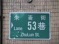 Road name sign of Lane 53, Zhulun Street, Taipei 20080816.jpg 2,592 × 1,944; 771 KB
-
 Road name sign of Nanjing East Road Section 2, Taipei City 20080806.jpg 2,592 × 1,944; 868 KB
-
 Road name sign of Zhulun Street, Zhongshan District, Taipei 20080921.jpg 3,072 × 2,304; 1.27 MB
-
 Roadside Park 路旁公園 - panoramio.jpg 3,500 × 2,626; 2.92 MB
-
 San-Chung Bus 2U-049 20040705.jpg 1,600 × 1,071; 432 KB
-
 Seafood Section At Addiction Aquatic Development (72928563).jpeg 2,048 × 1,516; 1.08 MB
-
 Section 1st, Nanjing East Road 20101114.JPG 4,000 × 3,000; 6.22 MB
-

-
 Si Ping Street and Yi Jiang Street intersection, Taipei City 20080806.jpg 2,592 × 1,944; 829 KB
-
 Taipeh imbiss.jpg 3,872 × 2,592; 2.54 MB
-
 Taipei 202 Bus stop.jpg 1,024 × 1,280; 233 KB
-
 Taipei Fish Market.JPG 1,922 × 1,442; 1.59 MB
-
 TCPD Zhongshan First Police Station motorcycles on Zhongshan North Road 20111007.jpg 3,264 × 2,448; 1.8 MB
-
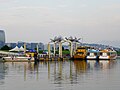 TIFE Meiti Pier 20110425.jpg 3,976 × 2,968; 5.58 MB
-
 Times Park24,ZhongShan N.Rd Sec.1 台北市中山北路一段 112 DSCF4698.jpg 2,304 × 1,728; 906 KB
-
 TMTC Zhonglun Station stop board rear 20100618.jpg 1,536 × 2,048; 546 KB
-
 TPFC AJH-5805 at Expo Dome 20220108.jpg 4,352 × 2,448; 1.98 MB
-
 Tropical Fruits With Ice Cream Drink At Dante Cafe (73078781).jpeg 2,048 × 1,152; 462 KB
-
 TW Taipei route 2 Taoyuen Airport - view signs Bin Jiang Street Keelung Feb-2013.JPG 2,048 × 1,536; 896 KB
-

-
 TW 台灣 Taiwan 台北 Taipei 遼寧街 Liaoning Street morning March 2024 R12S 300.jpg 4,000 × 3,000; 2.56 MB
-
 TW 台灣 Taiwan 台北 Taipei 遼寧街 Liaoning Street morning March 2024 R12S 301.jpg 4,000 × 3,000; 3.03 MB
-
 TW 台灣 Taiwan 台北 Taipei 遼寧街 Liaoning Street morning March 2024 R12S 302.jpg 3,264 × 2,448; 2.39 MB
-
 TW 台灣 Taiwan 台北 Taipei 遼寧街 Liaoning Street morning March 2024 R12S 303.jpg 4,000 × 3,000; 4.09 MB
-
 TW 台灣 Taiwan 台北 Taipei 遼寧街 Liaoning Street morning March 2024 R12S 304.jpg 4,000 × 3,000; 3.92 MB
-
 TW 台灣 Taiwan 台北 Taipei 遼寧街 Liaoning Street morning March 2024 R12S 305.jpg 4,000 × 3,000; 3.66 MB
-
 TW 台灣 Taiwan 台北 Taipei 遼寧街 Liaoning Street morning March 2024 R12S 306.jpg 3,000 × 4,000; 4.96 MB
-
 TW 台灣 Taiwan 台北 Taipei 遼寧街 Liaoning Street morning March 2024 R12S 307.jpg 4,000 × 3,000; 4.82 MB
-
 TW 台灣 Taiwan 台北 Taipei 遼寧街 Liaoning Street morning March 2024 R12S 308.jpg 4,000 × 3,000; 3.49 MB
-
 TW 台灣 Taiwan 台北 Taipei 遼寧街 Liaoning Street morning March 2024 R12S 309.jpg 3,000 × 4,000; 3.5 MB
-
 TW 台灣 Taiwan 台北 Taipei 遼寧街 Liaoning Street morning March 2024 R12S 310.jpg 3,000 × 4,000; 3.02 MB
-
 TW 台灣 Taiwan 台北 Taipei 遼寧街 Liaoning Street morning March 2024 R12S 311.jpg 4,000 × 3,000; 1.86 MB
-
 TW 台灣 Taiwan 台北 Taipei 遼寧街 Liaoning Street morning March 2024 R12S 312.jpg 4,000 × 3,000; 3.37 MB
-
 TW 台灣 Taiwan 台北 Taipei 遼寧街 Liaoning Street morning March 2024 R12S 313.jpg 4,000 × 3,000; 2.73 MB
-
 TW 台灣 Taiwan 台北 Taipei 遼寧街 Liaoning Street morning March 2024 R12S 314.jpg 4,000 × 3,000; 3.14 MB
-
 United Daily News Group NBM-3238 left side on Lane 3, Munsheng West Road 20221106.jpg 3,600 × 2,700; 1.83 MB
-
 View from a Street in Zhongshan District, Taipei.jpg 5,456 × 3,632; 6.34 MB
-
 VoyageBanner of Zhongshan District.jpg 4,828 × 692; 1.03 MB
-
 Waiters At Addiction Aquatic Development (72928537).jpeg 2,048 × 1,516; 1.07 MB
-
 Water Pipe Bridge 水管橋 - panoramio.jpg 2,672 × 3,563; 1.78 MB
-
 Water Tanks At Addiction Aquatic Development (72928553).jpeg 2,048 × 1,516; 785 KB
-
 Water Tanks At Addiction Aquatic Development (72928557).jpeg 2,048 × 1,516; 777 KB
-
 Water Tanks At Addiction Aquatic Development (72928559).jpeg 1,516 × 2,048; 1.12 MB
-
 Water Tanks At Addiction Aquatic Development (72928561).jpeg 2,048 × 1,516; 1.01 MB
-
 WaterCalamity 20070814 TaipeiYuanshan-1.jpg 3,296 × 2,472; 2.31 MB
-
 WaterCalamity 20070814 TaipeiYuanshan-2.jpg 2,672 × 2,004; 1.39 MB
-
 West View of Section 2, Nanjing East Road 20170125.jpg 3,264 × 2,448; 3.09 MB
-
 Wine Section At Addiction Aquatic Development (72928569).jpeg 2,048 × 1,516; 850 KB
-
 Ye Fu-Tai letter box 20231028.jpg 2,700 × 4,800; 1.52 MB
-
 Yuanshan Tunnel 圓山隧道 - panoramio.jpg 3,562 × 2,670; 2.33 MB
-
 Zhong Xing High School stop board of Chung-Shing Bus 20100618.jpg 1,536 × 2,048; 572 KB
-
 Zhongshan Market bus stop on Zhongshan North Road 20190814.jpg 2,432 × 3,648; 5.31 MB
-
 Zhongshan North Road and Chang'an West Road intersection, Taipei City 20120430 night.jpg 3,264 × 2,448; 4.45 MB
-
 三隻兔子 Three Rabbits - panoramio.jpg 3,648 × 2,736; 2.4 MB
-
 中山北路三段花博前.jpg 3,264 × 2,448; 1.84 MB
-
 中山北路二段84巷 - panoramio.jpg 1,536 × 2,048; 1.14 MB
-
 中山北路林蔭 (48837060886).jpg 5,143 × 3,429; 12.09 MB
-
 中山區街景 - panoramio - Tianmu peter (3).jpg 2,592 × 1,944; 752 KB
-
 中山區街景 - panoramio - Tianmu peter (30).jpg 2,592 × 1,944; 821 KB
-
 中山區街景 - panoramio - Tianmu peter (31).jpg 2,592 × 1,944; 848 KB
-
 中山地下街 (50174326258).jpg 6,497 × 3,655; 12.73 MB
-
 中山地下街 (50174866301).jpg 3,723 × 2,482; 3.06 MB
-
 中山捷運站-咖啡車 (49060119087).jpg 6,439 × 4,293; 10.38 MB
-
 中山高速公路 & 五楊高架高速公路 (14461637663).jpg 4,363 × 3,272; 5.48 MB
-
 中山高速公路日出 (9698825584).jpg 2,195 × 2,927; 1.85 MB
-
 內湖區大樓 - panoramio (1).jpg 2,248 × 4,000; 2.42 MB
-
 內湖區大樓 - panoramio (10).jpg 4,000 × 2,248; 2.1 MB
-
 內湖區大樓 - panoramio (11).jpg 4,000 × 2,248; 1.71 MB
-
 內湖區大樓 - panoramio (12).jpg 4,000 × 2,248; 1.96 MB
-
 內湖區大樓 - panoramio (2).jpg 2,248 × 4,000; 2.35 MB
-
 內湖區大樓 - panoramio (3).jpg 4,000 × 2,248; 2.13 MB
-
 內湖區大樓 - panoramio (4).jpg 4,000 × 2,248; 2.56 MB
-
 內湖區大樓 - panoramio (5).jpg 4,000 × 2,248; 2.73 MB
-
 內湖區大樓 - panoramio (6).jpg 4,000 × 2,248; 2.75 MB
-
 內湖區大樓 - panoramio (7).jpg 4,000 × 2,248; 2.73 MB
-
 內湖區大樓 - panoramio (8).jpg 4,000 × 2,248; 1.84 MB
-
 內湖區大樓 - panoramio (9).jpg 2,248 × 4,000; 2.14 MB
-
 內湖區大樓 - panoramio.jpg 4,000 × 2,248; 2.64 MB
-
 內湖街景 - panoramio (1).jpg 4,000 × 2,248; 1.98 MB
-
 內湖街景 - panoramio (2).jpg 4,000 × 2,248; 1.92 MB
-
 公理堂 - panoramio (2).jpg 3,648 × 2,736; 4 MB
-
 公理堂 - panoramio.jpg 2,736 × 3,648; 4.17 MB
-
 冷清的中山地下街 (49513832092).jpg 3,276 × 2,184; 5.1 MB
-
 南京東路三段.JPG 4,000 × 3,000; 1.9 MB
-
 南京西路人行地下道 20110605.jpg 4,000 × 2,248; 1.81 MB
-
 台北市中山區一江公園一江島殉難烈士紀念碑.jpg 3,148 × 2,362; 1.95 MB
-
 台北市中山區聚盛里元宵聯歡晚會.jpg 3,008 × 2,000; 2.4 MB
-
 台北市景觀 - panoramio (78).jpg 4,000 × 2,248; 2.43 MB
-
 台北捷運橘線松江南京站7號出口旁藝術品.JPG 2,748 × 3,664; 3.85 MB
-
 台北晶華酒店附近街景 - panoramio - Tianmu peter.jpg 2,592 × 1,944; 735 KB
-
 合庫圓山00459.jpg 1,280 × 960; 603 KB
-
 合庫圓山00460.jpg 1,280 × 960; 577 KB
-
 合庫圓山00464.jpg 1,280 × 960; 578 KB
-
 合庫圓山00465.jpg 1,280 × 960; 583 KB
-
 合庫圓山00996.jpg 2,560 × 1,920; 1.92 MB
-
 合庫圓山01071.jpg 1,280 × 960; 557 KB
-
 合庫圓山01246.jpg 1,280 × 960; 574 KB
-
 合庫圓山01247.jpg 1,280 × 960; 593 KB
-
 合庫圓山01248.jpg 1,280 × 960; 580 KB
-
 合庫圓山01271.jpg 1,280 × 960; 572 KB
-
 合庫圓山01272.jpg 1,280 × 960; 600 KB
-
 合庫圓山01438.jpg 2,560 × 1,920; 2.08 MB
-
 合庫圓山01439.jpg 2,560 × 1,920; 2.1 MB
-
 合庫圓山01441.jpg 2,560 × 1,920; 2.2 MB
-
 合庫圓山01443.jpg 2,560 × 1,920; 1.89 MB
-
 合庫圓山01444.jpg 2,560 × 1,920; 1.84 MB
-
 合庫圓山01450.jpg 2,560 × 1,920; 2.24 MB
-
 合庫圓山01451.jpg 2,560 × 1,920; 2.15 MB
-
 合庫圓山01458.jpg 2,560 × 1,920; 2.17 MB
-
 合庫圓山01459.jpg 2,560 × 1,920; 2.06 MB
-
 合庫圓山01460.jpg 2,560 × 1,920; 2.05 MB
-
 合庫圓山01461.jpg 2,560 × 1,920; 1.97 MB
-
 合庫圓山01511.jpg 2,240 × 1,680; 1.58 MB
-
 合庫圓山01512.jpg 2,240 × 1,680; 1.54 MB
-
 合庫圓山01513.jpg 2,240 × 1,680; 1.6 MB
-
 合庫圓山01514.jpg 2,240 × 1,680; 1.65 MB
-
 合庫圓山01515.jpg 2,240 × 1,680; 1.58 MB
-
 合庫圓山01540.jpg 2,240 × 1,680; 1.49 MB
-
 合庫圓山0304.jpg 1,280 × 960; 586 KB
-
 合庫圓山0305.jpg 1,280 × 960; 588 KB
-
 合庫圓山0306.jpg 1,280 × 960; 607 KB
-
 合庫圓山0307.jpg 1,280 × 960; 536 KB
-
 合庫圓山0412.jpg 1,856 × 1,392; 1.13 MB
-
 吉林路與長安東路 - panoramio - Tianmu peter (10).jpg 1,944 × 2,592; 647 KB
-
 吉林路與長安東路 - panoramio - Tianmu peter (21).jpg 2,592 × 1,944; 873 KB
-
 四季陽光商圈.jpg 2,167 × 2,167; 1.49 MB
-
 大同公司大門對面(晴光市場) - panoramio - Tianmu peter.jpg 2,592 × 1,944; 812 KB
-
 宅急便三輪車SD-043 20080225.jpg 2,592 × 1,944; 1.12 MB
-
 小仙人掌 - panoramio - Tianmu peter (1).jpg 2,592 × 1,944; 733 KB
-
 小仙人掌 - panoramio - Tianmu peter (2).jpg 2,592 × 1,944; 857 KB
-
 小仙人掌 - panoramio - Tianmu peter.jpg 2,592 × 1,944; 798 KB
-
 小仙人掌 - panoramio.jpg 2,592 × 1,944; 816 KB
-
 德運京鼎20180214.jpg 3,024 × 4,032; 2.51 MB
-
 捷運中山地下街 (50300868733).jpg 5,277 × 3,518; 10.68 MB
-
 捷運中山地下街 (50300868753).jpg 6,315 × 4,210; 9.68 MB
-
 朱倫街 - panoramio - Tianmu peter (15).jpg 2,592 × 1,944; 786 KB
-
 民生林森路口 - panoramio.jpg 2,816 × 2,112; 905 KB
-
 洪煥銅像.jpg 3,024 × 4,032; 4.48 MB
-
 神召會中心 - panoramio.jpg 3,648 × 2,736; 4.03 MB
-
 紙人燈籠 Paper Figure Lanterns - panoramio.jpg 3,968 × 3,968; 4.43 MB
-
 臺北市中山區農安街166巷路標牌 20080804.jpg 2,592 × 1,944; 752 KB
-
 臺北市建築攝影 - panoramio - Tianmu peter (7).jpg 500 × 375; 21 KB
-
 臺北酒廠 0956.jpg 6,000 × 4,000; 10.72 MB
-
 臺北酒廠 0959.jpg 6,000 × 4,000; 10.28 MB
-
 臺北酒廠 0961.jpg 6,000 × 4,000; 10.89 MB
-
 臺北酒廠 0966.jpg 6,000 × 4,000; 14.43 MB
-
 臺北酒廠 0967.jpg 6,000 × 4,000; 10.83 MB
-
 臺北酒廠 0971.jpg 6,000 × 4,000; 10.27 MB
-
 臺北酒廠 0978.jpg 4,000 × 6,000; 12.3 MB
-
 臺北酒廠 0979.jpg 6,000 × 4,000; 14.18 MB
-
 臺北酒廠 0980.jpg 6,000 × 4,000; 10.33 MB
-
 臺北酒廠 0981.jpg 6,000 × 4,000; 10.5 MB
-
 臺北酒廠 0982.jpg 4,000 × 6,000; 12.42 MB
.jpg)
.jpg)
.jpg)
.jpg)


.jpeg)


.jpeg)
.jpeg)
.jpeg)
.jpeg)
.jpg)
.jpg)
.jpeg)
.jpeg)
.jpeg)

.jpeg)


.jpeg)
.jpeg)
.jpeg)


.jpeg)


.jpeg)


.jpeg)

.jpeg)
.jpeg)
.jpeg)
.jpeg)


.jpeg)


.jpg)
.jpg)
.jpg)
.jpg)
.jpg)
.jpg)
.jpg)
.jpg)
.jpg)
.jpg)
.jpg)
.jpg)
.jpg)
.jpg)
.jpg)
.jpg)
.jpg)
.jpg)
.jpg)
.jpg)
.jpg)

.jpg)
.jpg)
.jpg)

.jpg)


.jpg)


.jpg)
.jpg)

_-_panoramio_-_Tianmu_peter.jpg)

.jpg)
.jpg)


.jpg)
.jpg)
.jpg)


.jpg)


