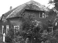
Category:Zuiderlingedijk 79, Spijk
| Object location | | View all coordinates using: OpenStreetMap |
|---|
farmhouse in Lingewaal, Netherlands  | |||||
| Upload media | |||||
| Instance of | |||||
|---|---|---|---|---|---|
| Location | Spijk, West Betuwe, Gelderland, Netherlands | ||||
| Street address |
| ||||
| Located on street |
| ||||
| Heritage designation |
| ||||
 | |||||
|
This is a category about rijksmonument number 21996
|
| Address |
|
Media in category "Zuiderlingedijk 79, Spijk"
The following 11 files are in this category, out of 11 total.
-
 Aanzicht - Spijk - 20203302 - RCE.jpg 1,200 × 797; 233 KB
-
 Exterieur OVERZICHT - Spijk - 20301255 - RCE.jpg 1,192 × 1,200; 317 KB
-
 Exterieur VOORGEVEL, LINKER ZIJGEVEL - Spijk - 20301256 - RCE.jpg 1,193 × 1,200; 393 KB
-
 Linker zijgevel - Spijk - 20203303 - RCE.jpg 1,200 × 954; 284 KB
-
 Spijk - Zuiderlingedijk Heukelum 51 Boerderij.jpg 3,888 × 2,592; 7.89 MB
-
 Spijk - Zuiderlingedijk Heukelum 79 Boerderij vanaf Zuiderlinge Dijk.jpg 3,888 × 2,592; 5.54 MB
-
 Spijk - Zuiderlingedijk Heukelum 79 Boerderij.jpg 3,888 × 2,592; 3.21 MB
-
 Spijk RM Zuiderlingedijk 79.jpg 3,950 × 2,595; 4.22 MB
-
 Voor- en zijgevel kleur - Spijk - 20498489 - RCE.jpg 1,200 × 900; 216 KB
-
 Voorgevel kleur - Spijk - 20498488 - RCE.jpg 1,200 × 900; 173 KB
-
 Zij- en voorgevel kleur - Spijk - 20498490 - RCE.jpg 1,200 × 900; 213 KB


