Category:Zvole (Rychnovek)
| Object location | | View all coordinates using: OpenStreetMap |
|---|
village in Náchod District of Hradec Králové region  | |||||
| Upload media | |||||
| Instance of | |||||
|---|---|---|---|---|---|
| Location | Rychnovek, Náchod District, Hradec Králové Region, Czechia | ||||
| Population |
| ||||
| Area |
| ||||
 | |||||
Subcategories
This category has only the following subcategory.
C
- Church of Saint Justus in Zvole (13 F)
Media in category "Zvole (Rychnovek)"
The following 30 files are in this category, out of 30 total.
-
 Zvole - bridge and church.jpg 3,264 × 2,448; 1.71 MB
-
 Zvole - building of Povodí Labe.jpg 3,264 × 2,448; 1.69 MB
-
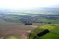 Zvole from air 1.jpg 2,400 × 1,600; 1.95 MB
-
 Zvole kříž.JPG 2,336 × 3,504; 5 MB
-
 Zvole mateřská škola.JPG 2,336 × 3,504; 3.29 MB
-
 Zvole novostavby.JPG 2,336 × 3,504; 3.78 MB
-
 Zvole návesní rybníček.JPG 2,336 × 3,504; 3.26 MB
-
 Zvole pomník padlých.JPG 2,336 × 3,504; 3.99 MB
-
 Zvole prodejna.JPG 3,504 × 2,336; 3.69 MB
-
 Zvole základní škola.JPG 3,504 × 2,336; 3.41 MB
-
 Zvole čp. 12 DSCF2081.jpg 2,994 × 2,246; 1.29 MB
-
 Zvole čp. 12.jpg 3,089 × 2,317; 1.32 MB
-
 Zvole čp. 14.JPG 3,504 × 2,336; 3.93 MB
-
 Zvole čp. 2.JPG 2,336 × 3,504; 3.58 MB
-
 Zvole čp. 25.JPG 3,504 × 2,336; 3.98 MB
-
 Zvole čp. 34.JPG 3,504 × 2,336; 4.34 MB
-
 Zvole čp. 38.JPG 3,504 × 2,336; 3.49 MB
-
 Zvole čp. 4.JPG 3,504 × 2,336; 3.98 MB
-
 Zvole čp. 48.JPG 3,504 × 2,336; 3.51 MB
-
 Zvole čp. 56.jpg 1,401 × 1,867; 604 KB
-
 Zvole čp. 58.JPG 3,504 × 2,336; 3.76 MB
-
 Zvole čp. 62.JPG 3,504 × 2,336; 3.61 MB
-
 Zvole čp. 65 former pub.jpg 2,953 × 2,215; 1.26 MB
-
 Zvole čp. 65.jpg 2,636 × 1,977; 1.03 MB
-
 Zvole čp. 70.JPG 3,504 × 2,336; 4.13 MB
-
 Zvole čp. 71.JPG 3,504 × 2,336; 4.14 MB
-
 Zvole čp. 85 a čp. 56.jpg 2,206 × 1,655; 845 KB
-
 Zvole čp. 85.JPG 3,504 × 2,336; 4.11 MB
-
 Zvole čp. 98.JPG 3,504 × 2,336; 5.02 MB
-
 Zvole škola.JPG 3,504 × 2,336; 3.92 MB


