Category:Zypendaal
| Object location | | View all coordinates using: OpenStreetMap |
|---|
entrance gate in Arnhem  | |||||
| Upload media | |||||
| Instance of |
| ||||
|---|---|---|---|---|---|
| Part of | |||||
| Location | Arnhem, Gelderland, Netherlands | ||||
| Street address |
| ||||
| Heritage designation |
| ||||
 | |||||
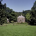
Nederlands: Buitenplaats met park; ligt ten noorden van Park Sonsbeek en ten oosten van Gulden Bodem in een beekdal van de stuwwal tussen en vertoont daardoor aanmerkelijke hoogteverschillen. Zypendaal wordt gekarakteriseerd door oude boomgroepen, open weiden, vergezichten en sprengen die uitmonden in vijverpartijen. Deze zetten zich voort als St. Jansbeek in het park van Sonsbeek.
|
This is a category about rijksmonumentcomplex number 528874
|
Landgoed:
|
This is a category about rijksmonument number 8382
|
Hoofdgebouw:
|
This is a category about rijksmonument number 528875
|
Historische tuin- en parkaanleg:
|
This is a category about rijksmonument number 528876
|
Koetshuis:
|
This is a category about rijksmonument number 528877
|
Orangerie:
|
This is a category about rijksmonument number 528878
|
Tuinhuis:
|
This is a category about rijksmonument number 528879
|
Dienstgebouw:
|
This is a category about rijksmonument number 528880
|
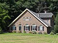
Hallehuisboerderij:
|
This is a category about rijksmonument number 528881
|
Toegangshek:
|
This is a category about rijksmonument number 528882
|
Weidehekken:
|
This is a category about rijksmonument number 529824
|
| Address |
|
Subcategories
This category has the following 6 subcategories, out of 6 total.
Media in category "Zypendaal"
The following 55 files are in this category, out of 55 total.
-
 20140822 Beuken bij Huis Zypendaal Arnhem.jpg 5,184 × 3,456; 4.35 MB
-

-
 Arnhem boerderij Teerhuis A.jpg 4,269 × 2,840; 2.66 MB
-
 Detail, voetstukken - Arnhem - 20025126 - RCE.jpg 1,190 × 1,200; 334 KB
-
 Detail, voetstukken - Arnhem - 20025127 - RCE.jpg 1,195 × 1,200; 337 KB
-
 Detail, voetstukken - Arnhem - 20025128 - RCE.jpg 1,191 × 1,200; 352 KB
-
 Detail, voetstukken - Arnhem - 20025129 - RCE.jpg 1,191 × 1,200; 400 KB
-
 Gietijzeren weidehekken in Park Zypendaal.JPG 2,816 × 2,112; 2.61 MB
-
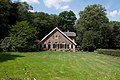
 Hallehuisboerderij bij Zypendaal.jpg 4,608 × 3,456; 4.85 MB
-
 Hoogkamp, Arnhem, Netherlands - panoramio (2).jpg 2,048 × 1,366; 1.06 MB
-
 Hoogkamp, Arnhem, Netherlands - panoramio.jpg 1,600 × 899; 456 KB
-
 Labyrinth van bierkratten anno 2021, Park Zypendaal, Arnhem.jpg 4,032 × 3,024; 5 MB
-
 Open kapschuur kleurrepro H.Schaareman, 1920 - Arnhem - 20504107 - RCE.jpg 1,200 × 900; 183 KB
-
 Overzicht van de oranjerie en koetshuis - Arnhem - 20424499 - RCE.jpg 1,200 × 1,200; 421 KB
-
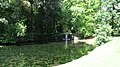
 Park Zypendaal.jpg 1,988 × 1,492; 1.18 MB
-
 Parkaanleg op Zypendaal.jpg 4,608 × 3,456; 5.52 MB
-
 Parkeerplaats bij het koetshuis - Arnhem - 20025134 - RCE.jpg 1,200 × 1,200; 431 KB
-
 Parkeerplaats bij koetshuis - Arnhem - 20025132 - RCE.jpg 1,200 × 1,200; 424 KB
-

-
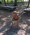 Sculptuur 'Uil', De Wolflaan-Park Zypendaal, Arnhem.jpg 2,846 × 3,240; 3.8 MB
-
 Sculptuur 'Wolf', De Wolflaan-Park Zypendaal, Arnhem.jpg 2,846 × 3,245; 3.9 MB
-
 Sonsbeek, Zijpendaal, Arnhem, Netherlands - panoramio (13).jpg 2,048 × 1,371; 613 KB
-
 Sonsbeek, Zijpendaal, Arnhem, Netherlands - panoramio (16).jpg 2,048 × 1,155; 580 KB
-
 Sonsbeek, Zijpendaal, Arnhem, Netherlands - panoramio (2).jpg 1,600 × 899; 473 KB
-
 Sonsbeek, Zijpendaal, Arnhem, Netherlands - panoramio (22).jpg 2,048 × 1,155; 664 KB
-
 Sonsbeek, Zijpendaal, Arnhem, Netherlands - panoramio (38).jpg 2,048 × 1,366; 991 KB
-
 Sonsbeek, Zijpendaal, Arnhem, Netherlands - panoramio (41).jpg 2,048 × 1,366; 859 KB
-
 Sonsbeek, Zijpendaal, Arnhem, Netherlands - panoramio (45).jpg 2,048 × 1,366; 1,018 KB
-
 Sonsbeek, Zijpendaal, Arnhem, Netherlands - panoramio (47).jpg 2,048 × 1,366; 1.02 MB
-
 Sonsbeek, Zijpendaal, Arnhem, Netherlands - panoramio (48).jpg 2,048 × 1,366; 972 KB
-
 Sonsbeek, Zijpendaal, Arnhem, Netherlands - panoramio (49).jpg 2,048 × 1,366; 934 KB
-
 Sonsbeek, Zijpendaal, Arnhem, Netherlands - panoramio (50).jpg 2,048 × 1,366; 983 KB
-
 Sonsbeek, Zijpendaal, Arnhem, Netherlands - panoramio (51).jpg 2,048 × 1,366; 1,003 KB
-
 Sonsbeek, Zijpendaal, Arnhem, Netherlands - panoramio (52).jpg 2,048 × 1,366; 1.02 MB
-
 Sonsbeek, Zijpendaal, Arnhem, Netherlands - panoramio (53).jpg 2,048 × 1,366; 1 MB
-
 Sonsbeek, Zijpendaal, Arnhem, Netherlands - panoramio (55).jpg 2,048 × 1,366; 945 KB
-
 Sonsbeek, Zijpendaal, Arnhem, Netherlands - panoramio (57).jpg 2,048 × 1,366; 770 KB
-
 Sonsbeek, Zijpendaal, Arnhem, Netherlands - panoramio (58).jpg 2,048 × 1,366; 1.04 MB
-
 Sonsbeek, Zijpendaal, Arnhem, Netherlands - panoramio (59).jpg 2,048 × 1,366; 1,019 KB
-
 Sonsbeek, Zijpendaal, Arnhem, Netherlands - panoramio (60).jpg 2,048 × 1,366; 873 KB
-
 Sonsbeek, Zijpendaal, Arnhem, Netherlands - panoramio (61).jpg 2,048 × 1,366; 677 KB
-
 Sonsbeek, Zijpendaal, Arnhem, Netherlands - panoramio (62).jpg 4,896 × 3,264; 3.07 MB
-
 Sonsbeek, Zijpendaal, Arnhem, Netherlands - panoramio (63).jpg 4,896 × 3,264; 4.27 MB
-
 Sonsbeek, Zijpendaal, Arnhem, Netherlands - panoramio (65).jpg 4,896 × 3,264; 3.91 MB
-
 Sonsbeek, Zijpendaal, Arnhem, Netherlands - panoramio (67).jpg 4,896 × 3,264; 3.17 MB
-
 Sonsbeek, Zijpendaal, Arnhem, Netherlands - panoramio (69).jpg 4,896 × 3,264; 3.34 MB
-
 Sonsbeek, Zijpendaal, Arnhem, Netherlands - panoramio (70).jpg 4,896 × 3,264; 4.8 MB
-
 Sonsbeek, Zijpendaal, Arnhem, Netherlands - panoramio (73).jpg 4,896 × 3,264; 3.56 MB
-
 Sonsbeek, Zijpendaal, Arnhem, Netherlands - panoramio (74).jpg 1,707 × 2,560; 1.63 MB
-
 Sonsbeek, Zijpendaal, Arnhem, Netherlands - panoramio (75).jpg 4,896 × 3,264; 3.62 MB
-
 Sonsbeek, Zijpendaal, Arnhem, Netherlands - panoramio (77).jpg 4,896 × 3,264; 2.6 MB
-
 Sonsbeek, Zijpendaal, Arnhem, Netherlands - panoramio.jpg 1,600 × 899; 372 KB
-

-
 Weidehekken op Zypendaal.jpg 4,608 × 3,456; 6.16 MB
-
 Zicht op de voorgevel - Arnhem - 20424493 - RCE.jpg 2,322 × 2,322; 1.5 MB


.jpg)


.jpg)


.jpg)
.jpg)
.jpg)
.jpg)
.jpg)
.jpg)
.jpg)
.jpg)
.jpg)
.jpg)
.jpg)
.jpg)
.jpg)
.jpg)
.jpg)
.jpg)
.jpg)
.jpg)
.jpg)
.jpg)
.jpg)
.jpg)
.jpg)
.jpg)
.jpg)
.jpg)
.jpg)
.jpg)
.jpg)
.jpg)


