Commons:Wiki4Alps/Ingenbohl


KGS-Nr Upload Foto   Object Other Cov. Cat. Type Address Town Coordinates
8915 Upload a file Archiv Institut Ingenbohl, Barmherzige Schwestern vom heiligen Kreuz No images B Klosterstrasse 10 [[:Category:|]]
46° 59′ 58.2″ N, 8° 37′ 00.88″ E Kartographer map based on OpenStreetMap.View all coordinates using: OpenStreetMapinfo


4803 Upload a file Bahnhof Brunnen Bahnhof Brunnen No images B Bahnhofstrasse 41 [[:Category:|]]
46° 59′ 57.3″ N, 8° 36′ 36.07″ E Kartographer map based on OpenStreetMap.View all coordinates using: OpenStreetMapinfo


12836 Upload a file Beinhaus No images B Klosterstrasse 4a [[:Category:|]]
47° 00′ 01.87″ N, 8° 36′ 56.56″ E Kartographer map based on OpenStreetMap.View all coordinates using: OpenStreetMapinfo


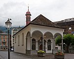
12837 Upload a file Dorfkapelle Brunnen Dorfkapelle Brunnen No images B Gersauerstrasse [[:Category:|]]
46° 59′ 39.01″ N, 8° 36′ 18.18″ E Kartographer map based on OpenStreetMap.View all coordinates using: OpenStreetMapinfo


12845 Upload a file Gasthaus zur Taube Gasthaus zur Taube No images B Bahnhofstrasse 4 [[:Category:|]]
46° 59′ 38.51″ N, 8° 36′ 20.59″ E Kartographer map based on OpenStreetMap.View all coordinates using: OpenStreetMapinfo


4805 Upload a file Grand Palais No images B Axenstrasse 17/19 [[:Category:|]]
46° 59′ 34.37″ N, 8° 36′ 31.5″ E Kartographer map based on OpenStreetMap.View all coordinates using: OpenStreetMapinfo


12838 Upload a file Haus No images B Bahnhofstrasse 1 [[:Category:|]]
46° 59′ 39.41″ N, 8° 36′ 19.22″ E Kartographer map based on OpenStreetMap.View all coordinates using: OpenStreetMapinfo


12839 Upload a file Haus No images B Bahnhofstrasse 12 [[:Category:|]]
46° 59′ 39.7″ N, 8° 36′ 21.02″ E Kartographer map based on OpenStreetMap.View all coordinates using: OpenStreetMapinfo


12840 Upload a file Haus No images B Bahnhofstrasse 31 [[:Category:|]]
46° 59′ 49.31″ N, 8° 36′ 26.46″ E Kartographer map based on OpenStreetMap.View all coordinates using: OpenStreetMapinfo


12841 Upload a file Haus No images B Feldweg 21 [[:Category:|]]
47° 00′ 22.07″ N, 8° 37′ 55.2″ E Kartographer map based on OpenStreetMap.View all coordinates using: OpenStreetMapinfo


12842 Upload a file Haus No images B Schillerweg 5 [[:Category:|]]
47° 00′ 04.79″ N, 8° 35′ 29.04″ E Kartographer map based on OpenStreetMap.View all coordinates using: OpenStreetMapinfo


12843 Upload a file Haus No images B Schränggigenstrasse 29 [[:Category:|]]
47° 00′ 42.44″ N, 8° 36′ 57.42″ E Kartographer map based on OpenStreetMap.View all coordinates using: OpenStreetMapinfo


12844 Upload a file Haus No images B Unterschönenbuch 14–16 [[:Category:|]]
46° 59′ 56.4″ N, 8° 38′ 05.53″ E Kartographer map based on OpenStreetMap.View all coordinates using: OpenStreetMapinfo


12846 Upload a file Haus (Grabachern) No images B Gätzlistrasse 50 [[:Category:|]]
47° 00′ 01.37″ N, 8° 37′ 57.22″ E Kartographer map based on OpenStreetMap.View all coordinates using: OpenStreetMapinfo


12847 Upload a file Hotel Rütli No images B Bahnhofstrasse 10 [[:Category:|]]
46° 59′ 39.41″ N, 8° 36′ 20.99″ E Kartographer map based on OpenStreetMap.View all coordinates using: OpenStreetMapinfo


4807 Upload a file Hotel Waldstätterhof Hotel Waldstätterhof No images B Waldstätterquai 6 [[:Category:|]]
46° 59′ 37.68″ N, 8° 36′ 13.17″ E Kartographer map based on OpenStreetMap.View all coordinates using: OpenStreetMapinfo


12848 Upload a file Hotel Weisses Rössli Hotel Weisses Rössli No images B Bahnhofstrasse 8 [[:Category:|]]
46° 59′ 39.12″ N, 8° 36′ 20.81″ E Kartographer map based on OpenStreetMap.View all coordinates using: OpenStreetMapinfo


12849 Upload a file Restaurant Poststübli No images B Bahnhofstrasse 6 [[:Category:|]]
46° 59′ 38.94″ N, 8° 36′ 20.59″ E Kartographer map based on OpenStreetMap.View all coordinates using: OpenStreetMapinfo


4810 Upload a file Theresianum No images B Klosterstrasse 14 [[:Category:|]]
46° 59′ 49.99″ N, 8° 36′ 55.33″ E Kartographer map based on OpenStreetMap.View all coordinates using: OpenStreetMapinfo


12850 Upload a file Villa Schoeck No images B Gütschweg 8 [[:Category:|]]
46° 59′ 37.07″ N, 8° 36′ 27.54″ E Kartographer map based on OpenStreetMap.View all coordinates using: OpenStreetMapinfo


4812 Upload a file Kapelle St. Laurentius No images B Wylen [[:Category:|]]
47° 00′ 23.65″ N, 8° 36′ 32.65″ E Kartographer map based on OpenStreetMap.View all coordinates using: OpenStreetMapinfo


4811 Upload a file Kapelle St. Wendelin No images B Unterschönenbuch [[:Category:|]]
46° 59′ 55.03″ N, 8° 37′ 50.84″ E Kartographer map based on OpenStreetMap.View all coordinates using: OpenStreetMapinfo


4806 Upload a file Letzimauer No images B Gersauerstrasse [[:Category:|]]
46° 59′ 42.32″ N, 8° 36′ 12.56″ E Kartographer map based on OpenStreetMap.View all coordinates using: OpenStreetMapinfo


12851 Upload a file Pfarrhaus No images B Klosterstrasse 6 [[:Category:|]]
47° 00′ 01.3″ N, 8° 36′ 58.43″ E Kartographer map based on OpenStreetMap.View all coordinates using: OpenStreetMapinfo


4809 Upload a file Pfarrkirche St. Leonhard No images B Klosterstrasse [[:Category:|]]
47° 00′ 01.98″ N, 8° 36′ 54.65″ E Kartographer map based on OpenStreetMap.View all coordinates using: OpenStreetMapinfo


12852 Upload a file Sigristenhaus No images B Am Karren 5 [[:Category:|]]
47° 00′ 01.22″ N, 8° 36′ 51.66″ E Kartographer map based on OpenStreetMap.View all coordinates using: OpenStreetMapinfo


4808 Upload a file Wylerbrücke No images B Wylenstrasse [[:Category:|]]
47° 00′ 10.8″ N, 8° 36′ 16.49″ E Kartographer map based on OpenStreetMap.View all coordinates using: OpenStreetMapinfo


Übrige Baudenkmäler
KGS-Nr Upload Foto   Object Other Cov. Cat. Type Address Town Coordinates
Upload a file Alte Post No images Waldstätterquai 2 [[:Category:|]]
46° 59′ 37.75″ N, 8° 36′ 17.68″ E Kartographer map based on OpenStreetMap.View all coordinates using: OpenStreetMapinfo


Upload a file Altes Bürgerheim No images Mettlenweg 1 [[:Category:|]]
47° 00′ 02.41″ N, 8° 36′ 44.24″ E Kartographer map based on OpenStreetMap.View all coordinates using: OpenStreetMapinfo


Upload a file Gasthaus Ochsen Gasthaus Ochsen No images Bahnhofstrasse 18 [[:Category:|]]
46° 59′ 40.6″ N, 8° 36′ 22.46″ E Kartographer map based on OpenStreetMap.View all coordinates using: OpenStreetMapinfo


Upload a file Haus No images Axenstrasse 4 [[:Category:|]]
46° 59′ 33.4″ N, 8° 36′ 29.88″ E Kartographer map based on OpenStreetMap.View all coordinates using: OpenStreetMapinfo


Upload a file Haus No images Bahnhofstrasse 5 [[:Category:|]]
46° 59′ 40.16″ N, 8° 36′ 19.62″ E Kartographer map based on OpenStreetMap.View all coordinates using: OpenStreetMapinfo


Upload a file Haus No images Bahnhofstrasse 14 [[:Category:|]]
46° 59′ 39.95″ N, 8° 36′ 21.42″ E Kartographer map based on OpenStreetMap.View all coordinates using: OpenStreetMapinfo


Upload a file Haus No images Bahnhofstrasse 22 [[:Category:|]]
46° 59′ 42.86″ N, 8° 36′ 23.26″ E Kartographer map based on OpenStreetMap.View all coordinates using: OpenStreetMapinfo


Upload a file Haus No images Bahnhofstrasse 32 [[:Category:|]]
46° 59′ 46.07″ N, 8° 36′ 25.88″ E Kartographer map based on OpenStreetMap.View all coordinates using: OpenStreetMapinfo


Upload a file Haus No images Eisengasse 3 [[:Category:|]]
46° 59′ 40.7″ N, 8° 36′ 17.82″ E Kartographer map based on OpenStreetMap.View all coordinates using: OpenStreetMapinfo


Upload a file Haus No images Feldweg 15 [[:Category:|]]
47° 00′ 20.66″ N, 8° 37′ 43.57″ E Kartographer map based on OpenStreetMap.View all coordinates using: OpenStreetMapinfo


Upload a file Haus No images Gersauerstrasse 4 [[:Category:|]]
46° 59′ 40.34″ N, 8° 36′ 16.63″ E Kartographer map based on OpenStreetMap.View all coordinates using: OpenStreetMapinfo


Upload a file Haus No images Gersauerstrasse 12 [[:Category:|]]
46° 59′ 42.65″ N, 8° 36′ 12.56″ E Kartographer map based on OpenStreetMap.View all coordinates using: OpenStreetMapinfo


Upload a file Haus No images Gersauerstrasse 14 [[:Category:|]]
46° 59′ 43.3″ N, 8° 36′ 11.63″ E Kartographer map based on OpenStreetMap.View all coordinates using: OpenStreetMapinfo


Upload a file Haus No images Klosterstrasse 7 [[:Category:|]]
47° 00′ 03.74″ N, 8° 36′ 58.57″ E Kartographer map based on OpenStreetMap.View all coordinates using: OpenStreetMapinfo


Upload a file Haus No images Suststrasse 3 [[:Category:|]]
46° 59′ 43.8″ N, 8° 36′ 25.85″ E Kartographer map based on OpenStreetMap.View all coordinates using: OpenStreetMapinfo


Upload a file Haus No images Unterschönenbuch 9 [[:Category:|]]
46° 59′ 58.88″ N, 8° 37′ 53.29″ E Kartographer map based on OpenStreetMap.View all coordinates using: OpenStreetMapinfo


Upload a file Haus No images Unterschönenbuch 11 [[:Category:|]]
47° 00′ 00.54″ N, 8° 37′ 54.41″ E Kartographer map based on OpenStreetMap.View all coordinates using: OpenStreetMapinfo


Upload a file Haus No images Unterschönenbuch 22/24 [[:Category:|]]
46° 59′ 54.78″ N, 8° 38′ 05.5″ E Kartographer map based on OpenStreetMap.View all coordinates using: OpenStreetMapinfo


Upload a file Haus zur Mühle No images Kirchweg 5 [[:Category:|]]
47° 00′ 00.5″ N, 8° 36′ 49.64″ E Kartographer map based on OpenStreetMap.View all coordinates using: OpenStreetMapinfo


Upload a file Hotel Belvedere No images Gütschweg 6 [[:Category:|]]
46° 59′ 38.94″ N, 8° 36′ 25.27″ E Kartographer map based on OpenStreetMap.View all coordinates using: OpenStreetMapinfo


Upload a file Hotel Löwen Hotel Löwen No images Bahnhofstrasse 9 [[:Category:|]]
46° 59′ 40.96″ N, 8° 36′ 20.59″ E Kartographer map based on OpenStreetMap.View all coordinates using: OpenStreetMapinfo


Upload a file Hotel Schmid No images Axenstrasse 5 [[:Category:|]]
46° 59′ 37.68″ N, 8° 36′ 22.39″ E Kartographer map based on OpenStreetMap.View all coordinates using: OpenStreetMapinfo


Upload a file Kapelle 14 Nothelfer No images Alte Gasse [[:Category:|]]
46° 59′ 40.74″ N, 8° 36′ 25.34″ E Kartographer map based on OpenStreetMap.View all coordinates using: OpenStreetMapinfo


Upload a file Kapelle St. Apollonia (Zahnwehkapelle) No images Gätzlistrasse [[:Category:|]]
47° 00′ 02.66″ N, 8° 38′ 06.76″ E Kartographer map based on OpenStreetMap.View all coordinates using: OpenStreetMapinfo


Upload a file Park Hotel No images Gersauerstrasse 8 [[:Category:|]]
46° 59′ 46.18″ N, 8° 36′ 16.45″ E Kartographer map based on OpenStreetMap.View all coordinates using: OpenStreetMapinfo


Upload a file Reformierte Kirche No images Alte Cantonsstrasse 8 [[:Category:|]]
46° 59′ 54.38″ N, 8° 36′ 37.91″ E Kartographer map based on OpenStreetMap.View all coordinates using: OpenStreetMapinfo


Upload a file Restaurant Viktoria No images Hafenstrasse 8 [[:Category:|]]
46° 59′ 42.76″ N, 8° 36′ 00.76″ E Kartographer map based on OpenStreetMap.View all coordinates using: OpenStreetMapinfo


Upload a file Schulhaus No images Schulstrasse [[:Category:|]]
46° 59′ 53.02″ N, 8° 36′ 45.47″ E Kartographer map based on OpenStreetMap.View all coordinates using: OpenStreetMapinfo