Commons:Wiki4Alps/Küssnacht


KGS-Nr Upload Foto   Object Other Cov. Cat. Type Address Town Coordinates
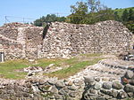
4813 Upload a file Gesslerburg Gesslerburg No images A F/G Seebodenstrasse [[:Category:|]]
47° 04′ 55.26″ N, 8° 26′ 55.19″ E Kartographer map based on OpenStreetMap.View all coordinates using: OpenStreetMapinfo


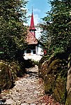
4815 Upload a file Hohle Gasse mit Tellskapelle Hohle Gasse mit Tellskapelle No images A G Hohle Gasse [[:Category:|]]
47° 05′ 33.37″ N, 8° 27′ 11.41″ E Kartographer map based on OpenStreetMap.View all coordinates using: OpenStreetMapinfo


8774 Upload a file Archiv Bethlehem Mission No images B S Bethlehemweg 10 [[:Category:|]]
47° 05′ 35.09″ N, 8° 27′ 17.35″ E Kartographer map based on OpenStreetMap.View all coordinates using: OpenStreetMapinfo


10186 Upload a file Gasthaus Rössli No images B G Unterdorfstrasse 5 [[:Category:|]]
47° 04′ 51.31″ N, 8° 26′ 27.6″ E Kartographer map based on OpenStreetMap.View all coordinates using: OpenStreetMapinfo


4816 Upload a file Haus No images B G Breitfeld [[:Category:|]]
47° 04′ 06.71″ N, 8° 26′ 15.4″ E Kartographer map based on OpenStreetMap.View all coordinates using: OpenStreetMapinfo


10187 Upload a file Haus No images B G Grepperstrasse 1 [[:Category:|]]
47° 04′ 52.21″ N, 8° 26′ 30.08″ E Kartographer map based on OpenStreetMap.View all coordinates using: OpenStreetMapinfo


12857 Upload a file Haus No images B G Haltikon 3 [[:Category:|]]
47° 05′ 24.11″ N, 8° 25′ 06.35″ E Kartographer map based on OpenStreetMap.View all coordinates using: OpenStreetMapinfo


12856 Upload a file Haus No images B G Haltikon 14 [[:Category:|]]
47° 05′ 26.66″ N, 8° 25′ 05.77″ E Kartographer map based on OpenStreetMap.View all coordinates using: OpenStreetMapinfo


12855 Upload a file Haus No images B G Hinter-Tannbüel 4 [[:Category:|]]
47° 05′ 52.66″ N, 8° 25′ 32.81″ E Kartographer map based on OpenStreetMap.View all coordinates using: OpenStreetMapinfo


12858 Upload a file Haus No images B G Luzernerstrasse 196 [[:Category:|]]
47° 03′ 57.96″ N, 8° 24′ 30.13″ E Kartographer map based on OpenStreetMap.View all coordinates using: OpenStreetMapinfo


13395 Upload a file Haus No images B G Pfarrhausplatz 3 [[:Category:|]]
47° 04′ 50.34″ N, 8° 26′ 27.82″ E Kartographer map based on OpenStreetMap.View all coordinates using: OpenStreetMapinfo


9752 Upload a file Haus No images B G Rotenhof 3 [[:Category:|]]
47° 03′ 53.32″ N, 8° 26′ 27.96″ E Kartographer map based on OpenStreetMap.View all coordinates using: OpenStreetMapinfo


10189 Upload a file Haus No images B G Unterdorfstrasse 8 [[:Category:|]]
47° 04′ 51.56″ N, 8° 26′ 26.02″ E Kartographer map based on OpenStreetMap.View all coordinates using: OpenStreetMapinfo


12859 Upload a file Haus Grossmatt No images B G Luzernerstrasse 186 [[:Category:|]]
47° 04′ 00.66″ N, 8° 24′ 34.7″ E Kartographer map based on OpenStreetMap.View all coordinates using: OpenStreetMapinfo


12860 Upload a file Haus Husmatt Haus Husmatt No images B G Luzernerstrasse 206 [[:Category:|]]
47° 03′ 55.51″ N, 8° 24′ 27.36″ E Kartographer map based on OpenStreetMap.View all coordinates using: OpenStreetMapinfo


12864 Upload a file Haus Merlischachen No images B G Luzernerstrasse 194 [[:Category:|]]
47° 03′ 58.72″ N, 8° 24′ 31.36″ E Kartographer map based on OpenStreetMap.View all coordinates using: OpenStreetMapinfo


12861 Upload a file Haus Räber No images B G Luzernerstrasse 195 [[:Category:|]]
47° 03′ 57.96″ N, 8° 24′ 32.54″ E Kartographer map based on OpenStreetMap.View all coordinates using: OpenStreetMapinfo


12862 Upload a file Haus Seehof No images B G Seeplatz 6 [[:Category:|]]
47° 04′ 49.08″ N, 8° 26′ 20.94″ E Kartographer map based on OpenStreetMap.View all coordinates using: OpenStreetMapinfo


12863 Upload a file Haus zur Sonne No images B G Hauptplatz 8 [[:Category:|]]
47° 04′ 52.9″ N, 8° 26′ 30.05″ E Kartographer map based on OpenStreetMap.View all coordinates using: OpenStreetMapinfo


4818 Upload a file Heimatmuseum No images B G/S Unterdorfstrasse 15 [[:Category:|]]
47° 04′ 50.34″ N, 8° 26′ 25.69″ E Kartographer map based on OpenStreetMap.View all coordinates using: OpenStreetMapinfo


10191 Upload a file Hotel Adler No images B G Hauptplatz 9 [[:Category:|]]
47° 04′ 51.92″ N, 8° 26′ 28.57″ E Kartographer map based on OpenStreetMap.View all coordinates using: OpenStreetMapinfo


10192 Upload a file Hotel Engel Hotel Engel No images B G Hauptplatz 1 [[:Category:|]]
47° 04′ 52.46″ N, 8° 26′ 27.6″ E Kartographer map based on OpenStreetMap.View all coordinates using: OpenStreetMapinfo


12865 Upload a file Hotel Hirschen No images B G Unterdorfstrasse 9 [[:Category:|]]
47° 04′ 50.66″ N, 8° 26′ 26.66″ E Kartographer map based on OpenStreetMap.View all coordinates using: OpenStreetMapinfo


12866 Upload a file Kapelle St. Katharina No images B G Haltikon [[:Category:|]]
47° 05′ 25.33″ N, 8° 25′ 05.41″ E Kartographer map based on OpenStreetMap.View all coordinates using: OpenStreetMapinfo


4820 Upload a file Kapelle St. Martin im Tal No images B G Adhusweg [[:Category:|]]
47° 05′ 59.71″ N, 8° 26′ 42″ E Kartographer map based on OpenStreetMap.View all coordinates using: OpenStreetMapinfo


12867 Upload a file Kappelmatt No images B G Luzernerstrasse 192 [[:Category:|]]
47° 03′ 59.51″ N, 8° 24′ 32.51″ E Kartographer map based on OpenStreetMap.View all coordinates using: OpenStreetMapinfo


12868 Upload a file Nühus No images B G Talstrasse 41 [[:Category:|]]
47° 05′ 49.7″ N, 8° 26′ 16.94″ E Kartographer map based on OpenStreetMap.View all coordinates using: OpenStreetMapinfo


10193 Upload a file Pfarrhaus Pfarrhaus No images B G Pfarrhausplatz 1 [[:Category:|]]
47° 04′ 49.3″ N, 8° 26′ 26.45″ E Kartographer map based on OpenStreetMap.View all coordinates using: OpenStreetMapinfo


4819 Upload a file Pfarrkirche St. Peter und Paul Pfarrkirche St. Peter und Paul No images B G Seeplatz 1 [[:Category:|]]
47° 04′ 49.08″ N, 8° 26′ 24.4″ E Kartographer map based on OpenStreetMap.View all coordinates using: OpenStreetMapinfo


12869 Upload a file Pfarrkirche St. Sebastian No images B G Immensee [[:Category:|]]
47° 05′ 44.27″ N, 8° 27′ 42.16″ E Kartographer map based on OpenStreetMap.View all coordinates using: OpenStreetMapinfo


4822 Upload a file Rathaus I Rathaus I No images B G Seeplatz 3 [[:Category:|]]
47° 04′ 47.68″ N, 8° 26′ 24.22″ E Kartographer map based on OpenStreetMap.View all coordinates using: OpenStreetMapinfo


10194 Upload a file Rathaus II Rathaus II No images B G Seeplatz 2 [[:Category:|]]
47° 04′ 47.42″ N, 8° 26′ 25.66″ E Kartographer map based on OpenStreetMap.View all coordinates using: OpenStreetMapinfo


12870 Upload a file Swiss Chalet Swiss Chalet No images B G Luzernerstrasse 204 [[:Category:|]]
47° 03′ 55.98″ N, 8° 24′ 27.9″ E Kartographer map based on OpenStreetMap.View all coordinates using: OpenStreetMapinfo


Übrige Baudenkmäler
KGS-Nr Upload Foto   Object Other Cov. Cat. Type Address Town Coordinates
Upload a file Astrid Hall Astrid Hall No images G Luzernerstrasse 202 [[:Category:|]]
47° 03′ 56.41″ N, 8° 24′ 28.37″ E Kartographer map based on OpenStreetMap.View all coordinates using: OpenStreetMapinfo


Upload a file Astrid-Kapelle Astrid-Kapelle No images G Luzernerstrasse [[:Category:|]]
47° 04′ 43.82″ N, 8° 25′ 50.02″ E Kartographer map based on OpenStreetMap.View all coordinates using: OpenStreetMapinfo


Upload a file Chappelmatt No images G Haltikon 18 [[:Category:|]]
47° 05′ 26.52″ N, 8° 25′ 03.86″ E Kartographer map based on OpenStreetMap.View all coordinates using: OpenStreetMapinfo


Upload a file Gasthaus Hürtel No images G Hürtelstrasse 13 [[:Category:|]]
47° 04′ 52.79″ N, 8° 26′ 23.32″ E Kartographer map based on OpenStreetMap.View all coordinates using: OpenStreetMapinfo


Upload a file Gasthaus Krone No images G Unterdorfstrasse 16 [[:Category:|]]
47° 04′ 50.59″ N, 8° 26′ 24.5″ E Kartographer map based on OpenStreetMap.View all coordinates using: OpenStreetMapinfo


Upload a file Genossenschaftshaus No images G Sigisrütiweg 7 [[:Category:|]]
47° 04′ 56.42″ N, 8° 27′ 00.65″ E Kartographer map based on OpenStreetMap.View all coordinates using: OpenStreetMapinfo


Upload a file Gymnasium Immensee, Z-Bau Gymnasium Immensee, Z-Bau No images G Bethlehemweg [[:Category:|]]
47° 05′ 34.73″ N, 8° 27′ 16.88″ E Kartographer map based on OpenStreetMap.View all coordinates using: OpenStreetMapinfo


Upload a file Haus No images G Bahnhofstrasse 67 [[:Category:|]]
47° 05′ 05.64″ N, 8° 26′ 07.37″ E Kartographer map based on OpenStreetMap.View all coordinates using: OpenStreetMapinfo


Upload a file Haus No images G Chliarni 2 [[:Category:|]]
47° 05′ 36.38″ N, 8° 26′ 01.1″ E Kartographer map based on OpenStreetMap.View all coordinates using: OpenStreetMapinfo


Upload a file Haus No images G Dorfplatz 3, Immensee [[:Category:|]]
47° 05′ 46.86″ N, 8° 27′ 47.66″ E Kartographer map based on OpenStreetMap.View all coordinates using: OpenStreetMapinfo


Upload a file Haus No images G Dorfplatz 7, Immensee [[:Category:|]]
47° 05′ 48.55″ N, 8° 27′ 47.56″ E Kartographer map based on OpenStreetMap.View all coordinates using: OpenStreetMapinfo


Upload a file Haus No images G Grepperstrasse 9 [[:Category:|]]
47° 04′ 50.09″ N, 8° 26′ 29.54″ E Kartographer map based on OpenStreetMap.View all coordinates using: OpenStreetMapinfo


Upload a file Haus No images G Haltikerstrasse 8 [[:Category:|]]
47° 05′ 05.24″ N, 8° 26′ 00.85″ E Kartographer map based on OpenStreetMap.View all coordinates using: OpenStreetMapinfo


Upload a file Haus No images G Haltikon 2 [[:Category:|]]
47° 05′ 25.48″ N, 8° 25′ 08.18″ E Kartographer map based on OpenStreetMap.View all coordinates using: OpenStreetMapinfo


Upload a file Haus No images G Hauptplatz 5 [[:Category:|]]
47° 04′ 53.9″ N, 8° 26′ 27.67″ E Kartographer map based on OpenStreetMap.View all coordinates using: OpenStreetMapinfo


Upload a file Haus No images G Hauptplatz 6 [[:Category:|]]
47° 04′ 53.76″ N, 8° 26′ 28.46″ E Kartographer map based on OpenStreetMap.View all coordinates using: OpenStreetMapinfo


Upload a file Haus No images G Luzernerstrasse 28 [[:Category:|]]
47° 04′ 56.17″ N, 8° 26′ 00.35″ E Kartographer map based on OpenStreetMap.View all coordinates using: OpenStreetMapinfo


Upload a file Haus No images G Oberdorf 15 [[:Category:|]]
47° 04′ 56.06″ N, 8° 26′ 29.62″ E Kartographer map based on OpenStreetMap.View all coordinates using: OpenStreetMapinfo


Upload a file Haus No images G Oberdorfstrasse 44 [[:Category:|]]
47° 05′ 01.97″ N, 8° 26′ 35.63″ E Kartographer map based on OpenStreetMap.View all coordinates using: OpenStreetMapinfo


Upload a file Haus No images G Oberseemattweg 2 [[:Category:|]]
47° 04′ 34.68″ N, 8° 26′ 21.41″ E Kartographer map based on OpenStreetMap.View all coordinates using: OpenStreetMapinfo


Upload a file Haus No images G Rischberg 4 [[:Category:|]]
47° 04′ 52.72″ N, 8° 27′ 40.93″ E Kartographer map based on OpenStreetMap.View all coordinates using: OpenStreetMapinfo


Upload a file Haus No images G Rosengarten 15 [[:Category:|]]
47° 04′ 55.2″ N, 8° 26′ 31.7″ E Kartographer map based on OpenStreetMap.View all coordinates using: OpenStreetMapinfo


Upload a file Haus No images G Seeplatz 4 [[:Category:|]]
47° 04′ 47.03″ N, 8° 26′ 24.83″ E Kartographer map based on OpenStreetMap.View all coordinates using: OpenStreetMapinfo


Upload a file Haus No images G Seeplatz 7 [[:Category:|]]
47° 04′ 49.55″ N, 8° 26′ 21.55″ E Kartographer map based on OpenStreetMap.View all coordinates using: OpenStreetMapinfo


Upload a file Haus No images G Sigisrütiweg 1 [[:Category:|]]
47° 04′ 58.01″ N, 8° 26′ 58.02″ E Kartographer map based on OpenStreetMap.View all coordinates using: OpenStreetMapinfo


Upload a file Haus No images G Staldenstrasse 20, Immensee [[:Category:|]]
47° 05′ 26.92″ N, 8° 27′ 57.85″ E Kartographer map based on OpenStreetMap.View all coordinates using: OpenStreetMapinfo


Upload a file Haus Chlibreitfeld No images G Grepperstrasse 79 [[:Category:|]]
47° 04′ 15.06″ N, 8° 26′ 16.62″ E Kartographer map based on OpenStreetMap.View all coordinates using: OpenStreetMapinfo


Upload a file Haus Litzi No images G Luzernerstrasse 24 [[:Category:|]]
47° 04′ 57.97″ N, 8° 26′ 02.83″ E Kartographer map based on OpenStreetMap.View all coordinates using: OpenStreetMapinfo


Upload a file Haus Tannbüel No images G Haltikon [[:Category:|]]
47° 05′ 42.18″ N, 8° 25′ 19.27″ E Kartographer map based on OpenStreetMap.View all coordinates using: OpenStreetMapinfo


Upload a file Haus Zelgerhöfli No images G Haltikon 16 [[:Category:|]]
47° 05′ 27.89″ N, 8° 25′ 03.72″ E Kartographer map based on OpenStreetMap.View all coordinates using: OpenStreetMapinfo


Upload a file Hotel Raben No images G Bahnhofstrasse 3 [[:Category:|]]
47° 04′ 53.9″ N, 8° 26′ 25.58″ E Kartographer map based on OpenStreetMap.View all coordinates using: OpenStreetMapinfo


Upload a file Kapelle Helgenstöckli No images G Immensee [[:Category:|]]
47° 05′ 34.8″ N, 8° 27′ 25.52″ E Kartographer map based on OpenStreetMap.View all coordinates using: OpenStreetMapinfo


Upload a file Kapelle Merlischachen Kapelle Merlischachen No images G Husmattweg [[:Category:|]]
47° 03′ 58.36″ N, 8° 24′ 28.94″ E Kartographer map based on OpenStreetMap.View all coordinates using: OpenStreetMapinfo


Upload a file Kapelle Rotkreuz No images G Talstrasse [[:Category:|]]
47° 05′ 31.02″ N, 8° 26′ 18.89″ E Kartographer map based on OpenStreetMap.View all coordinates using: OpenStreetMapinfo


Upload a file Kapelle St. Lorenz No images G Obereichliweg [[:Category:|]]
47° 05′ 29.83″ N, 8° 27′ 38.12″ E Kartographer map based on OpenStreetMap.View all coordinates using: OpenStreetMapinfo


Upload a file Schulhaus Dorfhalde No images G Dorfhaldeweg 6 [[:Category:|]]
47° 04′ 48.32″ N, 8° 26′ 31.67″ E Kartographer map based on OpenStreetMap.View all coordinates using: OpenStreetMapinfo


Upload a file Wegkapelle Moosrüti No images G Haltikon [[:Category:|]]
47° 05′ 12.48″ N, 8° 25′ 43.1″ E Kartographer map based on OpenStreetMap.View all coordinates using: OpenStreetMapinfo