Commons:Wiki4Alps/Vaulruz

KGS-Nr Upload Foto   Object Other Cov. Cat. Type Address Town Coordinates
? Upload a file Bauernhaus No images B G La Sionge 20 [[:Category:|]]
46° 37′ 04.15″ N, 6° 58′ 05.41″ E Kartographer map based on OpenStreetMap.View all coordinates using: OpenStreetMapinfo


? Upload a file Bauernhaus No images B G Rue de l’Hôtel-de-Ville 32 [[:Category:|]]
46° 37′ 28.92″ N, 6° 59′ 25.8″ E Kartographer map based on OpenStreetMap.View all coordinates using: OpenStreetMapinfo


13269 Upload a file Ehemaliges Café de la Croix Fédérale No images B G Grand-Rue 41 [[:Category:|]]
46° 37′ 15.13″ N, 6° 59′ 26.19″ E Kartographer map based on OpenStreetMap.View all coordinates using: OpenStreetMapinfo


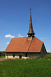
13270 Upload a file Kapelle Saint-Protais Kapelle Saint-Protais No images B G Vers la Chapelle 16 [[:Category:|]]
46° 37′ 25.51″ N, 6° 59′ 15.34″ E Kartographer map based on OpenStreetMap.View all coordinates using: OpenStreetMapinfo


2341 Upload a file Kirche Sainte-Marguerite Kirche Sainte-Marguerite No images B G Rue du Château [[:Category:|]]
46° 37′ 25.88″ N, 6° 59′ 35.31″ E Kartographer map based on OpenStreetMap.View all coordinates using: OpenStreetMapinfo


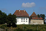
2340 Upload a file Schloss Vaulruz Schloss Vaulruz No images B G Le Château 1 [[:Category:|]]
46° 37′ 28.97″ N, 6° 59′ 39.28″ E Kartographer map based on OpenStreetMap.View all coordinates using: OpenStreetMapinfo