Commons:WikiProject Flag-map

The Flag map set has some common characteristics for all its flag-maps:
Country flags
editFor a list of countries and their flags, see the following links to the English Wikipedia:
- African countries
- Flag of Antarctica
- Asian countries
- European countries
- North American countries
- Oceanian countries
- South American countries
The ultimate goal is a scalable, recognizable flag for every country in the world. Currently there is the following set, grouped by continent and alphabetically by country;
Syntax
editFlag-map of ("country, entry, state, department, province, community, organization, etc").svg
What is SVG?
editScalable vector graphics (SVG) is an XML specification and file format for describing two-dimensional vector graphics, both static and animated. It is stored plain-text or compressed (binary). It allows embedding of raster graphics (bitmaps) and text. See:
- Scalable Vector Graphics for detailed description
- SVG examples
SVG file type tags
editFor making use of elements from other SVG images available on Commons, please use {{Attrib}} – see Category:Vector images using elements from other vector images
All validated SVGs should be tagged {{Image generation}}, you will find them automatically sorted at Category:Valid SVG. Please do not categorize directly.
The World
edit
| Flag maps of the world for historical use | |
|
1789 · 1900 · 1908 · 1914 · 1930 · 1935 · 1938 · 1942 · 1946 · 1965 · 1970 · 1972 · 1974 · 1989 · 1990 · 1991 · 1992 · 1993 · 2001 · 2010 · 2012 · 2013 · 2015 · 2016 · 2017 · 2018 · 2021 · 2022 · 2023 · 2024 | |
| (this template: • view • discuss ) | |
North America
edit-
 Canada
 -
 Greenland
 -
 Mexico
 -
 St Pierre and Miquelon (Saint-Pierre et Miquelon)
 -
 United States


.png)

Canada
edit-
 Alberta
 -
 British Columbia
 -
 Manitoba
 -
 New Brunswick
 -
 Newfoundland and Labrador
 -
 Nova Scotia
 -
 Ontario
 -
 Prince Edward Island
 -
 Quebec
 -
 Saskatchewan


United States
edit-
 Alabama
 -
 Alaska
 -
 Arizona
 -
 Arkansas
 -
 California
 -
 Colorado
 -
 Connecticut
 -
 Florida
 -
 Hawaii
 -
 Idaho
Idaho -
 Iowa
Iowa -
 Kansas
 -
 Kentucky
 -
 Louisiana
 -
 Maine
Maine -
 Maryland
 -
 Massachusetts
 -
 Mississippi
 -
 Missouri
 -
 Montana
 -
 Nebraska
 -
 Nevada
 -
 New Hampshire
 -
 New Jersey
 -
 New Mexico
 -
 New York
 -
 North Carolina
 -
 North Dakota
 -
 Oklahoma
 -
 Oregon
 -
 Pennsylvania
 -
 Rhode Island
 -
 South Carolina
 -
 South Dakota
 -
 Tennessee
 -
 Texas
Texas -
 Utah
Utah -
 Vermont
 -
 Virginia
 -
 Washington
 -
 West Virginia
 -
 Wyoming


Central America
edit-
 Belize
 -
 Costa Rica
 -
 El Salvador
 -
 Guatemala
 -
 Honduras
 -
 Nicaragua
 -
 Panama


Caribbean
edit-
 Antigua and Barbuda
 -
 Aruba
Aruba -
 Bahamas
 -
 Barbados
 -
 British Virgin Islands
 -
 Bonaire
 -
 Cuba
Cuba -
 Curaçao
 -
 Grenada
 -
 Guadeloupe
 -
 Dominica
 -
 Dominican Republic
 -
 Haití
Haití -
 Jamaica
 -
 Martinique
 -
 Montserrat
 -
 Puerto Rico
 -
 Saint Kitts and Nevis
 -
 Saint Lucia
 -
 Saint Vincent and the Grenadines
 -
 Trinidad and Tobago
 -
 Turks and Caicos Islands


.svg)


South America
edit-
 Argentina
 -
 Bolivia
 -
 Bolivia (state)
 -
 Brazil
 -
 Colombia
 -
 Chile
Chile -
 Ecuador
 -
 French Guiana
 -
 Guyana
 -
 Paraguay
 -
 Peru
Peru -
 Peru (state)
 -
 Suriname
 -
 Uruguay
 -
 Venezuela

.png)


.svg)


Chile
edit-
 Magallanes y Antártica Chilena (Region)
 -
![Easter Island [also known as Rapa Nui or Isla de Pascua] (Special Territory)](https://upload.wikimedia.org/wikipedia/commons/thumb/b/ba/Flag_map_of_Easter_Island.svg/100px-Flag_map_of_Easter_Island.svg.png) Easter Island [also known as Rapa Nui or Isla de Pascua] (Special Territory)
Easter Island [also known as Rapa Nui or Isla de Pascua] (Special Territory) -
 Easter Island with the national flag (Special Territory)
 -
 Arica y Parinacota (Region)
 -
 Antofagasta (Region)
 -
 Atacama (Region)
 -
 Santiago de Chile (City and province)
 -
 Chilean Antarctic Territory (Territorial claim)

![Easter Island [also known as Rapa Nui or Isla de Pascua] (Special Territory)](/wiki/File:Flag_map_of_Easter_Island.svg)


Brazil
edit-
 Bahia
Bahia -
 São Paulo
 -
 São Paulo (State)


Asia
edit-
 Afghanistan
 -
 Bahrain
 -
 Bangladesh
 -
 Bhutan
 -
 Brunei
 -
 Cambodia
 -
 China
China -
 Cyprus
 -
 East Timor
 -
 Hong Kong
 -
 India
India -
 Indonesia
 -
 Indonesia
 -
 Iran
Iran -
 Iraq
Iraq -
 Israel
 -
 Japan
Japan -
 Jordan
 -
 Kazakhstan
 -
 Kuwait
 -
 Kyrgyzstan
 -
 Laos
Laos -
 Lebanon
 -
 Macau
Macau -
 Malaysia
 -
 Maldives
 -
 Mongolia
 -
 Myanmar
 -
 Nepal
Nepal -
 North Korea
 -
 Oman
Oman -
 Pakistan
 -
 Palestine
 -
 People's Republic of China
 -
 Philippines
 -
 Qatar
Qatar -
 Republic of China (Taiwan)
 -
 Saudi Arabia
 -
 Singapore
 -
 South Korea
 -
 Sri Lanka
 -
 Syria
Syria -
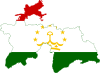 Tajikistan
 -
 Thailand
 -
 Turkey
 -
 Turkmenistan
 -
 United Arab Emirates
 -
 Thailand
 -
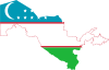 Uzbekistan
 -
 Vietnam
 -
 Vietnam
 -
 Yemen
Yemen
.svg)


.svg)


Oceania
edit-
 Australia
 -
 Fiji
Fiji -
 Federated States of Micronesia
 -
 Kiribati
 -
 New Zealand
 -
 Papua New Guinea


.png)
.svg)

Australia
edit-
 New South Wales
 -
 Tasmania
 -
 Victoria
 -
 Western Australia


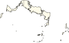
Europe
edit-
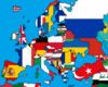 Europe
 -
 Albania
 -
 Austria
 -
 Belarus
 -
 Belgium
 -
 Armenia
 -
 Azerbaijan
 -
 Bosnia and Herzegovina
 -
 Bulgaria
 -
 Croatia
 -
Cyprus
-
 Czech Republic
 -
 Denmark
 -
 Estonia
 -
 Finland
 -
 France
 -
 Georgia
 -
 Germany
 -
 Greece
 -
 Hungary
 -
 Iceland
 -
 Ireland
 -
 Italy
Italy -
 Latvia
 -
 Lithuania
 -
 Luxembourg
 -
 Malta
Malta -
 Moldova
 -
 Montenegro
 -
 Netherlands
 -
 North Macedonia
 -
 Norway
 -
 Poland
 -
North Macedonia
-
 Portugal
 -
 Romania
 -
 Russia
 -
 Russia
 -
 Serbia (with Kosovo)
 -
 Serbia (without Kosovo)
 -
 Slovakia
 -
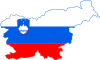 Slovenia
 -
 Spain
Spain -
 Spain (subdivisions)
 -
 Sweden
 -
 Switzerland
 -
 Ukraine
 -
 United Kingdom
 -
Turkey
-
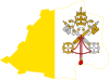 Vatican City
 -
 Yugoslavia
 -


.svg)
.svg)


.svg)


Spain
edit-
 Basque Country
 -
 Catalonia
 -
 Huelva


Italy
edit-
 Sicily

Czech Republic
edit-
 Central Bohemian Region
 -
 Hradec Králové Region
 -
 Karlovy Vary Region
 -
 Liberec Region
 -
 Moravian-Silesian Region
 -
 Olomouc Region
 -
 Pardubice Region
 -
 Plzeň Region
 -
 South Bohemian Region
 -
 South Moravian Region
 -
 Ústí nad Labem Region
 -
 Vysočina Region
 -
 Zlín Region


Africa
edit-
 Algeria
 -
 Angola
 -
 Benin
Benin -
 Botswana
 -
 Central African Repuiblic
 -
 Chad
Chad -
 Republic of the Congo
 -
 Democratic Republic of the Congo
 -
 Cote d'Ivoire
 -
 Djibouti
 -
 Egypt
Egypt -
 Eritrea
 -
 Eswatini
 -
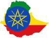 Ethiopia
 -
 Equatorial Guinea
 -
 Gabon
Gabon -
 Gambia
 -
 Ghana
Ghana -
 Guinea
 -
 Guinea-Bissau
 -
 Lesotho
 -
 Liberia
 -
 Libya
Libya -
 Madagascar
 -
 Malawi
 -
 Mali
Mali -
 Mauritania
 -
 Mauritius
 -
 Mozambique
 -
 Namibia
 -
 Niger
Niger -
 Nigeria
 -
 Rwanda
 -
 Sao Tome and Principe
 -
 Senegal
 -
 Seychelles
 -
 Sierra Leone
 -
 Somalia
 -
 South Africa
 -
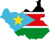 South Sudan
 -
 Sudan
Sudan -
 Swaziland
 -
 Tanzania
 -
 Togo
Togo -
 Tunisia
 -
 Uganda
 -
 Western Sahara
 -
 Western Sahara (by Spain)
 -
 Western Sahara (by Morocco)
 -
Western Sahara (by Sahrawi Arab Democratic Republic)
-
 Zambia
 -
 Zimbabwe
 -
Zimbabwe
-
 Mayotte


.svg)


.png)
.png)
.png)
.png)
.png)
.png)
.png)
.png)
.png)
.png)
.png)
.png)
.png)
.png)
.png)
.png)
.png)
.png)
.png)
.png)
.png)
.png)
.png)
.png)
.png)
.png)
.png)
.png)
.png)
.png)
Members
editIf you have an account on Commons, you can sign up by adding *~~~ to a new line below:
- Atesh
- Darwinek
- TK1244
- Fry1989
- Fred the Oyster (talk)
- Alvin Lee (talk)
- Scribblium ([[User talk:Scribblium|
- ZavierPalz (talk)
talk]])