| Name
|
Heritage list
|
Place
|
Street address
|
Coordinates
|
place_id
|
Image
|
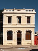
| Fmr Bank of New South Wales (NSW) (Q66975190)
|
State Registered Place
|
Cue
|
|
27°25′26″S 117°53′54″E / 27.423963°S 117.898443°E / -27.423963; 117.898443
|
631
|

|
| Forestry Houses, State Forest No 2 (Q56052930)
|
State Registered Place
|
Ludlow
|
|
33°36′08″S 115°28′50″E / 33.60222573°S 115.4804264°E / -33.60222573; 115.4804264
|
14872
|
|
| Former Bateman's Warehouse, 34 Mouat Street (Q56052933)
|
State Registered Place
|
|
|
32°03′23″S 115°44′38″E / 32.05635598°S 115.7439228°E / -32.05635598; 115.7439228
|
22562
|

|
| Former Court House (Q66975192)
|
State Registered Place
|
Yalgoo
|
|
28°20′29″S 116°40′54″E / 28.341438°S 116.681639°E / -28.341438; 116.681639
|
24431
|

|
| Former Dalgetys bond store, 2 High Street (Q56052934)
|
State Registered Place
|
|
|
32°03′20″S 115°44′31″E / 32.05560267°S 115.7418316°E / -32.05560267; 115.7418316
|
22535
|
|
| Former Gaol (Q56052935)
|
State Registered Place
|
|
|
28°20′29″S 116°40′54″E / 28.34126124°S 116.6816684°E / -28.34126124; 116.6816684
|
23795
|

|
| Former Headmaster's House (Q56052936)
|
State Registered Place
|
|
|
35°01′22″S 117°52′56″E / 35.0228807°S 117.8822442°E / -35.0228807; 117.8822442
|
24544
|

|
| Former Married Officers Quarters (Q66975195)
|
State Registered Place
|
Fremantle
|
|
32°02′40″S 115°45′14″E / 32.044442°S 115.753837°E / -32.044442; 115.753837
|
21555
|
|
| Former Mine Office (Q66975202)
|
State Registered Place
|
Gwalia
|
|
28°54′54″S 121°20′05″E / 28.914984°S 121.334676°E / -28.914984; 121.334676
|
24492
|

|
| Former Police Station (Q56052937)
|
State Registered Place
|
East Fremantle
|
|
32°02′29″S 115°45′45″E / 32.04132227°S 115.7626265°E / -32.04132227; 115.7626265
|
24909
|

|
| Former Railway Barracks (Q56052938)
|
State Registered Place
|
|
|
27°25′26″S 117°54′10″E / 27.42396586°S 117.9027693°E / -27.42396586; 117.9027693
|
17772
|
|
| Former Railway Master's House (Q66975203)
|
State Registered Place
|
Cue
|
|
27°25′36″S 117°53′54″E / 27.426624°S 117.898355°E / -27.426624; 117.898355
|
17773
|
|
| Former Railway Worker's Cottage (1) (Q66975205)
|
State Registered Place
|
Cue
|
|
27°25′39″S 117°53′52″E / 27.4274°S 117.897728°E / -27.4274; 117.897728
|
17774
|
|
| Former Railway Worker's Cottage (2) (Q66975206)
|
State Registered Place
|
Cue
|
|
27°25′39″S 117°53′52″E / 27.4274°S 117.897728°E / -27.4274; 117.897728
|
17775
|
|
| Former Strelitz Brothers Warehouse (Q66975210)
|
State Registered Place
|
Fremantle
|
|
32°03′21″S 115°44′37″E / 32.05584°S 115.743704°E / -32.05584; 115.743704
|
21315
|
|
| Former Victoria Coffee Palace (Q66975213)
|
State Registered Place
|
Fremantle
|
|
32°03′16″S 115°44′40″E / 32.054485°S 115.744493°E / -32.054485; 115.744493
|
22566
|
|
| Former Yalgoo Railway Station (Q66975197)
|
State Registered Place
|
Yalgoo
|
|
28°20′58″S 116°40′57″E / 28.349394°S 116.682393°E / -28.349394; 116.682393
|
24409
|

|
| Forrest Homestead (Q66975214)
|
State Registered Place
|
Wollaston
|
|
33°21′11″S 115°41′05″E / 33.353073°S 115.684602°E / -33.353073; 115.684602
|
381
|
|
| Forrest's Leschenault Water Mill & Mill Race - Site (Q66975216)
|
State Registered Place
|
Picton
|
|
33°21′09″S 115°41′02″E / 33.352416°S 115.683818°E / -33.352416; 115.683818
|
5676
|
|
| Fossil Downs Station (Q5473466)
|
State Registered Place
|
|
|
18°08′20″S 125°46′33″E / 18.138996°S 125.775734°E / -18.138996; 125.775734
|
697
|

|
| Fothergill Street Precinct (Q66975218)
|
State Registered Place
|
Fremantle
|
|
32°03′22″S 115°45′28″E / 32.056002°S 115.75765°E / -32.056002; 115.75765
|
9241
|

|
| Fowler's Warehouse (Q5476396)
|
State Registered Place
|
|
|
32°03′22″S 115°44′41″E / 32.056021°S 115.744733°E / -32.056021; 115.744733
|
889
|

|
| Frank Cadd Building (Q28225169)
|
State Registered Place
|
|
|
32°03′16″S 115°44′37″E / 32.054414°S 115.743505°E / -32.054414; 115.743505
|
983
|
|
| Frank Wise Institute of Tropical Agriculture (Q66975221)
|
State Registered Place
|
Kununurra
|
|
15°39′11″S 128°42′20″E / 15.653054°S 128.705497°E / -15.653054; 128.705497
|
16601
|
|
| Freemasons Hall, Subiaco (Q66975223)
|
State Registered Place
|
Subiaco
|
|
31°56′45″S 115°49′58″E / 31.945822°S 115.832778°E / -31.945822; 115.832778
|
2444
|

|
| Freemasons Hotel, Bridgetown (Q66975224)
|
State Registered Place
|
Bridgetown
|
|
33°57′30″S 116°08′15″E / 33.958467°S 116.13742°E / -33.958467; 116.13742
|
248
|

|
| Fremantle Arts Centre (Q5501470)
|
State Registered Place
|
Fremantle
|
|
32°02′51″S 115°45′15″E / 32.047468636943°S 115.75413727805116°E / -32.04746863694264; 115.75413727805116
|
875
|

|
| Fremantle Buffalo Club building (Q66975226)
|
State Registered Place
|
Fremantle
|
|
32°03′18″S 115°44′40″E / 32.054929°S 115.744563°E / -32.054929; 115.744563
|
24832
|
|
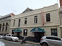
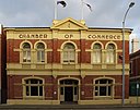
| Fremantle Chamber of Commerce Building (Q56052570)
|
State Registered Place
|
|
|
32°03′15″S 115°44′35″E / 32.05420182°S 115.7429167°E / -32.05420182; 115.7429167
|
980
|
|
| Fremantle Club building (Q66975227)
|
State Registered Place
|
Fremantle
|
|
32°03′20″S 115°44′47″E / 32.055566°S 115.746303°E / -32.055566; 115.746303
|
20203
|
|
| Fremantle Fire Station (Q66493922)
|
State Registered Place
|
Fremantle
|
|
32°03′13″S 115°44′37″E / 32.053682°S 115.743473°E / -32.053682; 115.743473
|
14510
|

|
| Fremantle Grammar School (Q5501487)
|
State Registered Place
|
|
|
32°03′04″S 115°45′22″E / 32.05112°S 115.756206°E / -32.05112; 115.756206
|
894
|

|
| Fremantle Infants' and Girls' School building (Q56052970)
|
State Registered Place
|
|
|
32°03′24″S 115°44′56″E / 32.05662485°S 115.7488206°E / -32.05662485; 115.7488206
|
1008
|

|
| Fremantle Markets (Q5501495)
|
State Registered Place
|
Fremantle
|
|
32°03′22″S 115°44′57″E / 32.0562°S 115.749212°E / -32.0562; 115.749212
|
1006
|

|
| Fremantle Municipal Tramways Car Barn (Q65549200)
|
State Registered Place
|
Fremantle
|
|
32°03′23″S 115°44′32″E / 32.056432°S 115.742166°E / -32.056432; 115.742166
|
897
|

|
| Fremantle Navy Club building (Q56052397)
|
State Registered Place
|
|
|
32°03′17″S 115°44′41″E / 32.05481994°S 115.744721°E / -32.05481994; 115.744721
|
918
|
|
| Fremantle Oval (Q5501496)
|
State Registered Place
|
Fremantle
|
|
32°03′22″S 115°45′05″E / 32.056111°S 115.751389°E / -32.056111; 115.751389
|
15464
|

|
| Fremantle Passenger Terminal (Q5501497)
|
State Registered Place
|
|
|
32°02′51″S 115°44′52″E / 32.04744016°S 115.7477384°E / -32.04744016; 115.7477384
|
3363
|

|
| Fremantle Police Station complex (Q5501499)
|
State Registered Place
|
Fremantle
|
|
32°03′17″S 115°45′01″E / 32.054817°S 115.750199°E / -32.054817; 115.750199
|
878
|

|
| Fremantle Port Authority Building (Q66377319)
|
State Registered Place
|
|
|
32°03′15″S 115°44′29″E / 32.054272°S 115.741339°E / -32.054272; 115.741339
|
20055
|

|
| Fremantle Post Office (Q5501500)
|
State Registered Place
|
Fremantle
|
|
32°03′12″S 115°44′44″E / 32.053456°S 115.745623°E / -32.053456; 115.745623
|
951
|

|
| Fremantle Prison (Q3089169)
|
State Registered Place
|
Fremantle
|
|
32°03′18″S 115°45′11″E / 32.055039°S 115.753177°E / -32.055039; 115.753177
|
25529 1014
25529
|

|
| Fremantle Providoring Company (Q56052966)
|
State Registered Place
|
|
|
32°03′15″S 115°44′44″E / 32.0542364°S 115.7454763°E / -32.0542364; 115.7454763
|
944
|
|
| Fremantle School building (Q22271767)
|
State Registered Place
|
|
|
32°03′02″S 115°44′57″E / 32.050683°S 115.749061°E / -32.050683; 115.749061
|
842
|
|
| Fremantle Station (Q5501510)
|
State Registered Place
|
Fremantle
|
|
32°03′08″S 115°44′43″E / 32.052085°S 115.745293°E / -32.052085; 115.745293
|
974
|

|
| Fremantle Substation (Q65092183)
|
State Registered Place
|
|
|
32°03′01″S 115°45′02″E / 32.050299°S 115.750581°E / -32.050299; 115.750581
|
3711
|

|
| Fremantle Synagogue (Q28220391)
|
State Registered Place
|
|
|
32°03′25″S 115°44′59″E / 32.05683°S 115.74975°E / -32.05683; 115.74975
32°03′24″S 115°44′59″E / 32.056737°S 115.749852°E / -32.056737; 115.749852
|
1010
|

|
| Fremantle Technical School building (Q28224680)
|
State Registered Place
|
|
|
32°03′23″S 115°44′55″E / 32.05646°S 115.74859°E / -32.05646; 115.74859
|
1007
|

|
| Fremantle Town Hall (Q5501504)
|
State Registered Place
|
Fremantle
|
|
32°03′15″S 115°44′52″E / 32.054293°S 115.7479°E / -32.054293; 115.7479
|
1015
|

|
| Fremantle Trades Hall (Q28220302)
|
State Registered Place
|
Fremantle
|
|
32°03′25″S 115°44′45″E / 32.057°S 115.7457°E / -32.057; 115.7457
|
864
|

|
| Fremantle Traffic Bridge & Ferry Capstan Base (Q56052971)
|
State Registered Place
|
|
|
32°02′28″S 115°45′17″E / 32.04102675°S 115.7546326°E / -32.04102675; 115.7546326
|
4027
|
|
| Fremantle War Memorial (Q5501505)
|
State Registered Place
|
Monument Hill
|
|
32°03′09″S 115°45′25″E / 32.05258199°S 115.7570704°E / -32.05258199; 115.7570704
|
22533
|

|
| Fremantle West End Heritage Area (Q28220373)
|
State Registered Place
|
Fremantle
|
|
|
25225
|

|
| Fremantle-Peel District Education Office (Q66498278)
|
State Registered Place
|
Beaconsfield
|
|
32°04′03″S 115°45′28″E / 32.067444°S 115.757837°E / -32.067444; 115.757837
|
1031
|

|
| Frenchman Bay Whaling Station (Q56052974)
|
State Registered Place
|
|
|
35°05′33″S 117°56′53″E / 35.09261917°S 117.9481555°E / -35.09261917; 117.9481555
|
16612
|

|
| Freshwater Bay Boatsheds, Peppermint Grove (Q66975241)
|
State Registered Place
|
Peppermint Grove
|
|
32°00′04″S 115°46′22″E / 32.001207°S 115.772863°E / -32.001207; 115.772863
|
17290
|

|
| Galbraith's Store (Q64582094)
|
State Registered Place
|
|
|
20°40′40″S 117°11′16″E / 20.67772°S 117.187759°E / -20.67772; 117.187759
|
2344
|

|
| Gallop House (Q66975242)
|
State Registered Place
|
Dalkeith
|
|
31°59′46″S 115°48′40″E / 31.995976°S 115.811055°E / -31.995976; 115.811055
|
1834
|

|
| Garratt Road Bridge (Q18694483)
|
State Registered Place
|
Bayswater
|
|
31°55′57″S 115°54′59″E / 31.932439°S 115.916439°E / -31.932439; 115.916439
|
11342
|

|
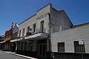
| Garrick Theatre (Q5523991)
|
State Registered Place
|
|
|
31°54′00″S 115°58′19″E / 31.89993551°S 115.9720714°E / -31.89993551; 115.9720714
|
2469
|

|
| Garryowen (Q66975244)
|
State Registered Place
|
Albany
|
|
35°01′31″S 117°52′43″E / 35.025333°S 117.878655°E / -35.025333; 117.878655
|
15562
|
|
| Gascoyne Research Station (Q66975246)
|
State Registered Place
|
Carnarvon
|
|
24°51′07″S 113°43′54″E / 24.851848°S 113.73165°E / -24.851848; 113.73165
|
6839
|
|
| Gascoyne River Bridge (Q66975247)
|
State Registered Place
|
Carnarvon
|
|
24°49′40″S 113°46′09″E / 24.827698°S 113.769232°E / -24.827698; 113.769232
|
463
|

|
| Geegelup Health Food Shop (Q66975249)
|
State Registered Place
|
Bridgetown
|
|
33°57′31″S 116°08′15″E / 33.958638°S 116.137369°E / -33.958638; 116.137369
|
2996
|

|
| General Post Office, Perth (Q5532116)
|
State Registered Place
|
|
|
31°57′08″S 115°51′32″E / 31.952215°S 115.858855°E / -31.952215; 115.858855
|
1979
|

|
| General Store (Q71267064)
|
State Registered Place
|
|
|
31°59′45″S 115°32′26″E / 31.995905°S 115.540453°E / -31.995905; 115.540453
|
527
|
|
| Geraldton Club (Q66975251)
|
State Registered Place
|
Geraldton
|
|
28°46′27″S 114°36′29″E / 28.774249°S 114.60802°E / -28.774249; 114.60802
|
1069
|
|
| Geraldton Court House (Q66975252)
|
State Registered Place
|
Geraldton
|
|
28°46′16″S 114°36′44″E / 28.771164°S 114.612096°E / -28.771164; 114.612096
|
1072
|

|
| Geraldton Customs House Complex (Q66975254)
|
State Registered Place
|
Geraldton
|
|
28°46′38″S 114°36′15″E / 28.777304°S 114.604168°E / -28.777304; 114.604168
|
3940
|
|
| Geraldton District Honour Roll, Birdwood House (Q66975256)
|
State Registered Place
|
Geraldton
|
|
28°44′43″S 114°37′18″E / 28.745225°S 114.621594°E / -28.745225; 114.621594
|
12422
|
|
| Geraldton Drill Hall Complex (Q38158133)
|
State Registered Place
|
Geraldton
|
|
28°46′33″S 114°36′35″E / 28.775769°S 114.609756°E / -28.775769; 114.609756
|
1065
|
|
| Geraldton Lighthouse Tower & Quarters (Q66975259)
|
State Registered Place
|
Bluff Point
|
|
28°44′37″S 114°37′17″E / 28.743641°S 114.621411°E / -28.743641; 114.621411
|
1074
|

|
| Geraldton Police Barracks (Q66975261)
|
State Registered Place
|
Geraldton
|
|
28°46′35″S 114°36′32″E / 28.776264°S 114.608769°E / -28.776264; 114.608769
|
1062
|
|
| Geraldton Primary School (Q66975263)
|
State Registered Place
|
Geraldton
|
|
28°46′43″S 114°36′29″E / 28.778588°S 114.608025°E / -28.778588; 114.608025
|
13390
|

|
| Geraldton Residency (Q66975267)
|
State Registered Place
|
Geraldton
|
|
28°46′40″S 114°36′09″E / 28.777861°S 114.602608°E / -28.777861; 114.602608
|
3715
|
|
| Geraldton Town Hall (Q66975270)
|
State Registered Place
|
Geraldton
|
|
28°46′24″S 114°36′41″E / 28.773413°S 114.61133°E / -28.773413; 114.61133
|
1058
|

|
| Geraldton railway station (Q20717401)
|
State Registered Place
|
Geraldton
|
|
28°46′01″S 114°36′54″E / 28.766909°S 114.6151°E / -28.766909; 114.6151
|
1052
|

|
| Geraldton to Walkaway Railway Precinct (Q66975268)
|
State Registered Place
|
Geraldton
|
|
28°46′30″S 114°38′37″E / 28.774891°S 114.643604°E / -28.774891; 114.643604
|
1259
|
|
| Gingin Post Office (Q56053000)
|
State Registered Place
|
|
|
31°20′44″S 115°54′18″E / 31.34568775°S 115.9049351°E / -31.34568775; 115.9049351
|
1076
|

|
| Gingin Railway Station and Quarters (Q56053001)
|
State Registered Place
|
|
|
31°21′03″S 115°54′17″E / 31.35088378°S 115.9048445°E / -31.35088378; 115.9048445
|
1082
|
|
| Glanville's Buildings (Q56053002)
|
State Registered Place
|
East Fremantle
|
|
32°02′29″S 115°45′34″E / 32.04149764°S 115.7593183°E / -32.04149764; 115.7593183
|
3352
|

|
| Glasgow House (Q24896754)
|
State Registered Place
|
|
|
35°01′37″S 117°53′11″E / 35.026943°S 117.886424°E / -35.026943; 117.886424
|
62
|

|
| Gledden Building (Q5567465)
|
State Registered Place
|
Perth
|
|
31°57′14″S 115°51′26″E / 31.95377338°S 115.8571354°E / -31.95377338; 115.8571354
|
2002
|

|
| Glen Forrest Hall (Q56053004)
|
State Registered Place
|
Glen Forrest
|
|
31°54′35″S 116°05′59″E / 31.90975666°S 116.0998206°E / -31.90975666; 116.0998206
|
1691
|

|
| Glenbourne Homestead (Q56053005)
|
State Registered Place
|
|
|
33°54′55″S 115°00′40″E / 33.9153255°S 115.0112293°E / -33.9153255; 115.0112293
|
116
|
|
| Glengarry Station Complex (Q56053006)
|
State Registered Place
|
Moonyoonooka
|
|
28°49′40″S 114°49′27″E / 28.8278535°S 114.8241076°E / -28.8278535; 114.8241076
|
3726
|
|
| Glentromie Farm Group (Q56053007)
|
State Registered Place
|
|
|
30°54′45″S 116°14′25″E / 30.91243668°S 116.2403672°E / -30.91243668; 116.2403672
|
12874
|
|
| Globe Hotel (Q66975272)
|
State Registered Place
|
Perth
|
|
31°57′06″S 115°51′31″E / 31.951756°S 115.85849°E / -31.951756; 115.85849
|
14888
|

|
| Gloucester Park (Q5572069)
|
State Registered Place
|
|
|
31°57′26″S 115°52′54″E / 31.95718675°S 115.881665°E / -31.95718675; 115.881665
|
2170
|

|
| Gnarlbine Soaks (Well No.22) (Q66975273)
|
State Registered Place
|
Coolgardie
|
|
31°08′50″S 120°57′35″E / 31.147241°S 120.959678°E / -31.147241; 120.959678
|
556
|
|
| Gnowangerup Noongar Centre (Q66975275)
|
State Registered Place
|
Gnowangerup
|
|
33°56′22″S 118°00′18″E / 33.939376°S 118.004992°E / -33.939376; 118.004992
|
5072
|

|
| Godfrey House (Q66975277)
|
State Registered Place
|
Subiaco
|
|
31°56′45″S 115°50′19″E / 31.945789°S 115.838611°E / -31.945789; 115.838611
|
5568
|

|
| Gogo Station (Q5577415)
|
State Registered Place
|
St George Ranges
|
|
18°17′32″S 125°35′02″E / 18.2922°S 125.584°E / -18.2922; 125.584
|
698
|

|
| Golden Valley (Q66975280)
|
State Registered Place
|
Balingup
|
|
33°47′57″S 115°59′35″E / 33.799068°S 115.993143°E / -33.799068; 115.993143
|
707
|

|
| Goods Shed Wyalkatchem (Q66975282)
|
State Registered Place
|
Wyalkatchem
|
|
31°10′51″S 117°22′51″E / 31.180797°S 117.380921°E / -31.180797; 117.380921
|
16982
|
|
| Goomalling Post Office & Quarters (Q66975283)
|
State Registered Place
|
Goomalling
|
|
31°17′56″S 116°49′37″E / 31.298797°S 116.827049°E / -31.298797; 116.827049
|
1114
|

|
| Government Buildings (Q66975285)
|
State Registered Place
|
Marble Bar
|
|
21°10′21″S 119°44′32″E / 21.172458°S 119.742353°E / -21.172458; 119.742353
|
814
|
|
| Government Buildings, Kalgoorlie (Q66975287)
|
State Registered Place
|
Kalgoorlie
|
|
30°44′48″S 121°28′22″E / 30.746547°S 121.472874°E / -30.746547; 121.472874
|
1291
|

|
| Government House Ballroom (Q66975288)
|
State Registered Place
|
Perth
|
|
31°57′26″S 115°51′42″E / 31.957331°S 115.861744°E / -31.957331; 115.861744
|
2096
|

|
| Government House and Grounds (Q5588883)
|
State Registered Place
|
|
|
31°57′28″S 115°51′44″E / 31.9578078°S 115.8622205°E / -31.9578078; 115.8622205
|
2095
|

|
| Government Jetty, Albany (Q24896680)
|
State Registered Place
|
|
|
34°56′56″S 117°58′38″E / 34.9488°S 117.9772°E / -34.9488; 117.9772
|
15582
|

|
| Government Printing Office (Q66975290)
|
State Registered Place
|
Perth
|
|
31°57′15″S 115°51′48″E / 31.954109°S 115.863198°E / -31.954109; 115.863198
|
3470
|

|
| Government Quarries (Q66975291)
|
State Registered Place
|
Boya
|
|
31°55′21″S 116°03′55″E / 31.922578°S 116.06533°E / -31.922578; 116.06533
|
16788
|

|
| Government School, Cue (Q66975293)
|
State Registered Place
|
Cue
|
|
27°25′15″S 117°53′46″E / 27.420903°S 117.89603°E / -27.420903; 117.89603
|
644
|
|
| Governor Kennedy Fountain & Plane Trees West of Fountain (Q66975294)
|
State Registered Place
|
West Perth
|
|
31°57′48″S 115°50′30″E / 31.963439°S 115.84176°E / -31.963439; 115.84176
|
2185
|

|
| Graham Flats (Q66975296)
|
State Registered Place
|
West Perth
|
|
31°56′56″S 115°50′29″E / 31.948848°S 115.841397°E / -31.948848; 115.841397
|
4559
|

|
| Grand Central Hotel (Q66975297)
|
State Registered Place
|
Bunbury
|
|
33°19′25″S 115°38′12″E / 33.323705°S 115.636616°E / -33.323705; 115.636616
|
369
|

|
| Grasmere (Q21891417)
|
State Registered Place
|
|
|
32°02′43″S 115°51′29″E / 32.04533°S 115.85814°E / -32.04533; 115.85814
|
1546
|

|
| Gray's Store (Q66975299)
|
State Registered Place
|
Greenough
|
|
28°57′10″S 114°44′16″E / 28.952698°S 114.737674°E / -28.952698; 114.737674
|
1153
|

|
| Graylands Hospital (Q5598317)
|
State Registered Place
|
Mount Claremont
|
|
31°57′43″S 115°47′28″E / 31.962062248089°S 115.79112892129942°E / -31.962062248088515; 115.79112892129942
|
13630
|

|
| Great Fingall Mine office (Q81584125)
|
State Registered Place
|
Day Dawn
|
|
27°27′34″S 117°51′27″E / 27.459444°S 117.8575°E / -27.459444; 117.8575
|
627
|

|
| Great Southern Roller Flour Mill (Q66975302)
|
State Registered Place
|
North Fremantle
|
|
32°01′40″S 115°45′11″E / 32.027793°S 115.753111°E / -32.027793; 115.753111
|
3645
|

|
| Greenough Court House, Police Station and Gaol (Q56053032)
|
State Registered Place
|
Greenough
|
|
28°56′35″S 114°44′39″E / 28.94303642°S 114.7441442°E / -28.94303642; 114.7441442
|
1157
|
|
| Greenough Hotel (former) (Q56053033)
|
State Registered Place
|
Greenough
|
|
28°56′12″S 114°44′28″E / 28.93661979°S 114.7411423°E / -28.93661979; 114.7411423
|
1143
|
|
| Greenough Pioneer Cemetery (Q56053034)
|
State Registered Place
|
Greenough
|
|
28°56′03″S 114°44′23″E / 28.93404281°S 114.7396731°E / -28.93404281; 114.7396731
|
1133
|
|
| Greenough Road Board Office (former) (Q56053035)
|
State Registered Place
|
Greenough
|
|
28°56′33″S 114°44′36″E / 28.94255593°S 114.7434504°E / -28.94255593; 114.7434504
|
1159
|
|
| Grieve and Piper Buildings (Q56053036)
|
State Registered Place
|
Fremantle
|
|
32°03′21″S 115°44′38″E / 32.05596796°S 115.7437581°E / -32.05596796; 115.7437581
|
962
|
|
| Group of Four Houses at 19-25 Suffolk Street (Q56053037)
|
State Registered Place
|
|
|
32°03′30″S 115°44′58″E / 32.05838257°S 115.7495479°E / -32.05838257; 115.7495479
|
3481
|

|
| Guildford Cemetery (Q5615794)
|
State Registered Place
|
South Guildford
|
|
31°55′12″S 115°58′43″E / 31.91988567°S 115.9785458°E / -31.91988567; 115.9785458
|
4647
|

|
| Guildford Court House and Gaol (former) (Q56053038)
|
State Registered Place
|
|
|
31°53′52″S 115°58′19″E / 31.89778435°S 115.9720678°E / -31.89778435; 115.9720678
|
2479
|

|
| Guildford Fire Station & Quarters (Q56053039)
|
State Registered Place
|
|
|
31°54′03″S 115°58′19″E / 31.90086187°S 115.9720717°E / -31.90086187; 115.9720717
|
8806
|

|
| Guildford Gaol (Q66975304)
|
State Registered Place
|
Guildford
|
|
31°53′52″S 115°58′19″E / 31.897865°S 115.972014°E / -31.897865; 115.972014
|
23545
|

|
| Guildford Grammar School (Q3119537)
|
State Registered Place
|
|
|
31°53′44″S 115°58′48″E / 31.8956°S 115.98°E / -31.8956; 115.98
|
2470
|

|
| Guildford Grammar School Chapel (Q5615825)
|
State Registered Place
|
|
|
31°53′41″S 115°58′52″E / 31.89483486°S 115.9811606°E / -31.89483486; 115.9811606
|
2487
|

|
| Guildford Hotel (Q63358589)
|
State Registered Place
|
Guildford
|
|
31°53′59″S 115°58′07″E / 31.899654°S 115.968575°E / -31.899654; 115.968575
|
2463
|

|
| Guildford Post Office (Q66975307)
|
State Registered Place
|
Guildford
|
|
31°53′55″S 115°58′19″E / 31.898659°S 115.972071°E / -31.898659; 115.972071
|
2480
|

|
| Guildford Primary School (Q66975308)
|
State Registered Place
|
Guildford
|
|
31°54′08″S 115°58′04″E / 31.902329°S 115.967888°E / -31.902329; 115.967888
|
4088
|

|
| Guildford Railway Bridge (Q54641691)
|
State Registered Place
|
|
|
31°53′58″S 115°57′38″E / 31.89949°S 115.96054°E / -31.89949; 115.96054
|
13160
|

|
| Guildford Road Bridge (Q54263437)
|
State Registered Place
|
Bassendean
|
|
31°54′01″S 115°57′40″E / 31.900254°S 115.961219°E / -31.900254; 115.961219
|
14558
|

|
| Guildford Town Hall (Q45919594)
|
State Registered Place
|
Guildford
|
|
31°53′59″S 115°58′19″E / 31.899632°S 115.972071°E / -31.899632; 115.972071
|
2460
|

|
| Guildford railway station (Q5615858)
|
State Registered Place
|
|
|
31°53′56″S 115°57′58″E / 31.8989°S 115.966°E / -31.8989; 115.966
|
17684
|

|
| Gun House (Q66975312)
|
State Registered Place
|
Fremantle
|
|
32°02′36″S 115°45′21″E / 32.043347°S 115.755891°E / -32.043347; 115.755891
|
23317
|

|
| Guppy's House (Q66975313)
|
State Registered Place
|
Guildford
|
|
31°53′52″S 115°58′02″E / 31.89784°S 115.967197°E / -31.89784; 115.967197
|
2489
|
|
| Gwalia Museum Group (Q66975315)
|
State Registered Place
|
Gwalia
|
|
28°54′53″S 121°20′03″E / 28.914675°S 121.334288°E / -28.914675; 121.334288
|
1465
|
|
| Gwalia Townsite Precinct (Q66975316)
|
State Registered Place
|
Leonora
|
|
28°54′40″S 121°19′52″E / 28.911021°S 121.331169°E / -28.911021; 121.331169
|
1459
|

|
| Gwambygine Homestead (Q19874052)
|
State Registered Place
|
|
|
31°58′51″S 116°48′22″E / 31.9809°S 116.806°E / -31.9809; 116.806
|
14880
|

|
| HMAS Nizam Memorial (Q105745381)
|
State Registered Place
|
|
|
34°22′30″S 115°08′12″E / 34.375058217824°S 115.13678817544148°E / -34.37505821782436; 115.13678817544148
|
4976
|

|
| Hackett Hall (Q66975318)
|
State Registered Place
|
Northbridge
|
|
31°56′59″S 115°51′41″E / 31.949592041144°S 115.8612997459768°E / -31.94959204114414; 115.8612997459768
|
2026
|

|
| Hackett Memorial Buildings (Q66975320)
|
State Registered Place
|
Crawley
|
|
31°58′35″S 115°49′04″E / 31.976256°S 115.817733°E / -31.976256; 115.817733
|
3519
|

|
| Haddrill's House (Q66975321)
|
State Registered Place
|
Henley Brook
|
|
31°49′12″S 116°00′23″E / 31.819966°S 116.006253°E / -31.819966; 116.006253
|
2493
|
|
| Halco Tackle factory (Q56054345)
|
State Registered Place
|
|
|
32°03′13″S 115°44′41″E / 32.05370725°S 115.7447801°E / -32.05370725; 115.7447801
|
22565
|
|
| Hall's Cottage (Q66975323)
|
State Registered Place
|
Mandurah
|
|
32°32′01″S 115°42′49″E / 32.53361°S 115.713651°E / -32.53361; 115.713651
|
1485
|

|
| Halley's Comet Gold Mine, Marble Bar (Q66975325)
|
State Registered Place
|
Marble Bar
|
|
21°14′02″S 119°43′34″E / 21.233882°S 119.726038°E / -21.233882; 119.726038
21°14′01″S 119°43′32″E / 21.233689°S 119.725565°E / -21.233689; 119.725565
|
14198
|
|
| Halliday House (Q66975326)
|
State Registered Place
|
Bayswater
|
|
31°55′32″S 115°55′10″E / 31.925632°S 115.919318°E / -31.925632; 115.919318
|
3260
|

|
| Halls Creek Trackers' Hut (Q66975328)
|
State Registered Place
|
Halls Creek
|
|
18°13′28″S 127°39′57″E / 18.2245°S 127.665746°E / -18.2245; 127.665746
|
3241
|
|
| Hamel Nursery (Q66975329)
|
State Registered Place
|
Hamel
|
|
32°52′05″S 115°55′17″E / 32.86802°S 115.921464°E / -32.86802; 115.921464
|
3084
|

|
| Hammond Park Rotunda (Q66975331)
|
State Registered Place
|
Kalgoorlie
|
|
30°44′30″S 121°27′12″E / 30.74161°S 121.453216°E / -30.74161; 121.453216
|
1269
|
|
| Hampton Arms (Q66975333)
|
State Registered Place
|
Greenough
|
|
28°57′52″S 114°45′09″E / 28.964479°S 114.752621°E / -28.964479; 114.752621
|
1151
|
|
| Hannan's Club (Q56053068)
|
State Registered Place
|
Kalgoorlie
|
|
30°44′42″S 121°28′21″E / 30.74509675°S 121.4723813°E / -30.74509675; 121.4723813
|
1266
|
|
| Hanoe's Cottage (Q56053069)
|
State Registered Place
|
|
|
17°57′12″S 122°14′35″E / 17.95321148°S 122.2429229°E / -17.95321148; 122.2429229
|
2668
|

|
| Harold Boas Gardens (Q56053070)
|
State Registered Place
|
West Perth
|
|
31°56′48″S 115°50′41″E / 31.94660922°S 115.8448043°E / -31.94660922; 115.8448043
|
4241
|

|
| Harper's Buildings (Q56053071)
|
State Registered Place
|
Perth
|
|
31°57′10″S 115°51′19″E / 31.95273054°S 115.8552023°E / -31.95273054; 115.8552023
|
2007
|

|
| Harvest House, West Perth (Q111384740)
|
State Registered Place
|
|
|
31°57′03″S 115°50′48″E / 31.95083734051°S 115.84654232014655°E / -31.95083734051008; 115.84654232014655
|
3925
|

|
| Harvey Agricultural College (former) (Q56053072)
|
State Registered Place
|
|
|
33°04′31″S 115°54′48″E / 33.07538113°S 115.913252°E / -33.07538113; 115.913252
|
25228
|
|
| Hasell's Cottage (Q56053073)
|
State Registered Place
|
|
|
31°31′42″S 116°25′57″E / 31.5283584°S 116.4324997°E / -31.5283584; 116.4324997
|
3698
|
|
| Hassell Homestead (Q56053074)
|
State Registered Place
|
|
|
34°30′24″S 117°35′50″E / 34.50660219°S 117.5972348°E / -34.50660219; 117.5972348
|
2262
|

|
| Hawthorndene (Q56053075)
|
State Registered Place
|
|
|
35°01′03″S 117°54′12″E / 35.01748172°S 117.9032696°E / -35.01748172; 117.9032696
|
46
|
|
| Headframe and Winder House & Engine (Q66975335)
|
State Registered Place
|
Gwalia
|
|
28°54′53″S 121°20′04″E / 28.914657°S 121.334456°E / -28.914657; 121.334456
|
24523
|

|
| Heathcote Hospital (Q66975337)
|
State Registered Place
|
Applecross
|
|
32°00′14″S 115°50′36″E / 32.003877°S 115.843254°E / -32.003877; 115.843254
|
3289
|

|
| Henry Bull's Cottage (Q66975338)
|
State Registered Place
|
Belhus
|
|
31°46′43″S 115°59′59″E / 31.778482°S 115.999834°E / -31.778482; 115.999834
|
2536
|
|
| Henton Cottage (Q66975340)
|
State Registered Place
|
Australind
|
|
33°16′45″S 115°42′56″E / 33.279247°S 115.715606°E / -33.279247; 115.715606
|
1189
|

|
| Herdsman Lake Settlers Cottage (Q66975342)
|
State Registered Place
|
Churchlands
|
|
31°55′09″S 115°47′52″E / 31.919085°S 115.797642°E / -31.919085; 115.797642
|
3464
|

|
| Heritage Trails - Wireless Hill (Q66975343)
|
State Registered Place
|
Ardross
|
|
32°01′45″S 115°49′39″E / 32.029206°S 115.827582°E / -32.029206; 115.827582
|
17795
|

|
| Higgins Cut (Q66975345)
|
State Registered Place
|
Capel
|
|
33°32′28″S 115°29′38″E / 33.541136°S 115.493872°E / -33.541136; 115.493872
|
368
|
|
| Higham's Buildings (Q30622483)
|
State Registered Place
|
|
|
32°03′17″S 115°44′47″E / 32.05463889°S 115.74638889°E / -32.05463889; 115.74638889
|
927
|

|
| Highgate Hill Police Station, Lockup & Quarters (Q66975346)
|
State Registered Place
|
Perth
|
|
31°56′34″S 115°52′14″E / 31.942836°S 115.870636°E / -31.942836; 115.870636
|
4282
|
|
| Highgate Primary School (Q66975347)
|
State Registered Place
|
Perth
|
|
31°56′28″S 115°51′59″E / 31.941145°S 115.866367°E / -31.941145; 115.866367
|
2180
|

|
| Hill 60 (Q21968639)
|
State Registered Place
|
Rivervale
|
|
31°57′09″S 115°54′46″E / 31.952419430171°S 115.91264683538384°E / -31.9524194301712; 115.91264683538384
|
4490
|

|
| Hill View (Q66975348)
|
State Registered Place
|
Northampton
|
|
28°16′57″S 114°38′46″E / 28.282471°S 114.646109°E / -28.282471; 114.646109
|
8927
|
|
| Hillcrest (Q66975350)
|
State Registered Place
|
North Fremantle
|
|
32°02′02″S 115°45′23″E / 32.033768°S 115.756353°E / -32.033768; 115.756353
|
1035
|

|
| Hills' Residence (Q66975353)
|
State Registered Place
|
East Perth
|
|
31°57′27″S 115°52′11″E / 31.957443°S 115.869843°E / -31.957443; 115.869843
|
3235
|

|
| Hillside (Q66975354)
|
State Registered Place
|
Albany
|
|
35°01′20″S 117°52′42″E / 35.022145°S 117.878234°E / -35.022145; 117.878234
|
3572
|
|
| Hillston Boys Farm (Q66975356)
|
State Registered Place
|
Stoneville
|
|
31°51′29″S 116°09′42″E / 31.857933°S 116.16173°E / -31.857933; 116.16173
|
4038
|
|
| Hillview (Q66975358)
|
State Registered Place
|
Northampton
|
|
28°20′04″S 114°34′44″E / 28.33434°S 114.578806°E / -28.33434; 114.578806
|
17788
|
|
| Hillview House Group (Q66975360)
|
State Registered Place
|
Kellerberrin
|
|
31°38′06″S 117°42′35″E / 31.635071°S 117.709834°E / -31.635071; 117.709834
|
4045
|
|
| His Majesty's Hotel (Q66975362)
|
State Registered Place
|
Fremantle
|
|
32°03′17″S 115°44′36″E / 32.054671°S 115.743204°E / -32.054671; 115.743204
|
975
|

|
| His Majesty's Theatre (Q5772098)
|
State Registered Place
|
|
|
31°57′11″S 115°51′16″E / 31.95307821°S 115.8544388°E / -31.95307821; 115.8544388
|
2006
|

|
| Hitching Post outside National Bank (Q66975364)
|
State Registered Place
|
Wagin
|
|
33°18′33″S 117°20′41″E / 33.309153°S 117.344732°E / -33.309153; 117.344732
|
2636
|

|
| Holdsworth House (Q66975365)
|
State Registered Place
|
Fremantle
|
|
32°03′11″S 115°45′20″E / 32.053101°S 115.755667°E / -32.053101; 115.755667
|
4550
|

|
| Holman House (Q66975367)
|
State Registered Place
|
Derby
|
|
17°20′40″S 123°39′57″E / 17.344445°S 123.66591°E / -17.344445; 123.66591
|
9741
|
|
| Holmesdale (Q66975369)
|
State Registered Place
|
Darlington
|
|
31°54′49″S 116°04′21″E / 31.913676°S 116.072431°E / -31.913676; 116.072431
|
1688
|
|
| Holy Spirit Catholic Church, City Beach (Q56053102)
|
State Registered Place
|
City Beach
|
|
31°55′01″S 115°45′53″E / 31.91687681°S 115.7648485°E / -31.91687681; 115.7648485
|
13020
|

|
| Holy Trinity Anglican Church (Q56053103)
|
State Registered Place
|
|
|
20°46′29″S 117°08′38″E / 20.774661111111°S 117.14401944444°E / -20.774661111111; 117.14401944444
|
2332
|

|
| Holy Trinity Anglican Church (Q66975370)
|
State Registered Place
|
Walkaway
|
|
28°56′26″S 114°48′44″E / 28.940434°S 114.812208°E / -28.940434; 114.812208
|
1168
|
|
| Holy Trinity Anglican Church, Northampton (Q56053105)
|
State Registered Place
|
|
|
28°21′10″S 114°37′45″E / 28.35286218°S 114.6291148°E / -28.35286218; 114.6291148
|
1909
|
|
| Holy Trinity Church (Q55344686)
|
State Registered Place
|
|
|
31°53′11″S 116°46′20″E / 31.88642365°S 116.772288°E / -31.88642365; 116.772288
|
2883
|

|
| Holy Trinity Church, Hall & Rectory (Q56053107)
|
State Registered Place
|
|
|
31°53′14″S 116°46′21″E / 31.88735675°S 116.7725254°E / -31.88735675; 116.7725254
|
3213
|
|
| Holy Trinity Church, Norseman (Q56053108)
|
State Registered Place
|
Norseman
|
|
32°12′00″S 121°46′40″E / 32.20004519°S 121.7777698°E / -32.20004519; 121.7777698
|
762
|
|
| Homeswest Building (Q56053109)
|
State Registered Place
|
|
|
24°53′02″S 113°39′27″E / 24.88391359°S 113.6575312°E / -24.88391359; 113.6575312
|
468
|

|
| Hoopers Winery & Surroundings (Q66975372)
|
State Registered Place
|
Bakers Hill
|
|
31°44′46″S 116°27′20″E / 31.746202°S 116.455451°E / -31.746202; 116.455451
|
10917
|
|
| Horseshoe Bridge (Q3140812)
|
State Registered Place
|
|
|
31°57′03″S 115°51′34″E / 31.950853653384°S 115.8593609383718°E / -31.95085365338406; 115.8593609383718
|
2153
|

|
| Hotel Australia (Q66975373)
|
State Registered Place
|
Laverton
|
|
28°37′36″S 122°24′14″E / 28.62653°S 122.403932°E / -28.62653; 122.403932
|
1453
|
|
| Hotel Beverley (Q66975375)
|
State Registered Place
|
Beverley
|
|
32°06′34″S 116°55′31″E / 32.109343°S 116.925174°E / -32.109343; 116.925174
|
162
|

|
| Hotel Fremantle (Q5911505)
|
State Registered Place
|
Fremantle
|
|
32°03′20″S 115°44′33″E / 32.055475°S 115.742488°E / -32.055475; 115.742488
|
900
|

|
| Houghton Homestead (Q66975377)
|
State Registered Place
|
Middle Swan
|
|
31°51′17″S 115°59′56″E / 31.854612°S 115.998934°E / -31.854612; 115.998934
|
2498
|
|
| Houghton Winery - Stables/Worker's Quarters (Q66975378)
|
State Registered Place
|
Middle Swan
|
|
31°51′14″S 115°59′55″E / 31.853765°S 115.998534°E / -31.853765; 115.998534
|
23606
|
|
| Houghton Winery - Timber House (Q66975379)
|
State Registered Place
|
Middle Swan
|
|
31°51′15″S 115°59′53″E / 31.854066°S 115.998084°E / -31.854066; 115.998084
|
23585
|
|
| House (Q66975382)
|
State Registered Place
|
Fremantle
|
|
32°03′19″S 115°44′46″E / 32.055196°S 115.746144°E / -32.055196; 115.746144
|
933
|
|
| House & Former Milk Depot (Q66975395)
|
State Registered Place
|
Swanbourne
|
|
31°58′52″S 115°46′33″E / 31.981083°S 115.775704°E / -31.981083; 115.775704
|
7647
|

|
| House & Trees (fmr Warden Finnerty's House) (Q66975396)
|
State Registered Place
|
Coolgardie
|
|
30°57′31″S 121°10′01″E / 30.958616°S 121.16704°E / -30.958616; 121.16704
|
577
|
|
| House (Demolished), 16 Bannister Street, Fremantle (Q56053133)
|
State Registered Place
|
|
|
32°03′18″S 115°44′46″E / 32.05502487°S 115.7460702°E / -32.05502487; 115.7460702
|
22913
|
|
| House 258 William Street (Q116258390)
|
State Registered Place
|
|
|
31°56′52″S 115°51′37″E / 31.947821°S 115.860334°E / -31.947821; 115.860334
|
27023
|
|
| House 33 Wellington Street (Q56053134)
|
State Registered Place
|
East Perth
|
|
31°57′25″S 115°52′28″E / 31.9569145°S 115.8745229°E / -31.9569145; 115.8745229
|
4331
|

|
| House at 10 Turner Street (Q56053135)
|
State Registered Place
|
Bunbury
|
|
33°19′41″S 115°38′09″E / 33.32810676°S 115.6357798°E / -33.32810676; 115.6357798
|
366
|

|
| House at 84 Stirling Street (Q56053136)
|
State Registered Place
|
Bunbury
|
|
33°19′37″S 115°38′48″E / 33.32684785°S 115.646613°E / -33.32684785; 115.646613
|
359
|
|
| House, 10 Ord Street (Q56053137)
|
State Registered Place
|
|
|
32°03′09″S 115°45′19″E / 32.05249491°S 115.7553651°E / -32.05249491; 115.7553651
|
21422
|

|
| House, 111 Parry Street (Q66975393)
|
State Registered Place
|
Perth
|
|
31°56′53″S 115°52′02″E / 31.94818°S 115.86717°E / -31.94818; 115.86717
|
15793
|
|
| House, 12 Ord Street (Q56053138)
|
State Registered Place
|
|
|
32°03′09″S 115°45′19″E / 32.05262933°S 115.7553353°E / -32.05262933; 115.7553353
|
24630
|

|
| House, 14 Knutsford Street (Q56053139)
|
State Registered Place
|
|
|
32°03′12″S 115°45′21″E / 32.0533825°S 115.7557705°E / -32.0533825; 115.7557705
|
21122
|

|
| House, 14 Ord Street (Q56053141)
|
State Registered Place
|
|
|
32°03′10″S 115°45′19″E / 32.05276421°S 115.7553055°E / -32.05276421; 115.7553055
|
21423
|

|
| House, 16 Ord Street (Q66975398)
|
State Registered Place
|
Fremantle
|
|
32°03′10″S 115°45′19″E / 32.052899°S 115.755276°E / -32.052899; 115.755276
|
24622
|

|
| House, 162 Aberdeen Street, Northbridge (Q66975391)
|
State Registered Place
|
Northbridge
|
|
31°56′41″S 115°51′19″E / 31.944658°S 115.855401°E / -31.944658; 115.855401
|
13024
|

|
| House, 166 Aberdeen Street, Northbridge (Q66975389)
|
State Registered Place
|
Northbridge
|
|
31°56′40″S 115°51′18″E / 31.94448°S 115.855049°E / -31.94448; 115.855049
|
13017
|

|
| House, 170 Aberdeen Street, Northbridge (Q66975384)
|
State Registered Place
|
Northbridge
|
|
31°56′40″S 115°51′17″E / 31.944369°S 115.854839°E / -31.944369; 115.854839
|
15753
|

|
| House, 172 Aberdeen Street, Northbridge (Q66975383)
|
State Registered Place
|
Northbridge
|
|
31°56′40″S 115°51′17″E / 31.944345°S 115.85473°E / -31.944345; 115.85473
|
15754
|
|
| House, 174 Aberdeen Street, Northbridge (Q66975385)
|
State Registered Place
|
Northbridge
|
|
31°56′39″S 115°51′17″E / 31.944258°S 115.854661°E / -31.944258; 115.854661
|
15752
|

|
| House, 176 Aberdeen Street, Northbridge (Q66975387)
|
State Registered Place
|
Northbridge
|
|
31°56′39″S 115°51′16″E / 31.94425°S 115.854548°E / -31.94425; 115.854548
|
12021
|
|
| House, 178 Aberdeen Street, Northbridge (Q66975386)
|
State Registered Place
|
Northbridge
|
|
31°56′39″S 115°51′16″E / 31.944204°S 115.854454°E / -31.944204; 115.854454
|
2871
|
|
| House, 18 Fothergill Street (Q66975401)
|
State Registered Place
|
Fremantle
|
|
32°03′21″S 115°45′27″E / 32.055834°S 115.757371°E / -32.055834; 115.757371
|
22741
|

|
| House, 18 Ord Street (Q66975402)
|
State Registered Place
|
Fremantle
|
|
32°03′11″S 115°45′19″E / 32.053034°S 115.755246°E / -32.053034; 115.755246
|
24631
|

|
| House, 184 Aberdeen Street, Northbridge (Q66975388)
|
State Registered Place
|
Northbridge
|
|
31°56′39″S 115°51′15″E / 31.944126°S 115.854264°E / -31.944126; 115.854264
|
13015
|

|
| House, 2 Hill Terrace, Mosman Park (Q66975403)
|
State Registered Place
|
Mosman Park
|
|
32°00′17″S 115°46′11″E / 32.004791°S 115.769717°E / -32.004791; 115.769717
|
24857
|

|
| House, 20 Fothergill Street (Q66975405)
|
State Registered Place
|
Fremantle
|
|
32°03′21″S 115°45′27″E / 32.055826°S 115.75747°E / -32.055826; 115.75747
|
22398
|

|
| House, 22 Fothergill Street (Q66975406)
|
State Registered Place
|
Fremantle
|
|
32°03′21″S 115°45′27″E / 32.055819°S 115.757568°E / -32.055819; 115.757568
|
22744
|

|
| House, 24 Fothergill Street (Q66975408)
|
State Registered Place
|
Fremantle
|
|
32°03′21″S 115°45′28″E / 32.055809°S 115.757691°E / -32.055809; 115.757691
|
22745
|

|
| House, 24 Ord Street (Q66975411)
|
State Registered Place
|
Fremantle
|
|
32°03′12″S 115°45′19″E / 32.053417°S 115.755165°E / -32.053417; 115.755165
|
24602
|

|
| House, 25 Meadow Street, Guildford (Q66975412)
|
State Registered Place
|
Guildford
|
|
31°53′46″S 115°58′16″E / 31.896236°S 115.971216°E / -31.896236; 115.971216
|
2475
|
|
| House, 25 Rowley St (Q66975414)
|
State Registered Place
|
Albany
|
|
35°01′25″S 117°53′16″E / 35.023702°S 117.887764°E / -35.023702; 117.887764
|
42
|
|
| House, 26 Fothergill Street (Q66975415)
|
State Registered Place
|
Fremantle
|
|
32°03′21″S 115°45′28″E / 32.055738°S 115.757833°E / -32.055738; 115.757833
|
22400
|

|
| House, 26 King Street (Q66975416)
|
State Registered Place
|
East Fremantle
|
|
32°02′34″S 115°45′45″E / 32.042755°S 115.762547°E / -32.042755; 115.762547
|
4645
|

|
| House, 27 Fothergill Street (Q66975417)
|
State Registered Place
|
Fremantle
|
|
32°03′23″S 115°45′28″E / 32.056302°S 115.757663°E / -32.056302; 115.757663
|
20652
|

|
| House, 27A Fothergill Street (Q66975418)
|
State Registered Place
|
Fremantle
|
|
32°03′23″S 115°45′28″E / 32.056283°S 115.757705°E / -32.056283; 115.757705
|
22815
|

|
| House, 28 Fothergill Street (Q66975419)
|
State Registered Place
|
Fremantle
|
|
32°03′21″S 115°45′29″E / 32.055726°S 115.75798°E / -32.055726; 115.75798
|
22746
|

|
| House, 28 Solomon Street (Q66975420)
|
State Registered Place
|
Fremantle
|
|
32°03′21″S 115°45′26″E / 32.055844°S 115.757247°E / -32.055844; 115.757247
|
22817
|

|
| House, 29 Fothergill Street (Q66975421)
|
State Registered Place
|
Fremantle
|
|
32°03′23″S 115°45′29″E / 32.056252°S 115.757965°E / -32.056252; 115.757965
|
20653
|

|
| House, 3 Bateman Street (Q66975422)
|
State Registered Place
|
Fremantle
|
|
32°03′11″S 115°45′21″E / 32.052966°S 115.755697°E / -32.052966; 115.755697
|
20209
|
|
| House, 30 Solomon Street (Q66975423)
|
State Registered Place
|
Fremantle
|
|
32°03′22″S 115°45′27″E / 32.056163°S 115.757389°E / -32.056163; 115.757389
|
21784
|
|
| House, 35 Collie Street, Albany (Q66975381)
|
State Registered Place
|
Albany
|
|
35°01′35″S 117°52′55″E / 35.026461°S 117.881929°E / -35.026461; 117.881929
|
15468
|

|
| House, 4 Scott St, Guildford (Q66975425)
|
State Registered Place
|
Guildford
|
|
31°54′04″S 115°58′34″E / 31.901014°S 115.976086°E / -31.901014; 115.976086
|
4099
|
|
| House, 5 Bateman Street (Q66975426)
|
State Registered Place
|
Fremantle
|
|
32°03′10″S 115°45′21″E / 32.052831°S 115.755727°E / -32.052831; 115.755727
|
20210
|

|
| House, 53 Helena Street, Guildford (Q66975427)
|
State Registered Place
|
Guildford
|
|
31°54′07″S 115°58′30″E / 31.901894°S 115.974917°E / -31.901894; 115.974917
|
14344
|
|
| House, 55 Murray Street, Perth (Q66975394)
|
State Registered Place
|
Perth
|
|
31°57′17″S 115°51′49″E / 31.954814°S 115.863641°E / -31.954814; 115.863641
|
15724
|

|
| House, 57 Dampier Terrace (Q56053167)
|
State Registered Place
|
|
|
17°57′23″S 122°14′38″E / 17.95627463°S 122.2439301°E / -17.95627463; 122.2439301
|
4854
|
|
| House, 66 Stirling Highway (Q56053168)
|
State Registered Place
|
|
|
32°01′58″S 115°45′11″E / 32.03274167°S 115.7531887°E / -32.03274167; 115.7531887
|
10202
|
|
| House, 7 Bateman Street (Q56053169)
|
State Registered Place
|
|
|
32°03′10″S 115°45′21″E / 32.0526961°S 115.755757°E / -32.0526961; 115.755757
|
20211
|

|
| House, 89 Parry Street (Q66975392)
|
State Registered Place
|
Perth
|
|
31°56′55″S 115°52′05″E / 31.948492°S 115.867996°E / -31.948492; 115.867996
|
15798
|
|
| House, 9 Bateman Street (Q56053170)
|
State Registered Place
|
|
|
32°03′09″S 115°45′21″E / 32.05256168°S 115.7557868°E / -32.05256168; 115.7557868
|
20212
|

|
| Houses , 257 & 259 Adelaide Terrace (Q56053172)
|
State Registered Place
|
Perth
|
|
31°57′29″S 115°51′57″E / 31.95810562°S 115.8657063°E / -31.95810562; 115.8657063
|
3494
|

|
| Houses at 51-53 Goderich Street (Q56053173)
|
State Registered Place
|
East Perth
|
|
31°57′28″S 115°52′24″E / 31.95779372°S 115.8734245°E / -31.95779372; 115.8734245
|
4652
|
|
| Houses, 99-101 Parry Street (Q56053171)
|
State Registered Place
|
Perth
|
|
31°56′54″S 115°52′04″E / 31.94835617°S 115.8677324°E / -31.94835617; 115.8677324
|
15796
|
|
| Howard Smith Building (Q28225188)
|
State Registered Place
|
|
|
32°03′18″S 115°44′35″E / 32.05498844°S 115.7429503°E / -32.05498844; 115.7429503
|
957
|

|
| Hudson Building (Q66975428)
|
State Registered Place
|
Fremantle
|
|
32°03′16″S 115°44′34″E / 32.054317°S 115.742787°E / -32.054317; 115.742787
|
24839
|

|
| Hyde Park (Q14935818)
|
State Registered Place
|
Highgate
|
|
31°56′16″S 115°51′46″E / 31.937875185545°S 115.86289511004227°E / -31.93787518554535; 115.86289511004227
|
4634
|

|
| Hyden CWA Rooms (Q66975429)
|
State Registered Place
|
Hyden
|
|
32°26′57″S 118°51′54″E / 32.449033°S 118.864958°E / -32.449033; 118.864958
|
10930
|

|
| Hymus House and Outbuildings (Q66975430)
|
State Registered Place
|
East Rockingham
|
|
32°15′33″S 115°46′55″E / 32.259159°S 115.781875°E / -32.259159; 115.781875
|
2320
|

|
| Imperial Chambers (Q63507023)
|
State Registered Place
|
Fremantle
|
|
32°03′15″S 115°44′46″E / 32.054056°S 115.746032°E / -32.054056; 115.746032
|
954
|

|
| Imperial Hotel (Q60746091)
|
State Registered Place
|
|
|
31°53′28″S 116°46′05″E / 31.891034°S 116.768025°E / -31.891034; 116.768025
|
10725
|

|
| Industrial School (Q66975432)
|
State Registered Place
|
Subiaco
|
|
31°56′56″S 115°49′08″E / 31.949027°S 115.818997°E / -31.949027; 115.818997
|
4055
|

|
| Inglewood Police Quarters (Q66975433)
|
State Registered Place
|
Inglewood
|
|
31°55′20″S 115°53′04″E / 31.92212°S 115.884453°E / -31.92212; 115.884453
|
19453
|
|
| Inglewood Police Station (Q66975434)
|
State Registered Place
|
Inglewood
|
|
31°55′20″S 115°53′04″E / 31.92212°S 115.884453°E / -31.92212; 115.884453
|
6655
|
|
| Inglewood Police Station & Police Quarters (Q66975435)
|
State Registered Place
|
Inglewood
|
|
31°55′20″S 115°53′04″E / 31.92212°S 115.884453°E / -31.92212; 115.884453
|
19833
|
|
| International Order of Good Templars War Memorial, Supreme Court Gardens (Q105071981)
|
State Registered Place
|
Supreme Court Gardens
|
|
31°57′29″S 115°51′37″E / 31.958187°S 115.860158°E / -31.958187; 115.860158
|
13057
|

|
| Invercloy Park (Q66975436)
|
State Registered Place
|
Ascot
|
|
31°55′34″S 115°57′03″E / 31.926162°S 115.950843°E / -31.926162; 115.950843
|
25910
|
|
| Iron Tank on Stand (Q66975437)
|
State Registered Place
|
Yalgoo
|
|
28°20′53″S 116°41′19″E / 28.34794°S 116.688679°E / -28.34794; 116.688679
|
4182
|

|
| Ironclad Hotel, Marble Bar (Q66975438)
|
State Registered Place
|
Marble Bar
|
|
21°10′17″S 119°44′42″E / 21.171274°S 119.745064°E / -21.171274; 119.745064
|
3954
|
|
| Irwin House Group (Q66975439)
|
State Registered Place
|
Milo
|
|
29°13′21″S 115°06′26″E / 29.222375°S 115.107121°E / -29.222375; 115.107121
|
12245
|
|
| Irwin Roads Board Office inc 2 Moreton Bay Fig Trees (Q66975440)
|
State Registered Place
|
Dongara
|
|
29°15′07″S 114°56′07″E / 29.251927°S 114.935285°E / -29.251927; 114.935285
|
1227
|

|
| Island Manager's House (Q71267059)
|
State Registered Place
|
|
|
|
530
|
|
| Italian Prisoner of War Shrine at Harvey Agric High School (Q66975441)
|
State Registered Place
|
Harvey
|
|
33°04′22″S 115°54′36″E / 33.072879°S 115.910066°E / -33.072879; 115.910066
|
3168
|

|
| Jalbarragup Bridge (Q66975443)
|
State Registered Place
|
Jalbarragup
|
|
34°02′30″S 115°36′10″E / 34.041734°S 115.602896°E / -34.041734; 115.602896
|
3364
|

|
| Jardee School (Q66975444)
|
State Registered Place
|
Jardee
|
|
34°17′08″S 116°07′17″E / 34.285609°S 116.121467°E / -34.285609; 116.121467
|
1506
|

|
| Jardee School House (Q66975445)
|
State Registered Place
|
Jardee
|
|
34°17′10″S 116°07′21″E / 34.286218°S 116.122576°E / -34.286218; 116.122576
|
24709
|

|
| Jarman Island Lighthouse & Quarters (Q56053197)
|
State Registered Place
|
|
|
20°39′36″S 117°13′05″E / 20.66002304°S 117.218151°E / -20.66002304; 117.218151
|
2337
|
|
| Jarman Island Quarters (Q56053198)
|
State Registered Place
|
|
|
20°39′31″S 117°13′03″E / 20.65856214°S 117.2175091°E / -20.65856214; 117.2175091
|
25071
|
|
| Jim's House (Q56053199)
|
State Registered Place
|
|
|
28°54′45″S 121°19′55″E / 28.91256409°S 121.3318255°E / -28.91256409; 121.3318255
|
10961
|
|
| John Church Bulk Stores (Q56053200)
|
State Registered Place
|
Fremantle
|
|
32°03′20″S 115°44′42″E / 32.05543045°S 115.7448955°E / -32.05543045; 115.7448955
|
16625
|

|
| John Curtin College of the Arts (Q6227965)
|
State Registered Place
|
|
|
32°02′55″S 115°45′22″E / 32.048735°S 115.756077°E / -32.048735; 115.756077
|
15744
|

|
| John Forrest National Park (Q1699032)
|
State Registered Place
|
Greenmount
|
|
31°52′11″S 116°05′28″E / 31.869706°S 116.091161°E / -31.869706; 116.091161
|
8561
|

|
| John Morrell's Grave (Q56053202)
|
State Registered Place
|
|
|
31°38′24″S 116°40′47″E / 31.63986702°S 116.6796286°E / -31.63986702; 116.6796286
|
1885
|
|
| John Okey Davis Park (including grave) (Q56053203)
|
State Registered Place
|
Gosnells
|
|
32°03′44″S 115°58′50″E / 32.06232295°S 115.9805596°E / -32.06232295; 115.9805596
|
13817
|

|
| Johnson's Complex (Q56053204)
|
State Registered Place
|
|
|
31°54′00″S 115°58′09″E / 31.90009211°S 115.9692797°E / -31.90009211; 115.9692797
|
2465
|

|
| Jones's Buildings (Q66975448)
|
State Registered Place
|
Broomehill
|
|
33°50′43″S 117°38′17″E / 33.845383°S 117.638057°E / -33.845383; 117.638057
|
310
|

|
| Jubilee Bandstand (Q24882797)
|
State Registered Place
|
Albany
|
|
35°01′38″S 117°53′07″E / 35.0272°S 117.8853°E / -35.0272; 117.8853
|
53
|

|
| Kalamunda Hotel (Q66975449)
|
State Registered Place
|
Kalamunda
|
|
31°58′20″S 116°03′35″E / 31.97219°S 116.059751°E / -31.97219; 116.059751
|
24797
|
|
| Kalamunda Hotel and Original Kalamunda Hotel (Q66975450)
|
State Registered Place
|
Kalamunda
|
|
31°58′19″S 116°03′35″E / 31.972036°S 116.059707°E / -31.972036; 116.059707
|
1251
|
|
| Kalgoorlie Miner Building (Q66975451)
|
State Registered Place
|
Kalgoorlie
|
|
30°44′45″S 121°28′30″E / 30.745903°S 121.474894°E / -30.745903; 121.474894
|
1292
|

|
| Kalgoorlie Primary School (Q56085280)
|
State Registered Place
|
Kalgoorlie
|
|
30°44′43″S 121°28′13″E / 30.745272°S 121.470186°E / -30.745272; 121.470186
|
1272
|
|
| Kalgoorlie Racecourse and Buildings (Q66975452)
|
State Registered Place
|
Kalgoorlie
|
|
30°45′44″S 121°28′05″E / 30.76214°S 121.468002°E / -30.76214; 121.468002
|
1326
|
|
| Kalgoorlie School of the Air (Q66975453)
|
State Registered Place
|
Boulder
|
|
30°46′58″S 121°29′12″E / 30.782736°S 121.486798°E / -30.782736; 121.486798
|
212
|
|
| Kalgoorlie Town Hall (Q45919937)
|
State Registered Place
|
Kalgoorlie
|
|
30°44′55″S 121°28′14″E / 30.748696°S 121.470515°E / -30.748696; 121.470515
|
1306
|

|
| Kalgoorlie railway station (Q14935833)
|
State Registered Place
|
Kalgoorlie
|
|
30°44′46″S 121°28′00″E / 30.74611111°S 121.46666667°E / -30.74611111; 121.46666667
|
1279
|

|
| Karalee Reservoir, Rock Catchment & Aqueduct (Q66975455)
|
State Registered Place
|
Southern Cross
|
|
31°15′42″S 119°49′56″E / 31.261647°S 119.832322°E / -31.261647; 119.832322
|
10062
|

|
| Katanning Club (Q66975456)
|
State Registered Place
|
Katanning
|
|
33°41′28″S 117°33′10″E / 33.691201°S 117.552779°E / -33.691201; 117.552779
|
3274
|

|
| Katanning Post Office (Q66975457)
|
State Registered Place
|
Katanning
|
|
33°41′23″S 117°33′22″E / 33.689775°S 117.556146°E / -33.689775; 117.556146
|
1345
|

|
| Katanning Roller Flour Mill (Q66975458)
|
State Registered Place
|
Katanning
|
|
33°41′28″S 117°33′18″E / 33.691212°S 117.555119°E / -33.691212; 117.555119
|
1344
|

|
| Katanning Town Hall Buildings (Q66975459)
|
State Registered Place
|
Katanning
|
|
33°41′26″S 117°33′15″E / 33.690488°S 117.554264°E / -33.690488; 117.554264
|
3960
|

|
| Katharine Susannah Prichard's House (Q66975461)
|
State Registered Place
|
Greenmount
|
|
31°53′59″S 116°03′15″E / 31.899601°S 116.054221°E / -31.899601; 116.054221
|
1681
|
|
| Kellerberrin Fire Station (Q66975462)
|
State Registered Place
|
Kellerberrin
|
|
31°38′03″S 117°43′19″E / 31.6342°S 117.72198°E / -31.6342; 117.72198
|
1379
|

|
| Kellerberrin Post Office & Residence (Q66975463)
|
State Registered Place
|
Kellerberrin
|
|
31°38′03″S 117°43′07″E / 31.634064°S 117.718689°E / -31.634064; 117.718689
|
1372
|

|


.jpg)


.jpg)


.jpg)


.jpg)


.jpg)


.jpg)


.jpg)


.jpg)


.jpg)

,_Rivervale,_Western_Australia,_October_2023_04.jpg)


.jpg)


.jpg)


.jpg)


.jpg)


.jpg)

.jpg)

.JPG)