| Wikidata ID
|
Omschrijving
|
Adres
|
Coördinaten
|
Verstuur afbeelding
|
Afbeelding
|
Referenties
|
| Q15868275
|
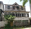
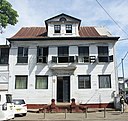
's Lands Hospitaal
|
Henck Arronstraat 64 Paramaribo
|
5°49′50″N 55°09′23″W / 5.830591666666667°N 55.156352777778°W / 5.830591666666667; -55.15635277777778
|
Verstuur afbeelding
|

|
|
| Q56613111
|
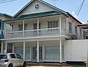
Nieuwe Oranjetuin
|
Dr. J.F. Nassylaan 8 Paramaribo
|
5°49′52″N 55°09′38″W / 5.831°N 55.160583°W / 5.831; -55.160583
|
Verstuur afbeelding
|

|
|
| Q57418873
|
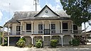
Benz-huis
|
Kromme Elleboogstraat 9-11 Paramaribo
|
5°49′34″N 55°09′15″W / 5.826167°N 55.154083°W / 5.826167; -55.154083
|
Verstuur afbeelding
|

|
|
| Q62676654
|
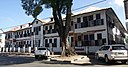
Bettencourtgebouw
|
Waterkant 84, Paramaribo
|
5°49′27″N 55°09′29″W / 5.824056°N 55.158028°W / 5.824056; -55.158028
|
Verstuur afbeelding
|

|
|
| Q56759997
|
Bisschopshuis
|
Henck Arronstraat 12 Paramaribo
|
5°49′40″N 55°09′11″W / 5.82775°N 55.152917°W / 5.82775; -55.152917
|
Verstuur afbeelding
|

|
|
| Q56542156
|
Ministerie van Sociale Zaken (gebouw)
|
Waterkant 30 Paramaribo
|
5°49′31″N 55°09′13″W / 5.825333°N 55.153722°W / 5.825333; -55.153722
|
Verstuur afbeelding
|

|
|
| Q107351220
|
Burenstraat 17-19/Waaldijkstr
|
Burenstraat 17-19/Waaldijkstr Paramaribo
|
5°49′38″N 55°09′48″W / 5.8270984°N 55.1632483°W / 5.8270984; -55.1632483
|
Verstuur afbeelding
|

|
|
| Q107351221
|
Burenstraat 24
|
Burenstraat 24 Paramaribo
|
5°49′38″N 55°09′48″W / 5.8271°N 55.1632511°W / 5.8271; -55.1632511
|
Verstuur afbeelding
|

|
|
| Q107351223
|
Burenstraat 46
|
Burenstraat 46 Paramaribo
|
5°49′41″N 55°09′53″W / 5.8280131°N 55.1648474°W / 5.8280131; -55.1648474
|
Verstuur afbeelding
|

|
|
| Q107351224
|
Burenstraat 48
|
Burenstraat 48 Paramaribo
|
5°49′41″N 55°09′54″W / 5.8280481°N 55.1649069°W / 5.8280481; -55.1649069
|
Verstuur afbeelding
|

|
|
| Q107351239
|
Grote Combéweg 32
|
Grote Combéweg 32 Paramaribo
|
5°49′54″N 55°08′57″W / 5.8315714°N 55.149137°W / 5.8315714; -55.149137
|
Verstuur afbeelding
|

|
|
| Q107351266
|
Costerstraat 24
|
Costerstraat 24 Paramaribo
|
5°49′55″N 55°09′14″W / 5.8320223°N 55.1539363°W / 5.8320223; -55.1539363
|
Verstuur afbeelding
|

|
|
| Q107351267
|
Costerstraat 34
|
Costerstraat 34 Paramaribo
|
5°49′57″N 55°09′13″W / 5.8324415°N 55.1537023°W / 5.8324415; -55.1537023
|
Verstuur afbeelding
|

|
|
| Q107351268
|
Costerstraat 54
|
Costerstraat 54 Paramaribo
|
5°50′01″N 55°09′11″W / 5.8335562°N 55.1530804°W / 5.8335562; -55.1530804
|
Verstuur afbeelding
|

|
|
| Q107351269
|
Costerstraat 59
|
Costerstraat 59 Paramaribo
|
5°50′02″N 55°09′10″W / 5.8338209°N 55.1528246°W / 5.8338209; -55.1528246
|
Verstuur afbeelding
|

|
|
| Q107351264
|
Costerstraat 6
|
Costerstraat 6 Paramaribo
|
5°49′54″N 55°09′14″W / 5.8317024°N 55.1538572°W / 5.8317024; -55.1538572
|
Verstuur afbeelding
|

|
|
| Q107351270
|
Costerstraat 69
|
Costerstraat 69 Paramaribo
|
5°50′02″N 55°09′11″W / 5.8338441°N 55.1529198°W / 5.8338441; -55.1529198
|
Verstuur afbeelding
|
|
|
| Q107351265
|
Costerstraat 8
|
Costerstraat 8 Paramaribo
|
5°49′54″N 55°09′14″W / 5.8317024°N 55.1538572°W / 5.8317024; -55.1538572
|
Verstuur afbeelding
|

|
|
| Q95976931
|
Court Charity (gebouw)
|
Burenstraat 26 Paramaribo
|
5°49′38″N 55°09′47″W / 5.82719°N 55.16314°W / 5.82719; -55.16314
|
Verstuur afbeelding
|

|
|
| Q107351174
|
Domineestraat 21
|
Domineestraat 21 Paramaribo
|
5°49′35″N 55°09′32″W / 5.8265001°N 55.15892°W / 5.8265001; -55.15892
|
Verstuur afbeelding
|

|
|
| Q107351175
|
Domineestraat 22a
|
Domineestraat 22a Paramaribo
|
5°49′37″N 55°09′34″W / 5.8268293°N 55.1593692°W / 5.8268293; -55.1593692
|
Verstuur afbeelding
|
|
|
| Q107351176
|
Domineestraat 23
|
Domineestraat 23 Paramaribo
|
5°49′36″N 55°09′32″W / 5.8265321°N 55.1589283°W / 5.8265321; -55.1589283
|
Verstuur afbeelding
|
|
|
| Q107351177
|
Domineestraat 30
|
Domineestraat 30 Paramaribo
|
5°49′36″N 55°09′35″W / 5.8266339°N 55.1598425°W / 5.8266339; -55.1598425
|
Verstuur afbeelding
|

|
|
| Q107351178
|
Domineestraat 32
|
Domineestraat 32 Paramaribo
|
5°49′36″N 55°09′36″W / 5.8265998°N 55.1599726°W / 5.8265998; -55.1599726
|
Verstuur afbeelding
|

|
|
| Q107351179
|
Domineestraat 34
|
Domineestraat 34 Paramaribo
|
5°49′36″N 55°09′36″W / 5.8265656°N 55.1601028°W / 5.8265656; -55.1601028
|
Verstuur afbeelding
|

|
|
| Q107351180
|
Domineestraat 35
|
Domineestraat 35 Paramaribo
|
5°49′34″N 55°09′36″W / 5.8261631°N 55.1601201°W / 5.8261631; -55.1601201
|
Verstuur afbeelding
|

|
|
| Q107351181
|
Domineestraat 36
|
Domineestraat 36 Paramaribo
|
5°49′36″N 55°09′37″W / 5.8265314°N 55.1602329°W / 5.8265314; -55.1602329
|
Verstuur afbeelding
|
|
|
| Q107351182
|
Domineestraat 38
|
Domineestraat 38 Paramaribo
|
5°49′35″N 55°09′37″W / 5.8264972°N 55.160363°W / 5.8264972; -55.160363
|
Verstuur afbeelding
|

|
|
| Q107351183
|
Domineestraat 46
|
Domineestraat 46 Paramaribo
|
5°49′34″N 55°09′39″W / 5.8262368°N 55.1607115°W / 5.8262368; -55.1607115
|
Verstuur afbeelding
|
|
|
| Q107351184
|
Domineestraat 48
|
Domineestraat 48 Paramaribo
|
5°49′34″N 55°09′41″W / 5.8260412°N 55.1614757°W / 5.8260412; -55.1614757
|
Verstuur afbeelding
|

|
|
| Q107351191
|
Dr. J.F. Nassylaan 17
|
Dr. J.F. Nassylaan 17 Paramaribo
|
5°49′50″N 55°09′38″W / 5.8305016°N 55.1604924°W / 5.8305016; -55.1604924
|
Verstuur afbeelding
|

|
|
| Q107351189
|
Dr. J.F. Nassylaan 2
|
Dr. J.F. Nassylaan 2 Paramaribo
|
5°49′48″N 55°09′36″W / 5.830096°N 55.1600213°W / 5.830096; -55.1600213
|
Verstuur afbeelding
|

|
|
| Q107351192
|
Dr. J.F. Nassylaan 21
|
Dr. J.F. Nassylaan 21 Paramaribo
|
5°49′49″N 55°09′40″W / 5.8303244°N 55.1610635°W / 5.8303244; -55.1610635
|
Verstuur afbeelding
|

|
|
| Q107351193
|
Dr. J.F. Nassylaan 23
|
Dr. J.F. Nassylaan 23 Paramaribo
|
5°49′48″N 55°09′41″W / 5.8299519°N 55.1614362°W / 5.8299519; -55.1614362
|
Verstuur afbeelding
|

|
|
| Q107351196
|
Dr. J.F. Nassylaan 41
|
Dr. J.F. Nassylaan 41 Paramaribo
|
5°49′52″N 55°09′43″W / 5.8310944°N 55.1618951°W / 5.8310944; -55.1618951
|
Verstuur afbeelding
|
|
|
| Q107351197
|
Dr. J.F. Nassylaan 42
|
Dr. J.F. Nassylaan 42 Paramaribo
|
5°49′51″N 55°09′41″W / 5.8309334°N 55.161437°W / 5.8309334; -55.161437
|
Verstuur afbeelding
|

|
|
| Q107351198
|
Dr. J.F. Nassylaan 43
|
Dr. J.F. Nassylaan 43 Paramaribo
|
5°49′51″N 55°09′41″W / 5.8309355°N 55.1614406°W / 5.8309355; -55.1614406
|
Verstuur afbeelding
|

|
|
| Q107351199
|
Dr. J.F. Nassylaan 44
|
Dr. J.F. Nassylaan 44 Paramaribo
|
5°49′51″N 55°09′41″W / 5.8309376°N 55.1614443°W / 5.8309376; -55.1614443
|
Verstuur afbeelding
|

|
|
| Q107351194
|
Dr. J.F. Nassylaan 27
|
Dr. J.F. Nassylaan 27 Paramaribo
|
5°49′50″N 55°09′41″W / 5.8304967°N 55.1615135°W / 5.8304967; -55.1615135
|
Verstuur afbeelding
|

|
|
| Q107351195
|
Dr. J.F. Nassylaan 39
|
Dr. J.F. Nassylaan 39 Paramaribo
|
5°49′51″N 55°09′41″W / 5.8309279°N 55.1614275°W / 5.8309279; -55.1614275
|
Verstuur afbeelding
|

|
|
| Q107351230
|
Dr. Sophie Redmondstraat 19
|
Dr. Sophie Redmondstraat 19 Paramaribo
|
5°49′28″N 55°09′43″W / 5.8244205°N 55.1620214°W / 5.8244205; -55.1620214
|
Verstuur afbeelding
|

|
|
| Q107351231
|
Dr. Sophie Redmondstraat 22
|
Dr. Sophie Redmondstraat 22 Paramaribo
|
5°49′30″N 55°09′44″W / 5.8248716°N 55.1621387°W / 5.8248716; -55.1621387
|
Verstuur afbeelding
|

|
|
| Q107351227
|
Mr. Eduard J. Brumastraat 17
|
Mr. Eduard Brumastraat 17 Paramaribo
|
|
Verstuur afbeelding
|

|
|
| Q107351228
|
Mr. Eduard J. Brumastraat 39
|
Mr. Eduard Brumastraat 39 Paramaribo
|
|
Verstuur afbeelding
|

|
|
| Q107351225
|
Mr. Eduard J. Brumastraat 4
|
Mr. Eduard Brumastraat 4 Paramaribo
|
|
Verstuur afbeelding
|

|
|
| Q107351229
|
Mr. Eduard J. Brumastraat 63
|
Mr. Eduard Brumastraat 63 Paramaribo
|
|
Verstuur afbeelding
|

|
|
| Q107351226
|
Mr. Eduard J. Brumastraat 8
|
Mr. Eduard Brumastraat 8 Paramaribo
|
|
Verstuur afbeelding
|

|
|
| Q656587
|
Fort Zeelandia
|
Zeelandiaweg 1 Paramaribo
|
5°49′31″N 55°09′00″W / 5.8252777777778°N 55.15°W / 5.8252777777778; -55.15
|
Verstuur afbeelding
|

|
[8]
|
| Q56677260
|
Gebouw 1790
|
Zeelandiaweg 11 Paramaribo
|
5°49′34″N 55°08′57″W / 5.826194°N 55.149222°W / 5.826194; -55.149222
|
Verstuur afbeelding
|

|
|
| Q4392658
|
Geyersvlijt
|
Anton Dragtenweg 240 Paramaribo
|
5°51′05″N 55°07′18″W / 5.851389°N 55.121667°W / 5.851389; -55.121667
|
Verstuur afbeelding
|

|
[9]
|
| Q107351254
|
Gongrijpstraat 11
|
Gongrijpstraat 11 Paramaribo
|
5°49′56″N 55°09′31″W / 5.832298°N 55.1586831°W / 5.832298; -55.1586831
|
Verstuur afbeelding
|

|
|
| Q107351255
|
Gongrijpstraat 14
|
Gongrijpstraat 14 Paramaribo
|
5°49′56″N 55°09′32″W / 5.8322565°N 55.1589261°W / 5.8322565; -55.1589261
|
Verstuur afbeelding
|

|
|
| Q107351256
|
Gongrijpstraat 16
|
Gongrijpstraat 16 Paramaribo
|
5°49′56″N 55°09′31″W / 5.832298°N 55.1586831°W / 5.832298; -55.1586831
|
Verstuur afbeelding
|

|
|
| Q107351257
|
Gongrijpstraat 65
|
Gongrijpstraat 65 Paramaribo
|
5°49′56″N 55°09′31″W / 5.832298°N 55.1586831°W / 5.832298; -55.1586831
|
Verstuur afbeelding
|

|
|
| Q107351237
|
Grote Combéweg 11
|
Grote Combéweg 11 Paramaribo
|
5°49′46″N 55°09′02″W / 5.8293946°N 55.1506735°W / 5.8293946; -55.1506735
|
Verstuur afbeelding
|

|
|
| Q107351238
|
Grote Combéweg 13
|
Grote Combéweg 13 Paramaribo
|
5°49′43″N 55°09′06″W / 5.828528°N 55.1515563°W / 5.828528; -55.1515563
|
Verstuur afbeelding
|

|
|
| Q107351235
|
Grote Combéweg 3
|
Grote Combéweg 3 Paramaribo
|
5°49′46″N 55°09′02″W / 5.8293946°N 55.1506735°W / 5.8293946; -55.1506735
|
Verstuur afbeelding
|

|
|
| Q107351240
|
Grote Combéweg 33/Van Rooseveltkade
|
Grote Combéweg 33 Paramaribo
|
|
Verstuur afbeelding
|

|
|
| Q107351241
|
Grote Combéweg 34
|
Grote Combéweg 34 Paramaribo
|
5°49′48″N 55°09′01″W / 5.8300388°N 55.1502838°W / 5.8300388; -55.1502838
|
Verstuur afbeelding
|
|
|
| Q107351243
|
Grote Combéweg 35
|
Grote Combéweg 35 Paramaribo
|
5°49′48″N 55°09′01″W / 5.8300388°N 55.1502838°W / 5.8300388; -55.1502838
|
Verstuur afbeelding
|

|
|
| Q107351112
|
Grote Hofstraat 7
|
Grote Hofstraat 7 Paramaribo
|
|
Verstuur afbeelding
|

|
|
| Q56649460
|
Grote Pastorie
|
Henck Arronstraat 21 Paramaribo
|
5°49′41″N 55°09′15″W / 5.828167°N 55.154222°W / 5.828167; -55.154222
|
Verstuur afbeelding
|

|
|
| Q57603554
|
Grote Stadskerk
|
Steenbakkerijstraat 21 Paramaribo
|
5°49′31″N 55°09′39″W / 5.825277777777778°N 55.160833333333°W / 5.825277777777778; -55.160833333333336
|
Verstuur afbeelding
|

|
|
| Q107351117
|
Heerenstraat 10-12
|
Heerenstraat 10-12 Paramaribo
|
5°49′44″N 55°09′23″W / 5.8287696°N 55.1563287°W / 5.8287696; -55.1563287
|
Verstuur afbeelding
|
|
|
| Q107351118
|
Heerenstraat 11-13
|
Heerenstraat 11-13 Paramaribo
|
5°49′43″N 55°09′26″W / 5.8286461°N 55.1571267°W / 5.8286461; -55.1571267
|
Verstuur afbeelding
|

|
|
| Q107351119
|
Heerenstraat 14
|
Heerenstraat 14 Paramaribo
|
5°49′43″N 55°09′26″W / 5.8286461°N 55.1571267°W / 5.8286461; -55.1571267
|
Verstuur afbeelding
|

|
|
| Q107351120
|
Heerenstraat 16
|
Heerenstraat 16 Paramaribo
|
5°49′44″N 55°09′23″W / 5.8287696°N 55.1563287°W / 5.8287696; -55.1563287
|
Verstuur afbeelding
|

|
|
| Q107351121
|
Heerenstraat 17
|
Heerenstraat 17 Paramaribo
|
5°49′44″N 55°09′23″W / 5.8287696°N 55.1563287°W / 5.8287696; -55.1563287
|
Verstuur afbeelding
|
|
|
| Q107351122
|
Heerenstraat 19
|
Heerenstraat 19 Paramaribo
|
5°49′43″N 55°09′26″W / 5.8286461°N 55.1571267°W / 5.8286461; -55.1571267
|
Verstuur afbeelding
|

|
|
| Q107351124
|
Heerenstraat 22a/Klipstenenstraat
|
Heerenstraat 22a/Klipstenenstraat Paramaribo
|
5°49′44″N 55°09′23″W / 5.8287696°N 55.1563287°W / 5.8287696; -55.1563287
|
Verstuur afbeelding
|

|
|
| Q107351125
|
Heerenstraat 24/Klipstenenstraat
|
Heerenstraat 24/Klipstenenstraat Paramaribo
|
5°49′44″N 55°09′23″W / 5.8287696°N 55.1563287°W / 5.8287696; -55.1563287
|
Verstuur afbeelding
|
|
|
| Q107351126
|
Heerenstraat 26
|
Heerenstraat 26 Paramaribo
|
5°49′43″N 55°09′26″W / 5.8286461°N 55.1571267°W / 5.8286461; -55.1571267
|
Verstuur afbeelding
|

|
|
| Q107351127
|
Heerenstraat 30
|
Heerenstraat 30 Paramaribo
|
5°49′44″N 55°09′23″W / 5.8287696°N 55.1563287°W / 5.8287696; -55.1563287
|
Verstuur afbeelding
|

|
|
| Q107351128
|
Heerenstraat 36
|
Heerenstraat 36 Paramaribo
|
5°49′44″N 55°09′23″W / 5.8287696°N 55.1563287°W / 5.8287696; -55.1563287
|
Verstuur afbeelding
|
|
|
| Q107351129
|
Heerenstraat 38
|
Heerenstraat 38 Paramaribo
|
5°49′43″N 55°09′26″W / 5.8286461°N 55.1571267°W / 5.8286461; -55.1571267
|
Verstuur afbeelding
|

|
|
| Q107351115
|
Heerenstraat 4
|
Heerenstraat 4 Paramaribo
|
5°49′43″N 55°09′26″W / 5.8286461°N 55.1571267°W / 5.8286461; -55.1571267
|
Verstuur afbeelding
|

|
|
| Q107351130
|
Heerenstraat 48
|
Heerenstraat 48 Paramaribo
|
5°49′43″N 55°09′26″W / 5.8286461°N 55.1571267°W / 5.8286461; -55.1571267
|
Verstuur afbeelding
|

|
|
| Q107351116
|
Heerenstraat 6
|
Heerenstraat 6 Paramaribo
|
5°49′44″N 55°09′23″W / 5.8287696°N 55.1563287°W / 5.8287696; -55.1563287
|
Verstuur afbeelding
|

|
|
| Q107351272
|
Heilig Hart-kerk
|
Hofstede Crulllaan 22 Paramaribo
|
5°49′56″N 55°08′50″W / 5.8321274°N 55.1472292°W / 5.8321274; -55.1472292
|
Verstuur afbeelding
|

|
|
| Q107351142
|
Heiligenweg 11
|
Heiligenweg 11 Paramaribo
|
5°49′31″N 55°09′25″W / 5.8254019°N 55.157037°W / 5.8254019; -55.157037
|
Verstuur afbeelding
|

|
|
| Q107351143
|
Heiligenweg 17
|
Heiligenweg 17 Paramaribo
|
5°49′31″N 55°09′25″W / 5.8254019°N 55.157037°W / 5.8254019; -55.157037
|
Verstuur afbeelding
|

|
|
| Q107351144
|
Heiligenweg 19
|
Heiligenweg 19 Paramaribo
|
5°49′31″N 55°09′26″W / 5.8253767°N 55.1571292°W / 5.8253767; -55.1571292
|
Verstuur afbeelding
|
|
|
| Q107351145
|
Heiligenweg 33
|
Heiligenweg 33 Paramaribo
|
5°49′34″N 55°09′27″W / 5.8262024°N 55.1573953°W / 5.8262024; -55.1573953
|
Verstuur afbeelding
|

|
|
| Q107351146
|
Heiligenweg 35
|
Heiligenweg 35 Paramaribo
|
5°49′35″N 55°09′27″W / 5.8264135°N 55.1574384°W / 5.8264135; -55.1574384
|
Verstuur afbeelding
|
|
|
| Q107351147
|
Heiligenweg 37
|
Heiligenweg 37 Paramaribo
|
5°49′31″N 55°09′25″W / 5.8254019°N 55.157037°W / 5.8254019; -55.157037
|
Verstuur afbeelding
|

|
|
| Q107351009
|
Henck Arronstraat 1
|
Henck Arronstraat 1 Paramaribo
|
5°49′38″N 55°09′09″W / 5.8272489°N 55.1525828°W / 5.8272489; -55.1525828
|
Verstuur afbeelding
|

|
|
| Q107351012
|
Henck Arronstraat 10
|
Henck Arronstraat 10 Paramaribo
|
5°49′51″N 55°09′32″W / 5.8308602°N 55.1587547°W / 5.8308602; -55.1587547
|
Verstuur afbeelding
|

|
|
| Q107351014
|
Henck Arronstraat 14
|
Henck Arronstraat 14 Paramaribo
|
5°49′51″N 55°09′32″W / 5.8308602°N 55.1587547°W / 5.8308602; -55.1587547
|
Verstuur afbeelding
|

|
|
| Q107351015
|
Henck Arronstraat 16
|
Henck Arronstraat 16 Paramaribo
|
5°49′42″N 55°09′14″W / 5.8283747°N 55.1537732°W / 5.8283747; -55.1537732
|
Verstuur afbeelding
|

|
|
| Q107351016
|
Henck Arronstraat 18
|
Henck Arronstraat 18 Paramaribo
|
5°49′41″N 55°09′13″W / 5.8281124°N 55.1536464°W / 5.8281124; -55.1536464
|
Verstuur afbeelding
|

|
|
| Q107351017
|
Henck Arronstraat 20
|
Henck Arronstraat 20 Paramaribo
|
5°49′51″N 55°09′32″W / 5.8308605°N 55.1587551°W / 5.8308605; -55.1587551
|
Verstuur afbeelding
|
|
|
| Q107351020
|
Henck Arronstraat 27
|
Henck Arronstraat 27 Paramaribo
|
5°49′51″N 55°09′32″W / 5.8308609°N 55.1587559°W / 5.8308609; -55.1587559
|
Verstuur afbeelding
|

|
|
| Q107351010
|
Henck Arronstraat 3
|
Henck Arronstraat 3 Paramaribo
|
5°49′38″N 55°09′09″W / 5.8273525°N 55.1525206°W / 5.8273525; -55.1525206
|
Verstuur afbeelding
|
|
|
| Q107351022
|
Henck Arronstraat 36
|
Henck Arronstraat 36 Paramaribo
|
5°49′51″N 55°09′32″W / 5.8308614°N 55.1587568°W / 5.8308614; -55.1587568
|
Verstuur afbeelding
|

|
|
| Q107351023
|
Henck Arronstraat 38
|
Henck Arronstraat 38 Paramaribo
|
5°49′51″N 55°09′32″W / 5.8308615°N 55.158757°W / 5.8308615; -55.158757
|
Verstuur afbeelding
|
|
|
| Q107351024
|
Henck Arronstraat 42
|
Henck Arronstraat 42 Paramaribo
|
5°49′51″N 55°09′32″W / 5.8308617°N 55.1587574°W / 5.8308617; -55.1587574
|
Verstuur afbeelding
|

|
|
| Q107351025
|
Henck Arronstraat 44
|
Henck Arronstraat 44 Paramaribo
|
5°49′51″N 55°09′32″W / 5.8308618°N 55.1587576°W / 5.8308618; -55.1587576
|
Verstuur afbeelding
|

|
|
| Q107351026
|
Henck Arronstraat 45
|
Henck Arronstraat 45 Paramaribo
|
5°49′51″N 55°09′32″W / 5.8308619°N 55.1587577°W / 5.8308619; -55.1587577
|
Verstuur afbeelding
|

|
|
| Q107351027
|
Henck Arronstraat 52-54
|
Henck Arronstraat 52-54 Paramaribo
|
5°49′51″N 55°09′32″W / 5.8308623°N 55.1587585°W / 5.8308623; -55.1587585
|
Verstuur afbeelding
|

|
|
| Q107351028
|
Henck Arronstraat 60
|
Henck Arronstraat 60 Paramaribo
|
5°49′47″N 55°09′23″W / 5.8296594°N 55.1564388°W / 5.8296594; -55.1564388
|
Verstuur afbeelding
|

|
|
| Q107351030
|
Henck Arronstraat 66
|
Henck Arronstraat 66 Paramaribo
|
5°49′48″N 55°09′26″W / 5.8299468°N 55.1571348°W / 5.8299468; -55.1571348
|
Verstuur afbeelding
|

|
|
| Q107351031
|
Henck Arronstraat 68
|
Henck Arronstraat 68 Paramaribo
|
5°49′50″N 55°09′25″W / 5.8304781°N 55.1569603°W / 5.8304781; -55.1569603
|
Verstuur afbeelding
|

|
|
| Q107351032
|
Henck Arronstraat 70
|
Henck Arronstraat 70 Paramaribo
|
5°49′51″N 55°09′32″W / 5.8308633°N 55.1587603°W / 5.8308633; -55.1587603
|
Verstuur afbeelding
|

|
|
| Q107351011
|
Henck Arronstraat 9
|
Henck Arronstraat 9 Paramaribo
|
5°49′51″N 55°09′32″W / 5.8308602°N 55.1587547°W / 5.8308602; -55.1587547
|
Verstuur afbeelding
|

|
|
| Q56612636
|
Hendrikschool
|
Henck Arronstraat 34 Paramaribo
|
5°49′44″N 55°09′18″W / 5.828833°N 55.154917°W / 5.828833; -55.154917
|
Verstuur afbeelding
|

|
|
| Q2147036
|
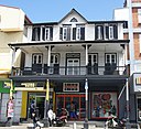
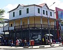
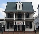
Binnenstad
|
|
5°49′34″N 55°09′14″W / 5.826°N 55.15387°W / 5.826; -55.15387
|
Verstuur afbeelding
|

|
|
| Q107351271
|
Hofstede Crulllaan 11
|
Hofstede Crulllaan 11 Paramaribo
|
5°49′56″N 55°08′50″W / 5.8321274°N 55.1472292°W / 5.8321274; -55.1472292
|
Verstuur afbeelding
|

|
|
| Q107351273
|
Hofstede Crulllaan 22a
|
Hofstede Crulllaan 22a Paramaribo
|
5°49′56″N 55°08′50″W / 5.8321274°N 55.1472292°W / 5.8321274; -55.1472292
|
Verstuur afbeelding
|

|
|
| Q56434052
|
Huis Du Plessis
|
Onafhankelijkheidsplein 2 Paramaribo
|
5°49′37″N 55°09′08″W / 5.826944°N 55.152139°W / 5.826944; -55.152139
|
Verstuur afbeelding
|

|
|
| Q107351153
|
Jodenbreestraat 13
|
Jodenbree straat 13 Paramaribo Suriname
|
5°49′30″N 55°09′31″W / 5.8249212°N 55.1586648°W / 5.8249212; -55.1586648
|
Verstuur afbeelding
|
|
|
| Q107351154
|
Jodenbreestraat 14
|
Jodenbree straat 14 Paramaribo Suriname
|
5°49′30″N 55°09′31″W / 5.8249212°N 55.1586648°W / 5.8249212; -55.1586648
|
Verstuur afbeelding
|

|
|
| Q107351155
|
Jodenbreestraat 16
|
Jodenbree straat 16 Paramaribo Suriname
|
5°49′30″N 55°09′31″W / 5.8249212°N 55.1586648°W / 5.8249212; -55.1586648
|
Verstuur afbeelding
|
|
|
| Q107351156
|
Jodenbreestraat 18
|
Jodenbree straat 18 Paramaribo Suriname
|
5°49′30″N 55°09′31″W / 5.8249212°N 55.1586648°W / 5.8249212; -55.1586648
|
Verstuur afbeelding
|

|
|
| Q107351165
|
Jodenbreestraat 28
|
Jodenbree straat 28 Paramaribo Suriname
|
5°49′30″N 55°09′31″W / 5.8249212°N 55.1586648°W / 5.8249212; -55.1586648
|
Verstuur afbeelding
|

|
|
| Q107351166
|
Jodenbreestraat 36
|
Jodenbree straat 36 Paramaribo Suriname
|
5°49′30″N 55°09′31″W / 5.8249212°N 55.1586648°W / 5.8249212; -55.1586648
|
Verstuur afbeelding
|

|
|
| Q107351157
|
Jodenbreestraat 37
|
Jodenbree straat 37 Paramaribo Suriname
|
5°49′30″N 55°09′31″W / 5.8249212°N 55.1586648°W / 5.8249212; -55.1586648
|
Verstuur afbeelding
|

|
|
| Q107351151
|
Jodenbreestraat 8
|
Jodenbree straat 8 Paramaribo,Suriname
|
5°49′30″N 55°09′31″W / 5.8249212°N 55.1586648°W / 5.8249212; -55.1586648
|
Verstuur afbeelding
|

|
|
| Q107351248
|
Julianastraat 56
|
Julianastraat 56 Paramaribo
|
5°50′01″N 55°09′01″W / 5.8336215°N 55.1501509°W / 5.8336215; -55.1501509
|
Verstuur afbeelding
|

|
|
| Q107351095
|
Keizerstraat 101
|
Keizerstraat 101 Paramaribo
|
5°49′46″N 55°09′44″W / 5.829446°N 55.1621529°W / 5.829446; -55.1621529
|
Verstuur afbeelding
|

|
|
| Q107351096
|
Keizerstraat 108
|
Keizerstraat 108 Paramaribo
|
5°49′49″N 55°09′48″W / 5.8303397°N 55.1633852°W / 5.8303397; -55.1633852
|
Verstuur afbeelding
|

|
|
| Q107351097
|
Keizerstraat 112
|
Keizerstraat 112 Paramaribo
|
5°49′46″N 55°09′41″W / 5.8294255°N 55.1613194°W / 5.8294255; -55.1613194
|
Verstuur afbeelding
|

|
|
| Q107351084
|
Keizerstraat 12
|
Keizerstraat 12 Paramaribo
|
5°49′36″N 55°09′24″W / 5.8265606°N 55.1565622°W / 5.8265606; -55.1565622
|
Verstuur afbeelding
|
|
|
| Q107351098
|
Keizerstraat 124
|
Keizerstraat 124 Paramaribo
|
5°49′45″N 55°09′41″W / 5.8292793°N 55.1614667°W / 5.8292793; -55.1614667
|
Verstuur afbeelding
|

|
|
| Q107351099
|
Keizerstraat 136
|
Keizerstraat 136 Paramaribo
|
5°49′49″N 55°09′48″W / 5.8303397°N 55.1633852°W / 5.8303397; -55.1633852
|
Verstuur afbeelding
|

|
|
| Q107351100
|
Keizerstraat 138
|
Keizerstraat 138 Paramaribo
|
5°49′49″N 55°09′48″W / 5.8303397°N 55.1633852°W / 5.8303397; -55.1633852
|
Verstuur afbeelding
|

|
|
| Q107351085
|
Keizerstraat 14
|
Keizerstraat 14 Paramaribo
|
5°49′36″N 55°09′24″W / 5.8265606°N 55.1565622°W / 5.8265606; -55.1565622
|
Verstuur afbeelding
|
|
|
| Q107351086
|
Keizerstraat 16/Watermolenstraat
|
Keizerstraat 16/Watermolenstraat Paramaribo
|
5°49′36″N 55°09′24″W / 5.8265606°N 55.1565622°W / 5.8265606; -55.1565622
|
Verstuur afbeelding
|

|
|
| Q107351105
|
Keizerstraat 197
|
Keizerstraat 197 Paramaribo
|
5°49′55″N 55°10′01″W / 5.8318174°N 55.1668579°W / 5.8318174; -55.1668579
|
Verstuur afbeelding
|

|
|
| Q107351101
|
Keizerstraat 199
|
Keizerstraat 199 Paramaribo
|
5°49′55″N 55°10′01″W / 5.8318174°N 55.1668579°W / 5.8318174; -55.1668579
|
Verstuur afbeelding
|

|
|
| Q107351082
|
Keizerstraat 2
|
Keizerstraat 2 Paramaribo
|
5°49′36″N 55°09′24″W / 5.8265606°N 55.1565622°W / 5.8265606; -55.1565622
|
Verstuur afbeelding
|

|
|
| Q107351087
|
Keizerstraat 27
|
Keizerstraat 27 Paramaribo
|
5°49′36″N 55°09′24″W / 5.8265606°N 55.1565622°W / 5.8265606; -55.1565622
|
Verstuur afbeelding
|

|
|
| Q107351083
|
Keizerstraat 4
|
Keizerstraat 4 Paramaribo
|
5°49′36″N 55°09′24″W / 5.8265606°N 55.1565622°W / 5.8265606; -55.1565622
|
Verstuur afbeelding
|

|
|
| Q107351088
|
Keizerstraat 71
|
Keizerstraat 71 Paramaribo
|
5°49′43″N 55°09′37″W / 5.8286875°N 55.1603964°W / 5.8286875; -55.1603964
|
Verstuur afbeelding
|

|
|
| Q107351089
|
Keizerstraat 75
|
Keizerstraat 75 Paramaribo
|
5°49′43″N 55°09′38″W / 5.8287279°N 55.1604693°W / 5.8287279; -55.1604693
|
Verstuur afbeelding
|

|
|
| Q107351091
|
Keizerstraat 84
|
Keizerstraat 84 Paramaribo
|
5°49′43″N 55°09′38″W / 5.8287279°N 55.1604693°W / 5.8287279; -55.1604693
|
Verstuur afbeelding
|

|
|
| Q107351092
|
Keizerstraat 91
|
Keizerstraat 91 Paramaribo
|
5°49′45″N 55°09′42″W / 5.8290614°N 55.1615747°W / 5.8290614; -55.1615747
|
Verstuur afbeelding
|

|
|
| Q107351094
|
Keizerstraat 99
|
Keizerstraat 99 Paramaribo
|
5°49′48″N 55°09′46″W / 5.8300023°N 55.1627747°W / 5.8300023; -55.1627747
|
Verstuur afbeelding
|

|
|
| Q107351113
|
Kerkplein 8
|
Kerkplein 8 Paramaribo
|
5°49′38″N 55°09′18″W / 5.8271344°N 55.1550147°W / 5.8271344; -55.1550147
|
Verstuur afbeelding
|

|
|
| Q107351114
|
Knuffelsgracht 10
|
Knuffelsgracht 10 Paramaribo
|
5°49′35″N 55°09′23″W / 5.8262938°N 55.1563652°W / 5.8262938; -55.1563652
|
Verstuur afbeelding
|

|
|
| Q107351110
|
Korte Kerkstraat 16
|
Korte Kerkstraat 16 Paramaribo
|
5°49′36″N 55°09′21″W / 5.8265357°N 55.1557994°W / 5.8265357; -55.1557994
|
Verstuur afbeelding
|
|
|
| Q107351107
|
Kromme Elleboogstraat 14a
|
Kromme Elleboogstraat 14a Paramaribo
|
5°49′35″N 55°09′14″W / 5.8264295°N 55.1539216°W / 5.8264295; -55.1539216
|
Verstuur afbeelding
|
|
|
| Q107351108
|
Kromme Elleboogstraat 20
|
Kromme Elleboogstraat 20 Paramaribo
|
5°49′35″N 55°09′14″W / 5.8264295°N 55.1539216°W / 5.8264295; -55.1539216
|
Verstuur afbeelding
|

|
|
| Q107351109
|
Kromme Elleboogstraat 22
|
Kromme Elleboogstraat 22 Paramaribo
|
5°49′35″N 55°09′14″W / 5.8263005°N 55.1538594°W / 5.8263005; -55.1538594
|
Verstuur afbeelding
|

|
|
| Q107351232
|
Ladesmastraat 14
|
Ladesmastraat 14 Paramaribo
|
5°49′23″N 55°09′44″W / 5.8231774°N 55.1621701°W / 5.8231774; -55.1621701
|
Verstuur afbeelding
|

|
|
| Q107351233
|
Ladesmastraat 16
|
Ladesmastraat 16 Paramaribo
|
5°49′23″N 55°09′44″W / 5.8231774°N 55.1621701°W / 5.8231774; -55.1621701
|
Verstuur afbeelding
|

|
|
| Q107351034
|
Mr. F.H.R. Lim A Postraat 1
|
Mr. F.H.R. Lim A Postraat 1 Paramaribo
|
5°49′36″N 55°09′12″W / 5.8266803°N 55.1533098°W / 5.8266803; -55.1533098
|
Verstuur afbeelding
|

|
|
| Q107351043
|
Mr. F.H.R. Lim A Postraat 13
|
Mr. F.H.R. Lim A Postraat 13 Paramaribo
|
5°49′36″N 55°09′13″W / 5.826626°N 55.1535576°W / 5.826626; -55.1535576
|
Verstuur afbeelding
|

|
|
| Q107351044
|
Mr. F.H.R. Lim A Postraat 20
|
Mr. F.H.R. Lim A Postraat 20 Paramaribo
|
5°49′36″N 55°09′12″W / 5.8267183°N 55.1533893°W / 5.8267183; -55.1533893
|
Verstuur afbeelding
|

|
|
| Q107351045
|
Mr. F.H.R. Lim A Postraat 21
|
Mr. F.H.R. Lim A Postraat 21 Paramaribo
|
5°49′38″N 55°09′16″W / 5.8272207°N 55.1543362°W / 5.8272207; -55.1543362
|
Verstuur afbeelding
|

|
|
| Q107351050
|
Mr. F.H.R. Lim A Postraat 26
|
Mr. F.H.R. Lim A Postraat 26 Paramaribo
|
5°49′39″N 55°09′15″W / 5.8273679°N 55.1542475°W / 5.8273679; -55.1542475
|
Verstuur afbeelding
|

|
|
| Q107351035
|
Mr. F.H.R. Lim A Postraat 3
|
Mr. F.H.R. Lim A Postraat 3 Paramaribo
|
|
Verstuur afbeelding
|

|
|
| Q107351051
|
Mr. F.H.R. Lim A Postraat 34a
|
Mr. F.H.R. Lim A Postraat 34a Paramaribo
|
5°49′39″N 55°09′17″W / 5.827629°N 55.1545978°W / 5.827629; -55.1545978
|
Verstuur afbeelding
|

|
|
| Q107351036
|
Mr. F.H.R. Lim A Postraat 4
|
Mr. F.H.R. Lim A Postraat 4 Paramaribo
|
5°49′36″N 55°09′12″W / 5.8266803°N 55.1533098°W / 5.8266803; -55.1533098
|
Verstuur afbeelding
|

|
|
| Q107351037
|
Mr. F.H.R. Lim A Postraat 5
|
Mr. F.H.R. Lim A Postraat 5 Paramaribo
|
5°49′36″N 55°09′12″W / 5.8266803°N 55.1533098°W / 5.8266803; -55.1533098
|
Verstuur afbeelding
|

|
|
| Q107351038
|
Mr. F.H.R. Lim A Postraat 6
|
Mr. F.H.R. Lim A Postraat 6 Paramaribo
|
5°49′36″N 55°09′12″W / 5.8266803°N 55.1533098°W / 5.8266803; -55.1533098
|
Verstuur afbeelding
|

|
|
| Q107351039
|
Mr. F.H.R. Lim A Postraat 7
|
Mr. F.H.R. Lim A Postraat 7 Paramaribo
|
5°49′36″N 55°09′12″W / 5.8266803°N 55.1533098°W / 5.8266803; -55.1533098
|
Verstuur afbeelding
|

|
|
| Q107351040
|
Mr. F.H.R. Lim A Postraat 8
|
Mr. F.H.R. Lim A Postraat 8 Paramaribo
|
5°49′36″N 55°09′12″W / 5.8266803°N 55.1533098°W / 5.8266803; -55.1533098
|
Verstuur afbeelding
|

|
|
| Q39337028
|
Maarten Lutherkerk
|
Waterkant 102 Paramaribo
|
5°49′25″N 55°09′34″W / 5.823569444444445°N 55.159569444444°W / 5.823569444444445; -55.15956944444444
|
Verstuur afbeelding
|

|
|
| Q107351148
|
Maagdenstraat 17
|
Maagdenstraat 17 Paramaribo
|
5°49′32″N 55°09′31″W / 5.8254283°N 55.1585265°W / 5.8254283; -55.1585265
|
Verstuur afbeelding
|

|
|
| Q107351149
|
Maagdenstraat 38
|
Maagdenstraat 38 Paramaribo
|
5°49′32″N 55°09′31″W / 5.8254283°N 55.1585265°W / 5.8254283; -55.1585265
|
Verstuur afbeelding
|

|
|
| Q107351150
|
Maagdenstraat 50
|
Maagdenstraat 50 Paramaribo
|
5°49′30″N 55°09′42″W / 5.8249516°N 55.1617043°W / 5.8249516; -55.1617043
|
Verstuur afbeelding
|

|
|
| Q107351258
|
Malebatrumstraat 16
|
Malebatrumstraat 16 Paramaribo
|
5°49′41″N 55°09′30″W / 5.8279819°N 55.1584553°W / 5.8279819; -55.1584553
|
Verstuur afbeelding
|

|
|
| Q107351259
|
Malebatrumstraat 18
|
Malebatrumstraat 18 Paramaribo
|
5°49′41″N 55°09′30″W / 5.8279819°N 55.1584553°W / 5.8279819; -55.1584553
|
Verstuur afbeelding
|

|
|
| Q107351260
|
Malebatrumstraat 20
|
Malebatrumstraat 20 Paramaribo
|
5°49′41″N 55°09′30″W / 5.8279819°N 55.1584553°W / 5.8279819; -55.1584553
|
Verstuur afbeelding
|
|
|
| Q107351244
|
Mgr. Wulfinghstraat 1
|
Mgr. Wulfinghstraat 1 Paramaribo
|
5°49′46″N 55°09′12″W / 5.8293603°N 55.1533705°W / 5.8293603; -55.1533705
|
Verstuur afbeelding
|

|
|
| Q107351245
|
Mgr. Wulfinghstraat 2-4
|
Mgr. Wulfinghstraat 2-4 Paramaribo
|
5°49′42″N 55°09′12″W / 5.8282122°N 55.1532508°W / 5.8282122; -55.1532508
|
Verstuur afbeelding
|

|
|
| Q107351057
|
Mr.dr. J.C. de Mirandastraat 10
|
Mr.dr. J.C. de Mirandastraat 10 Paramaribo
|
5°49′33″N 55°09′10″W / 5.8257098°N 55.1527494°W / 5.8257098; -55.1527494
|
Verstuur afbeelding
|

|
|
| Q107351058
|
Mr.dr. J.C. de Mirandastraat 11
|
Mr.dr. J.C. de Mirandastraat 11 Paramaribo
|
5°49′33″N 55°09′10″W / 5.8257098°N 55.1527494°W / 5.8257098; -55.1527494
|
Verstuur afbeelding
|

|
|
| Q107351060
|
Mr.dr. J.C. de Mirandastraat 17
|
Mr.dr. J.C. de Mirandastraat 17 Paramaribo
|
5°49′33″N 55°09′10″W / 5.8257098°N 55.1527494°W / 5.8257098; -55.1527494
|
Verstuur afbeelding
|

|
|
| Q107351054
|
Mr.dr. J.C. de Mirandastraat 4
|
Mr.dr. J.C. de Mirandastraat 4 Paramaribo
|
5°49′33″N 55°09′10″W / 5.8257098°N 55.1527494°W / 5.8257098; -55.1527494
|
Verstuur afbeelding
|

|
|
| Q107351055
|
Mr.dr. J.C. de Mirandastraat 5-7
|
Mr.dr. J.C. de Mirandastraat 5-7 Paramaribo
|
|
Verstuur afbeelding
|

|
|
| Q107351056
|
Mr.dr. J.C. de Mirandastraat 8
|
Mr.dr. J.C. de Mirandastraat 8 Paramaribo
|
5°49′32″N 55°09′09″W / 5.8256421°N 55.1526305°W / 5.8256421; -55.1526305
|
Verstuur afbeelding
|

|
|
| Q107351042
|
Mr. F.H.R. Lim A Postraat 10
|
Mr. F.H.R. Lim A Postraat 10 Paramaribo
|
5°49′36″N 55°09′12″W / 5.8266803°N 55.1533098°W / 5.8266803; -55.1533098
|
Verstuur afbeelding
|

|
|
| Q107351041
|
Mr. F.H.R. Lim A Postraat 9
|
Mr. F.H.R. Lim A Postraat 9 Paramaribo
|
5°49′36″N 55°09′12″W / 5.8266803°N 55.1533098°W / 5.8266803; -55.1533098
|
Verstuur afbeelding
|

|
|
| Q107351052
|
Mr.dr. J.C. de Mirandastraat 1
|
Mr.dr. J.C. de Mirandastraat 1 Paramaribo
|
5°49′33″N 55°09′10″W / 5.8257098°N 55.1527494°W / 5.8257098; -55.1527494
|
Verstuur afbeelding
|

|
|
| Q107351059
|
Mr.dr. J.C. de Mirandastraat 13-15
|
Mr.dr. J.C. de Mirandastraat 13-15 Paramaribo
|
|
Verstuur afbeelding
|
|
|
| Q107351053
|
Mr.dr. J.C. de Mirandastraat 2
|
Mr.dr. J.C. de Mirandastraat 2 Paramaribo
|
5°49′33″N 55°09′10″W / 5.8257098°N 55.1527494°W / 5.8257098; -55.1527494
|
Verstuur afbeelding
|

|
|
| Q2488071
|
Synagoge Neve Shalom
|
Keizerstraat 82 Paramaribo
|
5°49′42″N 55°09′33″W / 5.828388888888889°N 55.159222222222°W / 5.828388888888889; -55.15922222222222
|
Verstuur afbeelding
|

|
|
| Q107351033
|
Henck Arronstraat 73-75
|
Henck Arronstraat 73-75 Paramaribo
|
5°49′47″N 55°09′29″W / 5.8296397°N 55.1579559°W / 5.8296397; -55.1579559
|
Verstuur afbeelding
|

|
|
| Q56435243
|
Ministerie van Financiën (gebouw)
|
Onafhankelijkheidsplein 3 Paramaribo
|
5°49′36″N 55°09′08″W / 5.826667°N 55.152306°W / 5.826667; -55.152306
|
Verstuur afbeelding
|

|
|
| Q56461862
|
Hof van Justitie (gebouw)
|
Onafhankelijkheidsplein 4 Paramaribo
|
5°49′35″N 55°09′09″W / 5.826417°N 55.152444°W / 5.826417; -55.152444
|
Verstuur afbeelding
|

|
|
| Q107351007
|
Onafhankelijkheidsplein 7
|
Onafhankelijkheidsplein 7 Paramaribo
|
5°49′34″N 55°09′08″W / 5.8261111111111115°N 55.152222222222°W / 5.8261111111111115; -55.15222222222222
|
Verstuur afbeelding
|

|
|
| Q107351008
|
Onafhankelijkheidsplein 8
|
Onafhankelijkheidsplein 8 Paramaribo
|
5°49′33″N 55°09′07″W / 5.825833333333334°N 55.151944444444°W / 5.825833333333334; -55.151944444444446
|
Verstuur afbeelding
|

|
|
| Q56816748
|
Dixiebar
|
Onafhankelijkheidsplein 9 Paramaribo
|
5°49′33″N 55°09′07″W / 5.825722°N 55.151806°W / 5.825722; -55.151806
|
Verstuur afbeelding
|

|
|
| Q107351111
|
Oude Hofstraat 1
|
Oude Hofstraat 1 Paramaribo
|
|
Verstuur afbeelding
|

|
|
| Q2196027
|
Presidentieel paleis van de Republiek Suriname
|
Onafhankelijkheidsplein 1 Paramaribo
|
5°49′37″N 55°09′05″W / 5.82681389°N 55.15127222°W / 5.82681389; -55.15127222
|
Verstuur afbeelding
|

|
|
| Q107351250
|
Prins Hendrikstraat 12
|
Prins Hendrikstraat 12 Paramaribo
|
5°49′51″N 55°09′09″W / 5.8308745°N 55.1524877°W / 5.8308745; -55.1524877
|
Verstuur afbeelding
|

|
|
| Q107351252
|
Prinsessestraat 37
|
Prinsessestraat 37 Paramaribo
|
5°49′57″N 55°09′28″W / 5.8325097°N 55.1576884°W / 5.8325097; -55.1576884
|
Verstuur afbeelding
|

|
|
| Q107351253
|
Prinsessestraat 39
|
Prinsessestraat 39 Paramaribo
|
5°49′57″N 55°09′28″W / 5.8324035°N 55.1577256°W / 5.8324035; -55.1577256
|
Verstuur afbeelding
|

|
|
| Q107351274
|
Gemenelandsweg 67
|
Gemenelandsweg 67 Paramaribo
|
5°49′14″N 55°10′11″W / 5.8205221°N 55.1698151°W / 5.8205221; -55.1698151
|
Verstuur afbeelding
|

|
|
| Q2736107
|
Sint-Petrus-en-Pauluskathedraal
|
Henck Arronstraat 22-24 Paramaribo
|
5°49′43″N 55°09′15″W / 5.828681°N 55.154092°W / 5.828681; -55.154092
|
Verstuur afbeelding
|

|
|
| Q107351203
|
Saramaccastraat 13
|
Saramaccastraat 13 Paramaribo
|
5°49′22″N 55°09′41″W / 5.8227254°N 55.1613377°W / 5.8227254; -55.1613377
|
Verstuur afbeelding
|

|
|
| Q107351204
|
Saramaccastraat 20
|
Saramaccastraat 20 Paramaribo
|
5°49′22″N 55°09′41″W / 5.8227254°N 55.1613377°W / 5.8227254; -55.1613377
|
Verstuur afbeelding
|

|
|
| Q107351205
|
Saramaccastraat 35
|
Saramaccastraat 35 Paramaribo
|
5°49′19″N 55°09′46″W / 5.8219284°N 55.1627537°W / 5.8219284; -55.1627537
|
Verstuur afbeelding
|

|
|
| Q107351206
|
Saramaccastraat 37
|
Saramaccastraat 37 Paramaribo
|
5°49′19″N 55°09′46″W / 5.8219284°N 55.1627537°W / 5.8219284; -55.1627537
|
Verstuur afbeelding
|

|
|
| Q107351207
|
Saramaccastraat 39
|
Saramaccastraat 39 Paramaribo
|
5°49′19″N 55°09′46″W / 5.8219208°N 55.162767°W / 5.8219208; -55.162767
|
Verstuur afbeelding
|

|
|
| Q107351202
|
Saramaccastraat 4
|
Saramaccastraat 4 Paramaribo
|
5°49′22″N 55°09′41″W / 5.8227254°N 55.1613377°W / 5.8227254; -55.1613377
|
Verstuur afbeelding
|
|
|
| Q107351208
|
Saramaccastraat 41
|
Saramaccastraat 41 Paramaribo
|
5°49′19″N 55°09′46″W / 5.8219055°N 55.1627936°W / 5.8219055; -55.1627936
|
Verstuur afbeelding
|

|
|
| Q107351209
|
Saramaccastraat 49-51
|
Saramaccastraat 49-51 Paramaribo
|
5°49′20″N 55°09′44″W / 5.8221578°N 55.1623539°W / 5.8221578; -55.1623539
|
Verstuur afbeelding
|

|
|
| Q107351210
|
Saramaccastraat 53-55
|
Saramaccastraat 53-55 Paramaribo
|
5°49′19″N 55°09′45″W / 5.8220763°N 55.162496°W / 5.8220763; -55.162496
|
Verstuur afbeelding
|

|
|
| Q107351211
|
Saramaccastraat 57
|
Saramaccastraat 57 Paramaribo
|
5°49′19″N 55°09′45″W / 5.8219948°N 55.162638°W / 5.8219948; -55.162638
|
Verstuur afbeelding
|

|
|
| Q107351275
|
Slangenhoutstraat 97-99
|
Slangenhoutstraat 97-99 Paramaribo
|
5°48′17″N 55°10′44″W / 5.8047996°N 55.1788159°W / 5.8047996; -55.1788159
|
Verstuur afbeelding
|

|
|
| Q23926510
|
Sint Vincentius Ziekenhuis
|
Koninginnestraat 4 Paramaribo
|
5°49′54″N 55°09′10″W / 5.831786°N 55.152869°W / 5.831786; -55.152869
|
Verstuur afbeelding
|

|
|
| Q56632823
|
Sint-Rosakerk
|
Prinsenstraat 10 Paramaribo
|
5°49′21″N 55°09′49″W / 5.822472°N 55.163528°W / 5.822472; -55.163528
|
Verstuur afbeelding
|

|
|
| Q107351168
|
Steenbakkerijstraat 30
|
Steenbakkerijstraat 30 Paramaribo
|
5°49′34″N 55°09′39″W / 5.8260224°N 55.1607261°W / 5.8260224; -55.1607261
|
Verstuur afbeelding
|

|
|
| Q107351169
|
Steenbakkerijstraat 32
|
Steenbakkerijstraat 32 Paramaribo
|
5°49′34″N 55°09′39″W / 5.8260224°N 55.1607261°W / 5.8260224; -55.1607261
|
Verstuur afbeelding
|
|
|
| Q107351170
|
Steenbakkerijstraat 38
|
Steenbakkerijstraat 38 Paramaribo
|
5°49′35″N 55°09′39″W / 5.8264316°N 55.1608291°W / 5.8264316; -55.1608291
|
Verstuur afbeelding
|

|
|
| Q107351171
|
Steenbakkerijstraat 41
|
Steenbakkerijstraat 41 Paramaribo
|
5°49′37″N 55°09′40″W / 5.8269892°N 55.16119°W / 5.8269892; -55.16119
|
Verstuur afbeelding
|

|
|
| Q107351172
|
Steenbakkerijstraat 42
|
Steenbakkerijstraat 42 Paramaribo
|
5°49′35″N 55°09′39″W / 5.8264316°N 55.1608291°W / 5.8264316; -55.1608291
|
Verstuur afbeelding
|
|
|
| Q107351173
|
Steenbakkerijstraat 68
|
Steenbakkerijstraat 68 Paramaribo
|
5°49′35″N 55°09′39″W / 5.8264316°N 55.1608291°W / 5.8264316; -55.1608291
|
Verstuur afbeelding
|

|
|
| Q107351261
|
Stoelmanstraat 27
|
Stoelmanstraat 27 Paramaribo
|
5°49′56″N 55°09′31″W / 5.8321167°N 55.1585596°W / 5.8321167; -55.1585596
|
Verstuur afbeelding
|

|
|
| Q107351262
|
Stoelmanstraat 40
|
Stoelmanstraat 40 Paramaribo
|
5°49′56″N 55°09′31″W / 5.8321167°N 55.1585596°W / 5.8321167; -55.1585596
|
Verstuur afbeelding
|

|
|
| Q107351263
|
Stoelmanstraat 44
|
Stoelmanstraat 44 Paramaribo
|
5°49′56″N 55°09′31″W / 5.8321167°N 55.1585596°W / 5.8321167; -55.1585596
|
Verstuur afbeelding
|

|
|
| Q107351200
|
Swalmbergstraat 7
|
Swalmbergstraat 7 Paramaribo
|
5°49′51″N 55°09′41″W / 5.8309151°N 55.1613811°W / 5.8309151; -55.1613811
|
Verstuur afbeelding
|

|
|
| Q107351201
|
Swalmbergstraat 7a
|
Swalmbergstraat 7a Paramaribo
|
5°49′51″N 55°09′41″W / 5.8309151°N 55.1613811°W / 5.8309151; -55.1613811
|
Verstuur afbeelding
|

|
|
| Q24930261
|
Tzedek ve-Shalom
|
Heerenstraat 22 Paramaribo
|
5°49′40″N 55°09′19″W / 5.82776°N 55.15537°W / 5.82776; -55.15537
|
Verstuur afbeelding
|

|
|
| Q107351247
|
Van Roseveltkade 34
|
Van Rooseveltkade 34 Paramaribo
|
5°49′48″N 55°09′07″W / 5.8300966°N 55.1518211°W / 5.8300966; -55.1518211
|
Verstuur afbeelding
|

|
|
| Q107351249
|
Van Roseveltkade 36
|
Van Rooseveltkade 36 Paramaribo
|
5°49′48″N 55°09′07″W / 5.8300967°N 55.1518211°W / 5.8300967; -55.1518211
|
Verstuur afbeelding
|

|
|
| Q107351093
|
Verlengde Keizerstraat 92
|
Verlengde Keizerstraat 92 Paramaribo
|
5°49′56″N 55°10′00″W / 5.8322299°N 55.1667903°W / 5.8322299; -55.1667903
|
Verstuur afbeelding
|
|
|
| Q56537564
|
Waag
|
Waterkant 5 Paramaribo
|
5°49′30″N 55°09′15″W / 5.825028°N 55.15425°W / 5.825028; -55.15425
|
Verstuur afbeelding
|

|
|
| Q56711658
|
Huis van Elisabeth Samson
|
Wagenwegstraat 22 Paramaribo
|
5°49′44″N 55°09′28″W / 5.829°N 55.157861°W / 5.829; -55.157861
|
Verstuur afbeelding
|

|
|
| Q107351185
|
Wagenwegstraat 37
|
Wagenwegstraat 37 Paramaribo
|
5°49′45″N 55°09′31″W / 5.829216°N 55.1585501°W / 5.829216; -55.1585501
|
Verstuur afbeelding
|

|
|
| Q57280077
|
Huis van Nanette Samson
|
Wagenwegstraat 47 Paramaribo
|
5°49′43″N 55°09′28″W / 5.828611°N 55.15775°W / 5.828611; -55.15775
|
Verstuur afbeelding
|

|
|
| Q107351186
|
Wagenwegstraat 50
|
Wagenwegstraat 50 Paramaribo
|
5°49′47″N 55°09′33″W / 5.8296055°N 55.1592595°W / 5.8296055; -55.1592595
|
Verstuur afbeelding
|

|
|
| Q107351187
|
Wagenwegstraat 51
|
Wagenwegstraat 51 Paramaribo
|
5°49′47″N 55°09′33″W / 5.8296055°N 55.1592595°W / 5.8296055; -55.1592595
|
Verstuur afbeelding
|

|
|
| Q107351188
|
Wagenwegstraat 62
|
Wagenwegstraat 62 Paramaribo
|
5°49′47″N 55°09′33″W / 5.8296055°N 55.1592595°W / 5.8296055; -55.1592595
|
Verstuur afbeelding
|

|
|
| Q107351063
|
Waterkant 10
|
Waterkant 10 Paramaribo
|
5°49′29″N 55°09′18″W / 5.8247373°N 55.1550676°W / 5.8247373; -55.1550676
|
Verstuur afbeelding
|

|
|
| Q107351064
|
Waterkant 12
|
Waterkant 12 Paramaribo
|
5°49′29″N 55°09′18″W / 5.8247373°N 55.1550676°W / 5.8247373; -55.1550676
|
Verstuur afbeelding
|

|
|
| Q107351065
|
Waterkant 14/Mirandastraat
|
Waterkant 14/Mirandastraat Paramaribo
|
5°49′31″N 55°09′12″W / 5.8252147°N 55.1534178°W / 5.8252147; -55.1534178
|
Verstuur afbeelding
|

|
|
| Q56816667
|
Hoekhuis
|
Waterkant 2 Paramaribo
|
5°49′31″N 55°09′07″W / 5.825389°N 55.151889°W / 5.825389; -55.151889
|
Verstuur afbeelding
|

|
|
| Q107351066
|
Waterkant 26
|
Waterkant 26 Paramaribo
|
5°49′31″N 55°09′12″W / 5.8253055555555555°N 55.153388888889°W / 5.8253055555555555; -55.15338888888889
|
Verstuur afbeelding
|

|
|
| Q107351067
|
Waterkant 28
|
Waterkant 28 Paramaribo
|
5°49′31″N 55°09′13″W / 5.8254126°N 55.1535576°W / 5.8254126; -55.1535576
|
Verstuur afbeelding
|

|
|
| Q107351070
|
Waterkant 32/Kromme Elleboogstr
|
Waterkant 32/Kromme Elleboogstr Paramaribo
|
5°49′31″N 55°09′13″W / 5.8252056°N 55.1535423°W / 5.8252056; -55.1535423
|
Verstuur afbeelding
|

|
|
| Q107351071
|
Waterkant 36
|
Waterkant 36 Paramaribo
|
5°49′31″N 55°09′13″W / 5.8252056°N 55.1535423°W / 5.8252056; -55.1535423
|
Verstuur afbeelding
|

|
|
| Q107351061
|
Waterkant 4
|
Waterkant 4 Paramaribo
|
5°49′32″N 55°09′07″W / 5.825419°N 55.1518934°W / 5.825419; -55.1518934
|
Verstuur afbeelding
|

|
|
| Q107351072
|
Waterkant 40
|
Waterkant 40 Paramaribo
|
5°49′31″N 55°09′13″W / 5.8252056°N 55.1535423°W / 5.8252056; -55.1535423
|
Verstuur afbeelding
|

|
|
| Q107351073
|
Waterkant 42
|
Waterkant 42 Paramaribo
|
5°49′31″N 55°09′13″W / 5.8252056°N 55.1535423°W / 5.8252056; -55.1535423
|
Verstuur afbeelding
|

|
|
| Q107351074
|
Waterkant 44
|
Waterkant 44 Paramaribo
|
5°49′31″N 55°09′13″W / 5.8252056°N 55.1535423°W / 5.8252056; -55.1535423
|
Verstuur afbeelding
|

|
|
| Q107351062
|
Waterkant 6-8
|
Waterkant 6-8 Paramaribo
|
5°49′29″N 55°09′18″W / 5.8247373°N 55.1550676°W / 5.8247373; -55.1550676
|
Verstuur afbeelding
|

|
|
| Q107351075
|
Waterkant 72
|
Waterkant 72 Paramaribo
|
5°49′28″N 55°09′26″W / 5.824312°N 55.1571366°W / 5.824312; -55.1571366
|
Verstuur afbeelding
|

|
|
| Q107351076
|
Waterkant 80
|
Waterkant 80 Paramaribo
|
5°49′29″N 55°09′28″W / 5.8247399°N 55.1578376°W / 5.8247399; -55.1578376
|
Verstuur afbeelding
|

|
|
| Q107351079
|
Waterkant 86
|
Waterkant 86 Paramaribo
|
5°49′26″N 55°09′29″W / 5.8240092°N 55.158186°W / 5.8240092; -55.158186
|
Verstuur afbeelding
|

|
|
| Q107351080
|
Waterkant 88/Jodenbreestraat
|
Waterkant 88/Jodenbreestraat Paramaribo
|
5°49′26″N 55°09′29″W / 5.8239198°N 55.1581609°W / 5.8239198; -55.1581609
|
Verstuur afbeelding
|

|
|
| Q107351131
|
Watermolenstraat 1/Waterkant
|
Watermolenstraat 1/Waterkant Paramaribo
|
5°49′31″N 55°09′07″W / 5.8252932°N 55.1518901°W / 5.8252932; -55.1518901
|
Verstuur afbeelding
|

|
|
| Q107351135
|
Watermolenstraat 11
|
Watermolenstraat 11 Paramaribo
|
|
Verstuur afbeelding
|

|
|
| Q107351136
|
Watermolenstraat 20
|
Watermolenstraat 20 Paramaribo
|
|
Verstuur afbeelding
|

|
|
| Q107351137
|
Watermolenstraat 47-49
|
Watermolenstraat 47-49 Paramaribo
|
|
Verstuur afbeelding
|

|
|
| Q107351133
|
Watermolenstraat 5
|
Watermolenstraat 5 Paramaribo
|
|
Verstuur afbeelding
|

|
|
| Q107351138
|
Watermolenstraat 51
|
Watermolenstraat 51 Paramaribo
|
|
Verstuur afbeelding
|

|
|
| Q107351139
|
Watermolenstraat 57
|
Watermolenstraat 57 Paramaribo
|
|
Verstuur afbeelding
|

|
|
| Q107351140
|
Watermolenstraat 58
|
Watermolenstraat 58 Paramaribo
|
|
Verstuur afbeelding
|

|
|
| Q107351141
|
Watermolenstraat 60/Henck Arronstraat
|
Watermolenstraat 60/Henck Arronstraat Paramaribo
|
5°49′39″N 55°09′14″W / 5.8275331°N 55.1538641°W / 5.8275331; -55.1538641
|
Verstuur afbeelding
|

|
|
| Q107351004
|
Zeelandiaweg 12
|
Zeelandiaweg 12 Paramaribo
|
5°49′30″N 55°08′59″W / 5.8251323°N 55.1497477°W / 5.8251323; -55.1497477
|
Verstuur afbeelding
|
|
|
| Q107350997
|
Zeelandiaweg 3
|
Zeelandiaweg 3 Paramaribo
|
5°49′30″N 55°08′59″W / 5.8251323°N 55.1497477°W / 5.8251323; -55.1497477
|
Verstuur afbeelding
|

|
|
| Q107350998
|
Zeelandiaweg 5
|
Zeelandiaweg 5 Paramaribo
|
5°49′30″N 55°08′59″W / 5.8251323°N 55.1497477°W / 5.8251323; -55.1497477
|
Verstuur afbeelding
|

|
|
| Q107350999
|
Zeelandiaweg 6
|
Zeelandiaweg 6 Paramaribo
|
5°49′30″N 55°08′59″W / 5.8251323°N 55.1497477°W / 5.8251323; -55.1497477
|
Verstuur afbeelding
|

|
|
| Q107351000
|
Zeelandiaweg 7
|
Zeelandiaweg 7 Paramaribo
|
5°49′31″N 55°09′00″W / 5.8253299°N 55.1498738°W / 5.8253299; -55.1498738
|
Verstuur afbeelding
|

|
|
| Q107351001
|
Zeelandiaweg 8
|
Zeelandiaweg 8 Paramaribo
|
|
Verstuur afbeelding
|

|
|
| Q107351002
|
Zeelandiaweg 9
|
Zeelandiaweg 9 Paramaribo
|
|
Verstuur afbeelding
|
|
|
| Q107351217
|
Zwartenhovenbrugstraat 116
|
Zwartenhovenbrugstraat 116 Paramaribo
|
5°49′23″N 55°09′51″W / 5.8231024°N 55.1642004°W / 5.8231024; -55.1642004
|
Verstuur afbeelding
|

|
|
| Q107351218
|
Zwartenhovenbrugstraat 130
|
Zwartenhovenbrugstraat 130 Paramaribo
|
5°49′23″N 55°09′51″W / 5.8231024°N 55.1642004°W / 5.8231024; -55.1642004
|
Verstuur afbeelding
|

|
|
| Q107351219
|
Zwartenhovenbrugstraat 133-135
|
Zwartenhovenbrugstraat 133-135 Paramaribo
|
5°49′21″N 55°09′51″W / 5.822606°N 55.1640329°W / 5.822606; -55.1640329
|
Verstuur afbeelding
|

|
|
| Q107351212
|
Zwartenhovenbrugstraat 53
|
Zwartenhovenbrugstraat 53 Paramaribo
|
5°49′35″N 55°09′42″W / 5.8264142°N 55.1617977°W / 5.8264142; -55.1617977
|
Verstuur afbeelding
|

|
|
| Q107351213
|
Zwartenhovenbrugstraat 56
|
Zwartenhovenbrugstraat 56 Paramaribo
|
5°49′36″N 55°09′43″W / 5.8266953°N 55.1620751°W / 5.8266953; -55.1620751
|
Verstuur afbeelding
|

|
|
| Q107351214
|
Zwartenhovenbrugstraat 88
|
Zwartenhovenbrugstraat 88 Paramaribo
|
5°49′33″N 55°09′44″W / 5.8259407°N 55.1622956°W / 5.8259407; -55.1622956
|
Verstuur afbeelding
|

|
|


.jpg)


.jpg)


.jpg)


.jpg)


