Edinburgh Park & Ride network
English: The Park & Ride network serving Edinburgh, Scotland. Services run by Lothian Buses call at all the sites except Ferrytoll.
| Site | County | Opened | Modes | Nearest major road |
|---|---|---|---|---|
| Ferrytoll | Fife | 10 Nov 2000 | bus; coach | A90 (Forth Bridge approach) |
| Ingliston | City | 11 Sep 2005 | bus, tram | A8 (Glasgow Road) |
| Hermiston | City | 11 Sep 2005 | bus | A71 (Calder Road) |
| Straiton | Midlothian | 5 Oct 2008 | bus | A701 (Straiton Road) |
| Sheriffhall | Midlothian (edge) | 3 Feb 2008 | bus | A7 (Old Dalkeith Road) |
| Newcraighall | City | 3 Jun 2002 | bus, rail | A1 |
| Wallyford | East Lothian | 23 Jun 2008 | bus, rail | A1 |
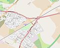
Location map edit
.jpg)
Individual sites edit
Ferrytoll edit
| Object location | | View all coordinates using: OpenStreetMap |
|---|
Ingliston edit
| Object location | | View all coordinates using: OpenStreetMap |
|---|
Ingliston opened as a bus facility in 2005; its capacity was doubled in 2008; tram services were added in 2014 through the adjacent Ingliston Park & Ride tram stop.
-

-

-
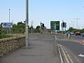
 looking east from Eastfield Road
 -
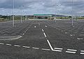
 looking north across the east car park and bus stops
 -
 looking east to the shelter
 -
 looking east to the shelter
 -
 west side of the shelter
 -
 west side of the shelter
 -
 south side of the shelter
 -
 south side of the shelter
.jpg)
.jpg)


Hermiston edit
| Object location | | View all coordinates using: OpenStreetMap |
|---|
-

-

-
 south side of the shelter
 -
 south side of the shelter
 -
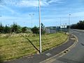
 looking north from Riccarton Mains Road roundabout to the site
 -
 looking north from Riccarton Mains Road roundabout to the site
 -
 inside the shelter
.jpg)
.jpg)


Straiton edit
| Object location | | View all coordinates using: OpenStreetMap |
|---|
-

-

-
 outbound direction (shelter left)
 -
 inbound direction (shelter right)
 -
 south side of the shelter
 -
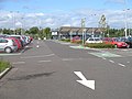
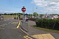
 left turn into the site from Straiton Road
.jpg)
.jpg)

.jpg)


Sheriffhall edit
| Object location | | View all coordinates using: OpenStreetMap |
|---|
-

-

-
 entrance
 -
 looking north west across the site
 -
 looking east across the Shawfair Park access road to the site
 -
 south side of the shelter
 -
 south side of the shelter
 -
 eastern end of the shelter
 -
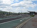
 the northern car park (shelter right)
 -
 bus about to depart for Ratho via Ingliston (X48)
(18 February 2008)
.jpg)
.jpg)


.jpg)


.jpg)


Newcraighall edit
| Object location | | View all coordinates using: OpenStreetMap |
|---|
Newcraighall opened at the same time as the new Newcraighall railway station, the eastern terminus of the Edinburgh Crossrail line.
.jpg)
.jpg)
Wallyford edit
| Object location | | View all coordinates using: OpenStreetMap |
|---|
Wallyford was opened near the site of Wallyford railway station, which itself opened in 1994.
-
-

-
 bus stop lane
 -
 construction sign
.jpg)
.jpg)

