File:"Danubius Fluvius Europae Maximus. Amsterdam, Guglielmus Blaeu, 1640.jpg
Size of this preview: 800 × 352 pixels. Other resolutions: 320 × 141 pixels | 640 × 282 pixels | 1,024 × 451 pixels | 1,280 × 563 pixels | 3,309 × 1,456 pixels.
Original file (3,309 × 1,456 pixels, file size: 2.74 MB, MIME type: image/jpeg)
Captions
Captions
Add a one-line explanation of what this file represents
Summary
edit
| Description |
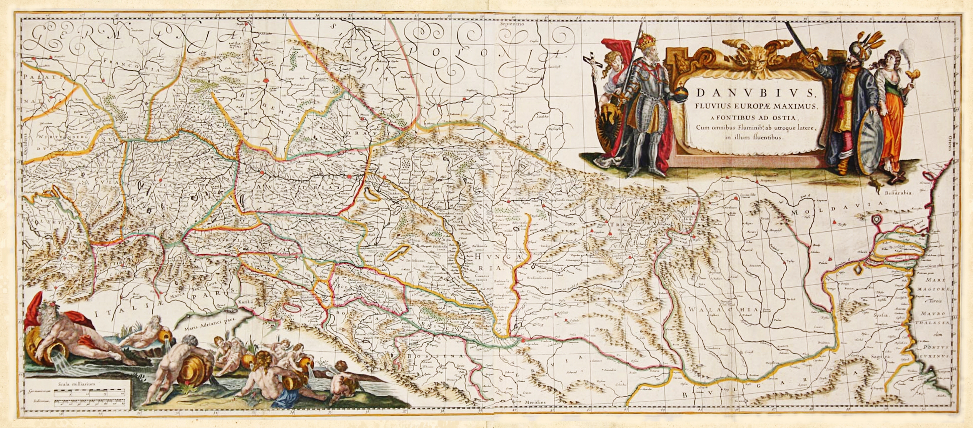
Italiano: Carta geografia raffigurante il corso del fiume Danubio, i suoi affluenti e i territori circostanti.
Due decorativi cartigli rendono preziosa questa tavola. In alto a destra il titolo è animato dall’allegoria dell’Europa e un Imperatore sul lato sinistro e sull’altro lato il sultano ottomano e l’Asia, che rappresenta la lunga lotta tra le due potenze per il controllo della regione.
日本語: ドナウ川とその流域および周辺を示す地図。右上の枠型の装飾に題名が示され、その左右に立つ男性は、向かって左側が甲冑を着用したヨーロッパのキリスト教世界を象徴する騎士、同じく右手は異文化のシンボルとしてのオスマントルコのスルタン。この地域の覇権をめぐる両勢力の長い闘争を表している。 |
| Date | |
| Source | Archivio Libreria Antiquaria Bourlot - Torino |
| Author | Argonitros |
Licensing
edit
I, the copyright holder of this work, hereby publish it under the following license:
This file is licensed under the Creative Commons Attribution-Share Alike 4.0 International license.
- You are free:
- to share – to copy, distribute and transmit the work
- to remix – to adapt the work
- Under the following conditions:
- attribution – You must give appropriate credit, provide a link to the license, and indicate if changes were made. You may do so in any reasonable manner, but not in any way that suggests the licensor endorses you or your use.
- share alike – If you remix, transform, or build upon the material, you must distribute your contributions under the same or compatible license as the original.
[[Category:Old maps of Slavonia]
File history
Click on a date/time to view the file as it appeared at that time.
| Date/Time | Thumbnail | Dimensions | User | Comment | |
|---|---|---|---|---|---|
| current | 14:35, 28 November 2018 | | 3,309 × 1,456 (2.74 MB) | Argonitros (talk | contribs) | User created page with UploadWizard |
You cannot overwrite this file.
File usage on Commons
There are no pages that use this file.