File:Čechy do roku 1920 a změna hranice po připojení Vitorazska.png

Size of this preview: 800 × 460 pixels. Other resolutions: 320 × 184 pixels | 640 × 368 pixels | 1,024 × 588 pixels | 1,280 × 735 pixels | 2,560 × 1,471 pixels | 3,662 × 2,104 pixels.
Original file (3,662 × 2,104 pixels, file size: 727 KB, MIME type: image/png)
Captions
Captions
Add a one-line explanation of what this file represents

|
This locator map image could be re-created using vector graphics as an SVG file. This has several advantages; see Commons:Media for cleanup for more information. If an SVG form of this image is available, please upload it and afterwards replace this template with
{{vector version available|new image name}}.
It is recommended to name the SVG file “Čechy do roku 1920 a změna hranice po připojení Vitorazska.svg”—then the template Vector version available (or Vva) does not need the new image name parameter. |
Summary
edit| Description |
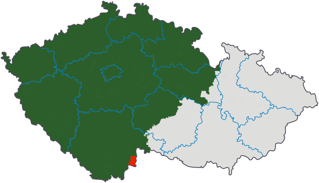
Čeština: *Zeleně je vyznačeno území Čech do 30. července 1920.
|
||||||||
| Date | 24 November 2006 (original upload date) | ||||||||
| Source |
|
||||||||
| Author | Original uploader was Kirk at cs.wikipedia | ||||||||
| Permission (Reusing this file) |
Kirk at Czech Wikipedia, the copyright holder of this work, hereby publishes it under the following license:
|

Original upload log
edit
The original description page was here. All following user names refer to cs.wikipedia.
- 2006-11-24 22:41 Kirk 3662×2104×??? (744648 bytes) miniaturní korekce hranic
File history
Click on a date/time to view the file as it appeared at that time.
| Date/Time | Thumbnail | Dimensions | User | Comment | |
|---|---|---|---|---|---|
| current | 11:58, 23 September 2008 | | 3,662 × 2,104 (727 KB) | Sevela.p (talk | contribs) | {{Information |Description= {{cs| *Zeleně je vyznačeno území Čech do 30. července 1920. *Červeně je vyznačeno území tzv. Západního Vitorazska ''(dnes nazývané '''Vitorazs |
You cannot overwrite this file.
File usage on Commons
There are no pages that use this file.
File usage on other wikis
The following other wikis use this file:
- Usage on cs.wikipedia.org
- Usage on eo.wikipedia.org
- Usage on pl.wikipedia.org
- Usage on www.wikidata.org