File:Đá ba chồng Định Quán - panoramio.jpg

Size of this preview: 398 × 599 pixels. Other resolutions: 159 × 240 pixels | 319 × 480 pixels | 510 × 768 pixels | 680 × 1,024 pixels | 1,424 × 2,144 pixels.
Original file (1,424 × 2,144 pixels, file size: 1.43 MB, MIME type: image/jpeg)
Captions
Captions
Add a one-line explanation of what this file represents
Summary
edit
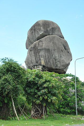
| Description | Đá ba chồng Định Quán | ||
| Date | Taken on 11 June 2011 | ||
| Source | https://web.archive.org/web/20161021035749/http://www.panoramio.com/photo/55495166 | ||
| Author | ChieuTimViet | ||
| Permission (Reusing this file) |
This file is licensed under the Creative Commons Attribution 3.0 Unported license. Attribution: ChieuTimViet
|
||
| Tags (from Panoramio photo page) | tt. Định Quán, 2011, Dong Nai, Vietnam |
| Camera location | | View this and other nearby images on: OpenStreetMap |
|---|
File history
Click on a date/time to view the file as it appeared at that time.
| Date/Time | Thumbnail | Dimensions | User | Comment | |
|---|---|---|---|---|---|
| current | 20:15, 1 December 2016 | | 1,424 × 2,144 (1.43 MB) | Panoramio upload bot (talk | contribs) | == {{int:filedesc}} == {{Information |description=Đá ba chồng Định Quán |date={{Taken on|2011-06-11}} |source=http://www.panoramio.com/photo/55495166 |author=[http://www.panoramio.com/user/4118232?with_photo_id=55495166 ChieuTimViet] |permissio... |
You cannot overwrite this file.
File usage on Commons
There are no pages that use this file.
File usage on other wikis
The following other wikis use this file:
- Usage on vi.wikipedia.org