File:Łapy (gmina) location map.png

Size of this preview: 481 × 600 pixels. Other resolutions: 192 × 240 pixels | 385 × 480 pixels | 778 × 970 pixels.
Original file (778 × 970 pixels, file size: 219 KB, MIME type: image/png)
Captions
Captions
Add a one-line explanation of what this file represents
| Description |
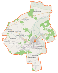
Polski: Mapa gminy Łapy, Polska
English: Map of Łapy, Poland |
|||||||||
| Date | ||||||||||
| Source | You may find a page on the OpenStreetMap wiki page for Łapy (gmina) | |||||||||
| Creator |
OpenStreetMap contributors OpenStreetMap contributors |
|||||||||
| Permission (Reusing this file) |
OpenStreetMap data is available under the Open Database License (details). Map tiles are licensed under the Creative Commons Attribution-ShareAlike 2.0 license (CC-BY-SA 2.0).
This file is licensed under the Creative Commons Attribution-Share Alike 2.0 Generic license.
|
|||||||||
| Geotemporal data | ||||||||||
| Bounding box |
|
|||||||||
| Georeferencing | If inappropriate please set warp_status = skip to hide. | |||||||||
File history
Click on a date/time to view the file as it appeared at that time.
| Date/Time | Thumbnail | Dimensions | User | Comment | |
|---|---|---|---|---|---|
| current | 08:08, 16 September 2014 | | 778 × 970 (219 KB) | VanWiel (talk | contribs) | {{Information |Description= |Source= |Date= |Author= |Permission= |other_versions= }} |
| 05:29, 5 June 2014 |  | 778 × 970 (211 KB) | VanWiel (talk | contribs) | new layout | |
| 16:10, 4 June 2014 |  | 803 × 1,000 (459 KB) | VanWiel (talk | contribs) | {{OpenStreetMap | name = Łapy (gmina) | location = Łapy (gmina) | description = {{pl|Mapa gminy Łapy, Polska}} {{en|Map of Łapy, Poland}} | top = 53.0833 | left = 22.7520 | right = 22... |
You cannot overwrite this file.
File usage on Commons
There are no pages that use this file.
File usage on other wikis
The following other wikis use this file:
- Usage on nl.wikipedia.org
- Usage on pl.wikipedia.org
- Łapy
- Łapy (gmina)
- Bokiny
- Daniłowo Duże
- Daniłowo Małe
- Gąsówka-Oleksin
- Gąsówka-Osse
- Gąsówka-Skwarki
- Gąsówka-Somachy
- Łapy-Dębowina
- Łapy-Kołpaki
- Łapy-Korczaki
- Łapy-Łynki
- Łapy-Pluśniaki
- Łapy-Szołajdy
- Łupianka Nowa
- Płonka Kościelna
- Płonka-Kozły
- Płonka-Matyski
- Płonka-Strumianka
- Roszki-Włodki
- Roszki-Wodźki
- Gąsówka Stara
- Łupianka Stara
- Uhowo
- Wólka Waniewska
- Łapy (stacja kolejowa)
- Uhowo (przystanek kolejowy)
- Łapy Osse
- Zakłady Naprawcze Taboru Kolejowego w Łapach
- Kościół św. św. Apostołów Piotra i Pawła w Łapach
- Kościół św. Jana Chrzciciela w Łapach
- Kościół Świętego Krzyża w Łapach
- Kościół św. Wojciecha w Uhowie
- Parafia św. Apostołów Piotra i Pawła w Łapach
- Parafia św. Jana Chrzciciela w Łapach
- Parafia Świętego Krzyża w Łapach
- Kościół św. Michała Archanioła w Płonce Kościelnej
- Płonka (przystanek kolejowy)
- Parafia św. Michała Archanioła w Płonce Kościelnej
- Parafia Najświętszego Serca Jezusowego w Bokinach
- Parafia św. Wojciecha w Uhowie
- Moduł:Mapa/dane/Łapy
- Moduł:Mapa/dane/Łapy (gmina)
- Barwiki (Łapy)
- Bociany (Łapy)
- Wity (Łapy)
- Goździki (Łapy)
- Leśniki (Łapy)
View more global usage of this file.
_location_map.png)
_location_map.png&oldid=505266316)