File:Łaskarzew (gmina wiejska) location map.png

Size of this preview: 723 × 599 pixels. Other resolutions: 290 × 240 pixels | 579 × 480 pixels | 831 × 689 pixels.
Original file (831 × 689 pixels, file size: 135 KB, MIME type: image/png)
Captions
Captions
Add a one-line explanation of what this file represents
| Description |
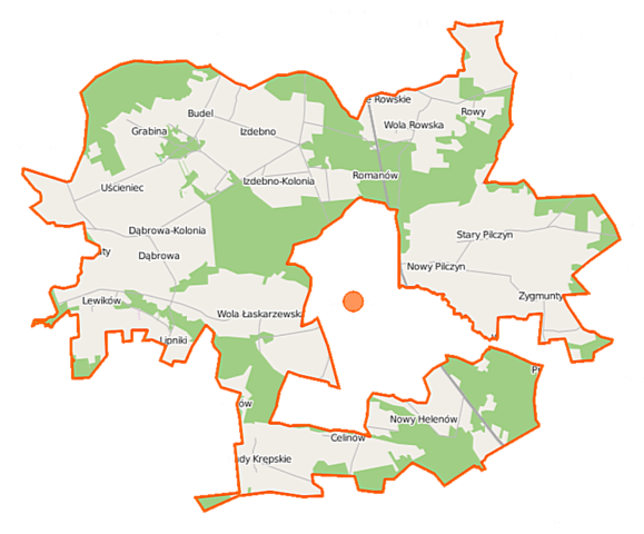
Polski: Mapa gminy Łaskarzew, Polska
English: Map of Gmina Łaskarzew, Poland |
|||||||||
| Date | ||||||||||
| Source | You may find a page on the OpenStreetMap wiki page for Łaskarzew (gmina wiejska) | |||||||||
| Creator |
OpenStreetMap contributors OpenStreetMap contributors |
|||||||||
| Permission (Reusing this file) |
OpenStreetMap data is available under the Open Database License (details). Map tiles are licensed under the Creative Commons Attribution-ShareAlike 2.0 license (CC-BY-SA 2.0).
This file is licensed under the Creative Commons Attribution-Share Alike 2.0 Generic license.
|
|||||||||
| Geotemporal data | ||||||||||
| Bounding box |
|
|||||||||
| Georeferencing | If inappropriate please set warp_status = skip to hide. | |||||||||
File history
Click on a date/time to view the file as it appeared at that time.
| Date/Time | Thumbnail | Dimensions | User | Comment | |
|---|---|---|---|---|---|
| current | 09:32, 12 September 2014 | | 831 × 689 (135 KB) | VanWiel (talk | contribs) | |
| 08:35, 8 July 2014 |  | 831 × 689 (158 KB) | VanWiel (talk | contribs) | {{OpenStreetMap | name = Łaskarzew (gmina wiejska) | location = Łaskarzew (gmina wiejska) | description = {{pl|Mapa gminy Łaskarzew, Polska}} {{en|Map of Gmina Łaskarzew, Poland}} | top = 51.8553 | left... |
You cannot overwrite this file.
File usage on Commons
There are no pages that use this file.
File usage on other wikis
The following other wikis use this file:
- Usage on de.wikipedia.org
- Usage on pl.wikipedia.org
- Łaskarzew (gmina wiejska)
- Budel
- Budy Krępskie
- Dąbrowa-Kolonia (województwo mazowieckie)
- Kacprówek
- Lewików
- Melanów (powiat garwoliński)
- Leokadia (województwo mazowieckie)
- Nowy Pilczyn
- Sośninka
- Stary Helenów
- Stary Pilczyn
- Uścieniec
- Wola Łaskarzewska
- Wola Rowska
- Izdebno-Kolonia (województwo mazowieckie)
- Izdebno (województwo mazowieckie)
- Ksawerynów (województwo mazowieckie)
- Zygmunty (województwo mazowieckie)
- Aleksandrów (powiat garwoliński)
- Celinów (powiat garwoliński)
- Dąbrowa (powiat garwoliński)
- Grabina (powiat garwoliński)
- Krzywda (powiat garwoliński)
- Lipniki (powiat garwoliński)
- Nowy Helenów
- Polesie Rowskie
- Rowy (powiat garwoliński)
- Wanaty (województwo mazowieckie)
- Wola Rowska (przystanek kolejowy)
- Leokadia (przystanek kolejowy)
- Rezerwat przyrody Polesie Rowskie
- Baranicha (osada)
- Rywociny (województwo mazowieckie)
- Wiktorzyn (gmina Łaskarzew)
- Włodków
- Janków (powiat garwoliński)
- Moduł:Mapa/dane/Łaskarzew (gmina wiejska)
- Romanów (Izdebno-Kolonia)
- Uścieniec-Kolonia (Uścieniec)
- Usage on pl.wikibooks.org
_location_map.png&oldid=494286575)