File:Зимовий Сейм.jpg

Size of this preview: 450 × 600 pixels. Other resolutions: 180 × 240 pixels | 360 × 480 pixels | 576 × 768 pixels | 768 × 1,024 pixels | 1,536 × 2,048 pixels | 3,000 × 4,000 pixels.
Original file (3,000 × 4,000 pixels, file size: 272 KB, MIME type: image/jpeg)
Captions
Captions
Add a one-line explanation of what this file represents
Summary
edit
| Description |
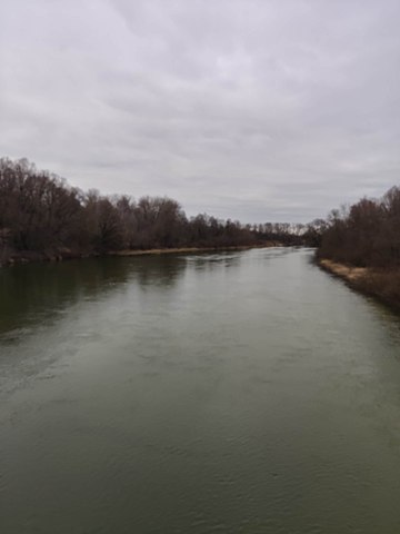
Українська: «Сеймський», Річкова долина Сейму від мосту в с. Чумакове до межі з Чернігівською областю. Буринський р-н: Червонослобідська, Олександрівська, Гвинтівська с/р; кв. 1 (вид. 6-23), 2 (6, 18-26), 3 (вид. 4-7, 14-32), 8 (вид. 1-4, 7-15), 9 (вид. 8-10). Конотопський р-н: Кузьківська, Козацька, Вирівська, Попівська, Хижківська, Мельнянська, Бочечківська, Присеймівська, Духанівська с/р. ДП «Конотопський лісгосп»: Конотопське л-во: кв. 77 (діл. 21, 27, 29-30); Новомутинське л-во: кв. 1-43, 50-54, 65-70, 81-84, 94-98, 99-109. ДП «Конотопський агролісгосп»: кв. 1 (вид. 1, 4-9, 13-43), 2-3, 4 (вид. 14-19), 11, 12 (вид. 29-34, 42-44), 13 (вид. 14-31), 14-15, 16 (вид. 1-4, 13-25, 29-31), 17 (15-16, 18), 18-31, 32 (вид. 1-16, 24-26), 33 (вид. 6-14), 34-36, 37 (вид. 1-20, 23-60), 38 (вид. 1-19), 42 (вид. 1-2), 44, 46, 48 (вид. 1-2), 49 (вид. 1-4, 13-26), 51 (вид. 1-5), 52 (вид. 2-3), 59, 72 (вид. 28-31), 73 (вид. 42). Кролевецький р-н: Зазірківська, Локнянська, Литвиновицька, Камінська, Мутинська, Ярівська, Дубовицька, Алтинівська, Червоноранківська, Ленінська с/р. ДП «Кролевецький агролісгосп»: Ярославецьке л-во, кв. 45, 47, 48 (вид. 12-22), 49 (вид. 2, 6, 8-24), 50-58; Червоноранківське л-во, кв. 18 (вид. 46-69, 72, 75-77), 20 (вид. 79, 87-91), 29 (вид. 6-15, 30-95), 30, 31 (вид. 16-67, 12), 33, 34 (вид. 45), 35-40, 41 (вид. 19-21), 42-46, 47 (вид. 1-37, 39-51, 55-66), 48-53. Путивльський р-н: Волокитинська, Стрільниківська, Яцинська, Бобинська, Сафонівська, Зіннівська, Князівська, Октябрьська, Чорнобривківська с/р. ДП «Кролевецьке лісомисливське господарство»: Ярославецьке л-во, кв. 48 (діл. 1, 5)**. ДП «Конотопський лісгосп»: Путивльське л-во: кв. 25-27, 32-34, 36, 42-44, 48-72, 80-86**. ДП «Путивльський агролісгосп»: кв. 1-11, 47-51, 56-58, 88-102, 103 (вид. 1-14), 104, 114–118, 120
|
||
| Date | |||
| Source | Own work | ||
| Author | Katiol |
| Camera location | | View this and other nearby images on: OpenStreetMap |
|---|
Licensing
edit
I, the copyright holder of this work, hereby publish it under the following license:
This file is licensed under the Creative Commons Attribution-Share Alike 4.0 International license.
- You are free:
- to share – to copy, distribute and transmit the work
- to remix – to adapt the work
- Under the following conditions:
- attribution – You must give appropriate credit, provide a link to the license, and indicate if changes were made. You may do so in any reasonable manner, but not in any way that suggests the licensor endorses you or your use.
- share alike – If you remix, transform, or build upon the material, you must distribute your contributions under the same or compatible license as the original.
This image was uploaded as part of Wiki Loves Earth 2021.
|
 |
File history
Click on a date/time to view the file as it appeared at that time.
| Date/Time | Thumbnail | Dimensions | User | Comment | |
|---|---|---|---|---|---|
| current | 18:26, 30 June 2021 | | 3,000 × 4,000 (272 KB) | Katiol (talk | contribs) | Uploaded own work with UploadWizard |
You cannot overwrite this file.
File usage on Commons
The following page uses this file: