File:Карта Камчатки 1755.jpg
Size of this preview: 624 × 600 pixels. Other resolutions: 250 × 240 pixels | 499 × 480 pixels | 696 × 669 pixels.
Original file (696 × 669 pixels, file size: 253 KB, MIME type: image/jpeg)
Captions
Captions
Add a one-line explanation of what this file represents
Summary
edit
| Description |
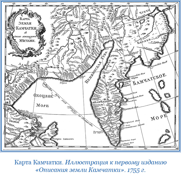
Русский: Карта Камчатки из первого издания книги "Описания земли Камчатки" С. Крашеннинникова. Издано в Санкт-Петербурге в 1755 году. Степан Крашеннинников - участник Второй Камчатской экспедии, ее научногоотдела. Исследовал Камчатку и написал книгу "Описание земли Камчатки". данная карта впервые была опубликована в его книге. |
| Date | |
| Source | https://libmir.com/book/230561/image |
| Author | Степан Крашеннинников |
Licensing
edit
|
This is a faithful photographic reproduction of a two-dimensional, public domain work of art. The work of art itself is in the public domain for the following reason:
The official position taken by the Wikimedia Foundation is that "faithful reproductions of two-dimensional public domain works of art are public domain".
This photographic reproduction is therefore also considered to be in the public domain in the United States. In other jurisdictions, re-use of this content may be restricted; see Reuse of PD-Art photographs for details. | ||||
File history
Click on a date/time to view the file as it appeared at that time.
| Date/Time | Thumbnail | Dimensions | User | Comment | |
|---|---|---|---|---|---|
| current | 09:07, 1 December 2022 | | 696 × 669 (253 KB) | Kontiger (talk | contribs) | Uploaded a work by Степан Крашеннинников from https://libmir.com/book/230561/image with UploadWizard |
You cannot overwrite this file.
File usage on Commons
There are no pages that use this file.