File:Крогулець (Чортківський район) на австрійській топографічній мапі, 1861—1864 рр.png

Size of this preview: 800 × 425 pixels. Other resolutions: 320 × 170 pixels | 640 × 340 pixels | 1,069 × 568 pixels.
Original file (1,069 × 568 pixels, file size: 882 KB, MIME type: image/png)
Captions
Captions
Add a one-line explanation of what this file represents
Summary
edit_%D0%BD%D0%B0_%D0%B0%D0%B2%D1%81%D1%82%D1%80%D1%96%D0%B9%D1%81%D1%8C%D0%BA%D1%96%D0%B9_%D1%82%D0%BE%D0%BF%D0%BE%D0%B3%D1%80%D0%B0%D1%84%D1%96%D1%87%D0%BD%D1%96%D0%B9_%D0%BC%D0%B0%D0%BF%D1%96,_1861%E2%80%941864_%D1%80%D1%80.png&action=edit§ion=1)
| Description |
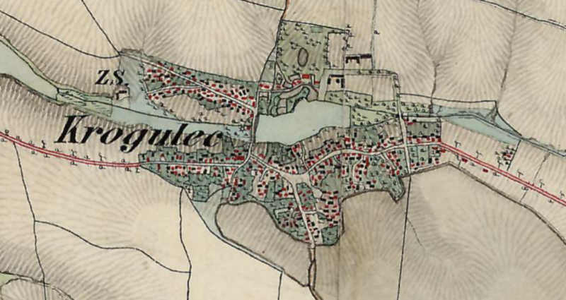
Українська: Крогулець Васильковецької громади Чортківського району Тернопільської области на австрійській топографічній мапі, 1861—1864 рр. |
| Date | XIX ст. |
| Source | https://maps.arcanum.com/en/map/europe-19century-secondsurvey/?bbox=2892620.9481888404%2C6290621.524982175%2C2899892.020504468%2C6293182.165429728&map-list=1&layers=158%2C164 |
| Author | http://mapire.eu/ Military survey Habsburg Empire |
Licensing
edit_%D0%BD%D0%B0_%D0%B0%D0%B2%D1%81%D1%82%D1%80%D1%96%D0%B9%D1%81%D1%8C%D0%BA%D1%96%D0%B9_%D1%82%D0%BE%D0%BF%D0%BE%D0%B3%D1%80%D0%B0%D1%84%D1%96%D1%87%D0%BD%D1%96%D0%B9_%D0%BC%D0%B0%D0%BF%D1%96,_1861%E2%80%941864_%D1%80%D1%80.png&action=edit§ion=2)
|
This work is in the public domain in its country of origin and other countries and areas where the copyright term is the author's life plus 100 years or fewer. | |
| This file has been identified as being free of known restrictions under copyright law, including all related and neighboring rights. | |
File history
Click on a date/time to view the file as it appeared at that time.
| Date/Time | Thumbnail | Dimensions | User | Comment | |
|---|---|---|---|---|---|
| current | 08:29, 17 July 2022 | | 1,069 × 568 (882 KB) | Максим Огородник (talk | contribs) | Uploaded a work by http://mapire.eu/ Military survey Habsburg Empire from https://maps.arcanum.com/en/map/europe-19century-secondsurvey/?bbox=2892620.9481888404%2C6290621.524982175%2C2899892.020504468%2C6293182.165429728&map-list=1&layers=158%2C164 with UploadWizard |
You cannot overwrite this file.
File usage on Commons
There are no pages that use this file.
File usage on other wikis
The following other wikis use this file:
- Usage on pl.wikipedia.org
- Usage on uk.wikipedia.org
_на_австрійській_топографічній_мапі,_1861—1864_рр.png&oldid=767143557)