File:Меркаторская карта пролива Купреянова.jpg

Size of this preview: 800 × 493 pixels. Other resolutions: 320 × 197 pixels | 640 × 394 pixels | 1,024 × 631 pixels | 1,280 × 788 pixels | 2,781 × 1,713 pixels.
Original file (2,781 × 1,713 pixels, file size: 748 KB, MIME type: image/jpeg)
Captions
Captions
Add a one-line explanation of what this file represents
Summary edit
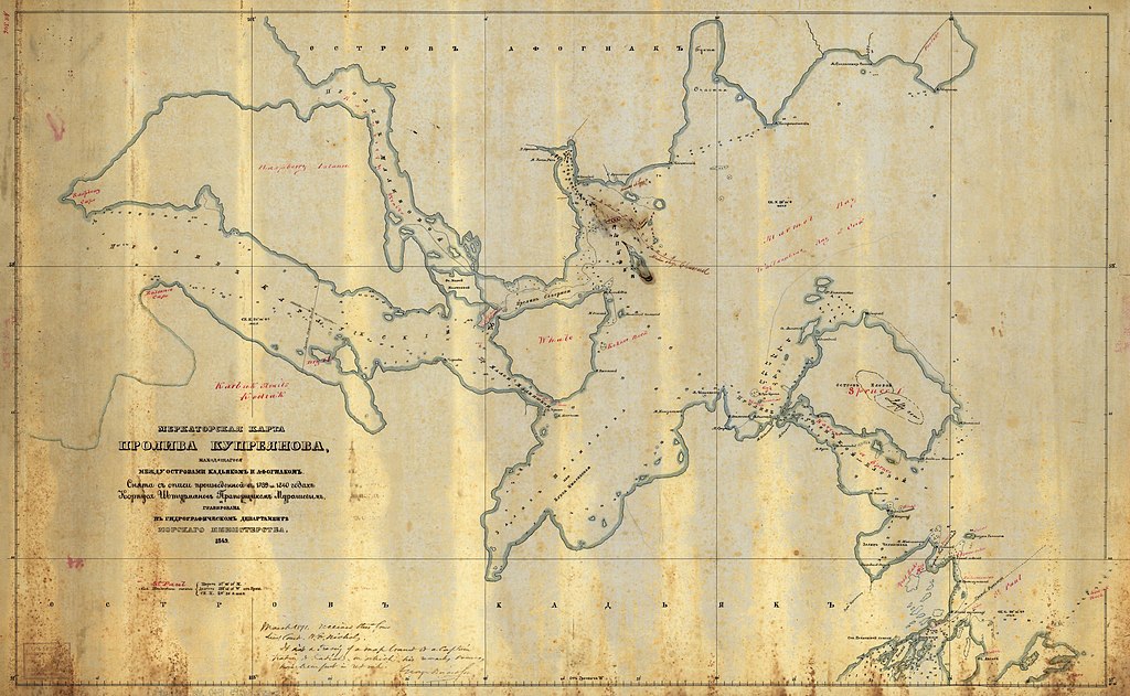
| Description |
Русский: «Меркаторская карта пролива Купреянова, находящегося между островами Кадьяком и Афогнаком», вышедшая в 1848 г. и составленная по описям И. Ф. Васильева 1809 г. и И. Я. Васильева 1833 г., |
||
| Date | |||
| Source |
|
||
| Author | Unknown author |

Licensing edit
|
This work is in the public domain in its country of origin and other countries and areas where the copyright term is the author's life plus 70 years or fewer. This work is in the public domain in the United States because it was published (or registered with the U.S. Copyright Office) before January 1, 1929. | |
| This file has been identified as being free of known restrictions under copyright law, including all related and neighboring rights. | |
File history
Click on a date/time to view the file as it appeared at that time.
| Date/Time | Thumbnail | Dimensions | User | Comment | |
|---|---|---|---|---|---|
| current | 18:03, 2 November 2016 | | 2,781 × 1,713 (748 KB) | Alpunin (talk | contribs) | User created page with UploadWizard |
You cannot overwrite this file.
File usage on Commons
The following page uses this file:
File usage on other wikis
The following other wikis use this file:
- Usage on ru.wikipedia.org