File:Остров Туренец.jpg

Size of this preview: 800 × 393 pixels. Other resolutions: 320 × 157 pixels | 640 × 314 pixels | 1,024 × 503 pixels | 1,280 × 629 pixels | 4,000 × 1,965 pixels.
Original file (4,000 × 1,965 pixels, file size: 1.43 MB, MIME type: image/jpeg)
Captions
Captions
Add a one-line explanation of what this file represents
Summary
edit
| Description |
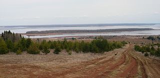
Русский: Вид на остров Туренец |
| Date | |
| Source | panoramio |
| Author | Maximovich Nikolay |
| Camera location | | View this and other nearby images on: OpenStreetMap |
|---|
Licensing
edit
This file is licensed under the Creative Commons Attribution 3.0 Unported license.
- You are free:
- to share – to copy, distribute and transmit the work
- to remix – to adapt the work
- Under the following conditions:
- attribution – You must give appropriate credit, provide a link to the license, and indicate if changes were made. You may do so in any reasonable manner, but not in any way that suggests the licensor endorses you or your use.
| This image, which was originally posted to Panoramio, was reviewed on 7 April 2012 by the administrator or trusted user Materialscientist, who confirmed that it was available on Panoramio under the above license on that date. |
File history
Click on a date/time to view the file as it appeared at that time.
| Date/Time | Thumbnail | Dimensions | User | Comment | |
|---|---|---|---|---|---|
| current | 08:44, 7 April 2012 | | 4,000 × 1,965 (1.43 MB) | Chtototakoe (talk | contribs) | {{Information |Description= {{ru|Вид на остров Туренец}} |Source=[http://www.panoramio.com/photo/38136055 panoramio] |Date=2010-04-26 16:07 |Author=[http://www.panoramio.com/user/4147970 Maximovich Nikolay] |Per... |
You cannot overwrite this file.
File usage on Commons
There are no pages that use this file.
File usage on other wikis
The following other wikis use this file:
- Usage on ceb.wikipedia.org
- Usage on ru.wikipedia.org
- Usage on www.wikidata.org