File:Річка Бігуча.jpg

Size of this preview: 800 × 305 pixels. Other resolutions: 320 × 122 pixels | 640 × 244 pixels | 1,024 × 390 pixels | 1,280 × 488 pixels | 2,560 × 975 pixels | 5,670 × 2,160 pixels.
Original file (5,670 × 2,160 pixels, file size: 14.77 MB, MIME type: image/jpeg)
Captions
Captions
Add a one-line explanation of what this file represents
Summary edit
| Description |
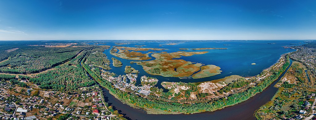
Українська: мікрорайон "Дахнівський" в місті Черкаси з показом річки Бігучої та Кременчуцького водосховища |
| Date | |
| Source | Own work |
| Author | Fedor Balaba |
| Camera location | | View this and other nearby images on: OpenStreetMap |
|---|
Licensing edit
I, the copyright holder of this work, hereby publish it under the following license:
This file is licensed under the Creative Commons Attribution-Share Alike 4.0 International license.
- You are free:
- to share – to copy, distribute and transmit the work
- to remix – to adapt the work
- Under the following conditions:
- attribution – You must give appropriate credit, provide a link to the license, and indicate if changes were made. You may do so in any reasonable manner, but not in any way that suggests the licensor endorses you or your use.
- share alike – If you remix, transform, or build upon the material, you must distribute your contributions under the same or compatible license as the original.
File history
Click on a date/time to view the file as it appeared at that time.
| Date/Time | Thumbnail | Dimensions | User | Comment | |
|---|---|---|---|---|---|
| current | 19:26, 25 September 2020 | 5,670 × 2,160 (14.77 MB) | Fedor Balaba (talk | contribs) | Cross-wiki upload from uk.wikipedia.org |
You cannot overwrite this file.
File usage on Commons
There are no pages that use this file.
File usage on other wikis
The following other wikis use this file:
- Usage on uk.wikipedia.org
- Usage on zh.wikipedia.org