File:Сторожинецький район Чернівецький регіональний парк.jpg
Original file (2,440 × 2,312 pixels, file size: 1.21 MB, MIME type: image/jpeg)
Captions
Summary
editDescriptionСторожинецький район Чернівецький регіональний парк.jpg |
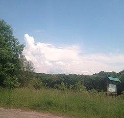
Українська: Чернівецький регіональний парк, Сторожинецький район: (5775 га) ДП «Сторожинецький лісгосп»: Сторожинецьке лісництво кв. 1-35- 3026,0 га Сторожинецький держспецлісгосп АПК: Сторожинецьке лісництво кв. 1-18, кв.
|
|||
Date | ||||
Source | Own work | |||
Author | Назар10 | |||
Permission (Reusing this file) |
I, the copyright holder of this work, hereby publish it under the following license: This file is licensed under the Creative Commons Attribution-Share Alike 4.0 International license.
|
Camera location | 48° 12′ 39.84″ N, 25° 48′ 31.94″ E | View this and other nearby images on: OpenStreetMap | 48.211067; 25.808872 |
---|
File history
Click on a date/time to view the file as it appeared at that time.
Date/Time | Thumbnail | Dimensions | User | Comment | |
---|---|---|---|---|---|
current | 18:58, 27 May 2016 | 2,440 × 2,312 (1.21 MB) | Назар10 (talk | contribs) | User created page with UploadWizard |
You cannot overwrite this file.
File usage on Commons
The following 4 pages use this file:
File usage on other wikis
The following other wikis use this file:
- Usage on uk.wikipedia.org
Metadata
This file contains additional information such as Exif metadata which may have been added by the digital camera, scanner, or software program used to create or digitize it. If the file has been modified from its original state, some details such as the timestamp may not fully reflect those of the original file. The timestamp is only as accurate as the clock in the camera, and it may be completely wrong.
Camera manufacturer | Apple |
---|---|
Camera model | iPhone 4S |
Exposure time | 1/341 sec (0.0029325513196481) |
F-number | f/2.4 |
ISO speed rating | 50 |
Date and time of data generation | 13:40, 27 May 2016 |
Lens focal length | 4.28 mm |
Latitude | 48° 12′ 39.84″ N |
Longitude | 25° 48′ 31.94″ E |
Altitude | 394 meters above sea level |
Orientation | Normal |
Horizontal resolution | 72 dpi |
Vertical resolution | 72 dpi |
Software used | Microsoft Windows Photo Viewer 6.1.7600.16385 |
File change date and time | 21:53, 27 May 2016 |
Y and C positioning | Centered |
Exposure Program | Normal program |
Exif version | 2.21 |
Date and time of digitizing | 13:40, 27 May 2016 |
Meaning of each component |
|
APEX shutter speed | 8.4119318181818 |
APEX aperture | 2.5260688216893 |
APEX brightness | 7.8649278062413 |
APEX exposure bias | 0 |
Metering mode | Pattern |
Flash | Flash did not fire, compulsory flash suppression |
DateTimeOriginal subseconds | 313 |
DateTimeDigitized subseconds | 313 |
Supported Flashpix version | 1 |
Color space | sRGB |
Sensing method | One-chip color area sensor |
Scene type | A directly photographed image |
Exposure mode | Auto exposure |
White balance | Auto white balance |
Focal length in 35 mm film | 35 mm |
Scene capture type | Standard |
GPS time (atomic clock) | 10:40:11.21 |
Speed unit | Kilometers per hour |
Speed of GPS receiver | 19.586723768737 |
Reference for direction of image | True direction |
Direction of image | 69.372395833333 |
Reference for bearing of destination | True direction |
Bearing of destination | 69.372395833333 |
GPS date | 27 May 2016 |