File:Уоллис и Футуна.png

Size of this preview: 800 × 532 pixels. Other resolutions: 320 × 213 pixels | 640 × 426 pixels | 1,024 × 681 pixels | 1,280 × 852 pixels | 1,924 × 1,280 pixels.
Original file (1,924 × 1,280 pixels, file size: 538 KB, MIME type: image/png)
Captions
Captions
Add a one-line explanation of what this file represents
Summary
edit
| Description |
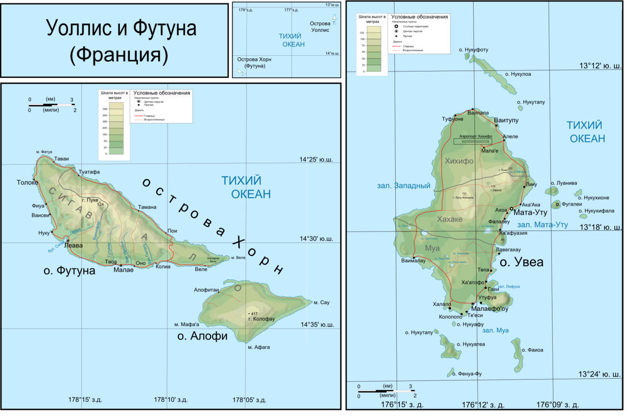
Русский: Топографическая карта островов Уоллис |
| Date | |
| Source |
Own work Рельеф местности от NASA Shuttle Radar Topography Mission (SRTM3 v.2.1) (public domain)(файлы [1], [2] и [3]; береговая линия и озёра от [4] (файлы [5], [6] и [7]. Данные обработаны с 3DEM GRASS, векторизованны с помощью Inkscape. Затенненный рельеф создан с помощью GIMP. Дороги, географические названия с [8] и [9] Другое:
|
| Author | Boodjoom |
Licensing
edit
Участник:Boodjoom85, the copyright holder of this work, hereby publishes it under the following license:
This file is licensed under the Creative Commons Attribution-Share Alike 3.0 Unported, 2.5 Generic, 2.0 Generic and 1.0 Generic license.
Attribution: Участник:Boodjoom85
- You are free:
- to share – to copy, distribute and transmit the work
- to remix – to adapt the work
- Under the following conditions:
- attribution – You must give appropriate credit, provide a link to the license, and indicate if changes were made. You may do so in any reasonable manner, but not in any way that suggests the licensor endorses you or your use.
- share alike – If you remix, transform, or build upon the material, you must distribute your contributions under the same or compatible license as the original.
Original upload log
edit
Transferred from ru.wikipedia to Commons using For the Common Good.
The original description page was here. All following user names refer to ru.wikipedia.
| Date/Time | Dimensions | User | Comment |
|---|---|---|---|
| 03:59, 20 October 2009 | 1,924 × 1,280 (551,267 bytes) | w:ru:Boodjoom85 (talk | contribs) | {{Изображение | Описание = Топографическая карта островов [[Уоллис (острова)|Уоллис]] | Источник = Собственная работа. Рельеф местности � |
File history
Click on a date/time to view the file as it appeared at that time.
| Date/Time | Thumbnail | Dimensions | User | Comment | |
|---|---|---|---|---|---|
| current | 22:43, 25 February 2015 | | 1,924 × 1,280 (538 KB) | Dogad75 (talk | contribs) | Transferred from ru.wikipedia: see original upload log above |
You cannot overwrite this file.
File usage on Commons
There are no pages that use this file.
File usage on other wikis
The following other wikis use this file:
- Usage on ru.wikipedia.org